I am a small town girl who is married Danny. I love Horror especially anything by Rob Zombie. I also love reading especially Stephen King and physics books.
THUNDERSTORM OUTLOOK
VALID: Today, 22nd June
[UPDATE 1] A very low-confidence, but a high-risk outlook has been issued. Should any thunderstorms develop within the area covering Bristol Channel and along the M4 corridor, there is the possibility of locally severe thunderstorms, maybe locally violent.
Elevated thunderstorm activity is possible further north during the overnight hours, as well as across the SE. Again, this is a low-confidence outlook, therefore the verification is more likely to be poor rather than successful.
https://t.co/AcdjvtPYel
@enix4ms4dnud My husband is too. Next day delivery, yep not so sure about that. Was meant to arrive yesterday, didn't. No updates today. Very bad on their behalf and it seems most people are in the same boat 😔 sorry you are having trouble.
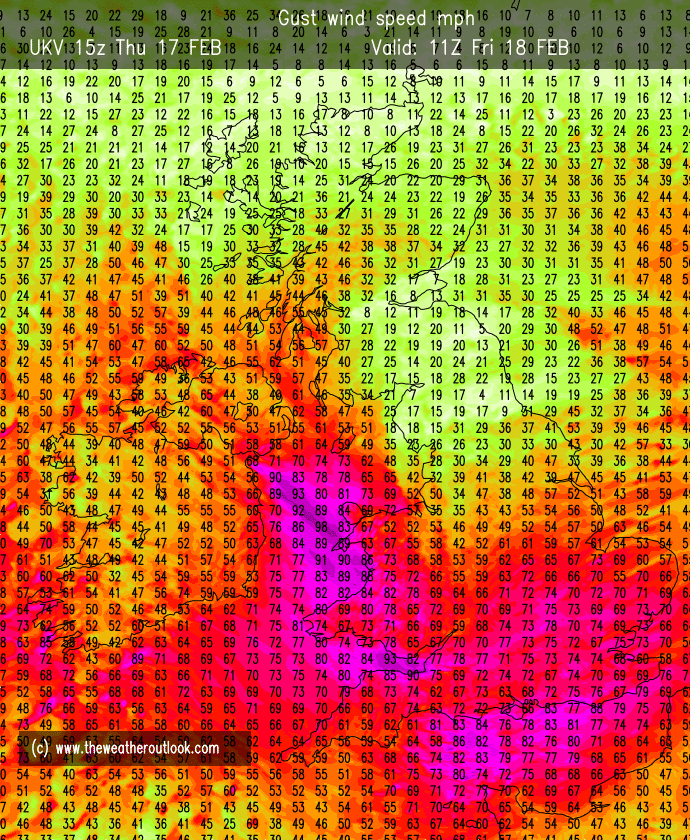
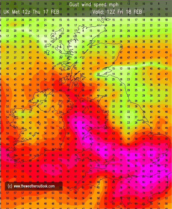
We can add UKV & ECM to the list of models predicting 70-80mph gusts across southern England tomorrow morning.
On the evening before the event, we finally have full model agreement. A widespread & disruptive event is imminent.
Looking through the 12z model outputs I do wonder whether the Met are going to extend that red warning area to a much wider area of southern England in the next few hours.
Widespread inland gusts of 70-80mph seem increasingly probable.
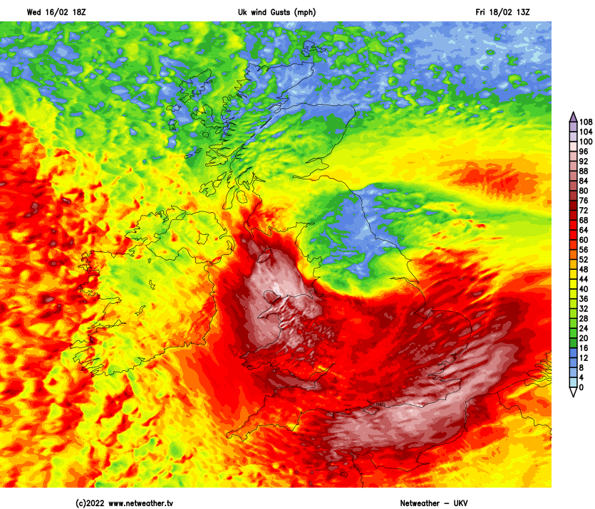
UKV 18z just offering casual 80-90mph gusts across SE England and N Wales early Friday afternoon.
Still a lot of uncertainty, GFS 18z for example going for slightly reduced wind strength.
Tomorrow should hopefully firm up on things.
It's going to get wild here in Biggleswade on Friday when #StormEunice arrives. I'm nervous and excited to see what she brings. But please let me remind you! Stay safe! Watch your local reports and please take any warning seriously 🤗