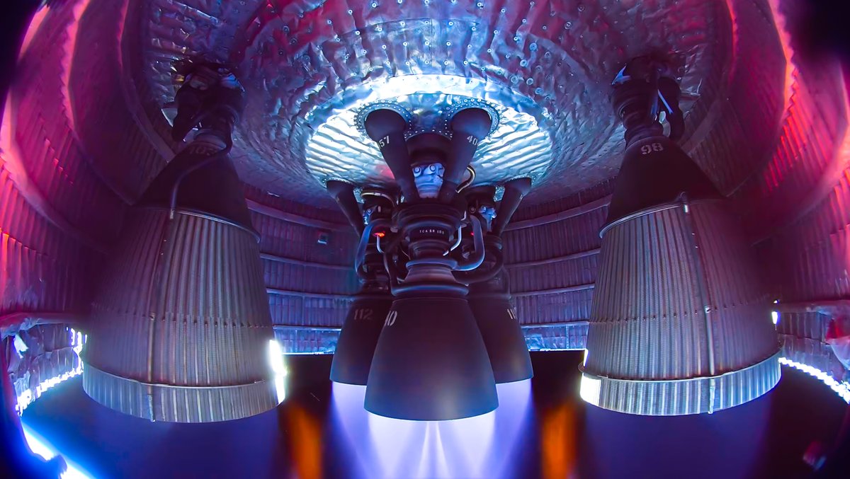
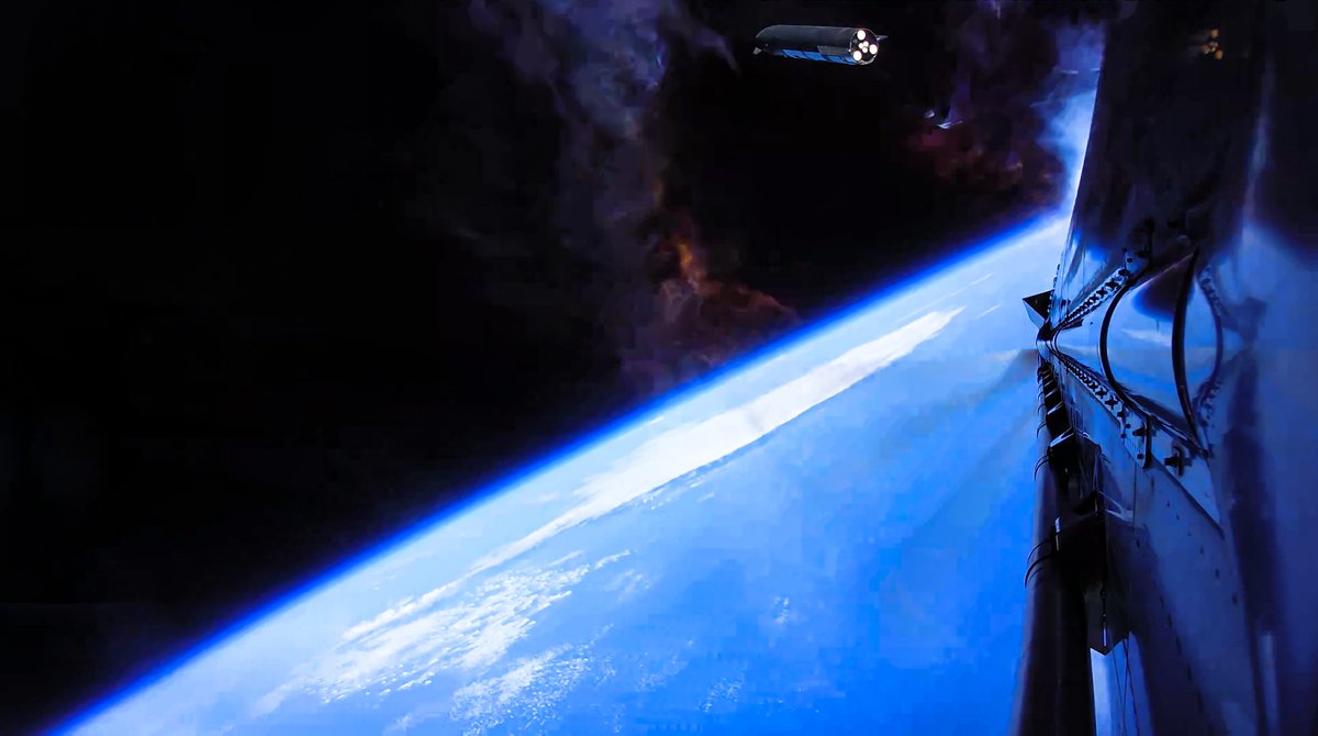
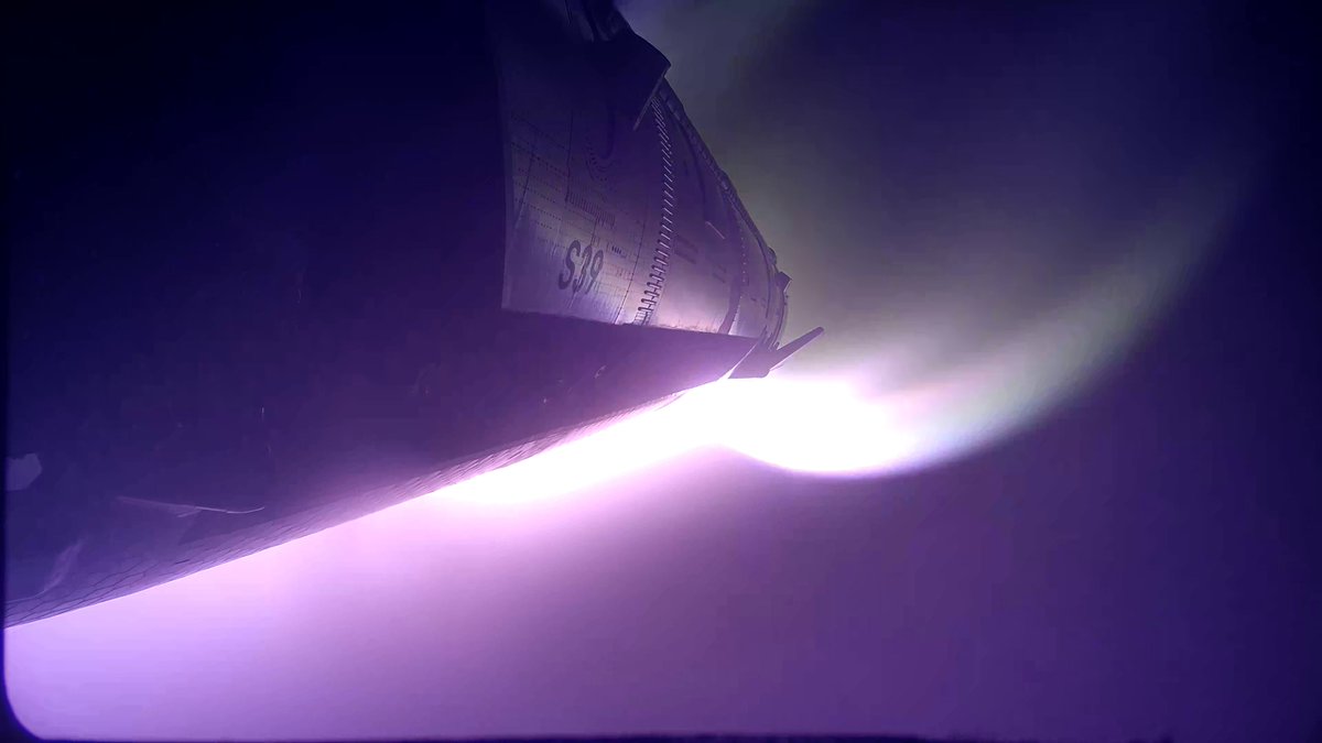
Onboard views from Starship and Super Heavy V3, which are equipped with upgraded cameras capable of streaming 4K video through every phase of flight via @Starlink
It’s ridiculous how much crap the SPC and NWS get from fellow weather enthusiasts on here. Everyone thinks they know better than the pros. Yeah, they’re human and mess up sometimes, but don’t we all. Give it a rest and be better than that.
Friendly reminder: It is impossible to predict specific weather conditions 2-3 weeks out. You cannot do it with current technology.
We can look at general ideas and trends but you cannot know if it’s going to rain or storm at your house 2-3 weeks out.
Don’t believe the hype and fear mongers. They’re everywhere in today’s world. You name it: News, weather, any topic. The fear mongers run wild. Unfortunately this now extends into the “professional” meteorology world as well due to content monetization.
what you say has an impact... comparing something to the most well known year for violent and deadly tornadoes in recent history is so irresponsible. if you just want to say it'll be an active year, say that. Don't compare it to 2011.
Continue to eat your heart out, tornado enthusiasts.
The right-most vorticity RFD surge that was trailed out behind the occluding tornado was the guide rail of the next strong tornado.
All it needed was an updraft to run across and tilt that horizontal vorticity into the vertical, and bam, tornadogenesis.
Tornado dynamics are on FULL display tonight.
A lot of talk and discussion has been going around about the different models used to predict the upcoming snowstorm. Two of the models named in this discussion are the GFS and Euro. We’ve gotten questions about which model we use for our forecast and which is right... (1/13)
Radar animations don't get much prettier than this.
This is the damaging likely-derecho getting organized in North Dakota, but which *may* be affecting NY on Sunday morning. Animation courtesy @CoDWXData. #ndwx