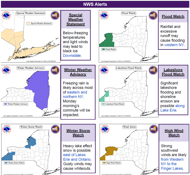
Winter weather, bringing cold temperatures, freezing rain, snow, wind, and flooding, is expected to impact the state throughout next week.
Below is a timeline of current weather products/alerts from the @NYSWRCC, followed by summaries of the alerts and their mapped locations.
A storm is expected to bring widespread rain, thunderstorms, strong winds & localized flooding tonight through Friday.
🌬️ 40–50 mph winds are possible statewide
🚘 Morning commutes may be hazardous on Friday
🥶 Cold air could cause a flash freeze on wet roadways Friday evening
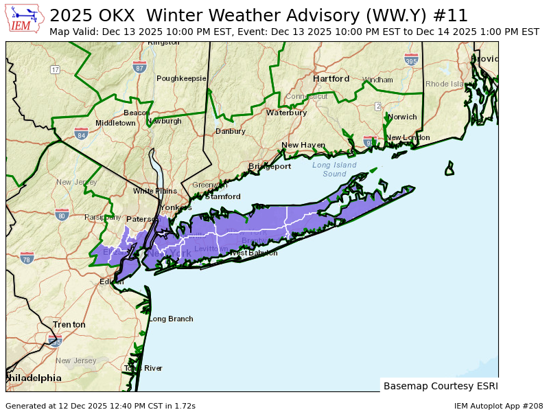
The first accumulating snow event will likely occur this weekend for NYC & Long Island. This is the first winter weather advisory for the area since Feb 2025. #NYCwx
“With warmer temps from climate change, you're going to have a warmer November... if you have warmer lake temps & you get a burst of intense cold air, that's going to make lake effect events a lot more significant." - Allison Finch, @UAlbany's @NYSWRCC
https://t.co/ucANC835Rn
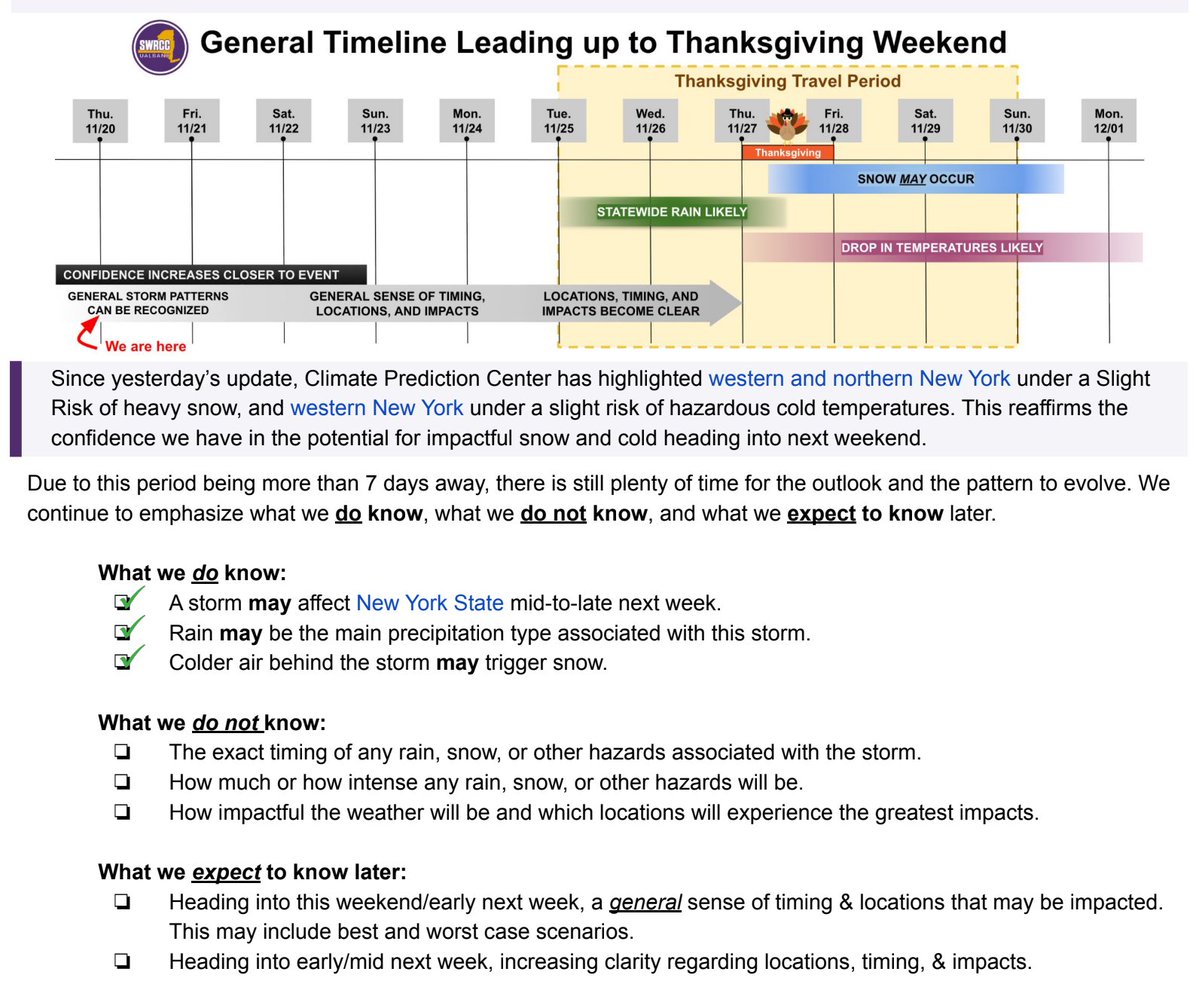
We're a week away from Thanksgiving, and there's a chance of some snowy or rainy weather during the extended weekend. Here's what we know, what we don't know, and when we expect to have more confidence. ⬇️
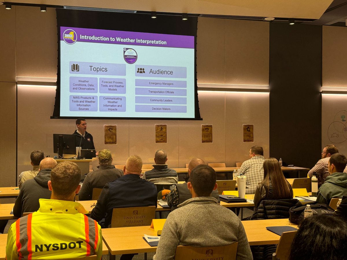
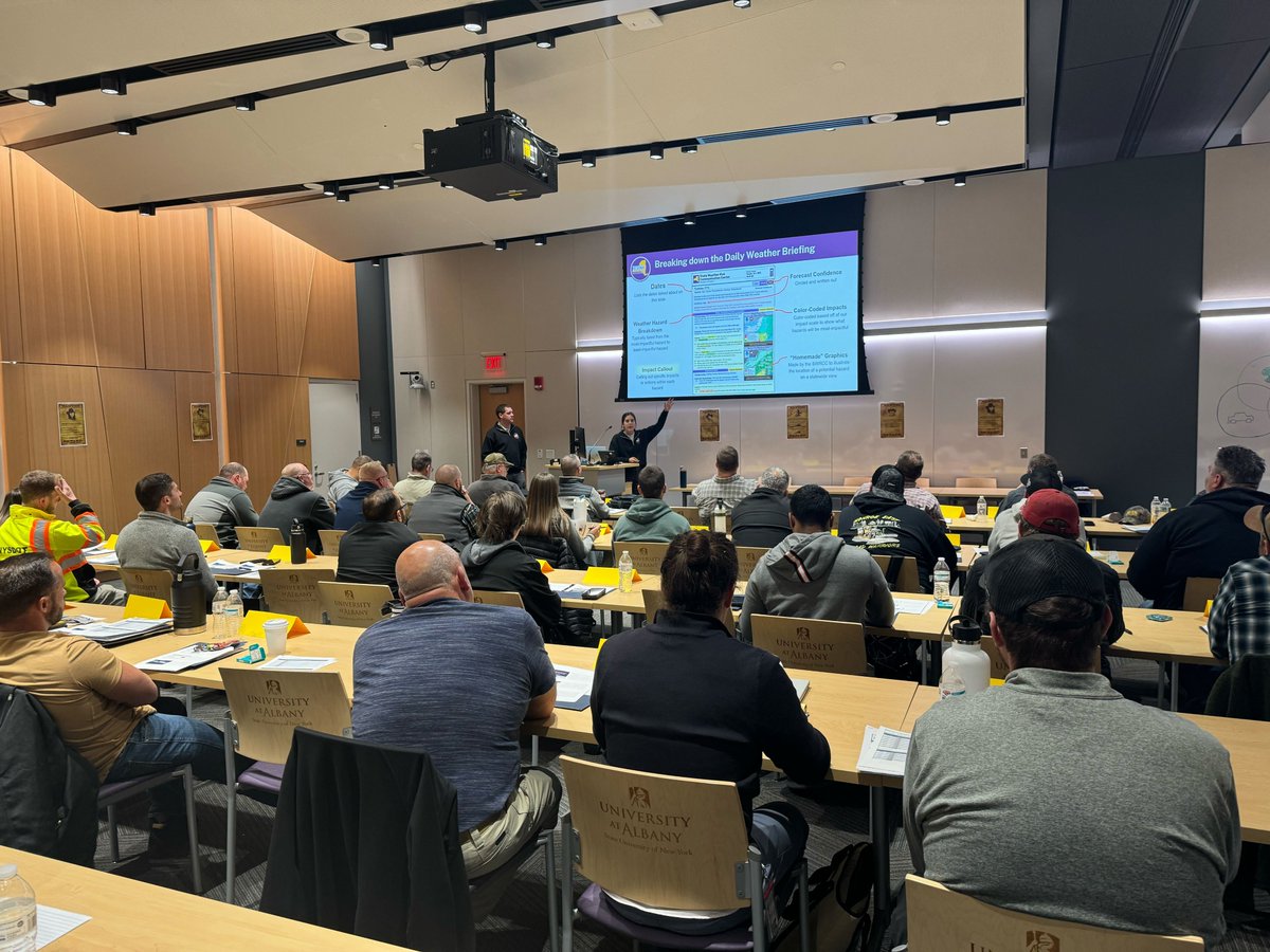
That’s a wrap on the @NYSDOT Snow & Ice University! ❄️ Two of our team members presented on the winter outlook and how we can support winter operations, while two others completed the course and gained great insight into DOT workflows. Thanks for having us!!
The @NWSWPC has upgraded the Moderate Risk for flash flooding to include NYC, western Long Island and the Lower Hudson Valley. Moderate-to-heavy rainfall is expected this afternoon and evening, which will likely result in flooding.
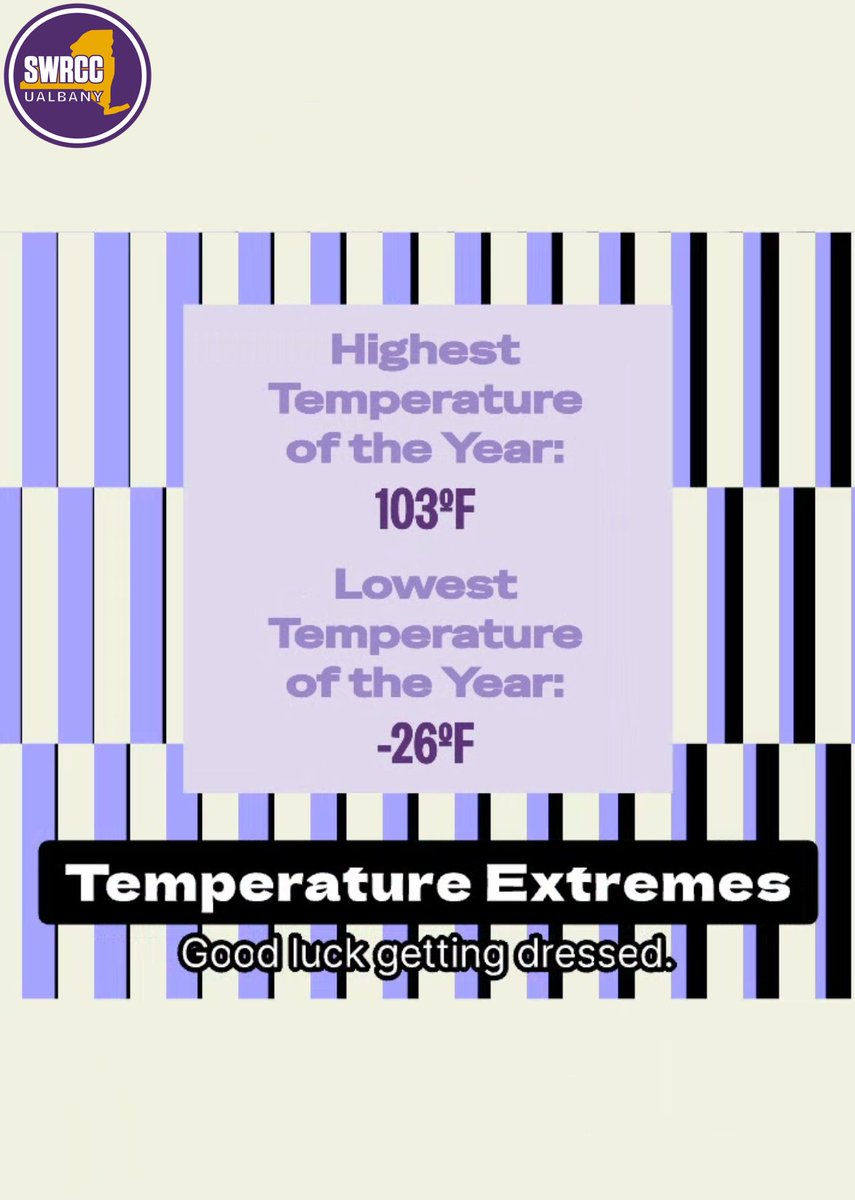
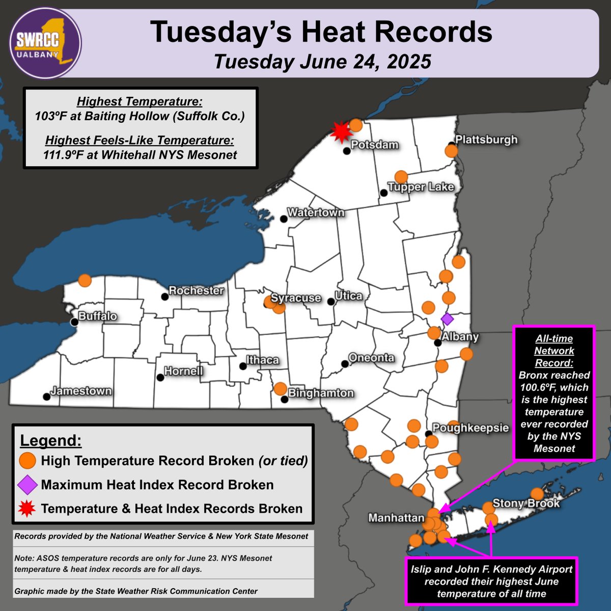
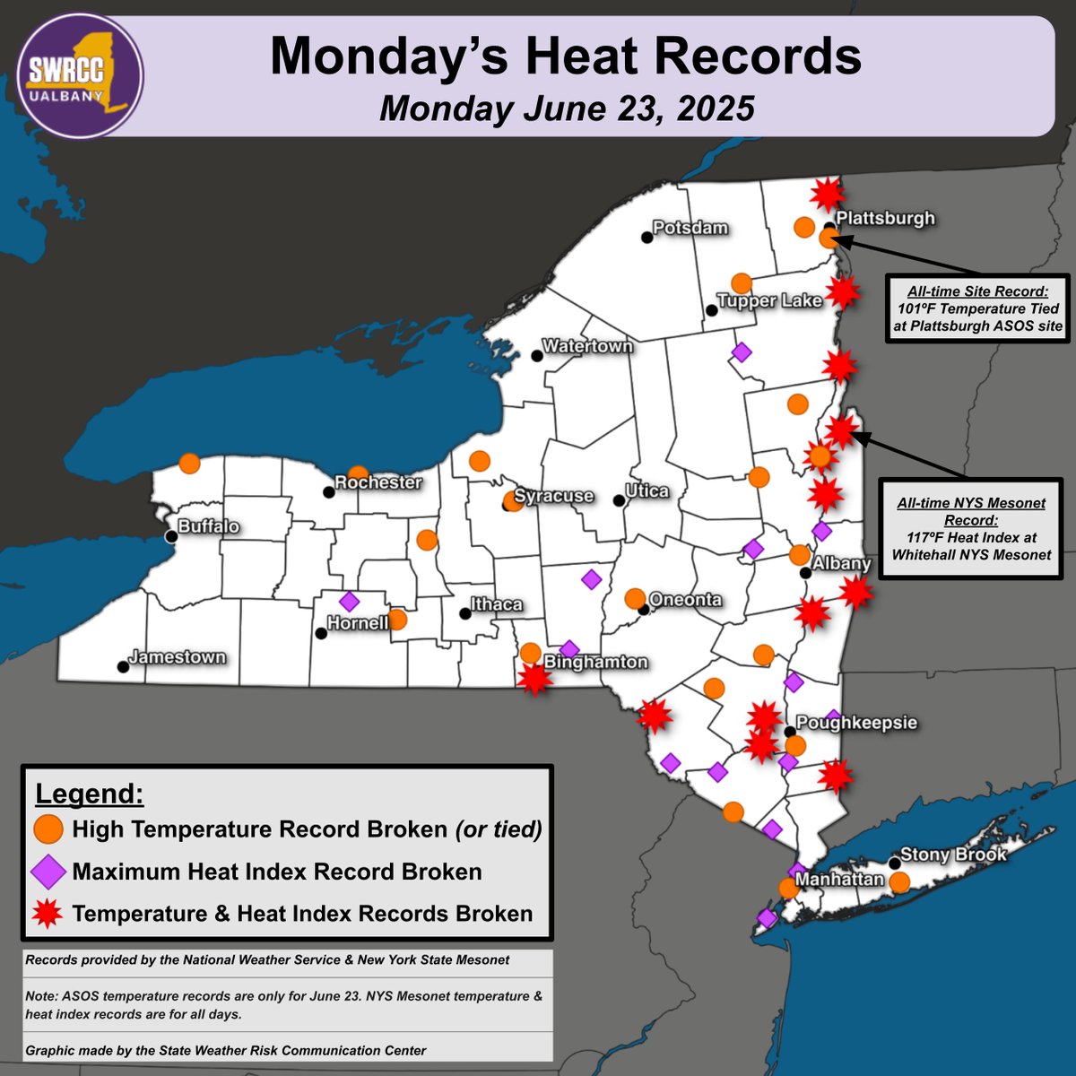
Yesterday was once again a record-breaking day across NY. Here are some of the "hot"-lights:
-Several long-running weather stations recorded their warmest ever June temperature, such as at JFK airport.
-The @nysmesonet network recorded their first ever 100F temperatures.
Many high temperature and high heat index ("feels like") records were tied or broken across NY yesterday.
We've compiled these records for both traditional long-running stations ("ASOS") as well as @nysmesonet stations.
It's likely you don't live far from a broken record!
We're grateful for fantastic opportunities for our students, such as internships with the @NYSWRCC! Pictured here are Atmospheric Science undergraduates Jack Fordyce, Bella Condo, and Harrison Miller, working with the SWRCC's Lead Meteorologist (and UAlbany alum) Allison Finch.
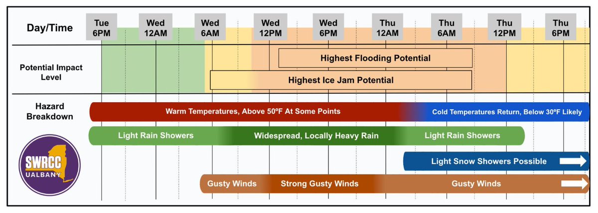
A complex early spring storm will affect NY this week, bringing warmer temperatures and potentially isolated strong thunderstorms. Heavy rain combined with snow melt-water and possibly ice jams may produce localized flooding Wednesday and/or Thursday.
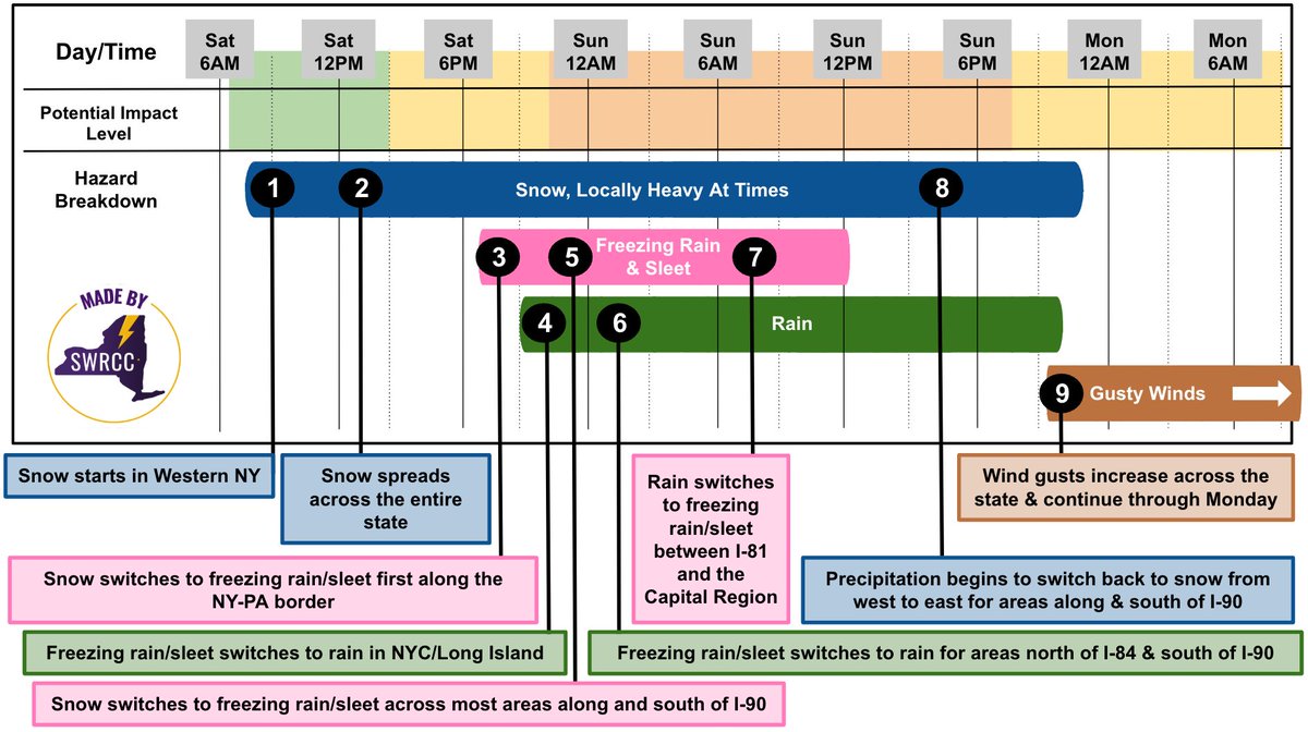
🎵 Freezing rain is pink, snow is blue
Rain is green, here's a forecast just for you 🎵
A complex winter storm will impact NY this weekend. Impacts include travel headaches and possible electric outages. Check out the graphic below to understand the expected timeline of weather.
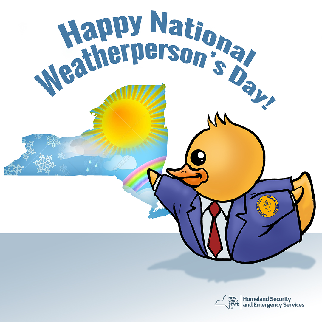
Happy National Weatherperson's Day! ❄️☀️🌧️
Thank you to our partners at the @nws and @NYSWRCC, who work around the clock to help us keep New Yorkers informed and safe during severe weather conditions and weather-related issues.
We're hiring! Come work at the New York State Weather Risk Communication Center. ☁️ 🌦️ ☔ ☃️ ⚡ Questions? Message me!
Meteorologist: https://t.co/qp9whlIyko
Product Developer: https://t.co/fzOtMSMStQ
Software Engineer: https://t.co/0oUd67OMjD
A #Winter Storm Watch is in effect for a handful of counties touching the Thruway system. Please monitor the forecasts and adjust travel plans accordingly. If you are traveling, slow down to the conditions and expect plows to be out for the storm’s duration. #dontcrowdtheplow
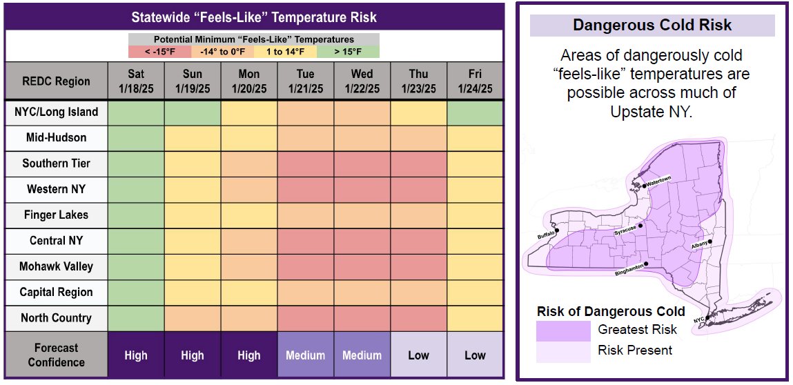
Heads up New Yorkers: A cold weather outbreak will affect New York State next week. Below-normal temperatures are likely statewide with “feels-like” temperatures falling -15°F across many Upstate areas.
Monitor your local forecast & prepare ahead now: https://t.co/rjzZ9kEhNj