It has been exactly 7 days since Isaias hit.
After widespread vegetative destruction and infrastructure damage, over 300,000 people lost power in Florida alone.
Today, just over 3,000 people remain without power.
Florida continues to be one of, if not the, most resilient hurricane-prone location in the world.
Impacts from Hurricane #Isaias caused nearly 25,000 power outages, most due to downed trees & downed power lines. Crews have restored over 17,000 customers since the start of local impacts & will keep working overnight to make repairs. (1/2)
Good reminder for the Florida panhandle to review their hurricane preparedness plan, inventory needed supplies, and take mind of your county evac zones
11 PM CT / 12 AM ET Isaias update: Timing is slightly faster, and Hurricane Isaias will make landfall late Friday. Rush preparations to completion early Friday morning. Wind, surge, flooding rain, and tornado impacts will occur well east of the landfall point. #FLwx#ALwx#GAwx
I am VERY concerned about this zone from Panama City to Tallahassee to Dothan, Alabama and Albany, Georgia. I actually think the impacts here may be more significant than in the eyewall.
Isaias's core is going to pass to the west, probably closer to Mobile or Gulf Shores (or even Pensacola). To the east, however, it will swirl robust tropical moisture northward and pinwheel a string of thunderstorms ashore.
High-resolution computer models suggest a feeder band (strip of downpours/thunderstorms swirling into Isaias) will take aim at the highlighted region for between 18 and 24 hours. Rainfall rates of 2 to 4 inches per hour are possible in the heaviest downpours within this band. I could easily see a narrow strip of 10 to 22+ inches of rain falling, causing locally significant to extreme flash flood cocerns.
If you find yourself under a flash flood emergency, it's a time to move IMMEDIATELY to the highest point you reasonably, and safely, can.
Models simulate plentiful convergence, or gathering/colliding air. When air is squeezed together, it is pushed upwards. That lifts moisture upwards into storms. That moisture then falls as extremely heavy rain.
Meanwhile, I also expect some tornadoes in this area, and the chance of an isolated significant (EF2+) tornado. Changing winds with height will help thunderstorm cells to rotate, and several tornadoes are possible. Machine learning models are highlighting this region too.
On Saturday afternoon, the threat will shift north toward Valdosta.
If a tornado warning is issued, seek shelter in an interior room away from windows as low as you can be without putting yourself at risk of flooding.
October 8, 2026 - 5 PM ET/4 PM CT:
Hurricane #Isaias has strengthened into a 100 mph hurricane in the central Gulf. It's forecast to continue moving northeast and eventually to the north later tonight. (1/5)
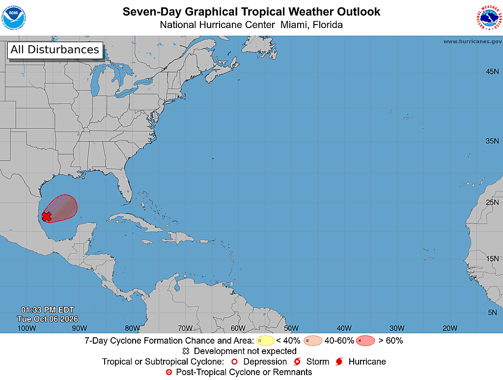
🚨 10/6: @FLSERT is closely monitoring Invest #92L, which is expected to strengthen in the coming days.
Take the time now to review your disaster plan & stay alert for more updates.