@topologicBIM@atfritsch@aothms@willy_maps@archilogic @AAltahlawi @ProjectJupyter@Blender@FrancoisMockers Good point. Francois is the expert here. But to my understanding it's a purely geometric algorithm that operates on a single navigation mesh. Meaning if you'd want different rules ( public / accessibility ) you'd need to provide a different mesh by excluding some polygons.
@FrancoisMockers@topologicBIM@atfritsch@aothms@willy_maps@archilogic @AAltahlawi @ProjectJupyter@Blender First, thanks for the library. It works great and I didn't spot any issues so far. It took me a while to figure out how to get the faces in ccw order per vertex in the correct format to build the mesh - if that part would be handled by the library it would be very easy to use.
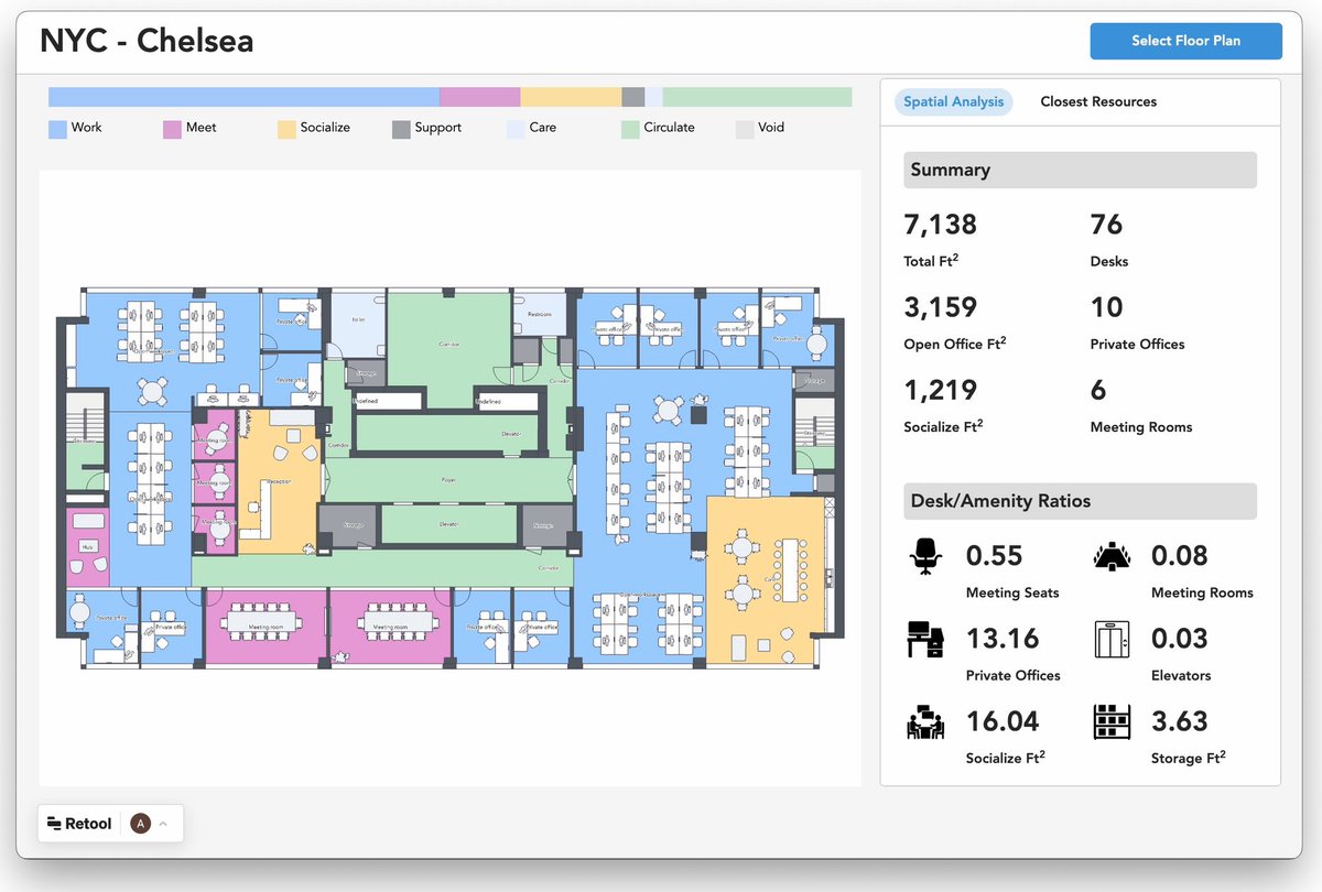
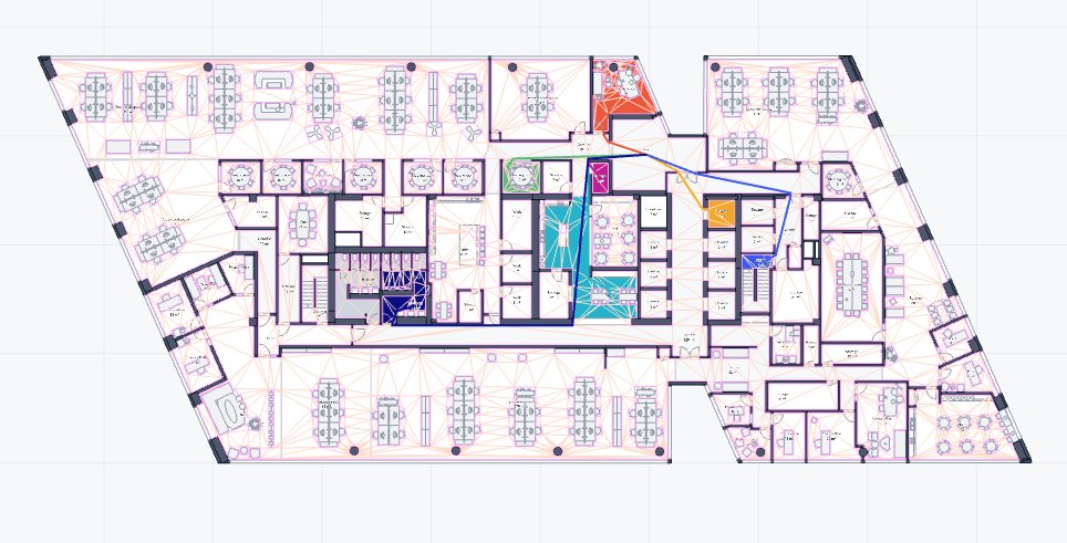
while our building data at @archilogic data may seem like a nicely hierarchic dandelion it's actually a bit more complex - adding relations and filtering this graph for space connectivity reveals lots of insights - like a missing door and a disconnected space
In floor plans you often deal with a space in a space. Nature takes this one step further. According to the "recursive islands and lakes" article on wikipedia there is an island in a lake on an island in a lake on an island in a lake in Nunavut Canada🤯 https://t.co/YdzHMTAdWr
Maybe we’ve been looking at BIM Data in the wrong way.
Rather than attempting to catalogue it, we should be looking at indexing and recalling that info more effectively?
Works for this web, why not BIM?
We launched DXF export in our editor. Kudos to @fredric_ and team! Which other export formats would you like to see and how could they support your workflows?
@jmanooch@dburgauer@archilogic The entire platform including editor is ready to be used. That particular piece is not yet. If you're interested you can DM me for a quick demo.