Not many people will see this, but if you're ever feeling down, just remember that you tried and you're still here today. You're still here after all your worst days, stronger than ever.
If you ever need someone to talk to, I'm here for you (^-^)/
I love you <3
@iJailbreak10@LuftkoppTim Image 1 is a typo, grow a pair of balls and admit you’re bitching just to bitch.
Image 2-4 were leaks, so obviously nothing was 100% confirmed. Quit embarrassing yourself 🥀
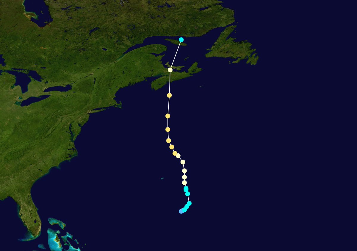
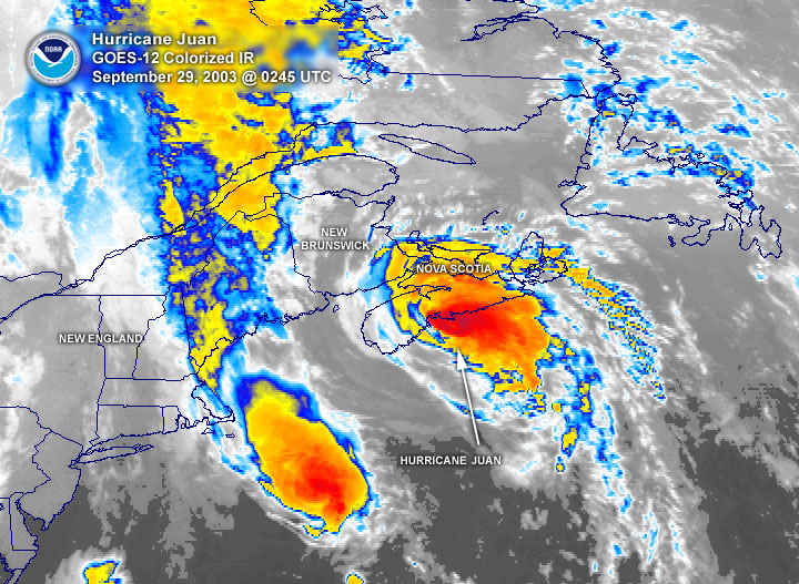
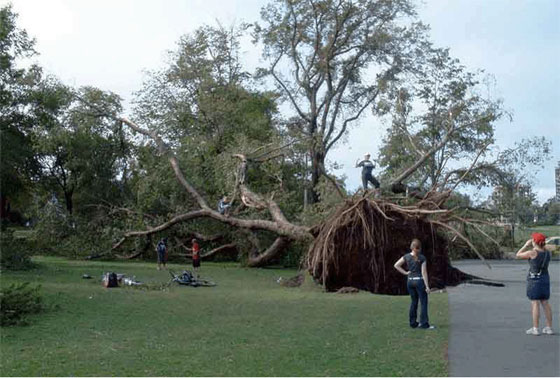
September 28, 2003:
Hurricane Juan made landfall in Nova Scotia as a Category 2. The storm was the worst tropical cyclone to impact Atlantic Canada in over a century. Juan knocked out power to 300,00 residents, caused $200 million in damage, and killed eight people.
#wxhistory
The Hurricane Hunters have confirmed that Hurricane Polo is STILL a Category 3 Major Hurricane, with winds of 115 MPH (185 kph) and a core pressure of 964 mbar.
Conditions are now deteriorating over Baja California Sur as Polo’s life-threatening winds and rainfall are set to begin soon. Flash flooding from 6-12 IN of rain (especially in areas of steep desert terrain) and coastal storm surge across arid beaches to the south of the eye is expected.
Just another day in the Pacific and another system (4th) attempting Cat 5 status! #Nolo
NHC says temps of 21C within the 30-mile diameter eye while the surrounding ring of convection has likely cooled below -85C!
September 28, 2022:
Hurricane Ian reached Category 5 intensity in the Gulf of Mexico before making a catastrophic landfall in Florida as a high-end Category 4 during the afternoon. The storm killed 150 people and produced around $110 billion in damage in the state.
#wxhistory
The explosive transformation of Hurricane Nolo to the south of Hawaii.
From a struggling, misshapen CAT 1 storm to an annular, CAT 4 monster in less than 30 hours.
With winds now at 155 MPH, a 929 MBAR eye that’s warmer and drier than ever (-16.9 C), and a superchilling doughnut ring of convection, Nolo is on the absolute precipice of Category 5 status. A potentially historic upgrade from the NHC is imminent.
41 years ago today, Hurricane Gloria made landfall on Long Island. This would be the most recent landfalling hurricane in New York. (And before people come at me, Sandy wasn't a hurricane at landfall and didn't make landfall in New York).
Hurricane Nolo’s structure has remarkably improved this evening — at this rate it may very well become the record-breaking 4th category 5 hurricane of the East/Central Pacific season.
This could be one of the most hyperactive Pacific Hurricane Seasons we ever see in our lifetimes.
Only FIVE DAYS after Hurricane Polo exploded to a historic 180 MPH, 892 MBAR peak intensity, Hurricane Nolo is now potentially just moments away from clinching CAT 5 status herself.
We’ve already had three CAT 5 Pacific Hurricanes this year. No season in the satellite era has ever had four. And it’s not even October yet.
Hurricane Nolo is now a Category 4, and is making a run at Category 5 strength. (This is the one southwest of Hawaii – NOT the one offshore of Mexico heading for the Baja).
Its center is 380 miles south-southwest of Honolulu; the storm had 145 mph winds as of Sunday evening local time.
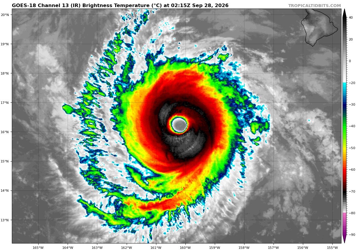
It's an annular cyclone, meaning it's made of one solid ring of thunderstorms, rather than spiral bands. Annular cyclones typically strengthen more easily due to their symmetry; they also weaken slower, made hardier by their solid ring of storminess.
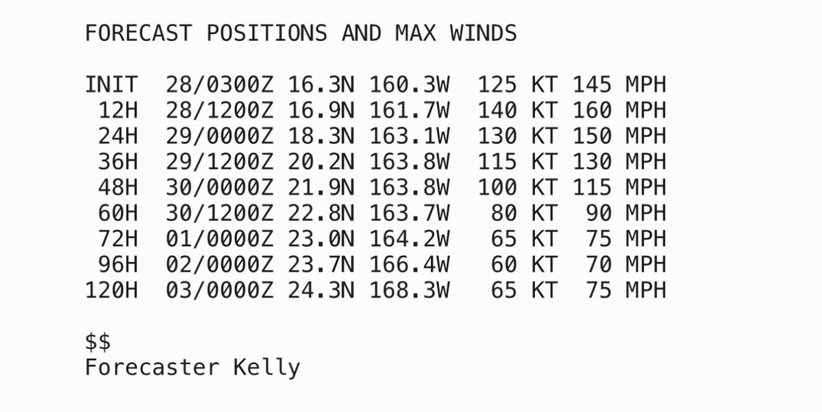
The National Hurricane Center is explicitly forecasting Nolo to become a Category 5 on Monday morning – the fourth of the 2026 central/eastern Pacific hurricane season. That would mark a new record.
Yep... Hurricane #Nolo is now forecast to become a Category 5, if so, it would be the fourth of the season. This will break the record for the most amount of C5s ever seen in a single Epac season. And we still have October...
Oh would you look at the time, it’s C5 o’clock again. #Nolo is at a C4 & is expected to be the EPac/CPac’s 4th C5. And it’s another C4 S of #Hawaii. I know Nolo wants to copy Lowell’s homework but it’s too obvious.
#tropicswx
THIS IS WILD! Hurricane Nolo has the "stadium effect" and mesovortices, and is nearly a Category 5 Hurricane about 350 miles Southwest of Hawaii...
@WxFront
It’s one unbelievable Stadium Effect after another.
Extreme close-up of the 939 MBAR eye of Hurricane Nolo right now as her eyewall winds accelerate to 145 MPH.
The NHC is now predicting that she could become the unprecedented 4TH Category 5 Pacific Hurricane of the year.