WHAT DID I JUST WITNESS?!?!? I just watched a Starship reenter after over 22 hours in orbit AND GOT CAUGHT BY THE TOWER!!!!! UNBELIEVABLE!!!! Huge congrats @SpaceX@elonmusk
In our OSINT investigation of Spain's information space ahead of the Nov 29 election, we found a Vietnamese page farm riding the campaign. It is the largest foreign structure in the country's pre-election information space.
12 Facebook pages posing as Spanish news and community outlets, every manager located in Vietnam. Together: about 270,000 followers, built in eleven weeks this summer. Since Oct 27 they publish fabricated election stories dated to the campaign calendar.
We traced the pages, the ads that bought their audience, the company behind the links, and the operator's own desk, captured by malware.
This is how a Spanish audience is manufactured abroad.
Un poco de hielo marciano brillando al Sol
MISSION_NAME = #PHOENIX
INSTRUMENT_NAME = ROBOTIC ARM CAMERA
TARGET_NAME = #MARS
NASA/JPL/Univ. of Arizona/Texas University/j .Roger
🛰️☄️ Selon l’US Space Force, le télescope spatial Swift de la NASA s’est désintégré dans l’atmosphère ce mercredi 4 novembre à 12h39 UTC, au nord de Sumatra. Des observations concordantes montrent la chute de fragments dans la région. RIP Swift. 🫡
Naixen cinc nous cadells de llop entre l'Alt Empordà i l'Alta Garrotxa
El Govern prepara un Pla de recuperació i assumirà directament les indemnitzacions
https://t.co/5R1EWKcl2n
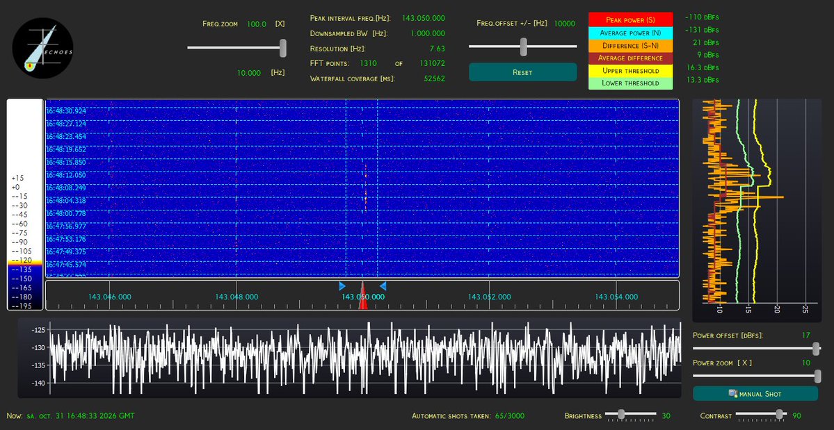
UN BÓLIDO DIURNO #SPMN311026E DEBIÓ APARECER AYER TARDE sobre las 16h47m52 TUC (17h47 CEST). Aquí vemos los dos registros en forward-scatter desde Riudellots de la Selva de Joan Figueras @gavarres y desde Zaragoza de Xema Oncins @XemaOncins82. Al listado:
https://t.co/ZL49qmxk5y
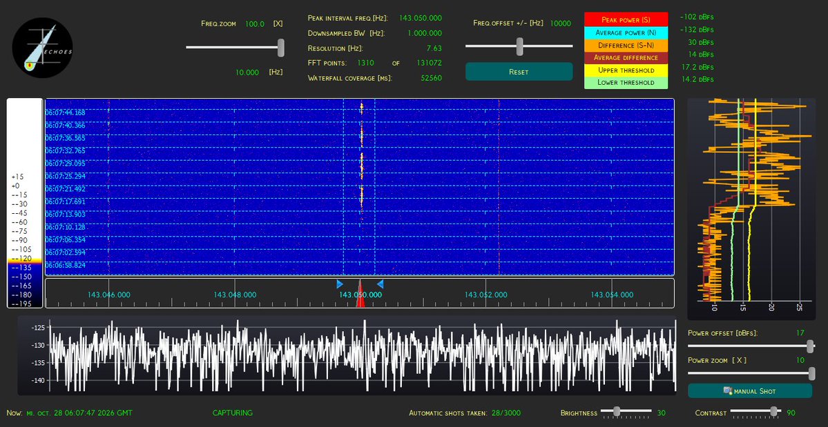
IMPORTANTE ECO DE BÓLIDO #SPMN081026FWS AYER a las 6h07m04 TUC (7h07 CEST). Aquí lo vemos captado por Joan Figueras @gavarres desde Riudellots de la Selva, #Girona y @XemaOncins82 desde Zaragoza
Si lo vistes, ya en plena mañana, puedes enviarnos los detalles: 📨 [email protected]
What’s under the ice? 🧊
This map from @NASA scientists and others shows the land underneath the Greenland Ice Sheet, linking hundreds of valleys that previous maps missed or left fragmented. https://t.co/cla8mk9wHB
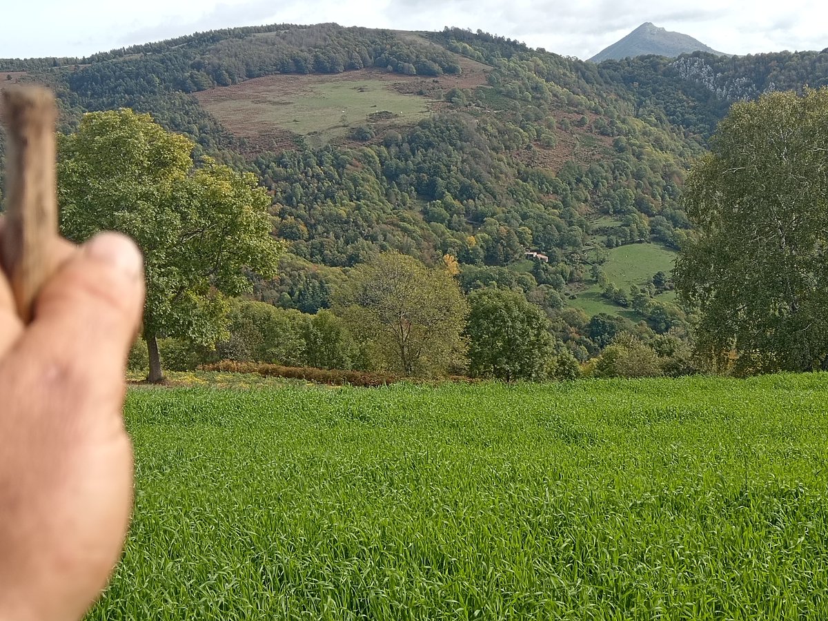
Guardem bestiar, però també guardem les velles i noves històries:
La lloba emmetzinada, les rutes del contraban, dels maquis, de les guerrilles del nostres dies, dels llamps que cauen..
No és només paisatge, tot el que ens ha fet com som és aquí.
#HistòriesDeMuntanya#Pertinença
La dépression responsable de la tempête Austen s'est creusée et arrivera à mâturité ces prochaines heures. Elle a subi un développement explosif avec chute de pression significative.
Des rafales de 90/110 sont prévues dans les terres avec des pointes à 120/140 km/h sur les côtes du nord Bretagne et département de la Manche.
What happens when Google WxNext3 assigns a substantially higher probability to a European weather regime than other forecast models?
Today's World Climate Service analysis highlights a significant difference in the 11–15 day Euro-Atlantic weather regime forecasts from ECMWF, AIFS ENS, WxNext3, GEFS, and CMC.
Through the medium range, the models show relatively consistent weather regime probabilities. However, WxNext3 diverges considerably in the 11–15 day period.
On October 24, WxNext3 assigns a 77% probability of Scandinavian Blocking, compared with 47% from ECMWF, 39% from AIFS ENS, 29% from GEFS, and 24% from CMC.
WxNext3 maintains a relatively high probability of Scandinavian Blocking through October 28, although it declines to 52%.
What does this mean for energy meteorologists on power and natural gas trading desks?
The WxNext3 ensemble members associated with Scandinavian Blocking indicate warmer-than-normal temperatures across much of Europe and below-normal wind speeds.
This scenario would suggest:
• Reduced heating demand relative to normal temperatures.
• Below-normal wind power generation potential.
• Different weather-related risks for natural gas demand and power markets.
Using the World Climate Service Grams seven-regime forecasts, energy meteorologists can quantify differences in regime probabilities across models, identify the circulation scenarios driving those differences, and evaluate their associated temperature and wind risks.
Rather than relying solely on ensemble mean forecasts, weather regime analysis provides additional information about the range of potential weather outcomes and where forecast models disagree.
The World Climate Service helps energy meteorologists amplify their meteorological expertise.
#EnergyMeteorology #WeatherRegimes #WeatherRisk #EnergyTrading #WeatherForecasting
Era impossible de predir, en els mapes no sortia.Quan un només mira un tipus de model i no s'obre la ment passa això a la Mediterrània. És un fenomen inèdit, però un grup de friquis de méteo de Telegram en el que estic ja varen predir ahir que això passaria a BCN i voltants
🔴 Emergència #Inuncat
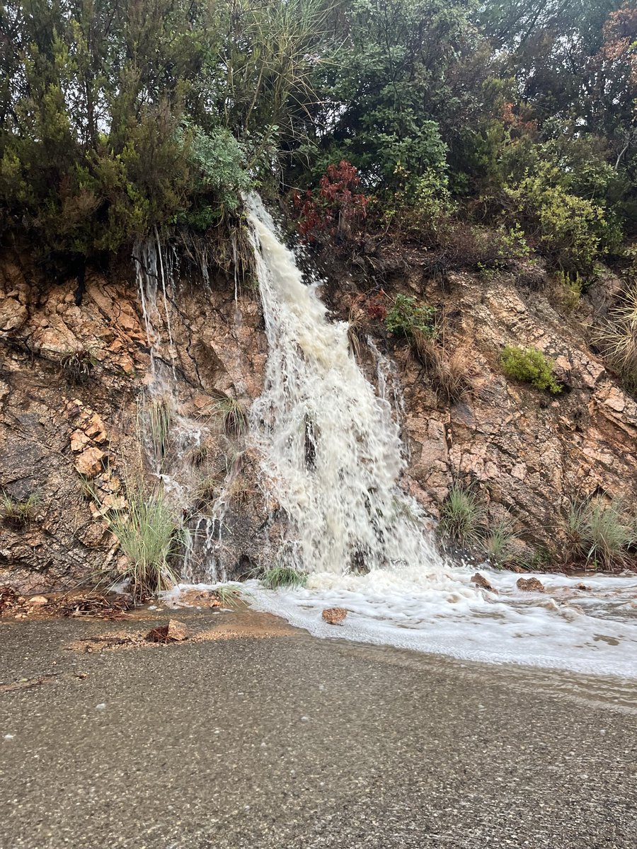
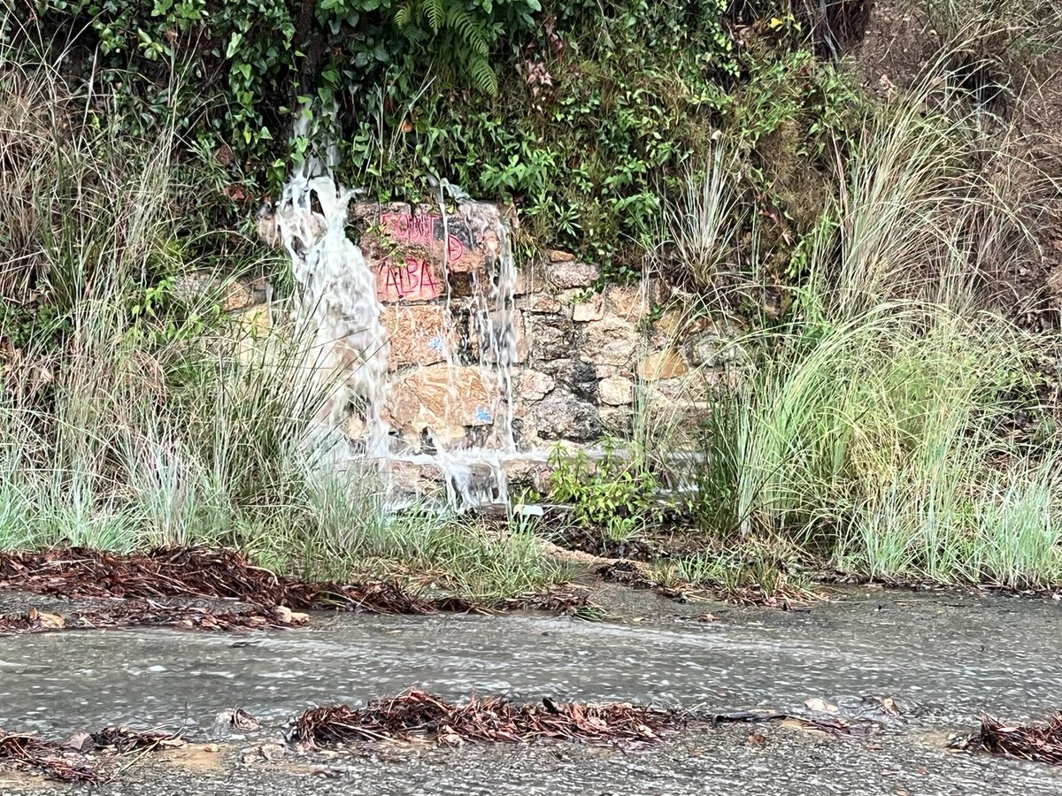
El cabal del riu #Ridaura a Santa Cristina d’Aro és de 300 m³/s i ha superat el llindar equivalent a un període de retorn de 100 anys.
Molta #Precaució. Eviteu apropar-vos a la llera.
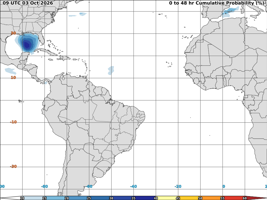
Que el Mediterrani estigui en ebullició té conseqüències. Hores crítiques per seguir l'evolució del sistema convectiu de mesoescala en actiu ara mateix.
Imatge: Probabilitat de formació de ciclons tropicals en les pròximes 48 hores (@NOAA) https://t.co/nSFOMeZwHr
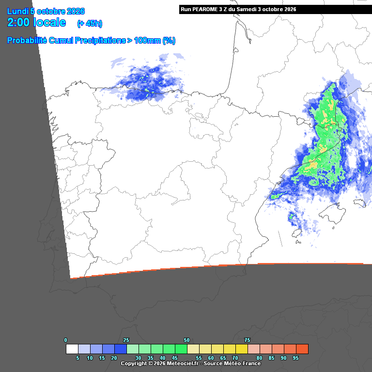
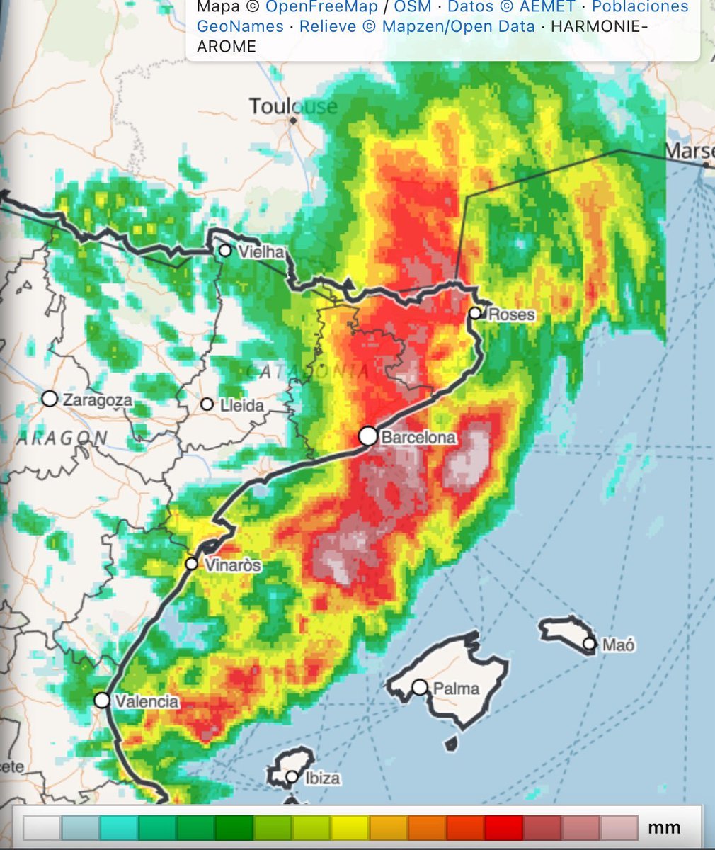
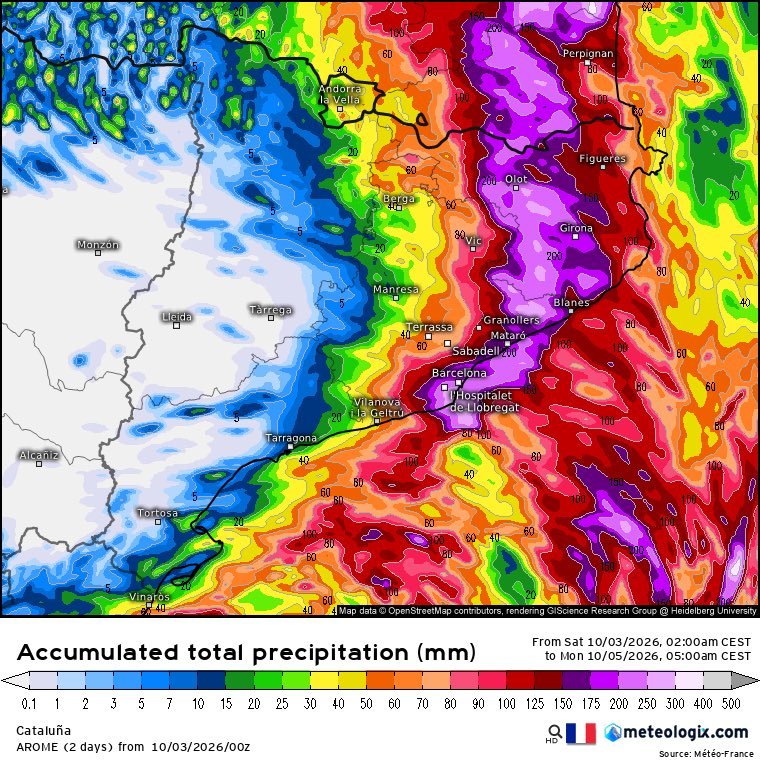
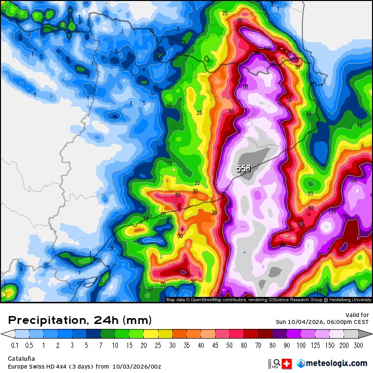
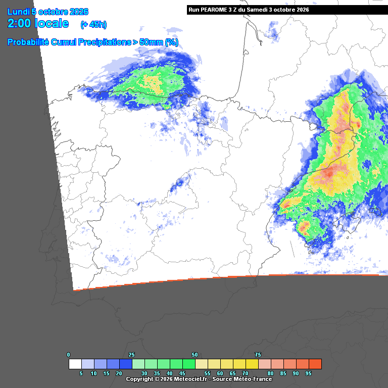
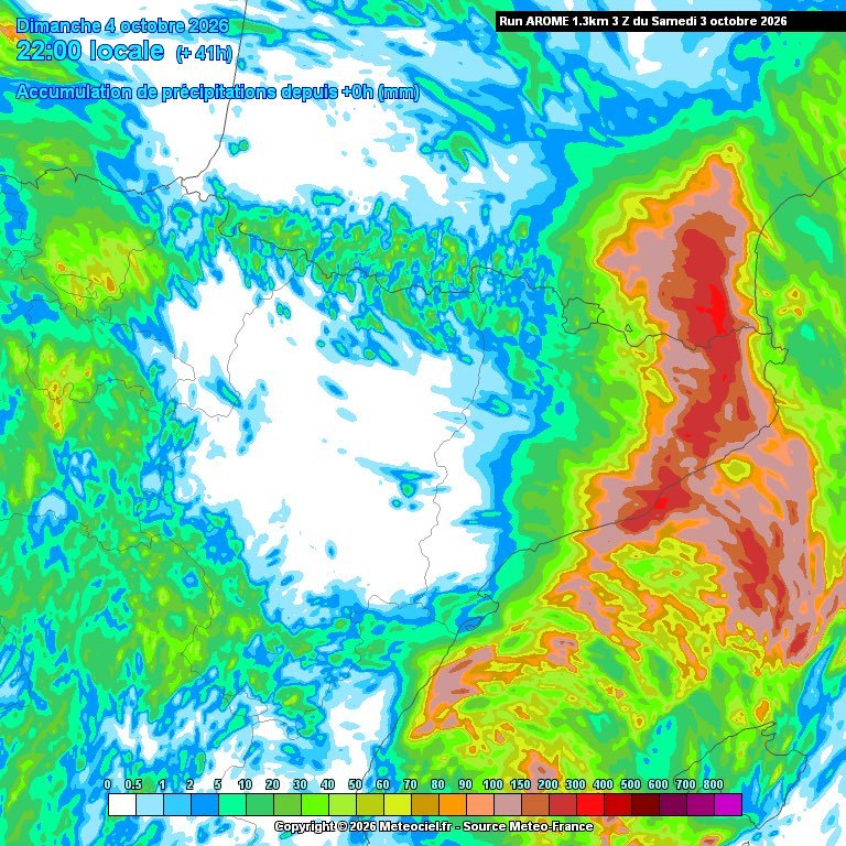
Malgrat que encara hi ha incertesa, els models es van posant cada cop més d'acord en un episodi de pluja torrencial, molt abundant i extensa des de la costa central cap al nord per a les pròximes hores.
Arome dóna 50% de prob. de superar els 100 mm i 75% de superar els 50 mm...
ATENCIÓ ⚠️ MOLT DE COMPTE ENTRE AQUEST VESPRE I DEMÀ ⚠️
Situació meteorològica complexa, i de confirmar-se, amb potencial per descarregar pluges torrencials a algunes comarques de GIR i BCN.
Veurem com actualitzen els models ara al migdia i aquesta tarda.
⚠️ 🌧️ 🌧️ 🌧️ 🌧️ 🌧️ ⚠️
El 12-09-26 = el mínim en extensió de gel àrtic segons #NSIDC. No és un mínim destacable. El desgel es resisteix a estius, i dins de la comunitat científica hi ha debat sobre l'aplanament de la tendència en desgel que semblava marcada fins a inicis de la 2a dèc. d'aquest segle.