Many things are lining up for a fast start to winter this year in the East-Central US
For ex: being in a La Niña w/ a slower-moving and more amplified MJO (due in part to the easterly QBO) makes a subsequent -NAO/AO more likely
Fig from Lee et al (2019): https://t.co/usgfR7NGv4
Excellent update of the Fu Berlin website that has added a very interesting and useful feature, the Eliassen-Palm Flux (Ep-Flux) composed of two parts a dynamic, momentum flux and the thermodynamics, heat flux, which show the negative or positive transport of vorticity (u-change) upwards or downwards with convergence of heat fluxes (negative divergence) or divergence of fluxes (positive divergence). Very useful in defining a slowing down of Westerlies or Westerlies (W'y) typically associated with positive vorticity with Easterly or Easterlies (E'y) with negative vorticity. @PvForecast@FransNucera@Met4CastUK@judah47
https://t.co/yjZNoIHv1q
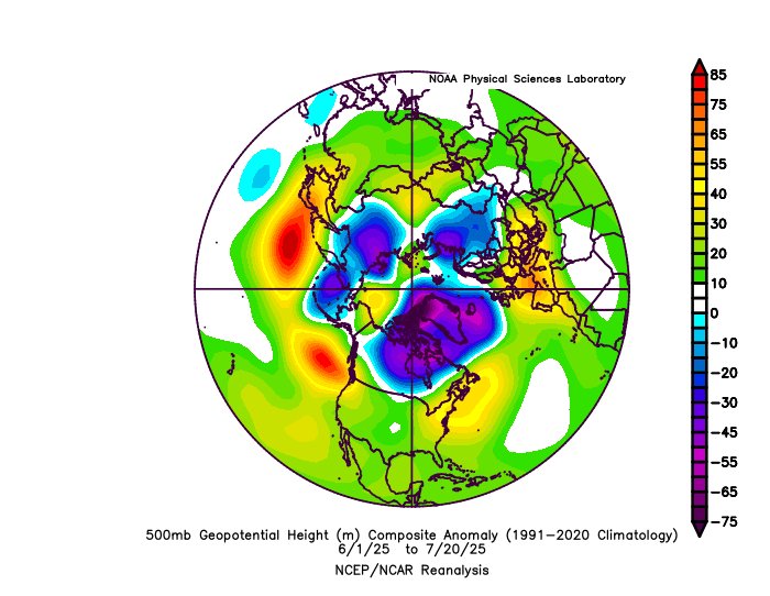
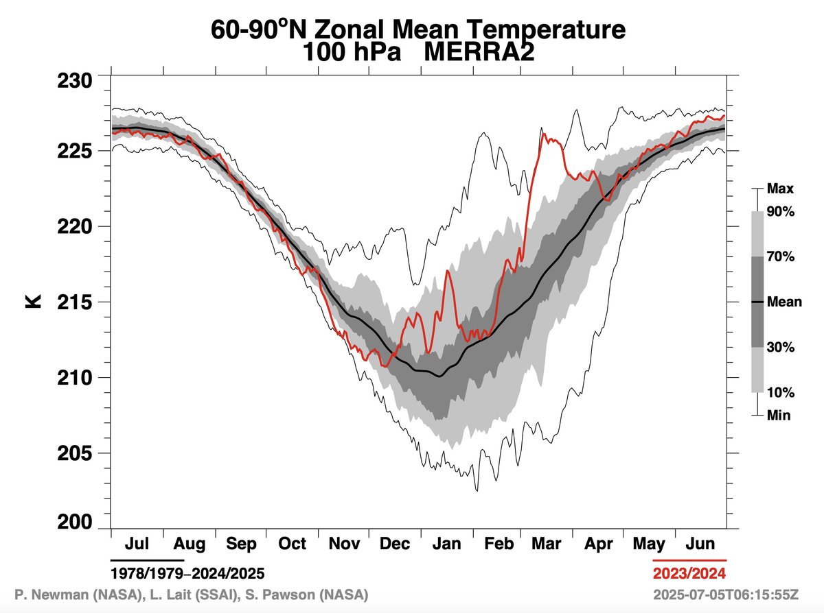
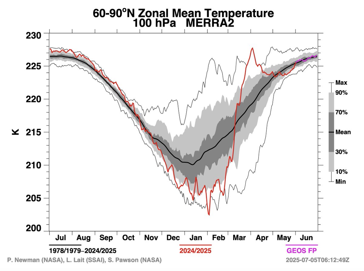
It's no coincidence that this yr & last yr's +NAO dominated summers have came after major strat warming events in early spring
The persistent +NAO has kept the Atlantic cooler/more stable than it otherwise would be & shouldn't be ignored in seasonal fcsts
https://t.co/MYFptD3RYx
#Europe: Increased model #spread towards W17 - what should we extract from the conflicting signals and #trends?
https://t.co/wc9516I9ZC
Since yesterday heading there is higher uncertainty in the placement of troughing either over W or N areas of Europe – or over both!
Since yesterday, we have a much larger #spread in model guidance going towards week 11 (mid-#March) for #Europe. The latest runs moved higher pressure from E Europe to higher latitudes, but with split guidance on where exactly ridging will set up.
https://t.co/MhRkJStqdr
I’ve been seeing a lot of misleading posts about stratospheric warming events lately.
Just want to remind everyone that the sensible weather impacts associated with stratospheric warming events are not linear. I.e. a stratospheric warming event doesn’t always favor more cold/snow, as the tweet below shows. In some cases, it can actually backfire on you.
Be careful what you wish(cast) for.
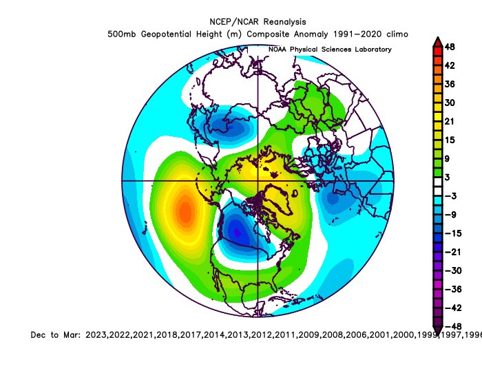
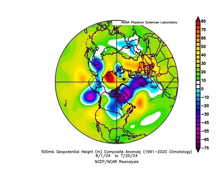
N Hem 500mb & SLP composite for all cool ENSO Neutral & La Niña winters over the last 30 years.
Note that most of these winters have a tendency to produce more Kara Sea blocking & a -NAM/-NAO, arguably more so than their older, mid-late 20th century counterparts.
First, preliminary glance at this coming winter suggests we may be going down a similar path… (1/?)
Tendenze per giugno. Questa mappa ci mostra una proiezione su quello che potrebbe essere, a livello atmosferico, il mese di giugno sull'Europa. Essendo una tendenza per l'intero mese, non basta guardare i colori della cartina va anche interpretata e lo farò per voi cercando di essere sintentico.
L'Europa Nord-Occidentale continuerà ad essere terra di conquista delle correnti perturbate nord-atlantiche mentre i balcani, l'Egeo e l'Anatolia vedranno la persistenza di risalite d'aria calda di matrice subtropicale sahariana. Cosa può accadere sull'Italia? Ritengo sia molto probabile che il mese di giugno vedrà un alternanza molto spiccata di brevi risalite molto calde di matrice sahariana a correnti umide oceaniche piu' instabili con una penisola spesso divisa in due sia a livello termico che di condizioni meteorologiche.
La buona notizia è che con questo schema barico, almeno per il mese di giugno, le risalite di aria calda subtropicale sahariana sul nostro paese sarebbero sempre brevi con una durata massima di 2-3 giorni e intervallate da cali termici dovuti al successivo arrivo di masse d'aria instabili dall'Europa Nord-Occidentale. Un continuo saliscendi, come un'onda sinusoidale.
In sintesi, per il mese di giugno non ci sono all'orizzonte anticicloni strutturati e persistenti di matrice sahariana capaci di portare lunghi periodi di caldo anomalo sul nostro paese ma questo ovviamente non significa che non possano arrivare successivamente, nei mesi di luglio ed agosto.
@FransNucera@peacockreports@judah47@PaulRoundy1 What I'd say is even more crucial than the average strength of the jet, it's its horizontal shear. This may well change from winter to spring, when the jet starts its transition towards a more poleward mode.
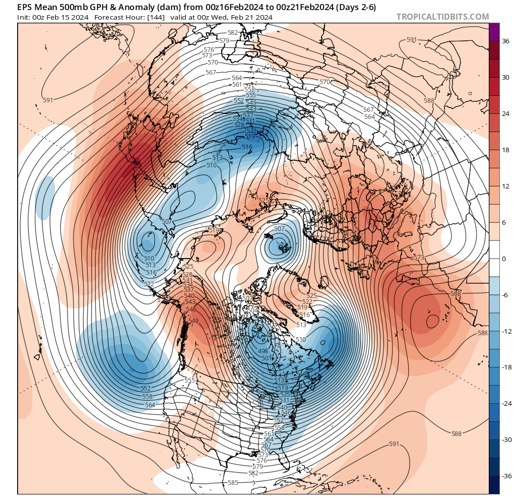
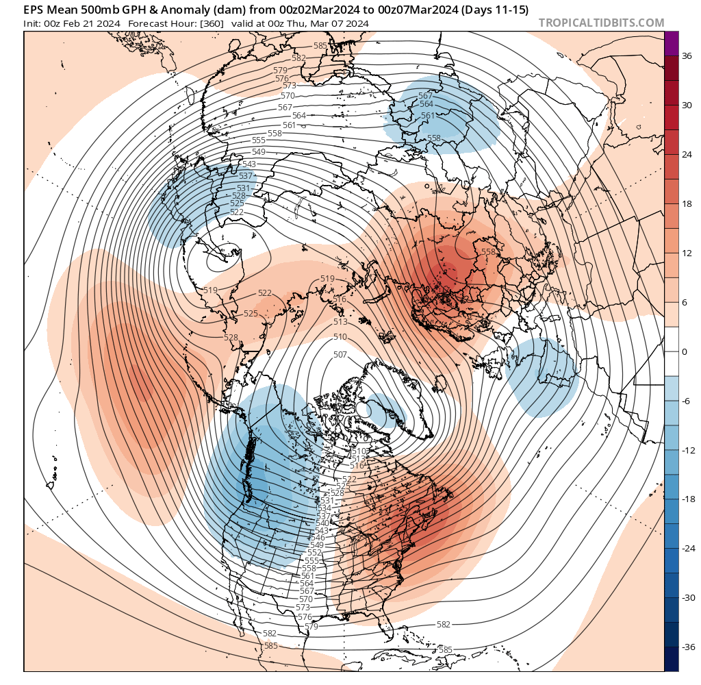
First map is what happened in that crucial time frame. A much flatter flow into continental Europe which led to a much weaker response in the stratosphere. Second map is what is predicted in 10-15 days. No wonder models now see again a significant SSW by the beginning of March.
This is a key ingredient to activate a forcing over the Euro-Atlantic sector, which in tandem with the Pacific forcing can eventually split the polar vortex. So, for those interested, the period Feb-15-22 will have to be closely monitored in the forecasts.
@FransNucera@climafluttuante Even worse, from the top left corner (the most wintry regime combination for continental Europe) to the bottom right (the least wintry). A complete debacle.
High-latitude blocking pulled a complete disappearing act in the medium and extended range forecast. Here's a visual of the last 10 runs of the ECMWF Weeklies, 7-day 500hPa height anomalies ending 2/25. The Greenland High regime now seems highly unlikely to develop at all.
The chart in the top left corner shows what happened back in 2018 just a few days before the SPV split (see https://t.co/qfsEq1q0Sz). The big map is instead the potential evolution from mid-February onward. You may notice some similarities...
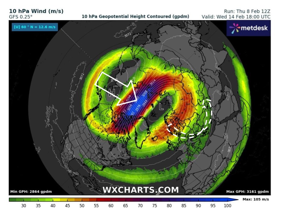
I'll take the latest GFS run to show why the model has been exploring a potential split of the stratospheric polar vortex by the end of the forecast period. This image shows the vortex is already weakened by a wave-1 forcing (represented by a high pressure over the Pacific side)