@UNHExtension's Geospatial Technologies Training Center helps NH citizens (and others!) use digital mapping in their lives. Comments & RT ≠ endorsements.
We've just completed a LONG overdue revamp of #GIS workshops. All workshops are offered remotely, topics include GIS basics, @ArcGISOnline, @ArcGISStoryMaps, @ArcGISPro, #ArcGISDashboards, and @ArcGISSurvey123.
Learn more: https://t.co/qD38NtOYDS
Not that #GIS users in New England need another excuse to attend the Northeast Arc User meeting this fall (https://t.co/fwOaf8Y9X1), but here you go anyway - don't miss an @ArcGISStoryMaps keynote and workshop led by @AllenCarroll himself!
PS: Early bird registration ends 9/18
We've just completed a LONG overdue revamp of #GIS workshops. All workshops are offered remotely, topics include GIS basics, @ArcGISOnline, @ArcGISStoryMaps, @ArcGISPro, #ArcGISDashboards, and @ArcGISSurvey123.
Learn more: https://t.co/qD38NtOYDS
The 2023 schedule for our 1-day, remote, instructor-led workshop on #ArcGISPro has just been released (sorry it took so long!) - use https://t.co/4JBRSglhBF to learn more and register. @UNHExtension@UofNH@UNH_ProfDev
A huge THANK YOU to the @ArcGISStoryMaps team for including built-in color contrast calculation in the theme builder! This feature will (1) increase #accessibility awareness and (2) make it MUCH easier for people to follow through and meet standards. https://t.co/n1VUS0dCIG
@UNHExtension's spring/summer schedule for 1-day workshops on #ArcMap (yes, still...) and @ArcGISPro is now available - https://t.co/sGk4MQA4Hv https://t.co/4JBRSgkJM7 @UNH_ProfDev
Excited to be part of a @UofNH project exploring risk and resilience response to #COVID19 in NH https://t.co/RdpLTzxcsY | my role: using @ArcGISOnline and @ArcGISStoryMaps to explore relevant data, engage stakeholders, & effectively share results @UNHExtension @CarseySchool
It's been INSPIRING to work with @UNHExtension and @NHSeaGrant (all at @UofNH) colleagues on #COVID19 response maps (I learned lots about @ArcGISStoryMaps on the way!) - looking forward to sharing our maps with others in #CoopExt (any ideas @eXtension4U?) https://t.co/9ms9uHliYG
Farmers and fisheries around #NH are increasing production to meet the needs of residents in their communities. The @UNHExtension has curated three new #food resource maps to assist individuals with finding locally produced foods: https://t.co/pjRKbEcdAn #localfood#farm#foodNH
Are you providing food for those in need? Is your food pantry or kitchen in need of donations? If so, please fill out @UNHExtension's #NH Food-Access Map Survey to help us understand food-access resources and needs around the state - https://t.co/BnG3G9Lbvi #COVID19
Calling all NH teachers - are you ready for GIS Educators Day in 2020? You'd better be! This year it's in NH ==> November 15th at the Mount Washington Hotel. https://t.co/mON1WK5NVQ
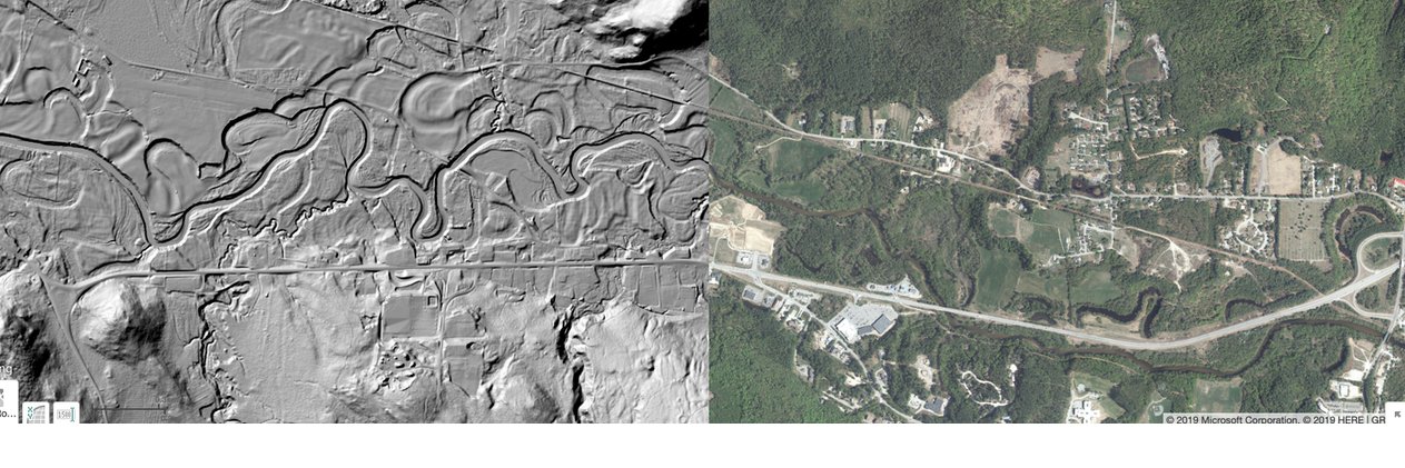
This is SUPER exciting (way to go @NHGRANIT and @NHDES!). Having 2-foot contours available for the entire state opens up a range of mapping possibilities. Any plans to add them to https://t.co/wpKRjkx9KO at some point?
Learn the basics of working with #ArcGIS Desktop (ArcMap) in a hands-on learning environment with our own @LimnoShane! We'll focus on #NH data and applications and you'll learn to produce attractive effective maps. Join us! #mapping#GIS https://t.co/zUfZV2KZix
Check out upcoming @UNHExtension & @UNH_ProfDev#GIS workshops and other GIS events (spring #NEARC!) in #NH in the next few months https://t.co/Ub1TkwgE03
Get your #GIS muscles in shape at our GIS/GPS Boot Camp this June https://t.co/4hL9xLdDTf | learn the basics, then apply your skills to your own mapping project | offered by @UNHExtension & @UNH_ProfDev