A few isolated severe thunderstorms are possible this evening, especially across central and north-central Kansas, although most locations should remain thunderstorm-free. Keep weather aware if outdoors this evening. #kswx
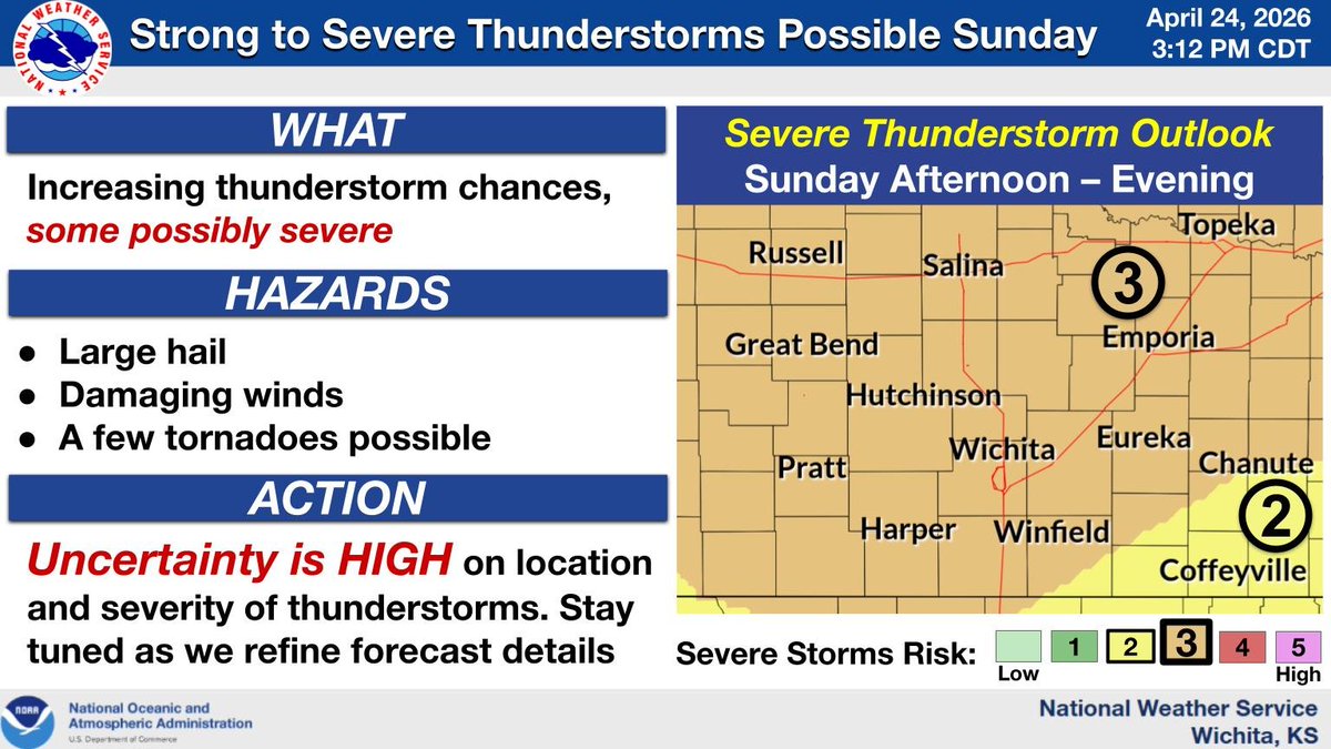
The potential for strong to severe thunderstorms is expected to increase Saturday and Sunday across the region. Uncertainty remains high though on the location and severity of storms, as low clouds may limit instability. Stay tuned as we refine forecast details. #kswx
Thunderstorms are expected to develop later this afternoon into the evening across south central and southeast KS. The strongest activity will be capable of producing large hail, damaging winds, and even a few tornadoes. Heavy rain may lead to localized flooding as well. #kswx
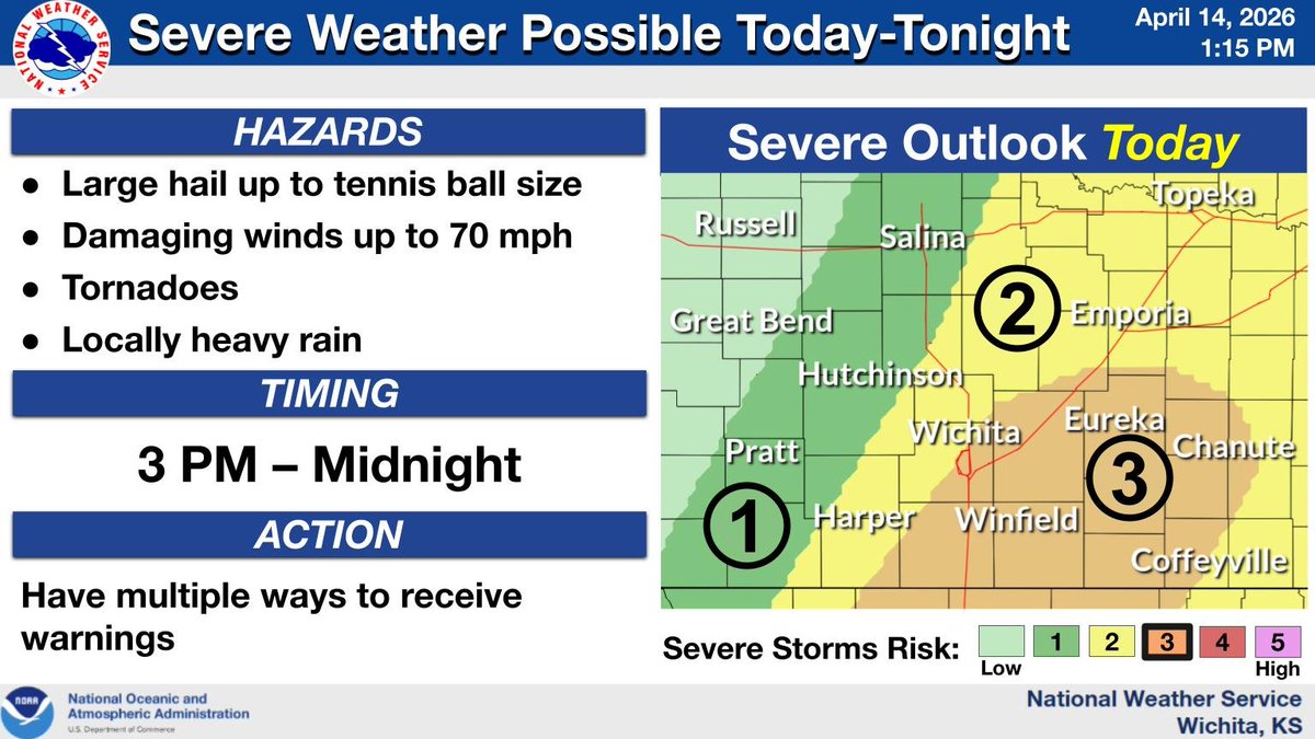
Storms are expected to redevelop along a cold front in central Kansas later this afternoon, then march southeast across the region tonight. Severe weather is likely with large hail, damaging winds, locally heavy rainfall, and a strong tornado all possible. #kswx
A potent winter system will impact our area beginning on Friday and continuing through the weekend bringing snow and bitter cold temperatures. Now is the time to prepare and stay weather aware! #KSwx
Scattered to numerous showers and storms will develop and track east overnight. Severe weather is not expected, however a strong storm is possible and would be capable of producing small hail or heavy downpours. #kswx
Showers and a thunderstorms will continue across the area today and tomorrow with the better chances of seeing additional rainfall greater than 1 inch south of Hwy 50. Highs in the 50s and 60s are expected. #KSwx
Shower and storm chances will increase late tonight and continue through Thursday afternoon. The stronger storms will be capable of small hail, gusty winds and brief heavy rain. #kswx
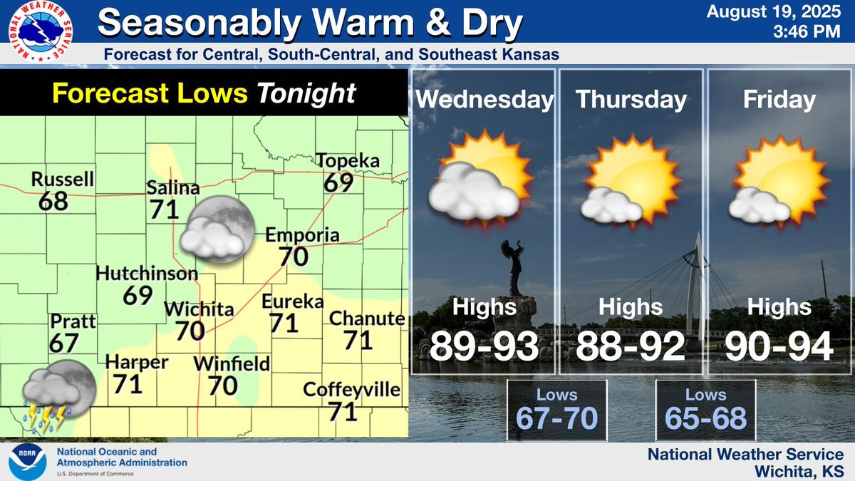
A few storms will linger across southern Kansas this evening with overnight lows falling into the upper 60s to lower 70s. Then seasonably warm and dry conditions are expected through Friday with afternoon highs warming into the upper 80s and lower 90s. #KSwx
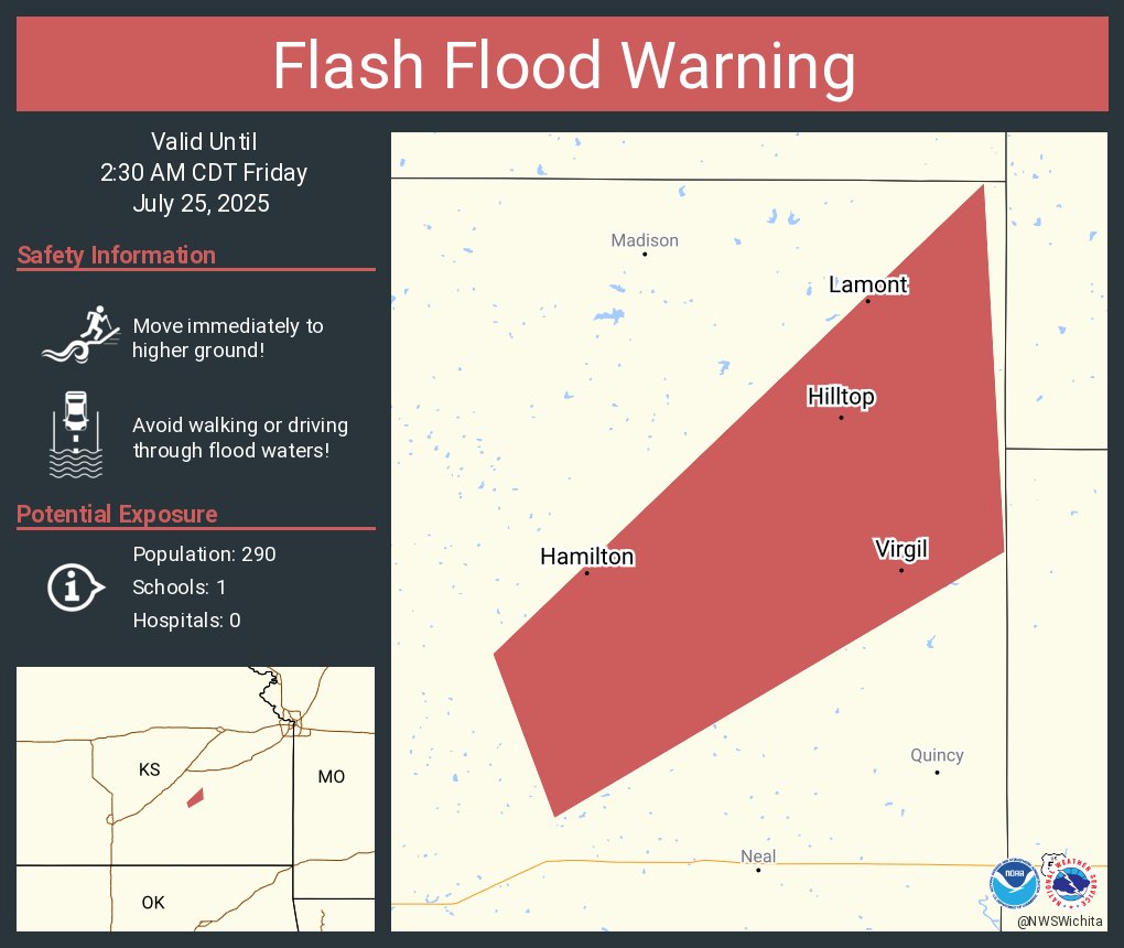
[4:49 PM | Wednesday, July 30th] A severe thunderstorm is in the vicinity of Hamilton (Greenwood County). Please let us know if you're receiving strong winds or hail. Thanks! #kswx
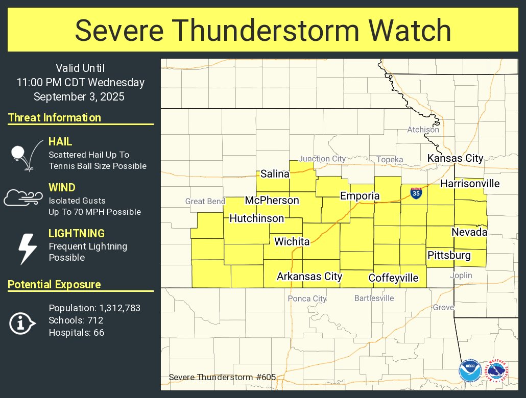
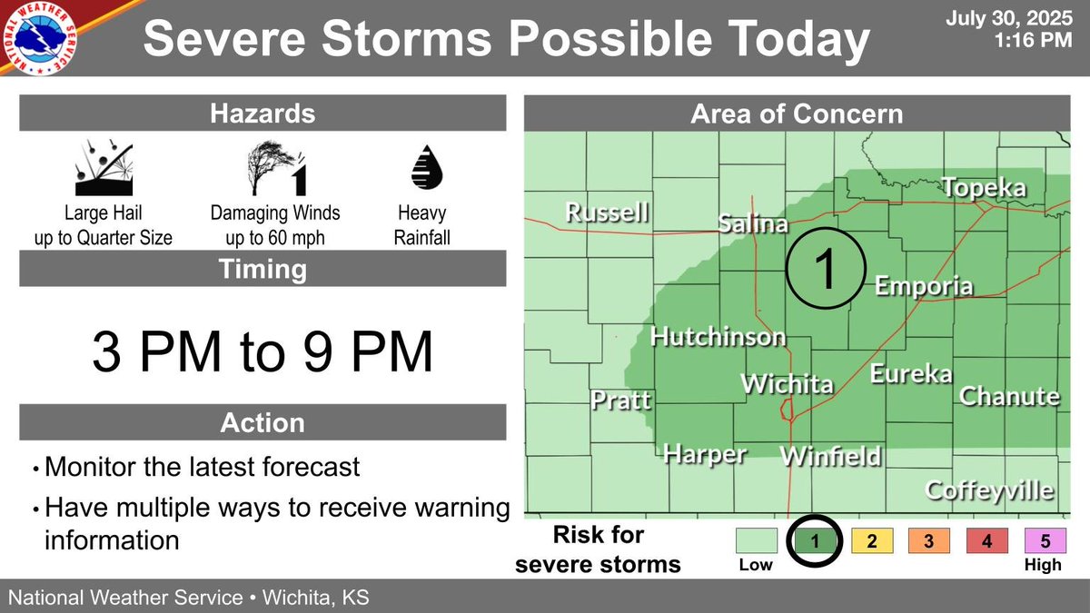
A few severe storms are possible this afternoon and this evening. The strongest storms may produce large hail up to quarter size, damaging winds up to 60 mph, and heavy rain. #kswx
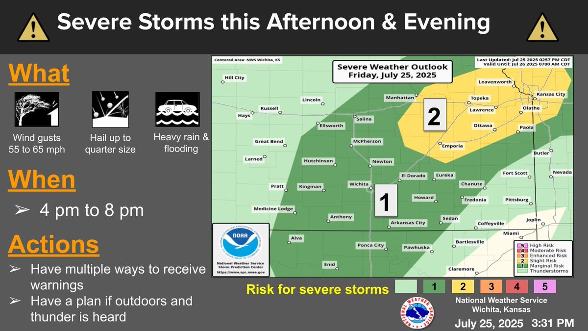
Some severe storms are expected from late this afternoon into the evening hours. The stronger storms will be capable of 55 to 65 mph winds along with hail up to quarter size and heavy rain producing flash flooding. #kswx
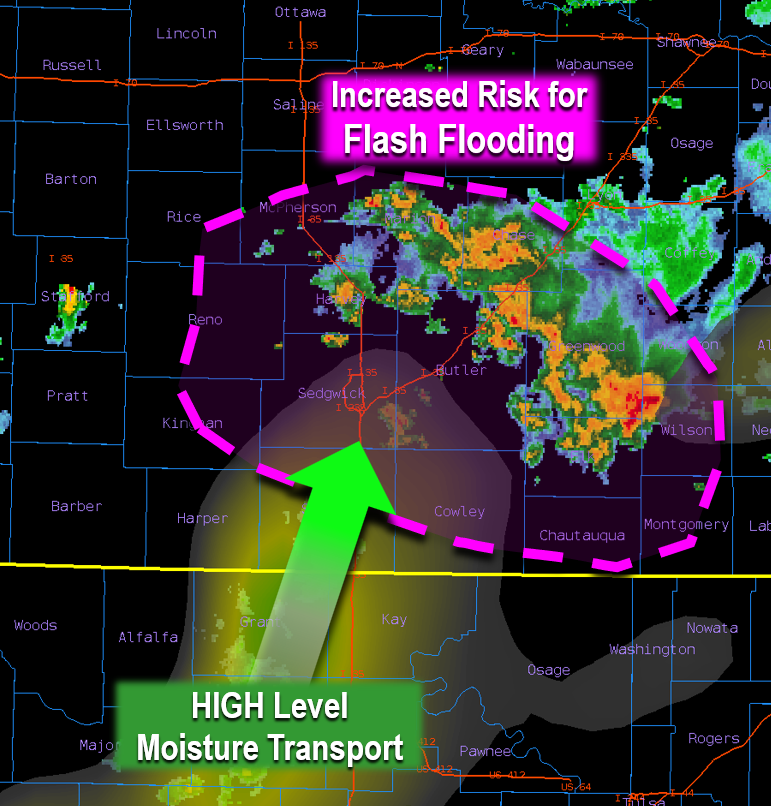
A low level jet will continue to bring HIGH levels of rich moisture into Kansas which will cause numerous showers/storms to keep redeveloping now through the overnight hours. Risk is for Flash Flooding will continue to increase mainly in the Pink Circled area! #kswx
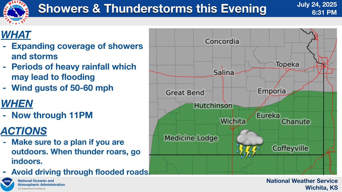
Showers and storms will continue to expand in coverage this evening across southern KS. Heavy rain which could lead to flooding will be the primary threats. A stronger storm could produce wind gusts of 50 to 60 mph. If you are outdoors, make sure to have a shelter option. #KSwx
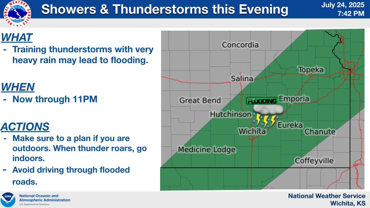
Showers and storms will continue to expand in coverage this evening across southern and eastern Kansas. Heavy rain may lead to flooding. If you are outdoors, make sure to have a plan for shelter. #kswx
Fire Safety Things to remember:
•Have an adult supervise all fireworks activities
•Have a water supply ready
•Have a first-aid kit
•Ignite fireworks outdoors
•Light only one firework at a time
•Never re-ignite malfunctioning fireworks
•Store fireworks in a cool, dry place