Our new @upnorthlive News Today morning show promo is done! So much hard work went into this…including our very talented creative services team. You’ll be seeing this air very soon! ☀️☺️
Dry and clearing this evening into tonight with widespread frost and freeze conditions expected. Next system builds Tuesday, bringing blustery conditions accompanied by rain showers. Shower chances carry into Wednesday before we trend noticeably milder and sunnier Thursday. #MIwx
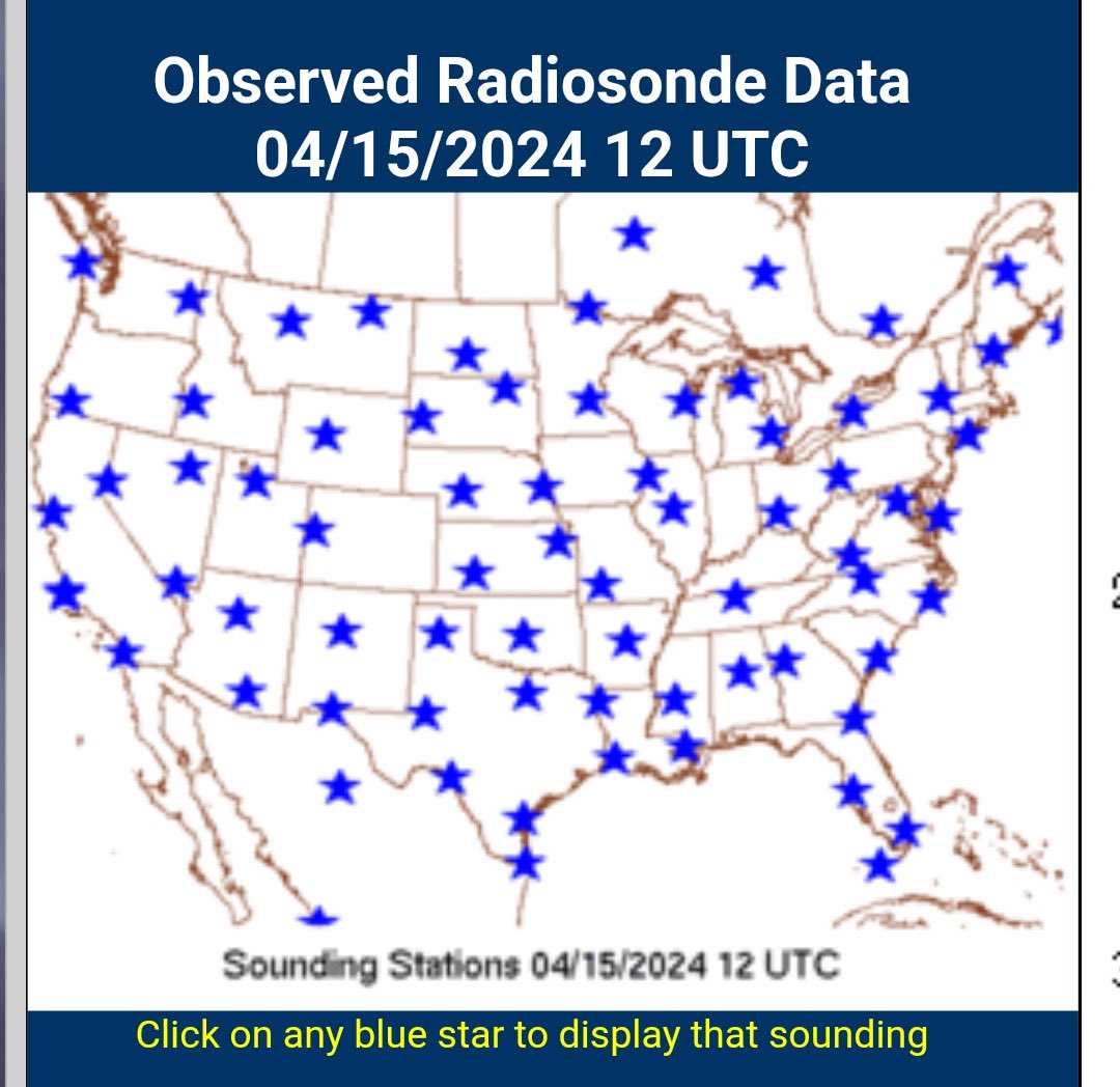
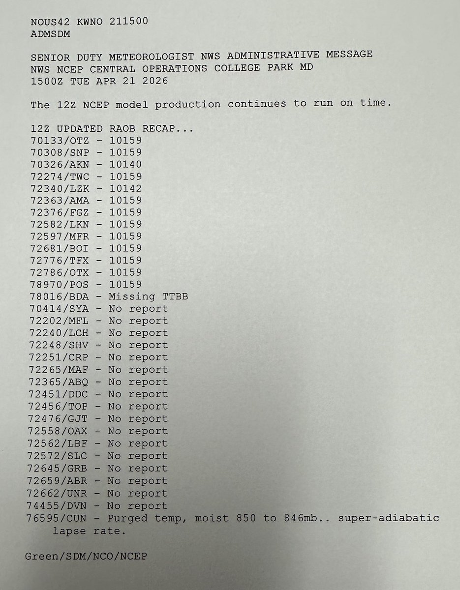
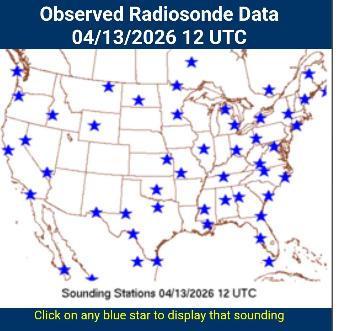
Surprise tornadoes in Kansas yesterday. Constant forecast flip flopping in fall & winter. Subpar hurricane intensity forecasts in 2025. The Trump DOGE cuts have had a long lasting effect. Compare Monday’s weather balloon releases to one year ago. The data gaps are immense.
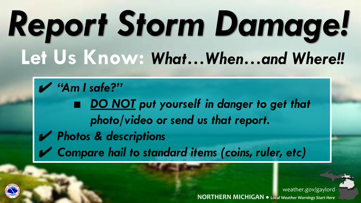
4/14/26 456am...Morning fam! We're looking for reports from the overnight storms. Anyone get hail? (Send pics compared to coins or ruler.) Any new flooding from last night? We appreciate your help!! Thank you!! Stay safe out there!! #miwx#northernmichigan
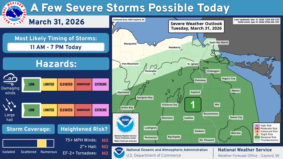
A few strong to severe thunderstorms are possible Thursday night, mainly in northern Lower Michigan. Any severe storms could produce damaging wind gusts and heavy rain. However, large hail and a tornado or two can not be ruled out. #miwx
After a short break from last night, another round of scattered to numerous showers and storms is expected across northern lower Michigan by early afternoon. A few embedded strong storms could produce frequent lightning, hail, and gusty winds.
This #TimelapseTuesday, we're reviewing this captivating imagery of a pair of low pressure systems beautifully swirling over the Gulf of Alaska.
This extended GeoColor imagery loop, captured by @NOAA's #GOESWest (#GOES18) satellite, spans from March 21–23 and covers roughly 53 hours in 11 seconds.
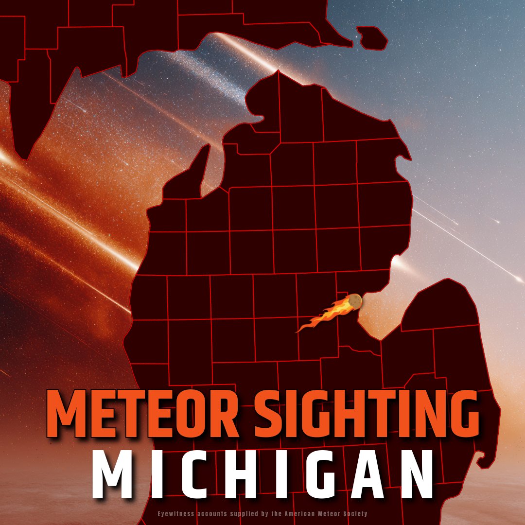
#MeteorSighting: A fireball was observed by witnesses in Illinois, Indiana, Michigan, Ohio, Wisconsin, and the Canadian province of Ontario on the night of March 23. The meteor was first detected over the Michigan town of Hope. It traveled northeast and disintegrated above Saginaw Bay. At its peak, the fireball was 40 times brighter than the planet Venus.
🔗 https://t.co/3BJA5KpyrA
Eyewitness accounts supplied by the American Meteor Society
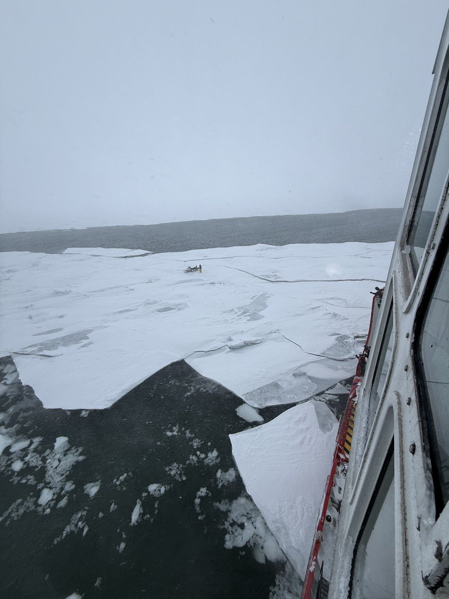
#News - @USCG Cutter Mackinaw rescued a snowmobile operator stranded on ice near #MackinacIsland, Michigan, March 15, 2026.
The person was brought aboard, received medical care, & is in stable condition. The snowmobile was also recovered by the cutter.
#IceRescue#GreatLakes
No words to describe the experience of seeing an overhead corona aurora at THE SAME TIME as a total lunar eclipse--this happened last night on our aurora workshop. Crazy experience. The aurora was so bright and the snow glowed green under the blood moon.
Rain will spread across the area this morning, eventually switching to a rain/snow mix by this afternoon. Highest amounts of 1-3” are expected across parts of the eastern U.P. and Tip of the Mitt, leading to slippery roads and localized hazardous travel into this evening.
#Mackinac Bridge is closed due to hazardous ice conditions. Currently, there is no timetable for reopening. Motorists should avoid the bridge area to allow maintenance vehicles to operate. We will share more information as it becomes available.
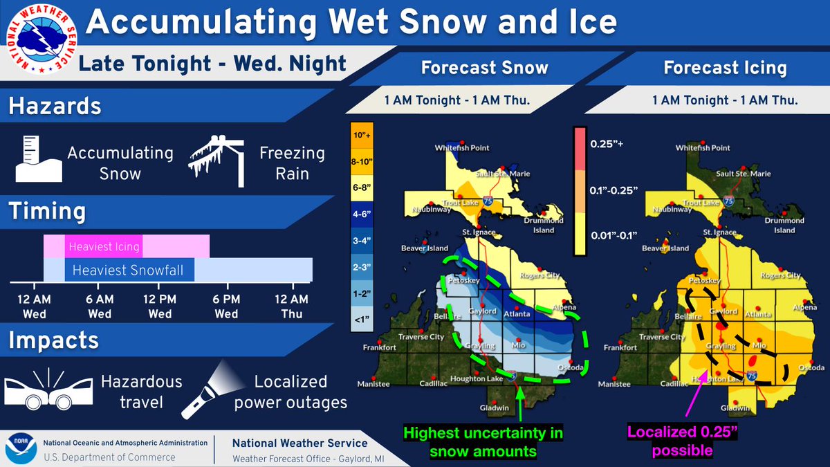
A combo of heavy, wet snow and freezing rain will impact much of northern Michigan late tonight into Wednesday night. Heaviest snow and icing is expected Wednesday morning, leading to hazardous travel and the potential for localized power outages. #miwx
A storm system will bring mixed precipitation to much of northern Michigan starting Tuesday evening and lasting through much of Wednesday. There is high potential for 4” or more of snow across eastern Upper, and high potential for 0.1” or more of ice accumulations. #miwx
For #TimelapseTuesday, @NOAA's #GOESEast 🛰️ took advantage of mainly clear skies to capture 8 hours of lake ice moving on the #GreatLakes from Feb. 1. More than 50% of the Great Lakes were covered in ice as of Sunday, with shallow Lake Erie having over 95% coverage. #GOES19
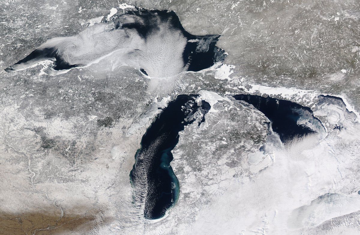
Here's a beautiful look at (most of) the Mitten State! Note the ice cover across the Straits, Whitefish Bay, and along many lakeshores. Current Great Lakes ice cover is at 51%, which is close to 20% higher than average to start February. Image from 1/31/26 curtesy NASA Worldview.
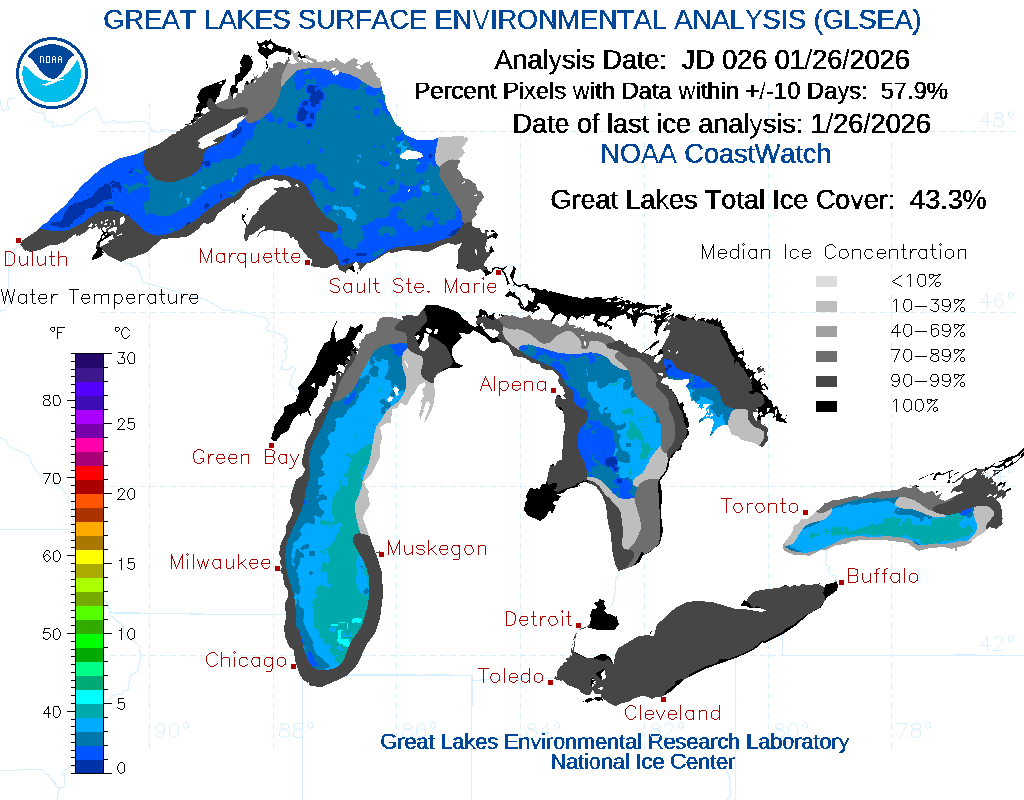
Recent arctic cold and lighter winds have led to a jump in Great Lakes ice cover (43.3% as of yesterday) and now well above the historical average. This can be important for winter forecasting as ice cover can limit lake effect snow. More cold days and increasing ice is expected!
Absolutely stunning footage of last night’s geomagnetic storm as seen from the ISS.
Russian cosmonaut Sergey Kud-Sverchkov said it was like flying straight through them.