Top Tweets for #GeoSpatialAI

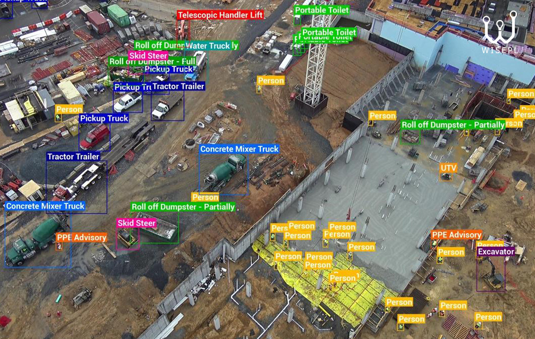
Data Annotation for Aerial & Drone Imagery
From agriculture and construction to mapping, surveillance, infrastructure inspection.
#DroneImageAnnotation #AerialImageAnnotation #GeospatialAI #ComputerVision #MachineLearning #DataAnnotation #ImageAnnotation #Wisepl

NGA’s AI Industry Day shows geospatial AI becoming a procurement question, not a lab curiosity. The hard part now is turning imagery, analytics and secure deployment into usable defence capability.
#GeospatialAI #GovTech #AI

Prithvi, the NASA/IBM Earth-observation foundation model, just ran inference in orbit. A first. The shift that matters isn't the model; it's moving reasoning to the sensor before the downlink.
https://t.co/CbsCxyiwMi #GeospatialAI

Your data holds more than you think. Knowvation GS combines geospatial intelligence with deep textual searching to unlock deeper insights.
👉 https://t.co/Y75M48RLBg
#GIS #GeospatialAI #PTFS


フィジカルAIに不可欠なジオメトリ精度の高い3D 再構築🤔- Niantic Spatial でどのように生成しているのかをブログでご案内しています。
ぜひご一読ください。
https://t.co/b8FbGIwgoY
#GaussianSplatting #NianticSpatial #PhysicalAI #GeoSpatialAI

LatConnect60 flags growth investment round for SWIR satellite constellation... Read more: https://t.co/vPv0syvVeo
#SpaceTech #EarthObservation #SatelliteTechnology #SWIR #AUKUS #SpaceIndustry #GeospatialAI #WesternAustralia #LatConnect60

Modernizing Property Valuation with Computer Vision & Geospatial AI
Image analysis and geospatial intelligence are helping streamline appraisal workflows with greater speed, consistency, and scalability. Read more: https://t.co/MaxKOTCJ7c
#ComputerVision #GeospatialAI #PropMix


Geospatial AI will not only detect floods faster but also help predict where flooding is likely to occur before disasters happen, making communities more resilient and data-driven.
#GeospatialAI #FloodMapping #RemoteSensing #ArtificialIntelligence #SatelliteImagery

What if AI could generate fully interactive demographic maps in minutes? 🌍
I tested Atlas AI and the platform is surprisingly powerful for geospatial analysis. #AtlasAI #GeospatialAI
👉 Get Perfecting Prompts https://t.co/WnORsE5u8F

Week one at UC Berkeley Haas done.
Barry Katz on Silicon Valley as infrastructure. Gauthier Vasseur on AI data strategy. A farm visit in the Central Valley.
More ground covered than most programmes do in two weeks.
#BerkeleyHaas #GeospatialAI #AgriTech


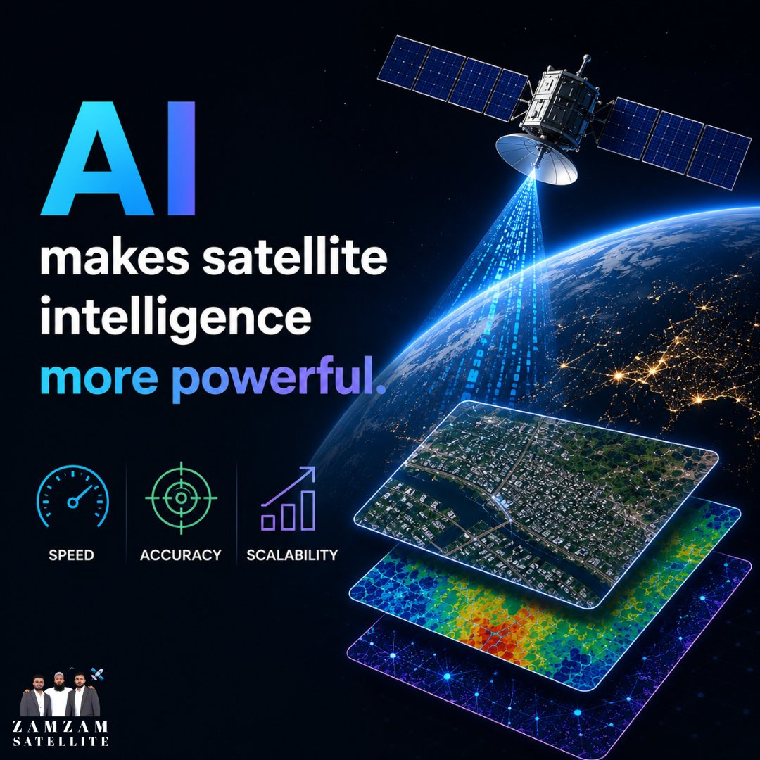
AI is transforming satellite intelligence with faster analysis, sharper accuracy, and limitless scalability.
Discover how advanced geospatial insights are shaping smarter decisions:
https://t.co/SJLRZtsNyr
#AI #SatelliteIntelligence #zamzamsatellite #GeospatialAI #RemoteSensing #EarthObservation

Environmental losses rarely start with a warning.
They begin in the blind spots.
At Axine Laboratories, we’re building environmental intelligence that sees risk before it becomes failure.
From assumptions to precision. 🌍
#AxineHMAS #GeospatialAI #AxineLaboratories

Geospatial AI gives AEC teams the analytical depth to act on spatial data at the speed modern projects demand. See what that looks like across the full project lifecycle. 🏗️
https://t.co/amjsRwEeG7
#AEC #GeospatialAI #GIS #Fulcrum

Bukan sekadar peta, AI kini jadi fondasi baru strategi bisnis!🚀
Pemanfaatan teknologi pemetaan berbasis AI terbukti bikin operasional makin efisien & presisi. Simak bagaimana bisnis bertransformasi di sini:
https://t.co/urwBYuOtpQ
#GeospatialAI #AgenticEra #MapTheWayIndonesia

At #GWF2026, the iSpatial Techno Solutions (IST) leadership team shared insights on how #GeospatialAI is transforming industries, enabling smarter decisions, and driving sustainable impact.
Watch highlights:
https://t.co/hHToDJuN80

YOLOv8-Based Object Detection from UAV Aerial Imagery | Computer Vision & Artificial Intelligence. Tutorial Link: https://t.co/1MCMnkT7iN
#YOLOv8 #ComputerVision #ArtificialIntelligence #DeepLearning #UAV
#DroneMapping #RemoteSensing #GeospatialAI #ObjectDetection


🚀🛰️ AI in Orbit!
NASA & IBM's Prithvi Geospatial AI model is now the first to operate in space! This breakthrough enables advanced Earth observation and analysis directly from satellites.
Source: NASA
#SpaceAI #EarthObservation #NASAInnovation #GeospatialAI #AIinSpace

Quick CS update: we now distinguish between Land Cover (what physically exists on the ground) and EUNIS Habitat (what it means ecologically).
Making environmental diagnostics more actionable directly from orbit.
#BuildInPublic #Startup #GeospatialAI


Spent the last couple of weeks having agents review @footstepai’s mcp server. At the end of the day they are the customers right?
Here’s the 3 questions I asked:
- Does it work?
- Is it useful?
- Is it token efficient?
#GeospatialAI #MCP #AI
Last Seen Hashtags on Sotwe
Trends for you
Most Popular Users

Elon Musk 
@elonmusk
240.1M followers

Barack Obama
@barackobama
119.3M followers

Donald J. Trump
@realdonaldtrump
111.6M followers

Cristiano Ronaldo
@cristiano
108.8M followers

Narendra Modi
@narendramodi
106.9M followers

Rihanna
@rihanna
97.2M followers

NASA
@nasa
92.1M followers

Justin Bieber
@justinbieber
90.5M followers

KATY PERRY
@katyperry
86.7M followers

Taylor Swift
@taylorswift13
80.5M followers

Lady Gaga
@ladygaga
72.1M followers

Kim Kardashian
@kimkardashian
69.3M followers

YouTube
@youtube
68.6M followers

Virat Kohli
@imvkohli
68.4M followers

Bill Gates
@billgates
63.4M followers

The Ellen Show
@theellenshow
62.5M followers

CNN
@cnn
61.9M followers

Neymar Jr
@neymarjr
60.9M followers

X
@x
60.9M followers

CNN Breaking News
@cnnbrk
59.9M followers