

Top Tweets for #MappingOldTO

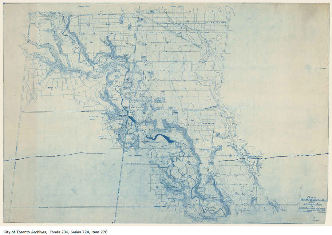
This beautiful, hand-drawn #MappingOldTO plan shows the west branch of the Don River Valley from Lawrence Avenue to the corner of Sheppard and Bathurst in 1915! Map: Parks Department https://t.co/NmwJpC5d6j
#MappingOldTO brings us to Regent Park today! This blueprint, from ca. 1949, shows the existing conditions at Regent Park North Housing Project. Map: J.E. Hoare, Jr. Architect https://t.co/H5lPikO3p6

Goad's Atlases can tell us a lot about city life when we're #MappingOldTO. In addition to businesses and homes, we can see buildings like the Provincial Lunatic Asylum and the Canadian Pacific Railway Yard labelled here in 1899 https://t.co/5h5OT1EekB

A Toronto Harbour Commissioners' plan from 1943 shows Sunnyside Amusement Park, which once ran alongside Lake Ontario. The park was demolished in 1955 to make way for the Gardiner Expressway. #MappingOldTO https://t.co/uFZ7VVuwLU

The West Toronto Junction was the 'choicest site for villa residences' in 1890 according to this #MappingOldTO advertisement! Buyers interested in the area, bordered by Jane St, Bloor St , and the Humber River, could apply to R.K. Sproule! https://t.co/ZBkDHPSLW4

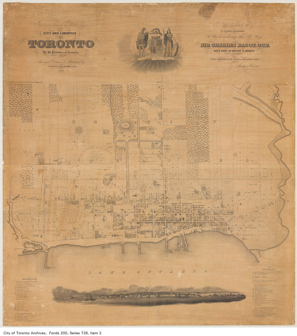
Curious about what Toronto was like over 150 years ago? Check out this topographical plan of the City and Liberties of Toronto from 1842! The plan also lists places of interest and facts about the city #MappingOldTO Map: James Cane, Topographical Engineer https://t.co/ehfbixC9vv
Calling all horse lovers! In 1931 you could take your horse for a ride across the city on one of the Don Valley Association's bridle paths! #MappingOldTO https://t.co/NiWKeeNYM2

The #TTC ride guides can give us a glimpse into how Torontonians navigated the city in the past as we keep #MappingOldTO. Here, we can see the TTC's routes, fares, and some places of interest in 1978! https://t.co/RgDMOPN6vc


The #CNE has been a beloved end-of-summer tradition since its opening in 1879! This #MappingOldTO pamphlet shows a plan of the grounds and buildings in 1927 along with an itinerary for each day of the fair @LetsGoToTheEX @ExPlaceTO https://t.co/oVP4litUnP


Looking for a new walking route through the city? Why not try out the Ontario Walkers' Associations Walking Race route from 1931? #MappingOldTO https://t.co/bAW6CHyAMN

The Parks Department was busy #MappingOldTO in 1934 during their restoration project at @fortyork! One of the items they acquired was this plan of the 'Fort at York' which shows the Fort's state in March, 1816. https://t.co/TJKtPJrRzK

After our #MappingOldTO post about Toronto's "Highlands," we've got an extra spring in our step! Here are some young Highland dancers in March 1927. Photo: John Boyd of the @globeandmail https://t.co/EQPPDG98ft

No time to fly to Scotland? Why not move to the 'Highlands of Toronto'! This advertisement from 1891 shows property for sale in 'Fairbank' along the Belt Line Railway. #MappingOldTO https://t.co/YT9Vho43sx


One of the oldest items in our collection, this plan of Toronto Harbour was created #OTD 1792 by Joseph Bouchette #MappingOldTO https://t.co/2IwDsJem02

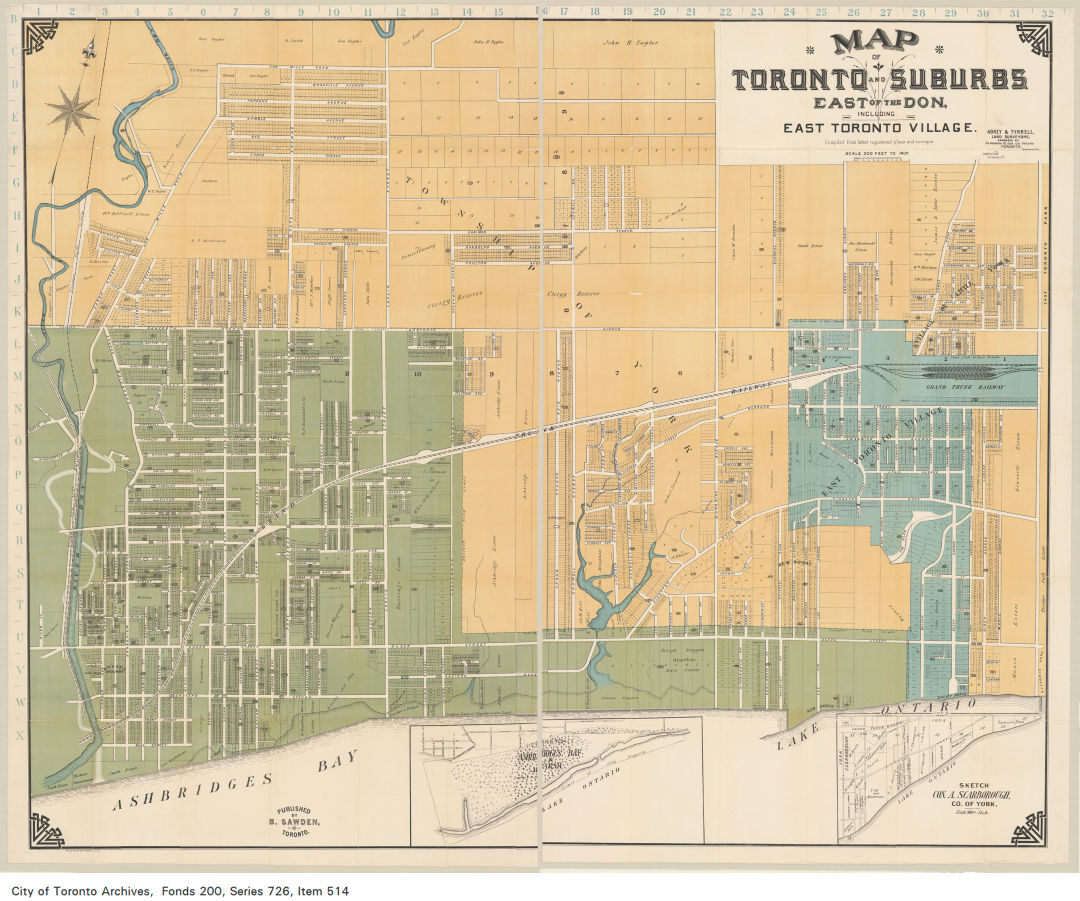
#DYK that the village of East Toronto was annexed to the City of Toronto in 1908? Visit our website to find out when your neighbourhood became part of the city! #MappingOldTO Map: Abrey and Tyrell, Land Surveyors https://t.co/bBxlMirl8Z
Toronto Island has been a popular destination for Torontonians looking to escape the city since the 1800's. This 1903 plan, created for the City Surveyor and Commissioner of Parks, shows the city's vision for park improvements to the island #MappingOldTO https://t.co/4OqVQGo3II


Behold the pond that bore my name. A dam roughly where Sherbourne is today generated power for my brewery. When Mr. Liddy drew this map in 1852, it was used for successor Castle Frank Brewery. Thank you @nathanng for posting: https://t.co/rl36vpm2g1 #MappingOldTO

Rosedale, "Toronto's Charming Suburb," is represented in this #MappingOldTO map compiled by George A. Kingston in 1905. If you look closely you can see street addresses and owners' names! https://t.co/yhhkZzPP0i

Our map today shows property ownership for the region formerly known as the Township of York in 1932 #MappingOldTO Map: Frank Barber and Associates Limited https://t.co/KnCsNBCyB4

If you liked today's #MappingOldTO post about #Cabbagetown and want to see more, here's a photo of Jarvis St and Gerrard St E from Micklethwaite Studio, ca. 1905. To trace the area's development through the years, check out our @Flickr album on Jarvis St: https://t.co/9E5Nl5RrL2

Last Seen Hashtags on Sotwe
Trends for you
Most Popular Users

Elon Musk 
@elonmusk
240.8M followers

Barack Obama
@barackobama
119.2M followers

Donald J. Trump
@realdonaldtrump
111.7M followers

Cristiano Ronaldo
@cristiano
111M followers

Narendra Modi
@narendramodi
107M followers

Rihanna
@rihanna
97.8M followers

NASA
@nasa
92.2M followers

Justin Bieber
@justinbieber
91M followers

KATY PERRY
@katyperry
87.9M followers

Taylor Swift
@taylorswift13
81.7M followers

Lady Gaga
@ladygaga
73.3M followers

Virat Kohli
@imvkohli
70.3M followers

Kim Kardashian
@kimkardashian
69.9M followers

YouTube
@youtube
68.7M followers

Bill Gates
@billgates
64M followers

Neymar Jr
@neymarjr
63.1M followers

The Ellen Show
@theellenshow
62.4M followers

CNN
@cnn
61.9M followers

Selena Gomez
@selenagomez
61M followers

X
@x
60.8M followers