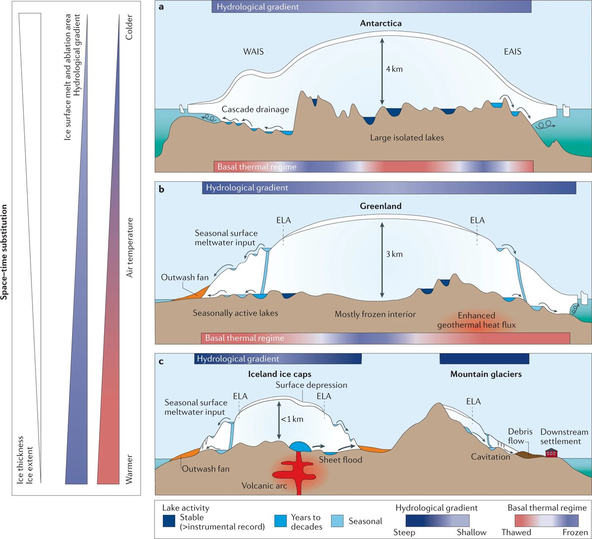
Over 700 lakes beneath #glaciers🧊impact hydrology and host ecosystems.
@living_stephen et al present a global🌎 inventory and discussion of subglacial lakes in this new review.
https://t.co/CpsQDyMhIQ (free to read https://t.co/uRes47aCrG)
Excited (and nervous!) to talk about my recent PhD findings this afternoon, and hear about Cryoegg from Mike and Liz. If you fancy joining, let me know and I can send you the Zoom meeting link ☺️
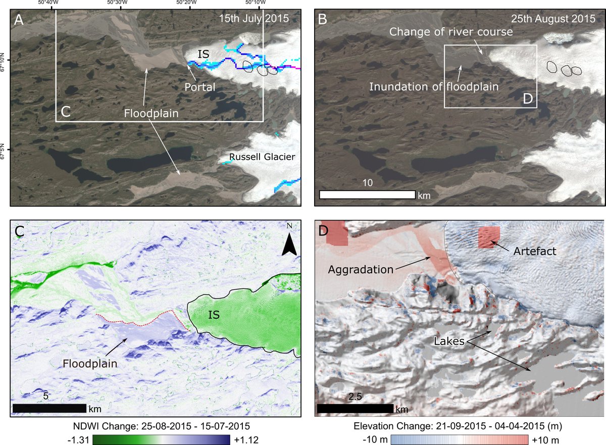
New article: Brief communication: Subglacial lake drainage beneath Isunguata Sermia, West Greenland: geomorphic and ice dynamic effects https://t.co/P5OrsqKoDs
New paper in @EGU_TC where we identify 3 active subglacial lakes beneath Isunguata Sermia, Greenland from time-stamped ArcticDEM strips. @sledge_ross @icers_SU @sheffieldgeog @DevinH_13@jadebowling94@rob_storrar (1/3)
@EGU_TC @sledge_ross @icers_SU @sheffieldgeog @DevinH_13@jadebowling94@rob_storrar Are these the most accessible subglacial lakes in the world given how close they are to the lateral margin of the outlet glacier and the luxury of a nearby road!? (3/3)
@EGU_TC @sledge_ross @icers_SU @sheffieldgeog @DevinH_13@jadebowling94@rob_storrar Each subglacial lake underwent one drainage-refill event. The 2015 lake drainage caused a net down-glacier slowdown in ice flow and flooded the foreland, aggrading up to 8 m of sediment. (2/3)
@TMondain@rstudio@rstudiotips I don't know how to do it in R, but in ArcGIS I would make a polygon for your new range area and clip the countries by mask. Then repeat for old range so you have 2 country polygons that you can colour fill. I'm in uni tomorrow if you want a better explanation! :)
Fantastic first paper by @jadebowling94, who looked at >500,000 km of icebridge flightlines to identify over 50 new subglacial lakes beneath the Greenland Ice Sheet. @icers_SU @NatureComms @sheffieldgeog @LancasterUni @RadioGlaciology https://t.co/kxl2QdYzQx