1/🧵 The Bay of Campeche disturbance has a narrow path to development, but the baseline still leans against organization. The main problem is that this is a broad/gyre-like disturbance with limited time over water before moving into eastern Mexico.
That matters because broad lows usually need multiple convective cycles to tighten a defined low-level center, and this window may be too short for that. #wxtwitter #tropics
May 29 11 AM PDT: There is a high chance (70%) of tropical cyclone formation well to the southwest of the Baja California peninsula next week. Visit https://t.co/Oy8uoeRKme for more details
Euro ensembles with a very slight signal for some possible development off the East Coast in 10 days or so. Pretty typical place for storms to develop in the early season and during #ElNiño.
Worth noting, though, that as of right now Google DeepMind is not really picking up any signal for development, and last year it was pretty good at "sniffing things out". So I'm not that intrigued yet for the possibility of our first named storm.
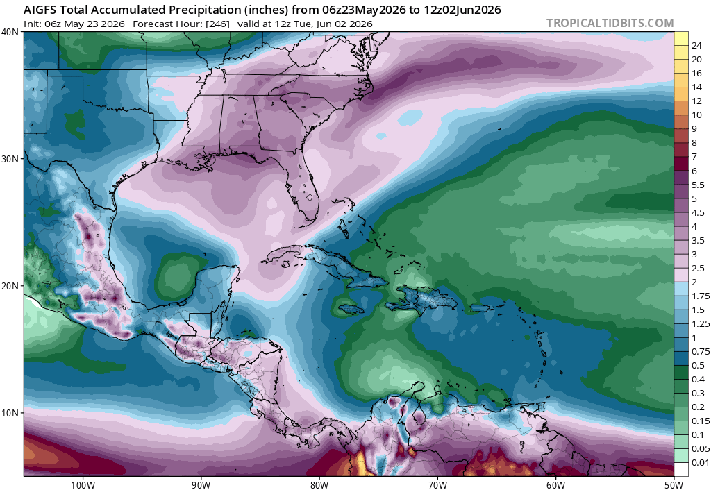
It does look like a lot of moisture will be coming North, though, which will enhance rain chances and hopefully bring some needed drought relief to the Southeast.
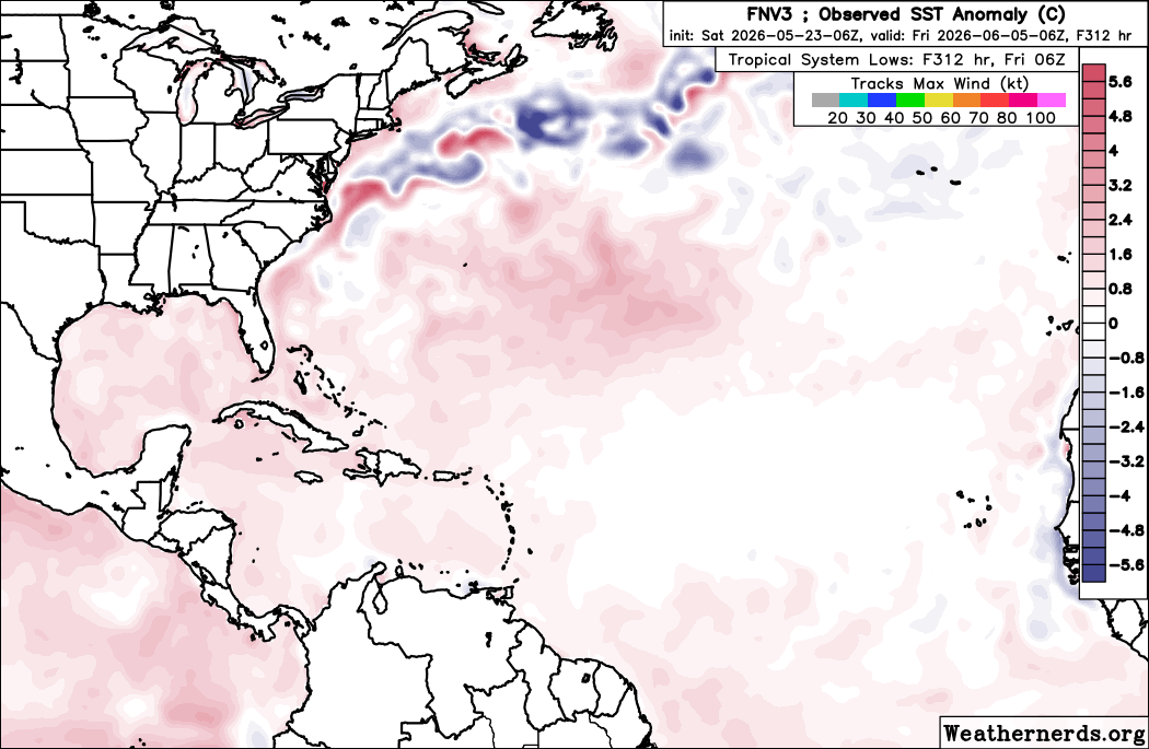
The Euro ensemble shows a classic El Niño shear pattern to start the 2026 Atlantic hurricane season, with enhanced westerly shear ripping through the Caribbean. We do see lower shear in the Southwest Atlantic/Gulf, but it's worth noting that this is because it's basically inside the TUTT/trough to the north of the shear axis. So it's not the classically favorable low shear in the deep tropics we look for. You could maybe get some baroclinic or homegrown development in one of these spots, but it's gonna be challenging to get anything significant, and any waves coming into a pattern like that will probably be shredded long before reaching that theoretically "more favorable" zone.
Digging into a couple case studies on this work. Frances (2004) vs. Floyd (1999) really shows the importance of that Rockies trough vs. ridge for the Florida East Coast landfalls.
Floyd actually had a stronger Bermuda High overhead 48h before it got close to Florida, but the Western ridge and downstream trough allowed the TC to be picked up just before it reached Florida. In the case of Frances, the Western Trough allowed the ridge to build in over the NE US and SE Canada, slowly steering the system into the coast.
As AI potentially reduces the barrier to coding and plotting, part of me wonders if things will circle back to where knowing fundamentals and understanding processes is more important in fields like meteorology (and others).
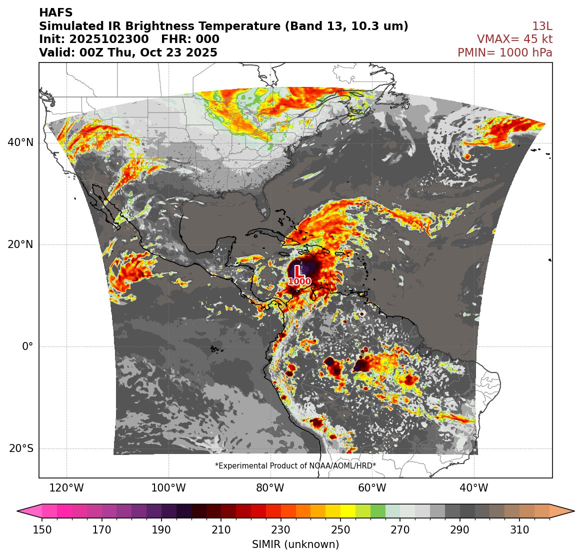
For example, today I was working with Claude on converting some NCL plotting code to Python (for our AOML model website) and also adding simulated IR maps. The initial output was "correct" in that it produced something that looked like a satellite image, but it was off in several key areas, and looked more like a microwave satellite channel.
Turns out that's exactly what happened (see screenshot), and I was able to work with the AI to get the correct version.
Obviously, you need to be able to know enough about code to do some things as well, but fundamentals may become critical again in this sort of environment, to know if what the AI is giving you makes any sense.
Very interesting "Standing Gravity Wave" (SGW) feature on the north side of Sinlaku's CDO with a distinct boundary in brightness temperatures. Their formation process is currently not understood, but (somewhat anecdotally) intense TCs often exhibit them in their structure.
Tom Anderson from Google: the Deepmind Model is the equivalent to a decade jump in progress in reducing track/intensity error.
In other words, this AI model — which is outperforming every global numerical model — is an absolute forecast game changer.
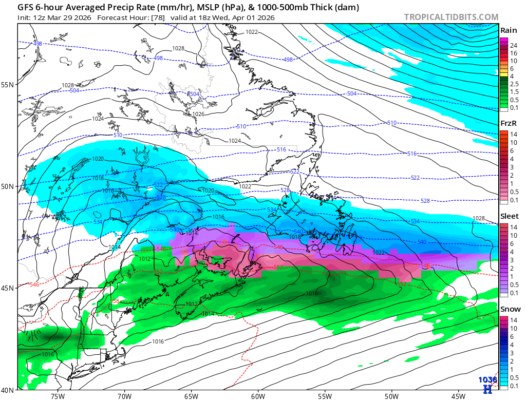
1/5 🧵
Breaking my winter hiatus for this one. Seeing a lot of posts about a potential winter system on April 1 to 2, but most of those “forecasts” are just singular operational runs. Guidance is still not resolved on the large scale pattern or the storm track. #nlwx
5/5
That is why I do not buy the colder operational runs at this stage. Until the Labrador trough is actually resolved, snowfall maps and impact graphics being shared around are conditional output from an unresolved pattern, not something I would treat as a forecast. #nlwx
4/5
That is a much warmer outcome. Stronger warm advection and a warmer boundary layer simply reduce the potential for widespread winter precipitation. The colder solution needs a deeper trough digging south over Labrador, and that looks under supported right now. #nlwx