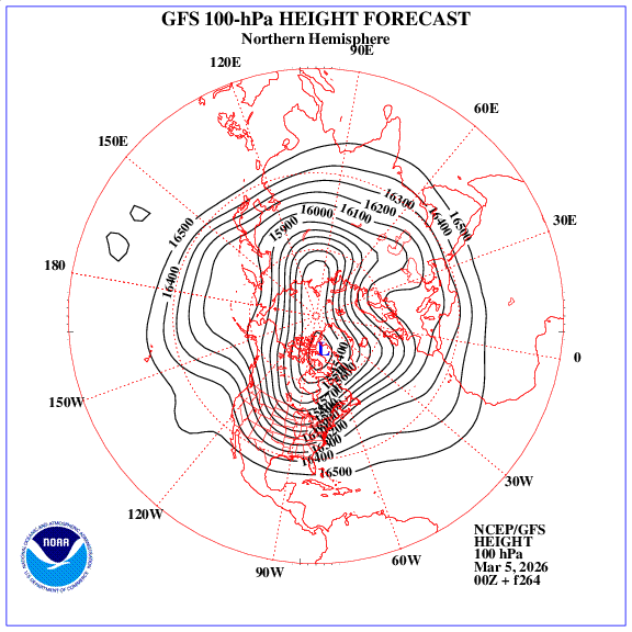
I can't emphasize this enough. Yes a #PolarVortex (PV) split happened but the predicted #cold for 3rd week of March in Eastern US isn't related to the classical downward influence. Instead it's our familiar friend the PV stretch, textbook looking at 100mb, NAO is raging positive!
There was much discussion about subsidence zones on the colder (WNW) side of snowbands during the recent blizzard. But you may still be wondering "why does it occur on that side of the band specifically?" Well, the answer has to do with the dynamics of frontogenesis:
Sunday February 1st, 2026:
We were able to catch some of the flurries here at the office, around 4:45am this morning. ❄️
Temperatures today will only warm into the 40s and 50s. Tonight the lows are back in the 20s and 30s. Stay warm out there. ��
+AAM build-up from an MJO event in mid-late Nov is still in the tropics trying to extend the Pacific Jet
Meanwhile, persistent negative E Asia Mtn Torque is counteracting it
These things offset each other & you end up w/ a persistent & stationary wave pattern in the N Pacific
This winter seems to be intent on following the cool ENSO/eQBO/solar max paradigm of early winter -AO/-NAO
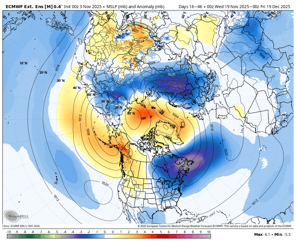
I replicated Gray et al (2004)'s analysis except used SLPa from 20CR & isolated -ENSO (left), which is close to the latest Euro weekly fcst (right)
https://t.co/fPHHcT8K9z
The Sentinel-2 satellite captured this image of Melissa's eye at peak intensity. 10m pixel resolution - one of the best satellite images ever captured of a hurricane of this intensity.
Image from 16z this morning.