🌞Solar Eclipse Saturday 🌞
An annular solar eclipse will occur across parts of TX on Saturday. Those in the path will see the sun nearly completely blocked with just a thin ring surrounding the moon. We'll have a partial eclipse in N TX. Skies should be cloud free! #dfwwx#txwx
A look at history. The cone is anywhere the eye can go. Hazards exist well outside the cone. Charley, Irma, Ian all forecast to hit the Tampa Bay area a couple days before landall. All turned inside the east side of the cone. Stay alert. Nothing ever is a given. https://t.co/0EQMEw6Iu0
#OTD in 2005, the most infamous Atlantic #hurricane in history, #HurricaneKatrina, made landfall on the coast of #Mississippi and #Louisiana.
Though it had weakened from its Category 5 peak the day before, the massive storm caused untold devastation across the US Gulf Coast.
Welp, this is the last thing you guys want to hear... but both DFW and Waco broke the record high today. Both sites made it to 107°F, with previous records of 106°F for both locations in 2011. #dfwwx#ctxwx#txwx
🚨Hot off the press!🚨
As of 12:45 PM this afternoon, Dallas/Fort Worth reached 105 degrees moving the summer of 2023 into second place along with 2011 for the greatest number of days at or above 105 degrees (19 days). It's hot out there folks🥵stay cool! #dfwwx#txwx#ctxwx
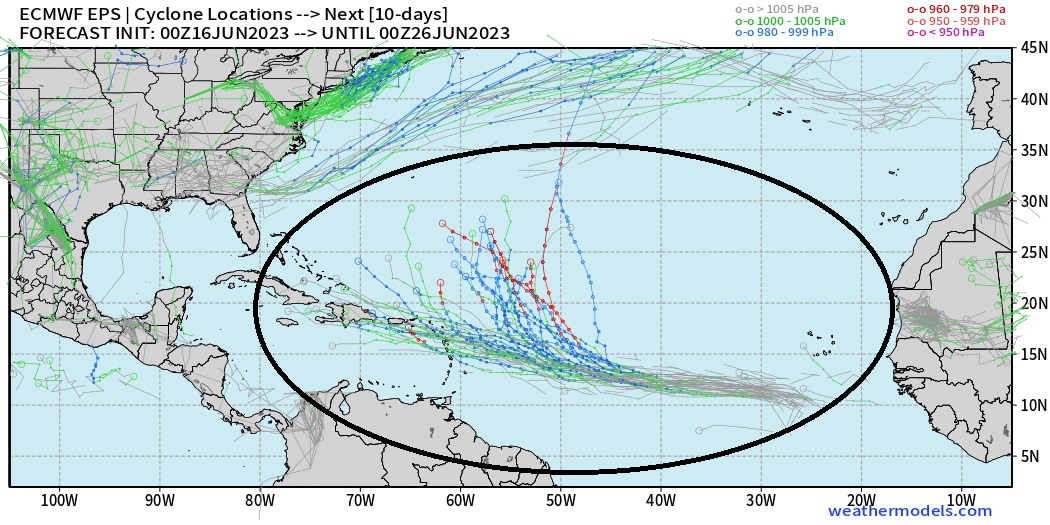
When looking for tropical development in models, we not only want a model to show the feature many cycles (run to run consistency), but we also look for it to show up in many different models. This is the case with the east Atlantic wave. Nearly all models suggest development with 10-day outcomes typical of a tropical Atlantic system. The range is from stronger/slower/northward to faster/weaker/westward. We will watch more closely for that westward possibility because it involves land/populations.
@Ana67126968 Gonna have to wait for the 5-7 day outlook. Tropical cyclones are almost completely unpredictable until it’s within days, especially a rare June storm in the MDR. Just look at NOAA’s daily outlooks 3-5 days or so before👍🏼👍🏼
@MajorsMom@wfaaweather So many good replies below..
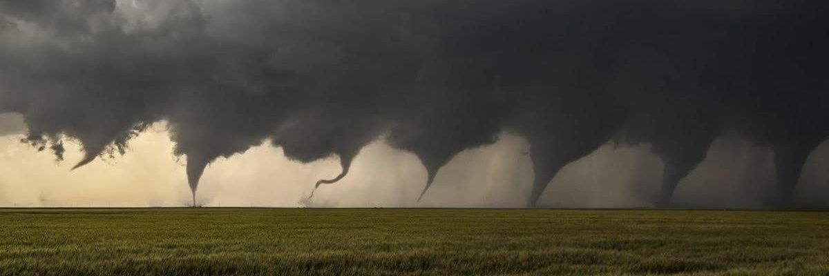
Ya gotta remember how quickly these kind of storms can form, and out of nowhere too. That’s why ya gotta stay more “weather-aware” on level 3 days like this. Also, make sure you use a local Wx network/app for any severe weather in your area/region. 👍🏼
6/17 6:08PM - Storms are continuing to pop up to our west and will generally move easterly this evening. Large hail and damaging winds will be possible with the more robust storms. Stay weather aware this evening! #dfwwx#txwx#ctxwx
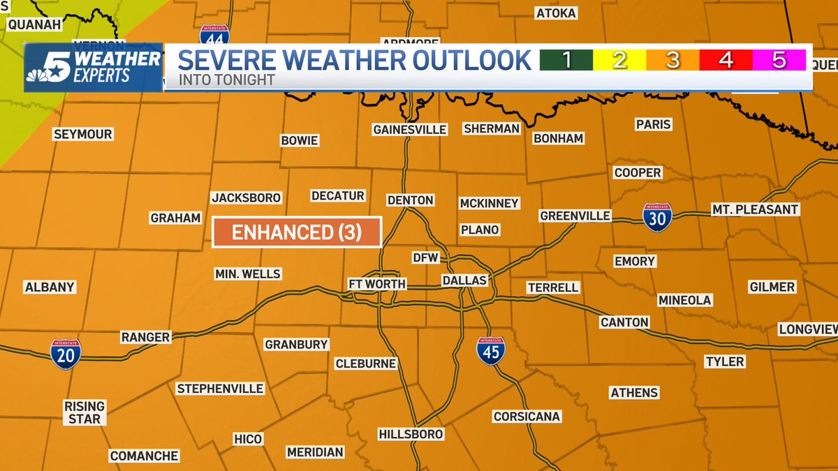
3:13 p.m. Saturday: Dallas and Fort Worth are now under an ENHANCED RISK for severe storms this evening. The threats are large hail, damaging winds and isolated tornadoes. @nbcdfw#NBCDFWWeather https://t.co/r2letuzJkx
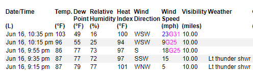
The weather ob in Hearne, TX just recorded a heat burst due to nearby dissipating storms! The temp rose from 86° to 103° in 40 minutes while the dewpoint fell by 30 degrees. These are often accompanied by strong wind gusts, but the highest speed has been 31mph so far. #ctxwx