Another round of showers and storms will move through the area late this afternoon into tonight. Additional rainfall amounts of 0.5 to 1 inch with localized amounts near 2 inches. A Flood Watch remains in effect until 7 AM Monday. #mowx#kswx
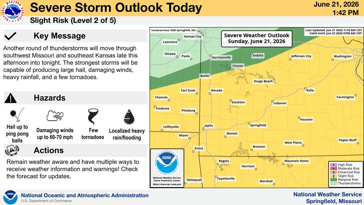
Another round of thunderstorms will move through southwest Missouri and southeast Kansas late this afternoon into tonight. The strongest storms will be capable of producing large hail, damaging winds, heavy rainfall, and a few tornadoes. #mowx#kswx
..FLOOD ADVISORY IN EFFECT UNTIL 5 PM CDT THIS AFTERNOON...Camden, Hickory and Dallas until 500 PM Sunday.
* IMPACTS...Minor flooding in low-lying and poor drainage areas. Turn around, don`t drown when encountering flooded roads. #loto#lotowx#mowx
FLOOD WATCH IN EFFECT Through Monday morning for the entire lake region, coming with it is the possibility of widespread 1 to 3 inches of rain, with locally higher possible. Turn around, don't drown! #lotowx#loto#mowx
Here is an estimated timeline for thunderstorms developing and moving into and through the area late this afternoon and evening into tonight. Remain weather aware this evening, especially across central Missouri. #sgf#mowx#kswx#ozarkswx#midmowx
A line of strong to severe storms will move through the area late this evening through tonight. Here is a map of estimated storm time of arrival. #mowx#kswx