Other than areas of fog again tomorrow morning, we look ahead to spotty thunderstorms tomorrow and Friday afternoon. While it won't be a washout, you may need an umbrella and plan on bringing the outdoor fun inside. https://t.co/CgQ99QJQJT #rain#heat#forecast
We now have the chance for some storms both on Thursday and Friday afternoon. No, we aren’t looking for a washout and no, we aren’t looking for anything severe. https://t.co/TPKPHaqMOF
Our heatwave will continue for the rest of the week as heat indices rise to near and just over 100° by Friday and Saturday. Other than some storms both on Thursday and Friday, your outdoor plans will be good to go. https://t.co/CgQ99QJQJT #heat#storms#forecast
You may think it's hot, and you're right! Highs will run in the low to mid-90s through next Monday. With outside temperatures near 92° tomorrow, the inside of your car can exceed 125° in just 30 minutes. This is why you need to look before you lock. https://t.co/TPKPHaqMOF
Tomorrow may bring our first 90° day of the year for some folks 🥵 Then, comes the chance for storms tomorrow evening, followed by a big cooldown. https://t.co/TPKPHaqMOF #heat#forecast
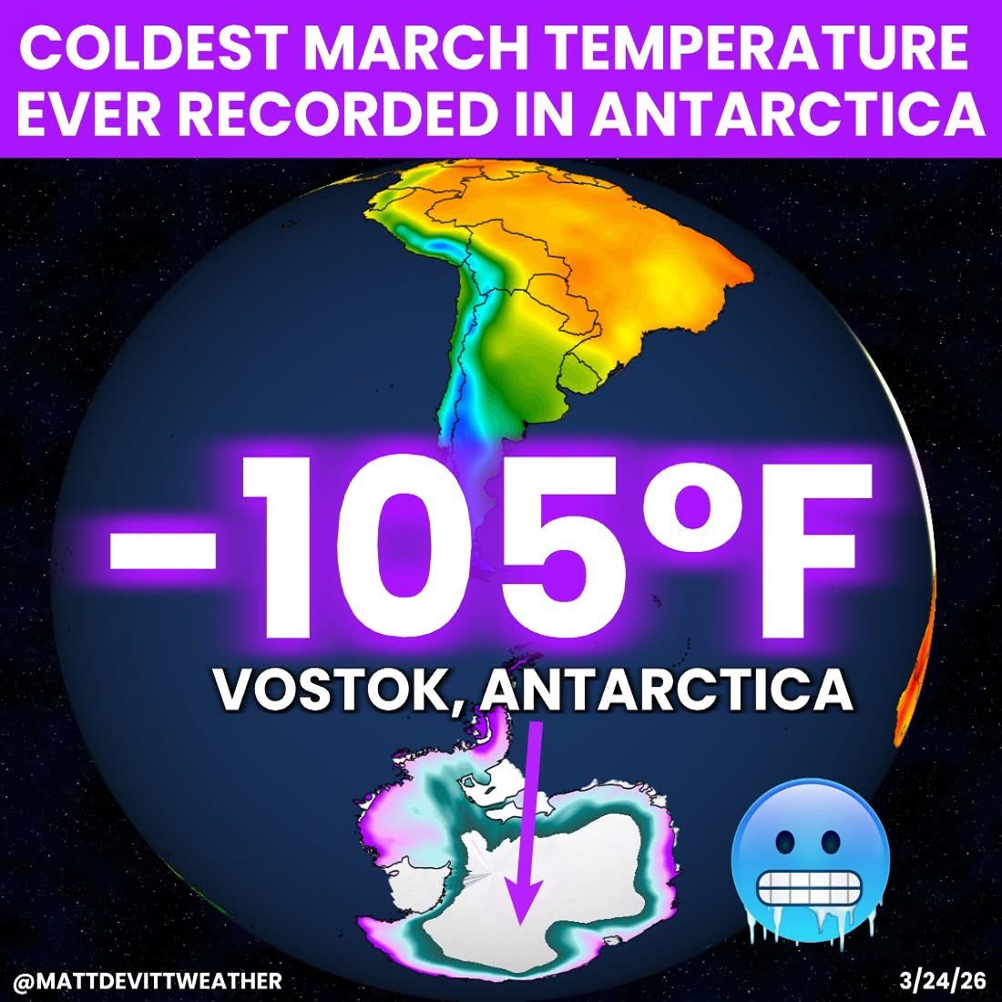
CAN YOU IMAGINE? 🥶😳 Antarctica just broke their coldest ever recorded in March with an extreme -105°F! The temperature occurred in Vostok, a Russian research station home to the coldest ever recorded on Earth...−128.6°F in July of 1983.
Following thunderstorms alongside a cold front Thursday night, Friday will be breezy and cooler. If your outdoor plants have already begun to sprout and bloom, cover them Friday night, as a light freeze is expected. Our average last freeze is April 12th. #freeze#plants
Our storm survey team in far southeast IA has confirmed two EF1 tornadoes near Donnellson in Lee County. One had maximum winds of 90 mph and the other of 100 mph. Damage was mainly to outbuildings and trees. More specific information will be posted this afternoon. #IAwx
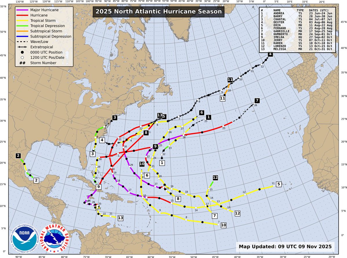
CSU has released its Atlantic seasonal #hurricane forecast verification. 2025 was an above-normal season per NOAA, but with an unusual distribution of storms (e.g., fewer storms but more strong hurricanes) than typically expected given overall activity:
https://t.co/HAcQtg35cj
#Melissa is now a Category 5 #hurricane - the 3rd of the 2025 Atlantic season - Erin & Humberto were other two. Only 1 other Atlantic season on record has had >2 Cat. 5s: 2005 (Emily, Katrina, Rita, Wilma)
But no money in the budget to support keeping WPSU going. WPSU is the home of @WeatherWorldPSU, one of the most crucial pillars in supporting not just me, but so many other Penn State Meteorology graduates in their preparation for work after PSU in weather communication.
🙄🤚
NHC will initiate advisories on Tropical Storm Erin, located in the Eastern Tropical Atlantic, just west of the Cabo Verde Islands, at 1100 AM EDT (1500 UTC).
This will make tracking severe weather harder across the Tri-States if in the event service issues arise. In fact, we are already in a radar hole. However, us meteorologists @WGEM will stop at nothing to keep the community safe. #ilwx
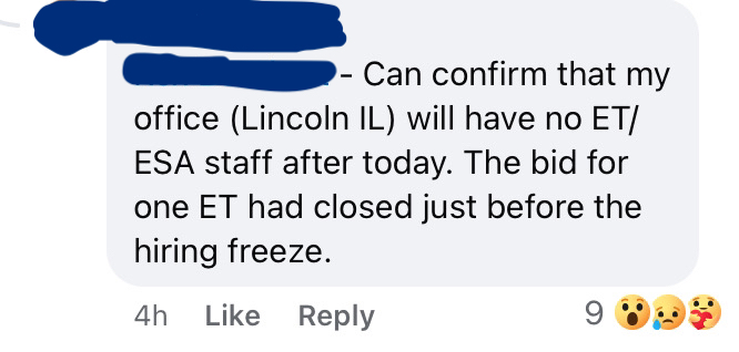
Reposting this to redact the identities, but the central #ilwx radar (KILX) in Lincoln now has no techs to service it if it goes down. @JBPritzker@ERICSORENSEN this will make central IL residents less safe during severe weather.
Some snow totals from this morning’s light snow. Additionally, Pittsfield, IL accumulated 3” of snow! Find out when more Arctic cold arrives at https://t.co/TPKPHaqMOF!
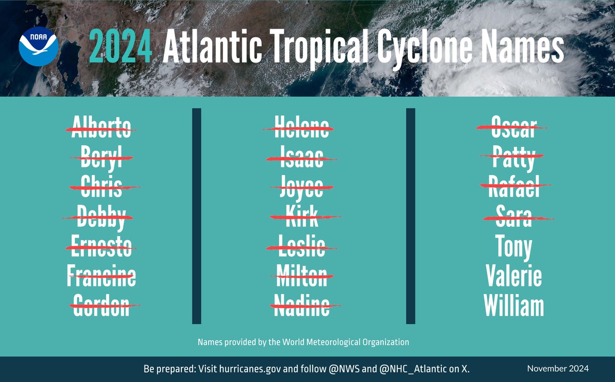
(1/ 2) JUST IN: The 2024 Atlantic #HurricaneSeason ends on Nov. 30. It was an above-average season w/ 18 named storms, including 11 hurricanes, of which 5 intensified to be major:
https://t.co/hkM6ZOaSfF
#WeatherReadyNation@NWS
@sportcat075@NWSStLouis@KHQARich@CoreyStott_KMEM Hi David, thanks for reporting this! Were you able to see some flurries earlier last night and this morning? The only report I have coming from west of the Mississippi River is from Canton in Lewis County.