https://t.co/BIAQ3ueLab
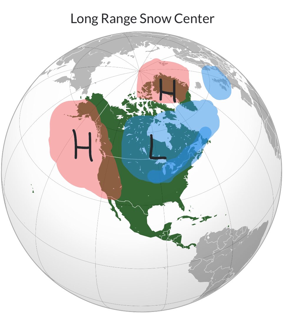
My North American winter snowfall outlook is now available with climate driver analysis and conclusions. Apologies for its lateness, but I hope you all appreciate it :)
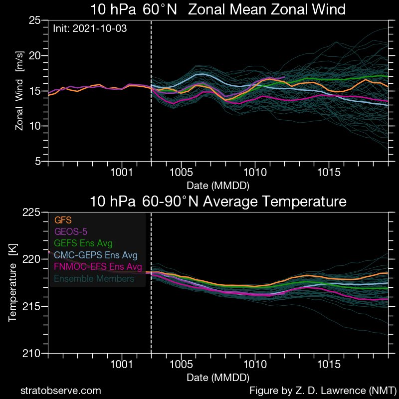
As we see a rapid decline in the SH stratospheric polar vortex to end our somewhat up and down season, we see a somewhat unexpected stagnation to the building of the NH stratospheric polar vortex:
Images: @zd1awrence
1st analog: Neutral ENSO years preceded by Nina, controlled against +IOD years
2nd analog: Years with similar Indian Ocean and Western Pacific SSTA patterns.
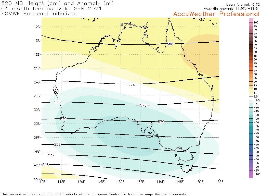
From the relatively fresh EC seasonal run: troughing for the Australian Alps throughout winter, a good sign. Best precipitation anomalies in Aug/Sept. A tad warm in June, colder than usual in Sept, suggesting a backloaded snowfall season #aussnow
However lots of moisture from the tropics isn’t always a good thing, and warm temps in the Great Australian Bight may weaken the power of cold fronts hitting SE Australia.
Still a variety of factors and plenty of time until the snow season really starts going though #aussnow 4/4
Just some thoughts on the upcoming Australian snow season (thread): EC looking the best for July and to a lesser extent August, and potentially a poor June and Sept (which is workable as they aren’t usually the key snowy months anyway) 1/4 #aussnow
Although it’s not a Nina (those ENSO regions starting to warm during our winter), the cool SSTs in the SH tropical Pacific matched with the warm SSTs to Australia’s NE and NW bodes well for plenty of moisture for snowfall.
3/4 #aussnow
8-10 feet possible over the next 10 days over the Sierra range peaks, focused on the period from Wednesday to Friday. 4-5 feet for Lake Tahoe level. #tahoewx
https://t.co/jnKuGOh0tW
Cold and snowy for the next 2 weeks for Europe, afterwards depends on the GWO staying in the -AAM phases and the progress of the polar vortex and the NAO....
Just a reminder that the current strong -AO state is bringing snowy weather events in uncommon locations, even if it isn’t in the Eastern US as of yet. It’s certainly bringing the cold deep down into the CONUS.
Strong positive EAMT, Strong Aleutian Low, SSW, -AO tropospheric base state, some real potential brewing for the Eastern and Southern US for snowfall risk.
More discussion here:
https://t.co/9mviFLepvx
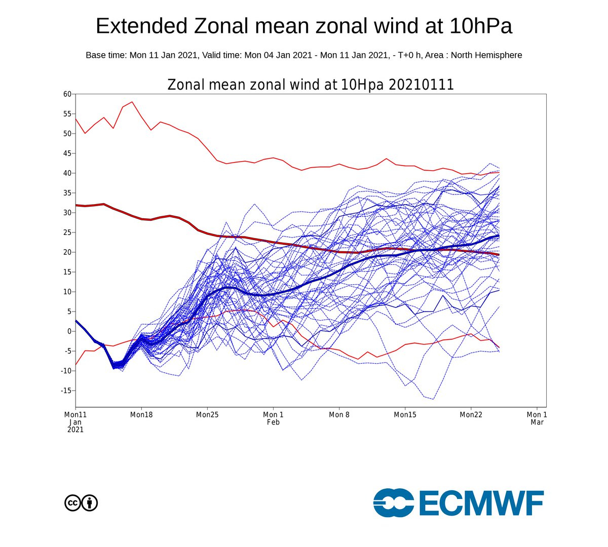
Possibility of a colder and snowier January for Southern Europe and the UK, thanks to a possible SSW and favourable GWO/AAM conditions in the forecast, more in the forecast below:
https://t.co/olXQcycQeD