🌧️ Attention: Heavy rainfall of more than 30mm in 24hrs is expected over several parts of the Lake Victoria Basin, the Rift Valley, Highlands West and East of the Rift Valley including Nairobi area on Tuesday 2nd April, 2024. The heavy rainfall is likely to intensify to more
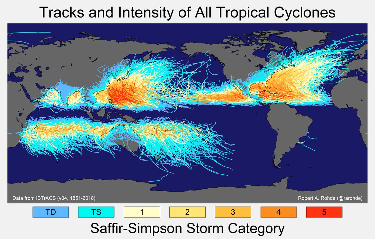
Great demonstration of Coriolis effect at the Equator.
This phenomenon on a wider scale deflects winds near the Equator and explains why for instance Kenya does not experience the tropical cyclones that affects Southern TZ and Mozambique
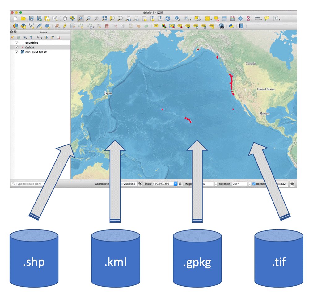
The list of web mapping tools is long.
You also need to consider the design principles for efficient web maps.
More information published;
https://t.co/tlm7qUHcw3
UPDATE: CTrees' Land Use Change Alerts (LUCA) tool has been updated with two new features:
1 . Describe and monitor a specific area using GeoJSON
2. Select lower-level administrative areas, such as municipalities.
➡ News story with instructions: https://t.co/MD49CkQYUo
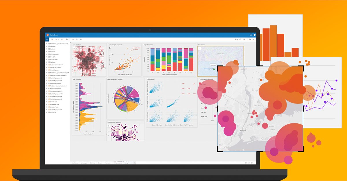
Location analytics can help you:
🔸Answer questions you didn’t know to ask
🔸Analyze data completely
🔸Unlock new insights
Learn more in our #ArcGIS Insights course → https://t.co/Mzkbvheeii
Publishing web maps?
Here is a list of tools to do it effortlessly
- Mapbox studio
- QGIS2Web plugin
- ArcGIS Online
- Carto Builder
- Maphub
- Mango map
- Map Tiler
- Mapme
- Google My Maps
- uMap
- FacilMap
Create your exciting stories with ease!
Join us online on 1 Dec, for two keynote lectures on Decolonising Research. Open to all—come, listen, and engage in the discussions as we interrogate our approaches to research. Streaming link: https://t.co/j9i7Y7DLnV #IHEDelft#DecolonialApproaches#KnowledgePluralism
Do you work in the #water sector, and need training in #waterpolicy analysis, strategy and planning? Enrol in this new online programme starting February 2024 developed by @tudelft and @ihedelft: https://t.co/w8eD5YNOFK
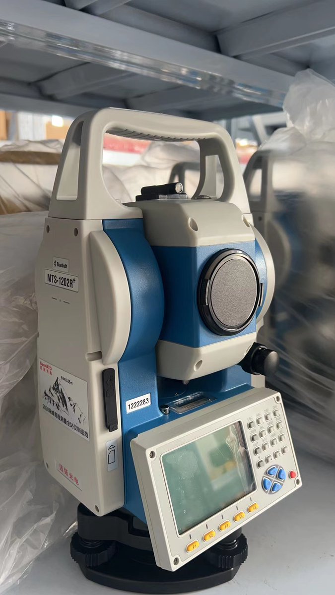
Mts1202r+
1. Up to 7500m with prism, a wide variety of uses, a large display screen.
3. The functions of the F1-F5 keys can be set
4.With the communication functions with mobile phones and computers
https://t.co/DFhkiOYTVV SD card, USB drive and bluetooth
📞:+8615779156738
Geospatial Data Standards refer to documents that outline the encoding, storage, exchange and utilization of data. These guidelines are maintained by organizations, like the International Organization for Standardization (ISO) & the Open Geospatial Consortium (OGC).
#geospatial
Want to learn the basics of Machine Learning directly from a Data Scientist? You're in luck.
This course takes you through some of the main ways engineers use key ML techniques, plus you'll learn about overfitting & underfitting data.
Find it on freeCodeCamp's YouTube channel.