International disaster mapping charity working to ensure humanitarian responders have access to the maps & data they need to save lives & relieve suffering.
We are always looking for new ways to narrate what we do at #MapAction. Our latest effort is this 145-second animation. #VIDEO: https://t.co/wtIFTmUxvj
📷 Jamaica, Mozambique, Vanuatu – with pitstops in St Vincent and the Grenadines, Myanmar and Micronesia; a quick tour of seven #MapAction maps from emergency responses in the last few years.
#mapssavelives#gis4good#maps
https://t.co/j3POeEBSXW
🙏🤝@AuswaertigesAmt
Technical support can be "the connective tissue that allows local leadership to function at scale." Find out how MapAction and partners are working together to reinforce a locally-led information management landscape in #Lebanon. https://t.co/jBbDO7Qniq
#DataForGood#LocalAction
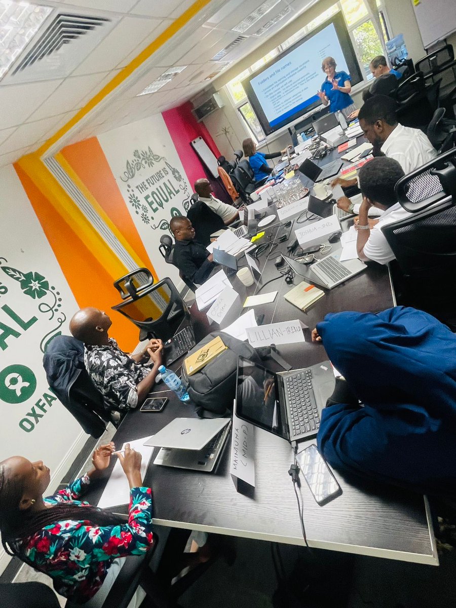
We are delighted to be able to continue this partnership with @KenyaAsal (Arid and Semi-Arid Lands Network) to strengthen local civil society resilience to droughts.
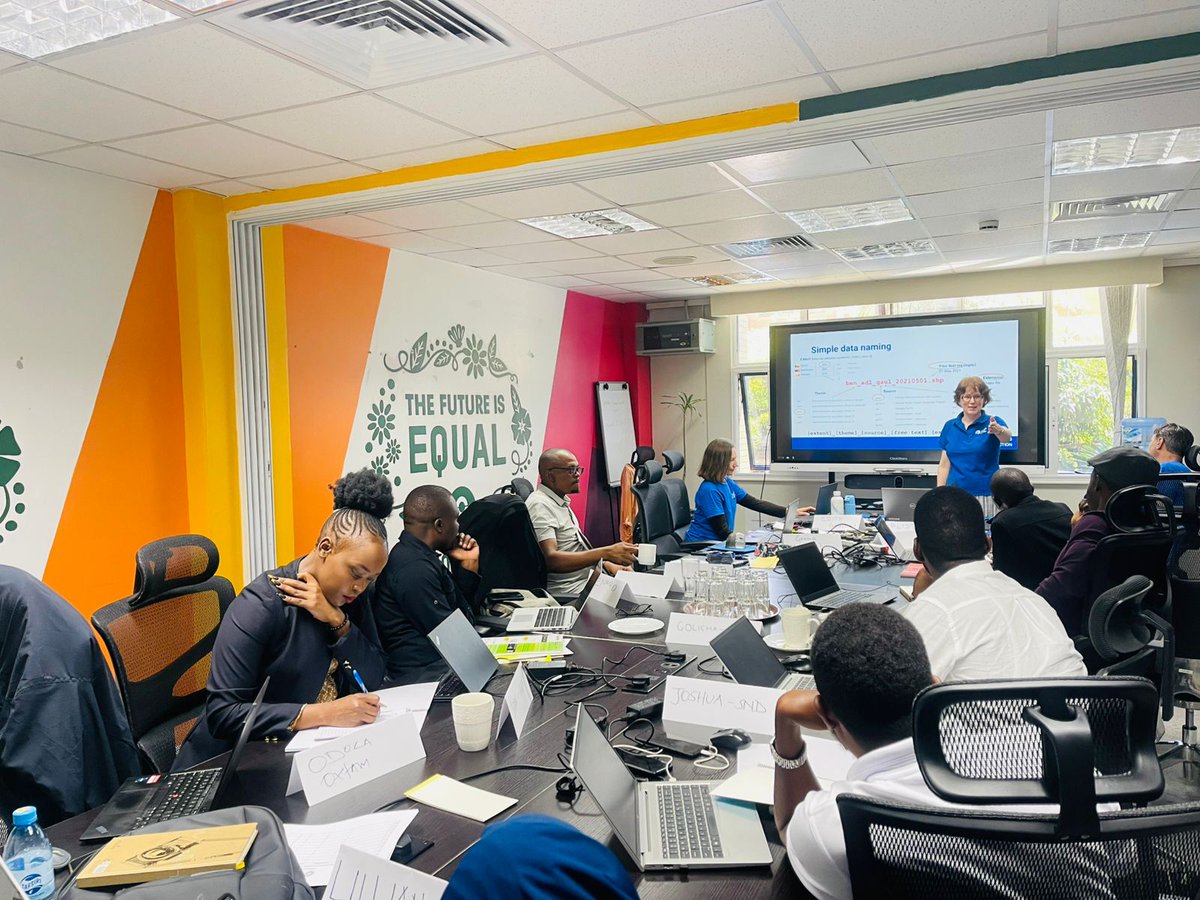
@KenyaAsal & @oxfamkenya has kicked off data and GIS training supported by @mapaction with the hope to strengthen data collection, analysis and mapping, with a goal of improving coordination, evidence-based decision-making, and timely humanitarian response across ASAL regions.
@KenyaAsal & @oxfamkenya has kicked off data and GIS training supported by @mapaction with the hope to strengthen data collection, analysis and mapping, with a goal of improving coordination, evidence-based decision-making, and timely humanitarian response across ASAL regions.
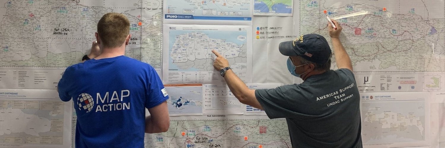
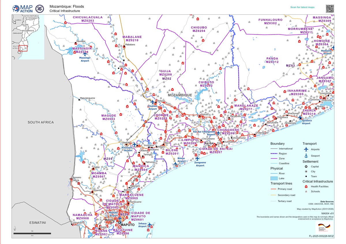
MapAction has sent a team of humanitarian mappers to support @UNOCHA in #Mozambique, where #floods have affected more than 700,000 people. Updates in our blog. https://t.co/DAUP63Hs7h
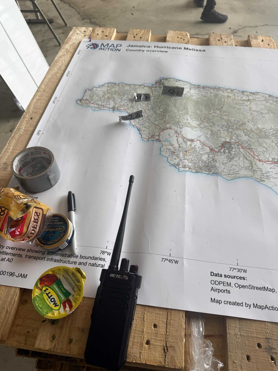
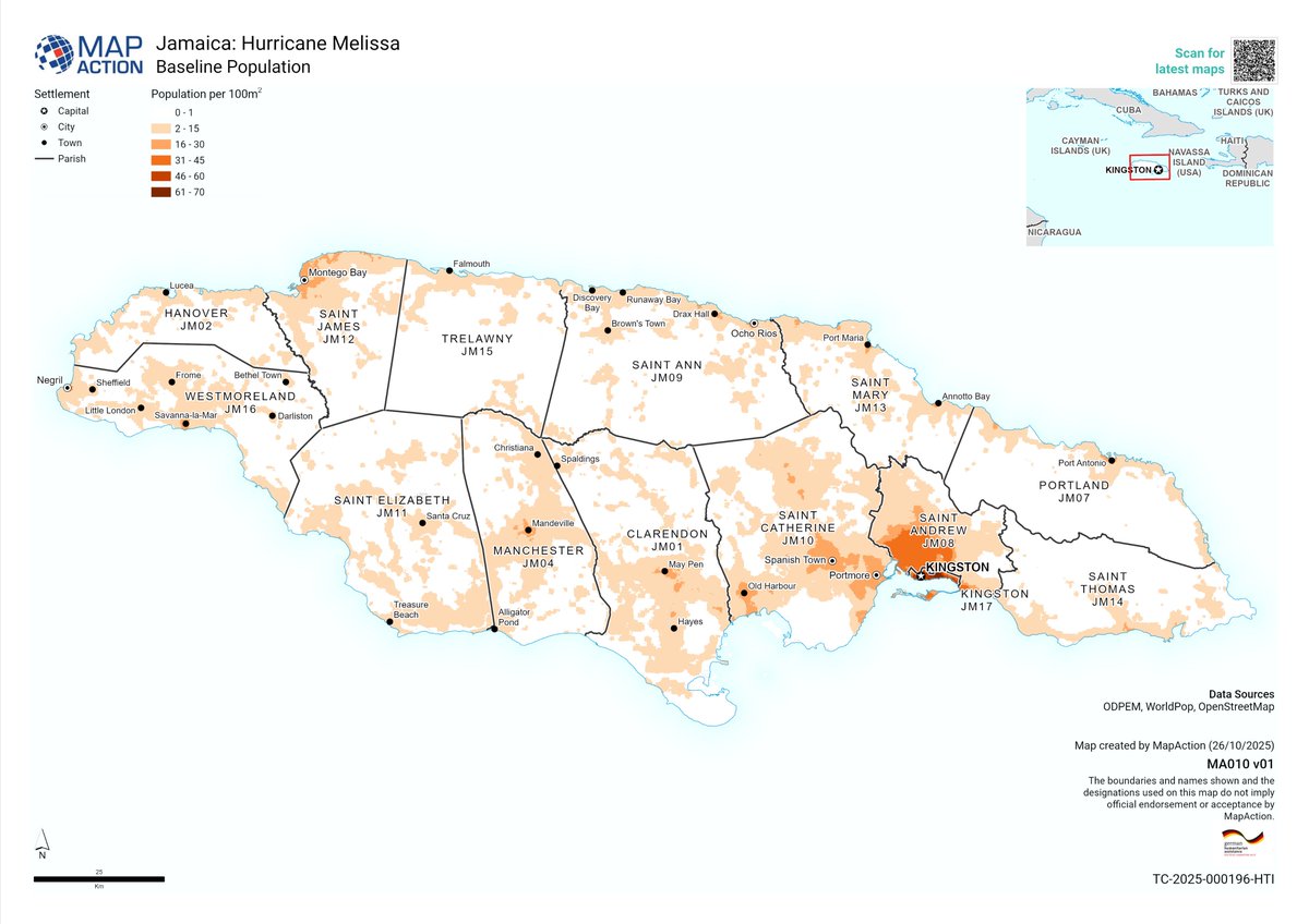
The MapAction team providing daily insights for humanitarian agencies in #Jamaica has handed over to two new experienced members.
More updates on our response to #HurricaneMelissa in our blog: https://t.co/9FzAtGuDdG
This work is supported by @AuswaertigesAmt#mapssavelives
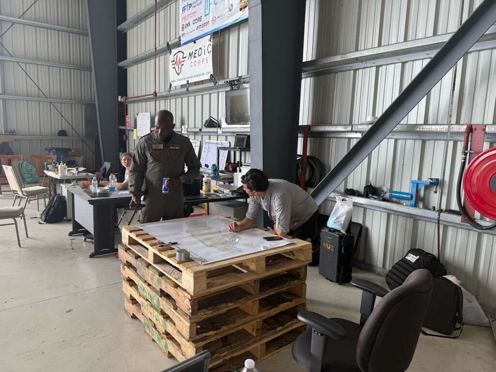
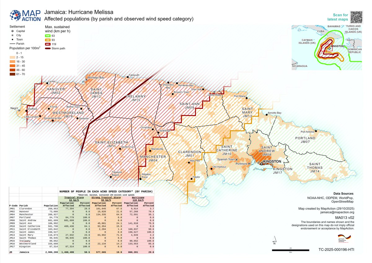
To plan how to get where by helicopter in a landscape where the geography has changed and where complex operations are evolving by the hour, humanitarian agencies need maps based on the latest data. This work is supported by @AuswaertigesAmt#mapssavelives#HurricaneMelissa
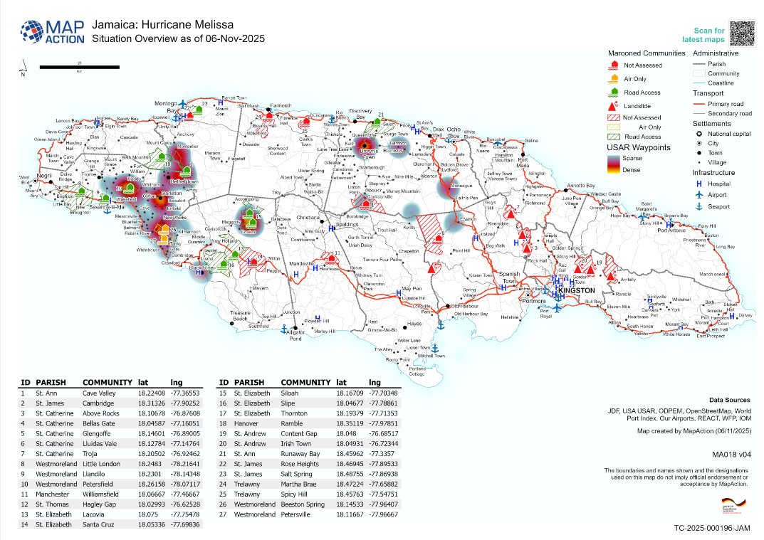
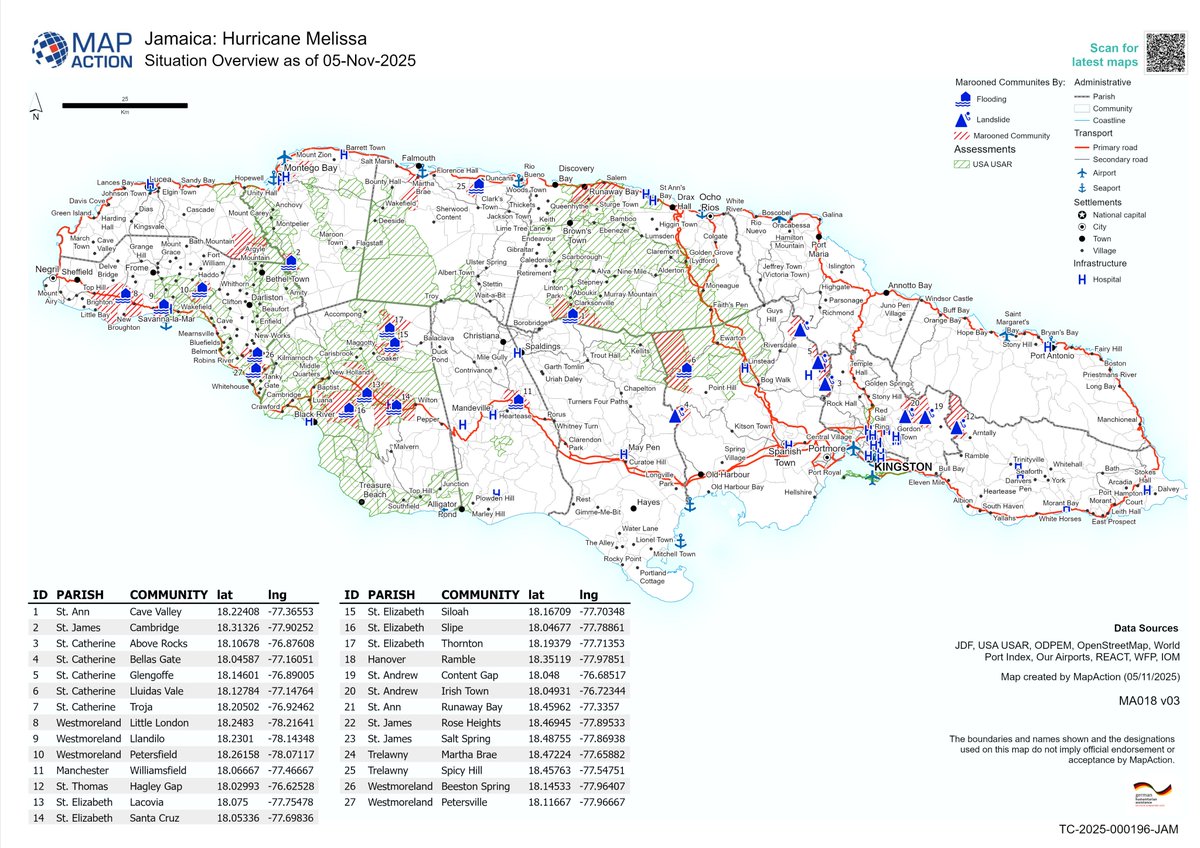
MapAction's latest map from our team working on the response to #HurricaneMelissa in #Jamaica highlights which marooned communities have been assessed and which haven't, as well as which ones can be reached by land or air only.
#mapssavelives
Supported by @AuswaertigesAmt
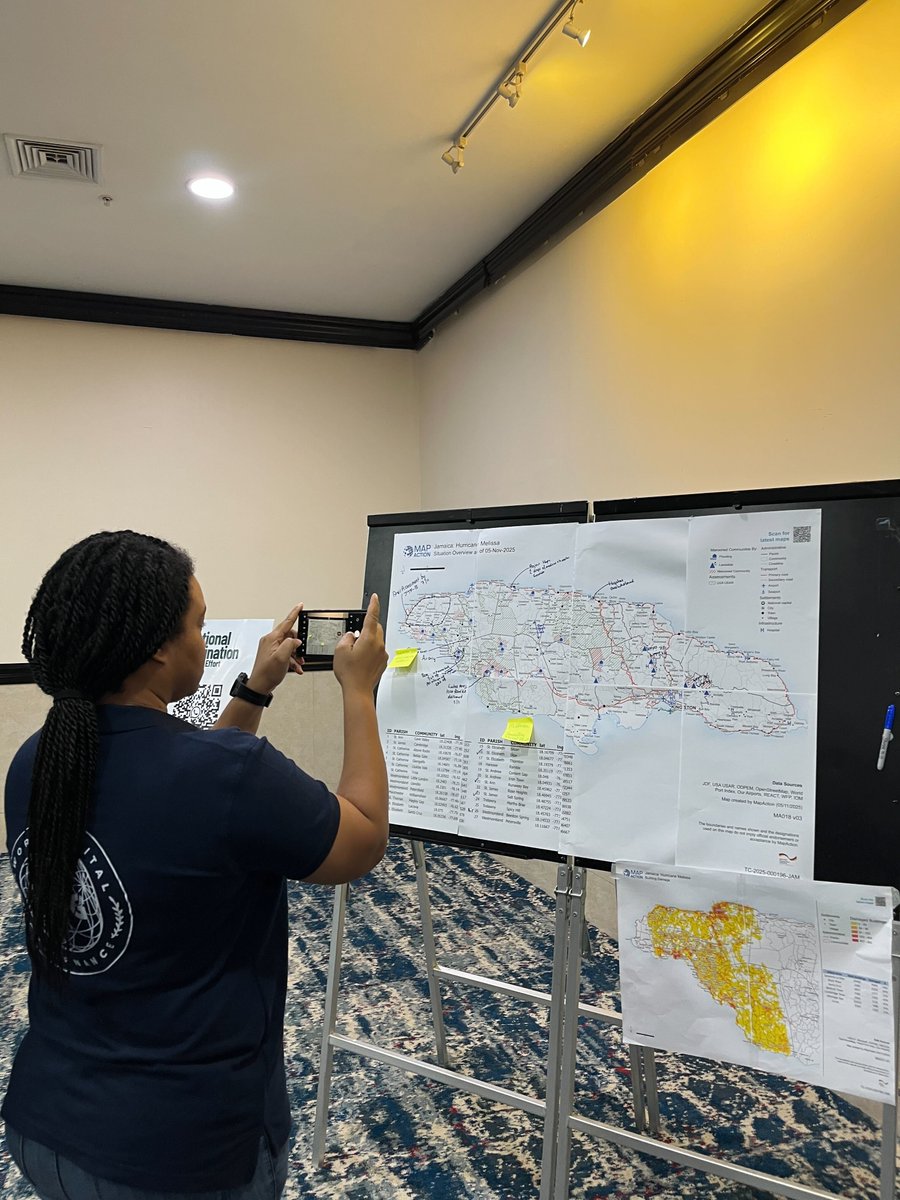
The latest situation overview map from MapAction in #Jamaica shows landslide and flooding sites, with roads and transport hubs highlighted too. More updates in our blog: https://t.co/9FzAtGuDdG
#hurricanemelissa#mapssavelives
This work is supported by @AuswaertigesAmt
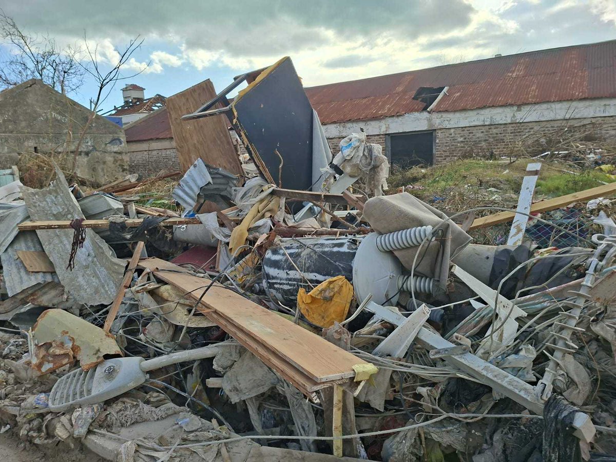
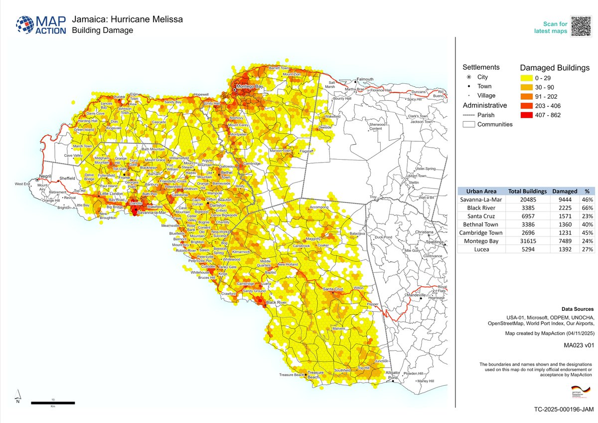
This map by our team in Jamaica shows the extent of damage to buildings, with more than 40% of all buildings damaged in several urban areas. In Black River, it is 65%. In western #Jamaica alone, nearly 25,000 buildings were damaged. This work is supported by @AuswaertigesAmt
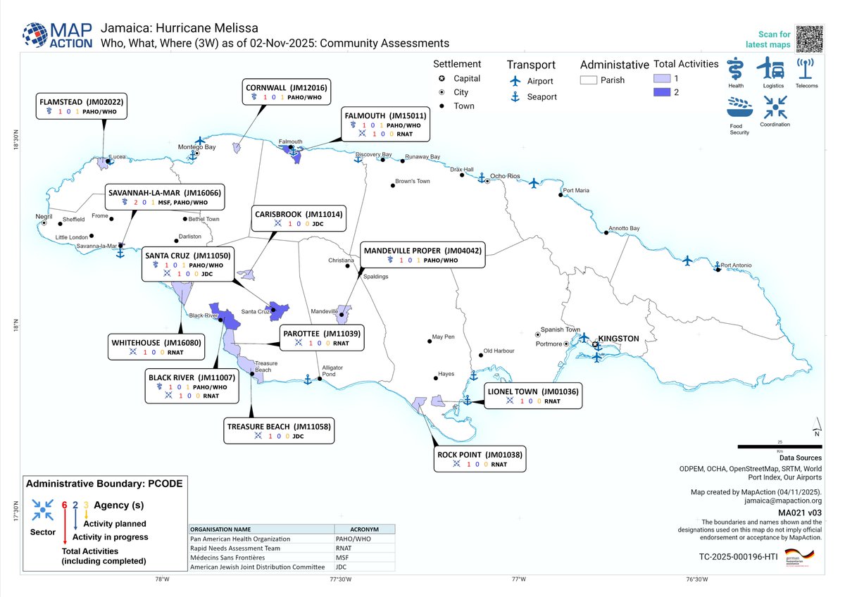
More updates from our team in #Jamaica, working on the response to #hurricanemelissa, who are producing maps to support various agencies and partners. This work is supported by @AuswaertigesAmt
https://t.co/Y2rpDVGWoH
✏️More updates from Jamaica and the Caribbean in our blog on #HurricaneMelissa
👉https://t.co/Y2rpDVGWoH
🙏This work is funded by @AuswaertigesAmt (German Federal Foreign Office)
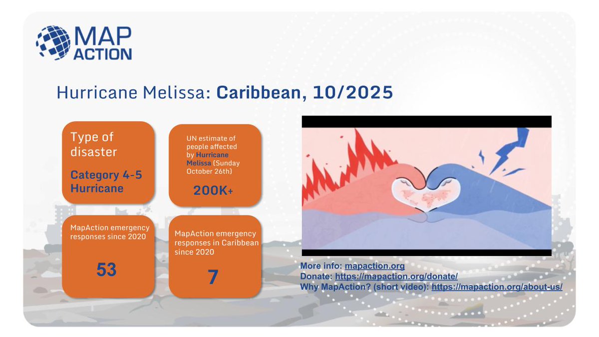
📢 Hurricane Melissa Update
In Kingston, WCK partner Mystic Thai prepared meals ahead of Hurricane Melissa’s arrival. Comforting plates of chicken curry with rice and salad were served to families sheltering from the storm. With our network of local partners, we’re ready to begin serving more meals as soon as it’s safe after Melissa’s landfall. #ChefsForJamaica