Storms are possible this afternoon, with some bringing damaging winds and hail. Stay tuned to local weather reports and avoid driving in dangerous conditions.
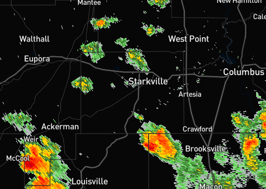
The Starkville campus has been placed under a TORNADO WATCH. Remember: A Watch means conditions are favorable for tornadoes to form, and a Warning could be issued at any time. Monitor local weather developments.
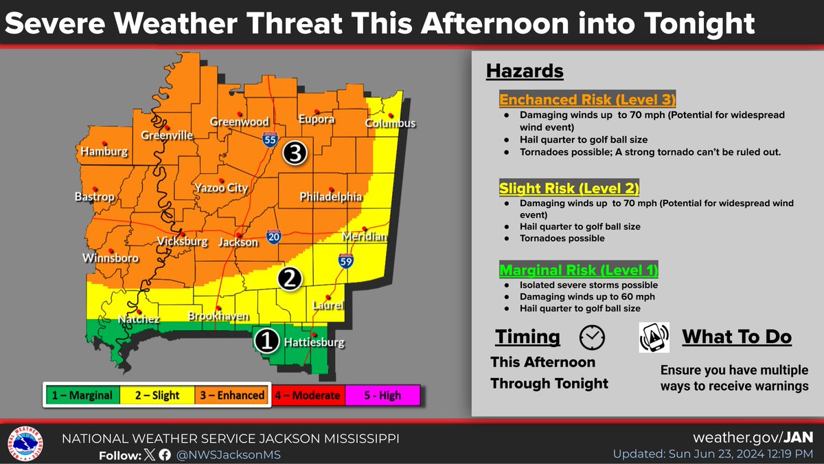
⚠️Severe storms and heavy rain are likely this afternoon through early Thursday. Hazards: Tornadoes, some strong, damaging wind gusts up to 70 mph and quarter to golf ball size hail. Areas of flash flooding likely, with flooded roads/structures and minor river flooding possible.
The Starkville campus has been placed under a TORNADO WATCH. Remember: A Watch means conditions are favorable for tornadoes to form, and a Warning could be issued at any time. Monitor local weather developments.
We expect more storms this afternoon and evening. Stay weather aware and be prepared to seek safety. Strong winds and hail are expected. Tornadoes are possible.
❗Severe storms are likely across the area today ❗
Severe thunderstorms move across the area this afternoon through tonight. Risks include widespread damaging winds with gusts to 70 mph, tornadoes, and large hail up to golf ball size. A strong tornado can't be ruled out.
Isolated strong to severe storms are forecast to move across Southeast Arkansas and North Mississippi late this afternoon through tonight. Damaging winds up to 60-70 mph and hail between quarter and golf ball will be the main hazards. A few tornadoes cannot be ruled out.
There will be an Outdoor Warning Siren test today at noon. This monthly test helps make sure we can notify the city and campus of dangerous weather conditions. Review your severe weather plans and make sure you are registered for Maroon Alerts.
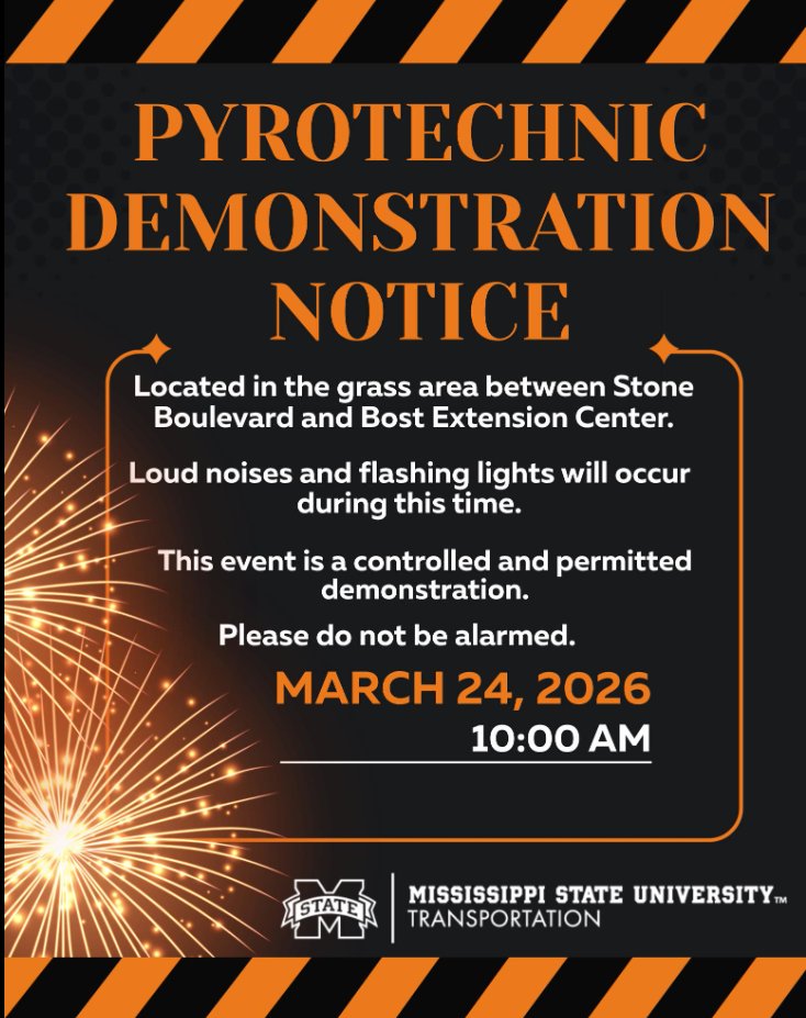
Stop by the PrepareAthon to learn important preparedness and response skills! Displays and booths are set up in front of and beside the YMCA, as well as inside the Union.
Join our PrepareAthon and Build-A-Kit event at the Union and YMCA Plaza on Tuesday, March 24, from 11:00am - 1:00pm.
Several emergency vehicles and other displays will be on site for you to visit.
The Starkville campus has been placed under a TORNADO WATCH. Remember: A Watch means conditions are favorable for tornadoes to form, and a Warning could be issued at any time. Monitor local weather developments.
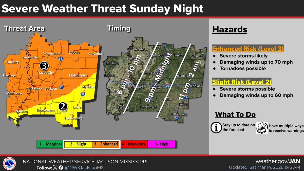
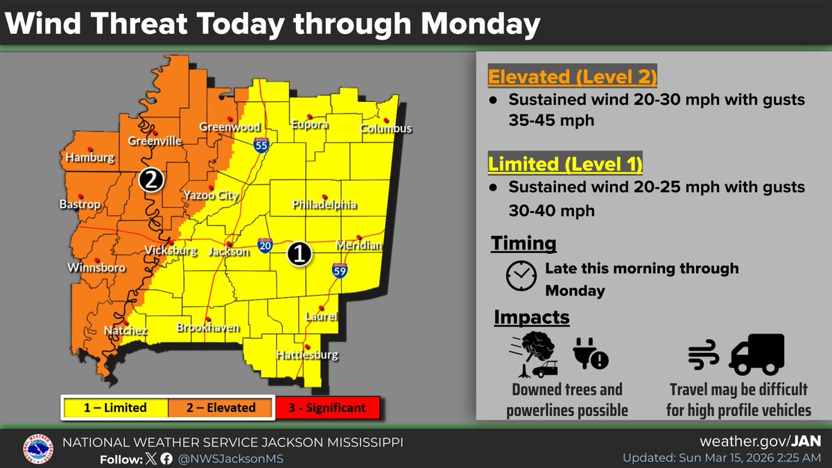
A line of severe storms capable of producing damaging wind gusts, tornadoes, and hail up to quarter size, will move across the area tonight. Additionally, strong and gusty southerly winds will develop today ahead of the storms, and they will persist behind the storms into Monday.
We're in for some big swings in the weather in the coming days! First, a cold front will bring a very gusty line of showers and storms Sunday night. Damaging winds will be the main concern, and tornadoes will be possible. Winds will be very gusty ahead of and following the line.