TS #MEKKHALA is heading WNW & will become #typhoon. Most models recurve it E of Philippines & Taiwan. It may threaten Japan—but models show weakening as it turns N, so I ain't feeling chaserdude tingles. *Next* system may stay further S & threaten Philippines in 8-12 days.
BAGYO UPDATE 🌀
11AM, June 20, 2026
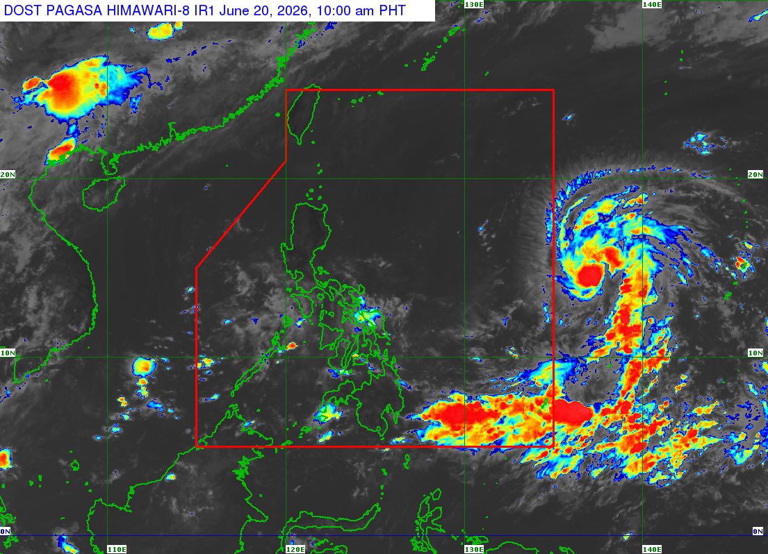
Tropical storm Mekkhala is now nearing severe tropical storm strength ahead of its Philippine area of responsibility entry on Saturday night or early Sunday.
It will be assigned the local name #FranciscoPH once inside the PAR.
Both JMA & JTWC like the track off the west coast of Okinawa and curve up toward offshore Tokyo. A classic track after the poleward turn. DeepMind is liking a track right over the Island chain-we shall see. I would not be surprised to see 75 knots sustained over Kadena.
#Jangmi is moving NNW over the Philippine Sea at 998 hPa, and JMA forecasts steady strengthening this weekend, potentially becoming a typhoon while staying well east of the Philippines. PAGASA now has it inside PAR as #DomengPH, but the main Philippine concern remains broad wind field, rough seas, and monsoon enhancement. The bigger downstream watch is Japan. The forecast brings it toward the Ryukyu Islands early next week, with Okinawa in the broader risk window for building seas, high surf, stronger winds, and heavier rain bands. Track details still matter, but JTWC guidance has shifted closer to Okinawa, so the southern islands should monitor closely through the weekend.
According to the @dost_pagasa, the Tropical Storm #Jangmi (to be called #DomengPH once inside PAR) is expected to start enhancing the Southwest #MonsoonPH (#HabagatPH) on Saturday, May 30.
Currently, the Southwesterly Windflow (weak Habagat) is affecting Palawan and the western sections of Mindanao. However, the fully-blown Habagat will begin to affect in these mentioned areas this coming weekend. 🍃🌧️
According to the weather models, Habagat will also start to affect Metro Manila, CALABARZON, Bicol Region, and other parts of MIMAROPA and Visayas on Sunday, May 31. ⚠️
Be alert and precautionary measures are advised. 🙏
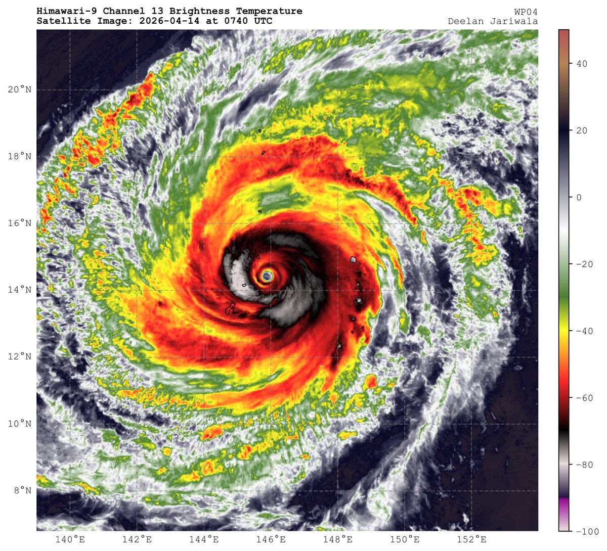
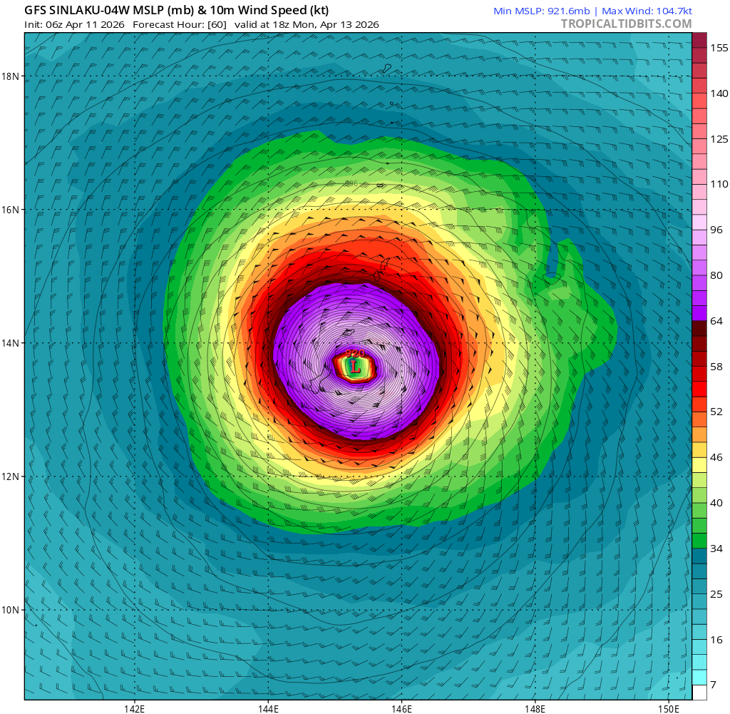
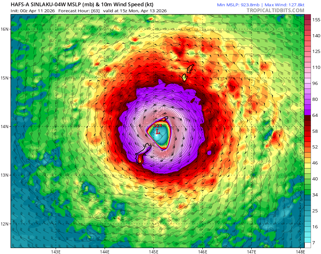
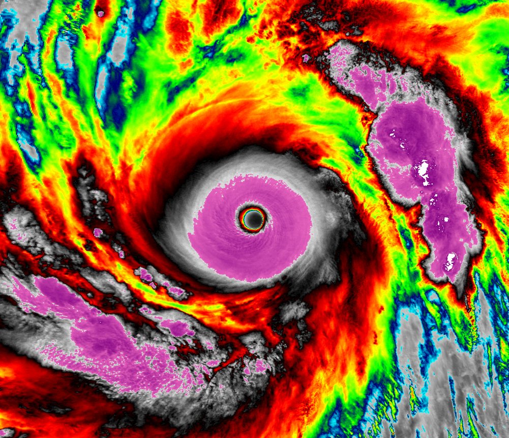
The JTWC did override the 18z intensity estimate for Super Typhoon SINLAKU, upgrading it to 160 kt (185 mph) with a minimum central pressure of 890 mb. This makes Sinlaku the strongest super typhoon by wind speed since Bolaven 2023 (165 kt/190 mph), and the first to reach sub-900 mb since Bolaven as well.
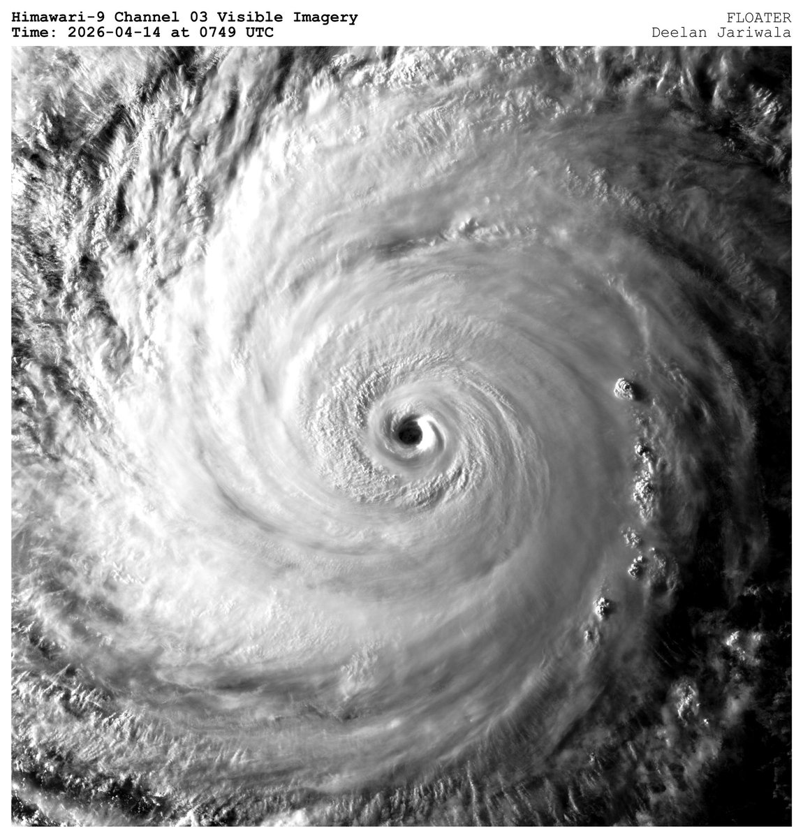
Daylight has revealed Super Typhoon Sinlaku, and it’s an absolutely stunning. What a powerful storm. Current intensity is likely nearing or at 160 kt (185 mph), Category 5. This might be a top 5 tropical cyclone I’ve tracked.
Sunrise imagery reveals an immaculate satellite presentation with STY #Sinlaku.
Despite the apparent band-heavy structure, we still have no indication of concentric eyewalls, nor any meaningful SEF attempts. Eventually an ERC will occur, but until then, the incredibly photogenic, long-duration category 5 peak continues.
#Sinlaku is an upper-echelon Typhoon. Virtually as perfect an appearance as you can get, and it has sustained for nearly ~12hrs.
That being said, we are observing a slight degradation of symmetry in recent frames, as the CDO becomes more "squashed". this is a remarkable storm for April; heralding the likely strong +ENSO event coming up.
Oh. My, Goodness.
Super Typhoon #SINLAKU is meteorological perfection this morning. Presentations don’t get much better than this in the world — this is most certainly now a Category 5.
ADT estimates are 160 kts (185 mph), 892 mb. And honestly, it might not be far off.
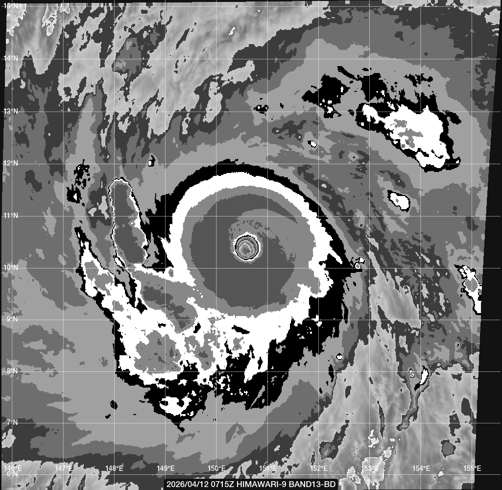
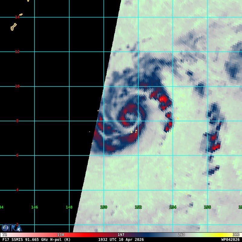
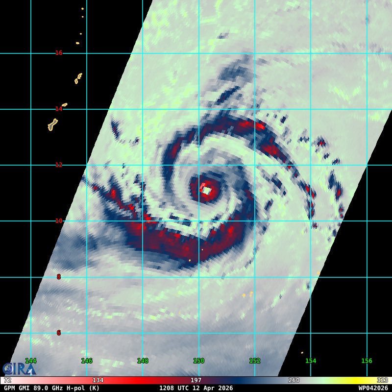
High resolution microwave imagery passed over Super Typhoon #Sinlaku
An intense, compact eyewall is surrounded by two larger spiral band structures with a large region of stratiform in between. Very picturesque.
#Sinlaku's rapid intensification has been absolutely mind blowing. @UWCIMSS ADT analyzes it with a raw T-number of 7.7 (about 163 kts). Although the actual intensity isn't that high, it is very likely approaching super #typhoon strength. Very dangerous situation for #Guam/CNMI.
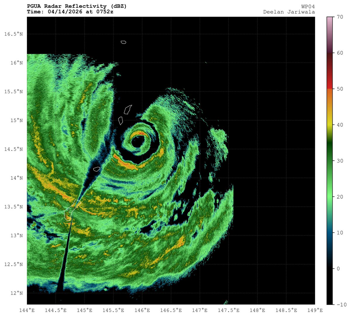
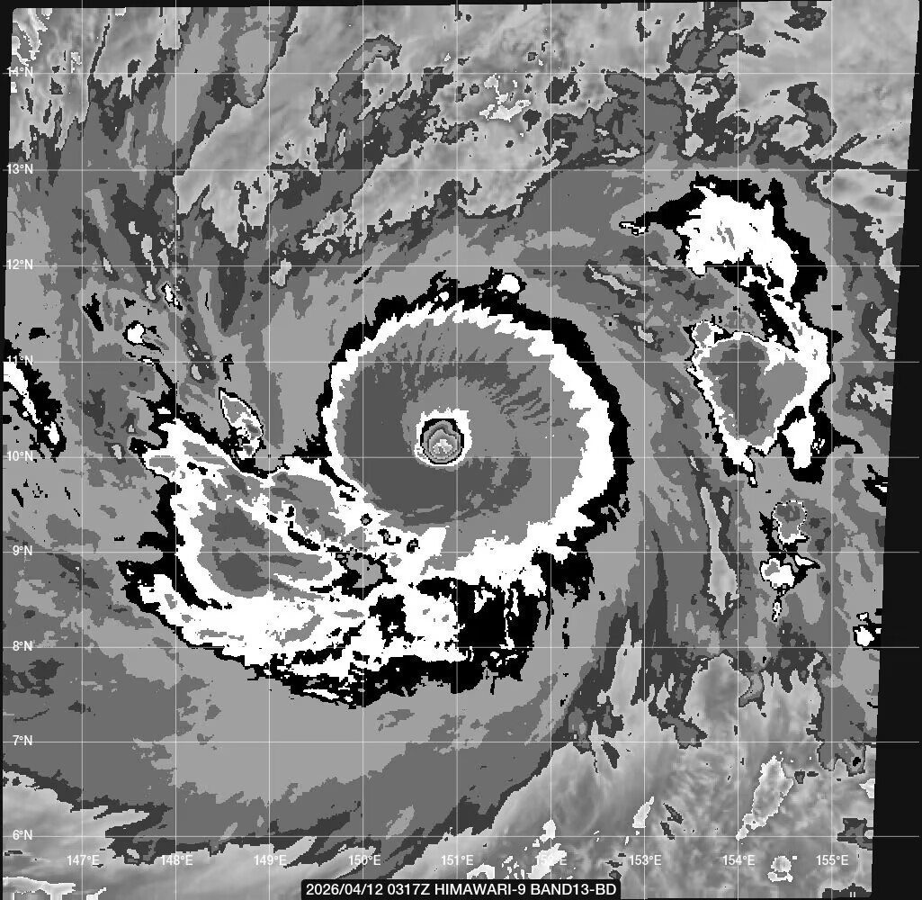
Eye of Typhoon Sinlaku has cleared and warmed.
Satellite intensity algorithms now over 7.0 (raw T#) so we're looking at a Category 5 (Super)
Sky is the limit on Sinlaku to T 8.0 (170-knots) in this environment.
Typhoon #Sinlaku is on course to become a Super Typhoon before it reaches the Mariana Islands. The storm currently in weak steering will begin to be steered NW'wards over the next few days.
The HAFS-A takes the storm to between Rota and Guam. Winds near 130knts. HWRF over Rota. GFS nearer to Guam.
It looks to be a very significant Typhoon to pass through the Mariana Islands. Deep Mind prefers a more NNW Track into the northern more islands.
Super Typhoon Mawar passed close by in May 2023.
#Sinlaku (#04W) was upgraded to #typhoon status at 18Z, and it appears to be poised for rapid intensification. Microwave satellite imagery from about 1930Z suggests that an inner core has formed with a very small eye feature. This is bad news for #Guam.