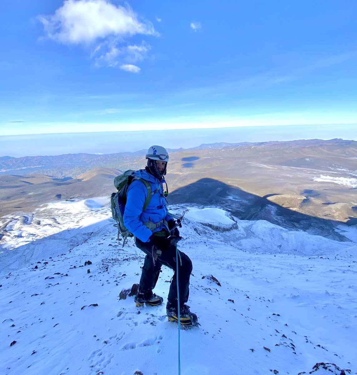
Runaway #glacier loss has been my unwanted companion as I climb in the Andes. It not only makes climbing more dangerous, this rising imbalance in our alpine ecosystems has dire consequences to humans and wildlife. #ClimateAction Follow/share the thread ⬇️
An intense heatwave is affecting western Europe.
This image of land surface temperature was captured by the @CopernicusEU Sentinel-3 mission on Wednesday, 23 June in the late morning.
Cities and regions of France, Spain and southern Italy are experiencing unseasonal temperatures: Madrid 48°C • Poitiers 46°C • Rome 44°C 🔥
More info 👉 https://t.co/Pb0xSpfLu7...
Good news: economic growth doesn’t have to come at the expense of air quality. Using @CopernicusEU Sentinel-5P data, researchers found many major cities are growing while cutting NO₂ - read the full story⬇️
https://t.co/gpACvO3JRl
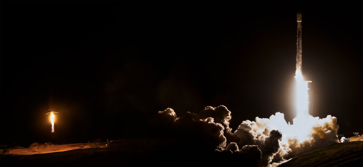
Two national EO missions were launched yesterday onboard a @SpaceX Falcon-9 rocket:
🛰️Italy's @IrideSpazio (https://t.co/C072CT8xAn)
🛰️Greece's Hellenic Fire System (https://t.co/mN8loPEROG)
Credits: SpaceX
Happy Earth Day! 🌎 🌍 🌏
To mark this special day, we’re tuning in to @sen, the world’s first continuous 4K video livestream from space.
Sen’s cameras are hosted on our Columbus module of the International @Space_Station, with data delivered via the @AirbusSpace platform.
Streaming in real time, it shows breathtaking views of our planet as the International Space Station passes over cities, oceans and deserts.
Watch Earth from above, just like our astronaut @SophieAdenot does on the #εpsilon mission.
📹 Sen
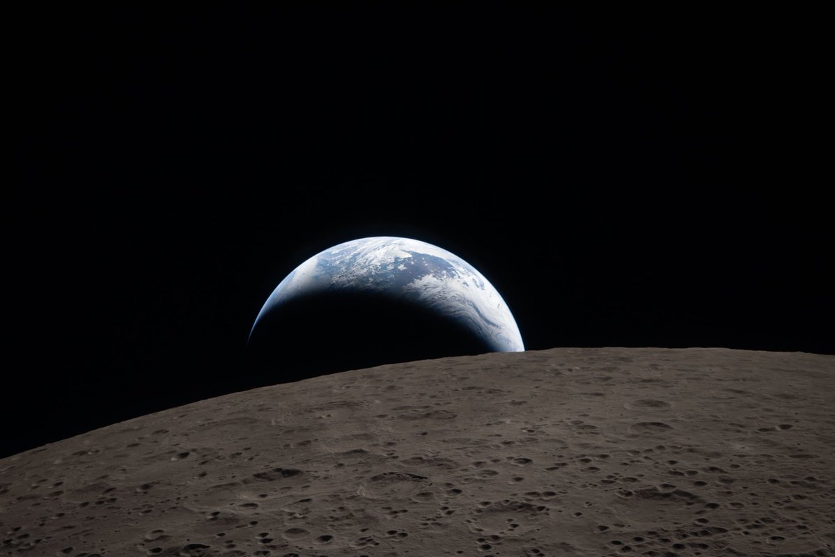
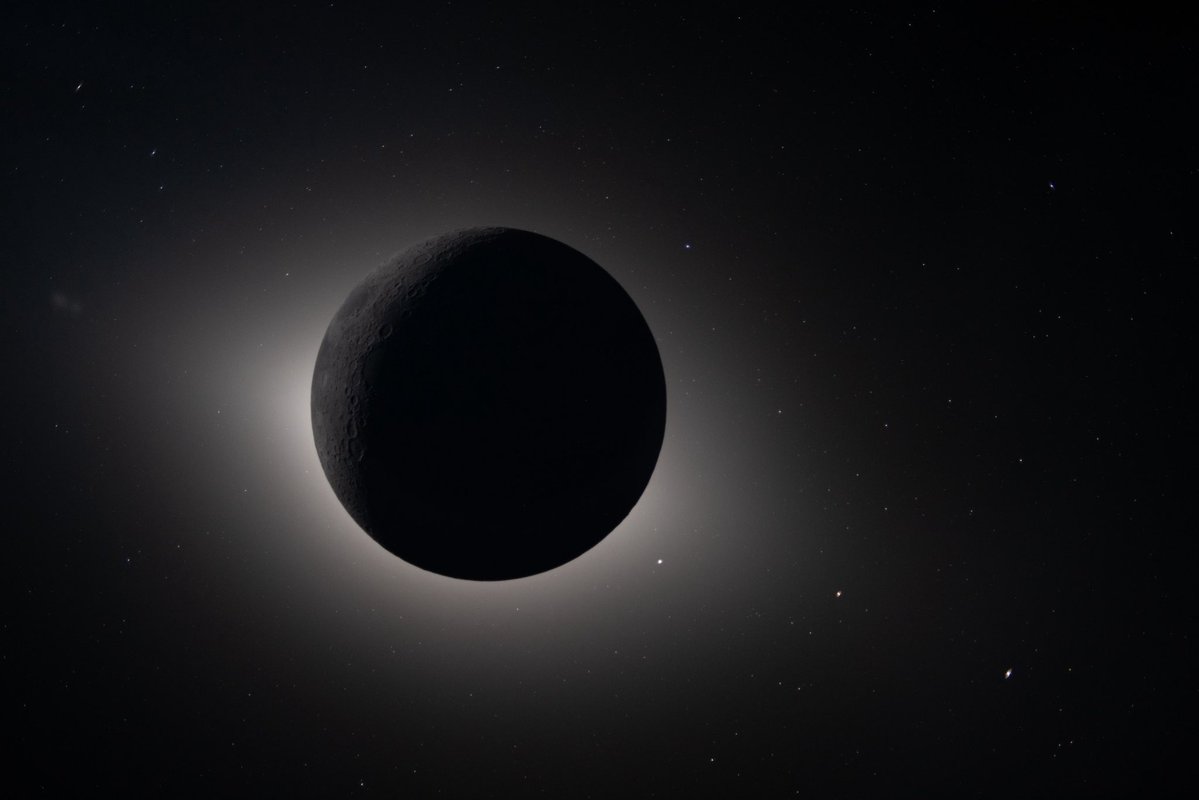
✅ #Artemis II update: 'Earthset', 6 April 2026, and 'totality', 7 April, seen from lunar orbit, the Moon eclipses the Sun, a view few humans have ever witnessed (pics: NASA)
🔗https://t.co/ld0YaC0PgO
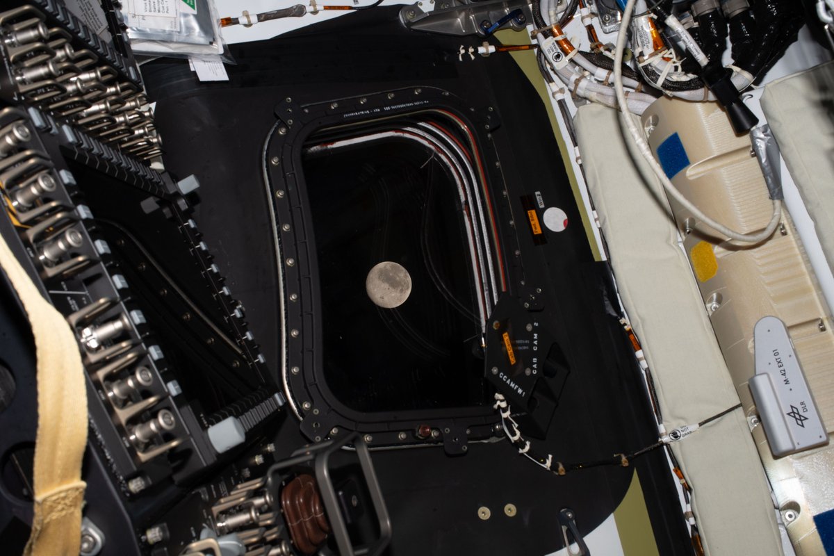
✅#Artemis II update: the spacecraft entered the lunar sphere of influence this morning at 05:37 BST/06:37 CEST, 6 April, at about 51 000 km from the Moon. This is the region of space where the Moon’s gravitational pull is stronger than that of Earth’s.
https://t.co/VksO0hNclR
Il est des moments où l’Histoire reprend son souffle et montre à l’Humanité l’horizon de sa grandeur.
Avec Artemis II, plus de cinquante ans après Apollo 17, la Lune redevient ce rendez-vous des peuples qui mettent en commun et qui osent.
Français, Européens, nous pouvons être fiers de participer à cette aventure extraordinaire en ayant un rôle clé grâce au module de service européen développé par l’ESA.
Félicitations aux équipes de la NASA et de l’ESA pour ce lancement réussi. Nous allons suivre de près toute la suite. Dans l’espace aussi, notre destin s’écrit par l’ambition, la souveraineté et l’unité.
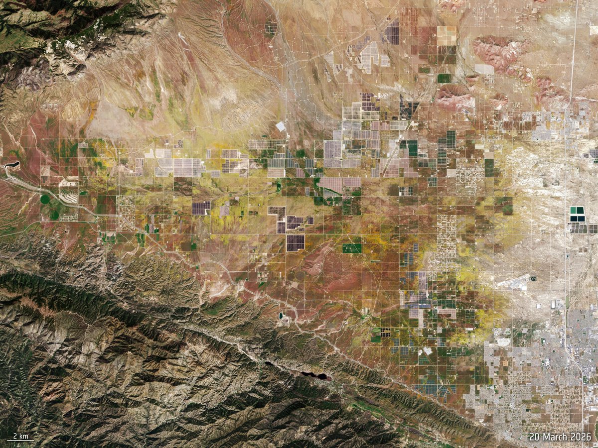
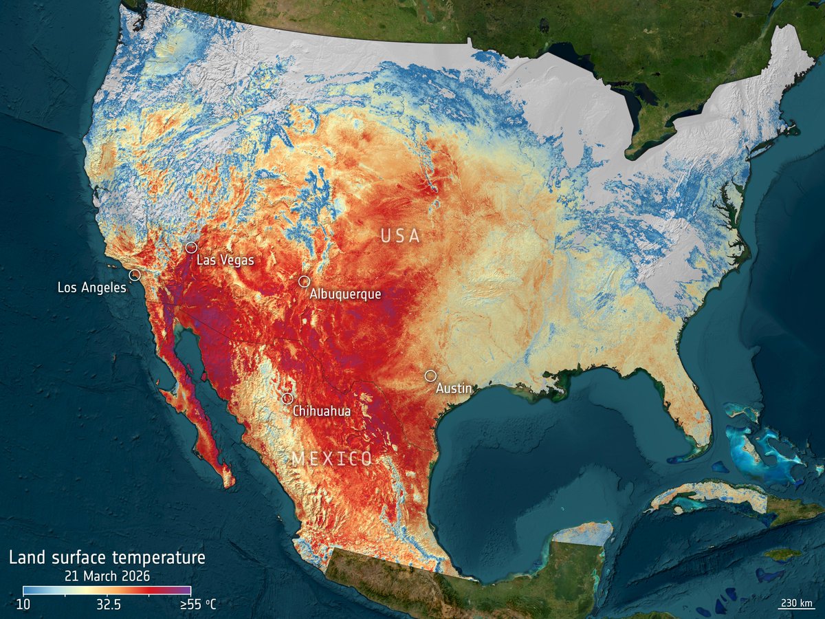
It's hot - and we can "see" it from space: On 21 March, Copernicus Sentinel-3 measured widespread land surface temperatures exceeding 40°C🥵
Recent extreme heat across the central and southwestern US and Mexico pushed ground temperatures far above seasonal norms according to @NOAA data.
These extreme temperatures and winter rain have triggered a super bloom in some areas. On 20 March 2026, satellites captured expanded flower cover across Antelope Valley and Grass Valley — a rare burst of colour driven by the same unusual conditions.
January–March 2026 was a busy season for us! Get up to speed on European space with our new ESA Impact visual report, out now 👉 https://t.co/uPqP5xIoYy
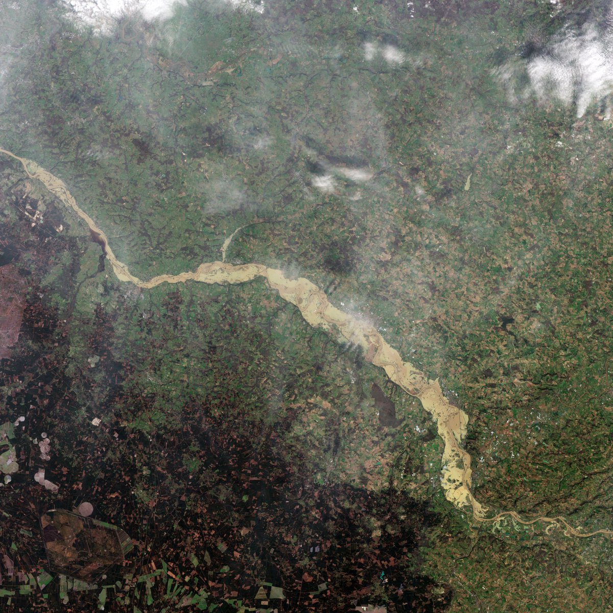
France has endured 35 consecutive days of rain.
One striking example:
According to @Vigicrues, the Garonne at Marmande rose from 3.50 m on 10 February to over 10 m by 14 February.
Here are 3 images that show the impact of the heavy rainfall from space:
• Accumulated rainfall map (9–18 February 2026) using data from the @NASA/@JAXA_en GPM mission
• Sentinel‑1 radar image (flooded areas in red)
• Sentinel‑2 true‑colour view of the same region
Our thoughts are with the communities affected as the region continues to face challenging conditions.
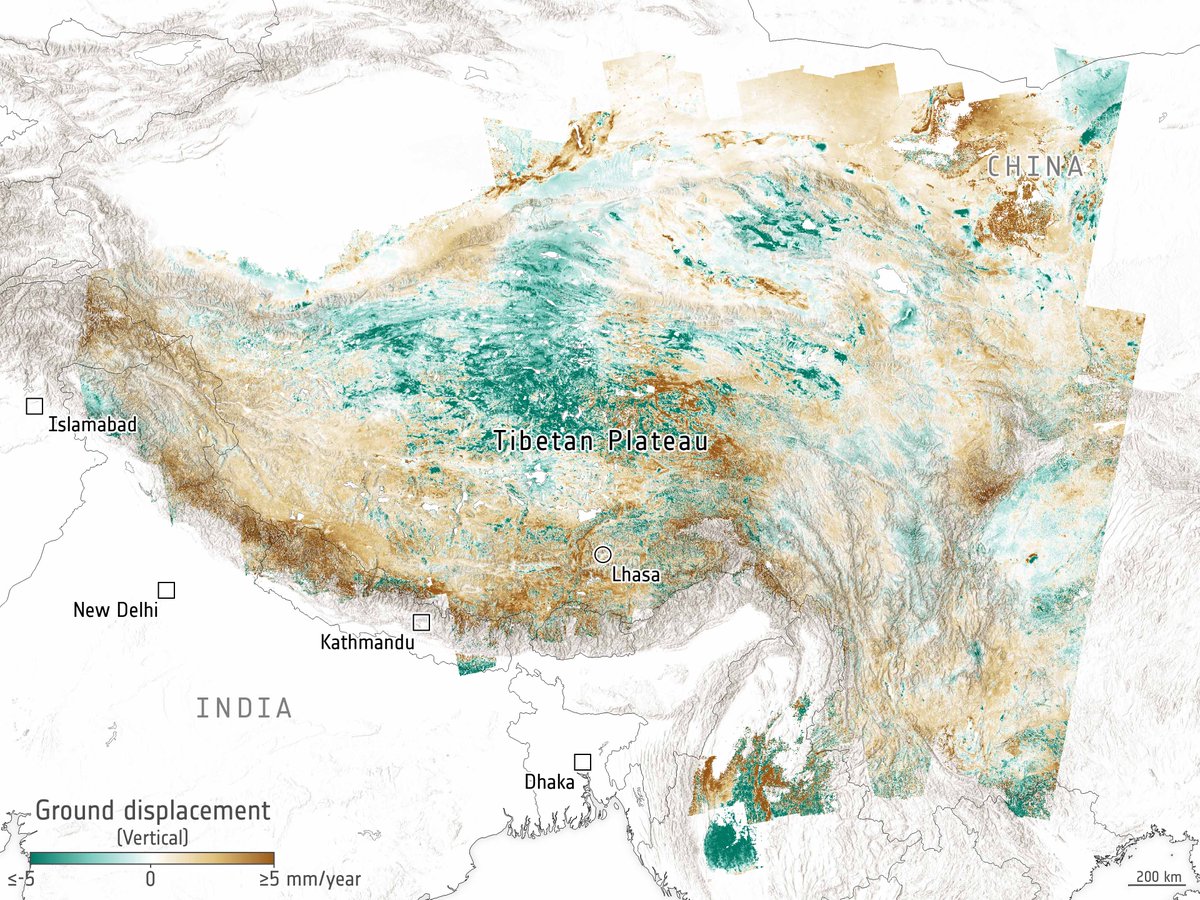
What if tectonic plates aren’t as solid as we thought?
Thanks to satellite data from @CopernicusEU Sentinel-1 and other data sources, scientists have mapped how the Tibetan Plateau stretches and shifts, showing that Earth’s crust and upper mantle behave more like flowing material.
📸ESA (Data source: Wright, T. et al, 2026)
https://t.co/wSLNLhorZD
Australia’s record heatwave as seen from space 🌡️
Thermal data acquired by the @copernicus_eu Sentinel‑3 Sea and Land Surface Temperature Radiometer highlight the severity of the ongoing heatwave across Australia, with extreme land surface temperatures (LST) detected over large regions.
For example, in Willcania and Broken Hill, recorded land surface temperatures ranged between 58 and 60 °C, whereas Adelaide appeared cooler, with temperatures of 45–48 °C, likely due to its proximity to the sea.
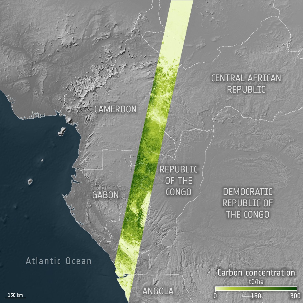
Biomass data are now available to the public✅
@esa's forest mission is the first satellite to carry a P-band synthetic aperture radar.
Why is it so cool?
It can penetrate dense forest canopies to measure woody biomass, including trunks and large branches, where the majority of forest carbon is held.
This will help scientists provide a robust proxy for carbon storage: https://t.co/yEdlF3TGeA
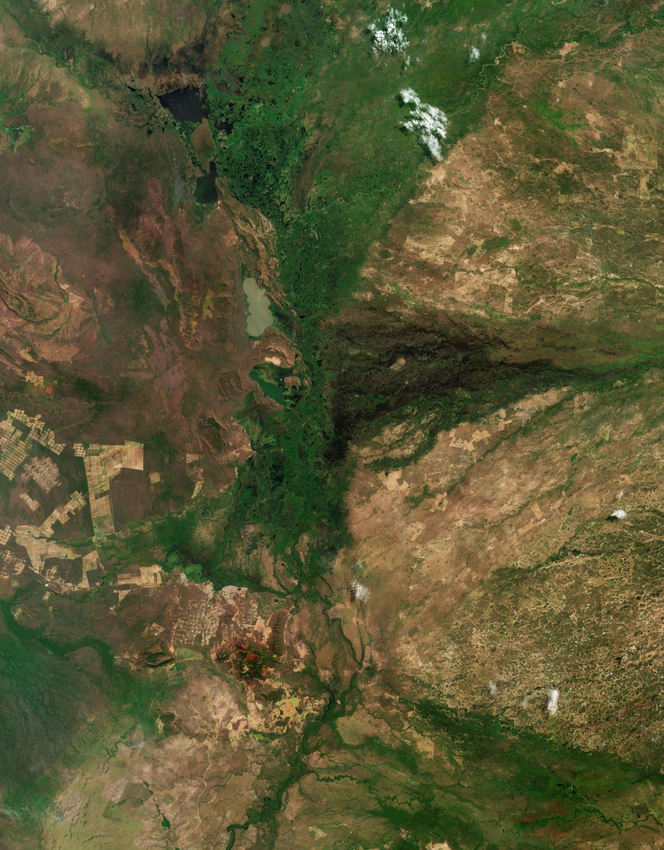
📸 This week's @ESA_EO#EarthFromSpace is a @CopernicusEU Sentinel-2 image of the Pantanal region, between Brazil and Bolivia. This vast wetland is home to a broad variety of plants and wildlife.
🔗 https://t.co/myxbApBU3R
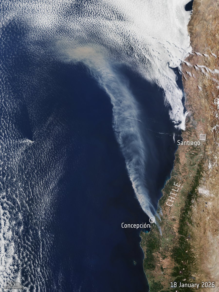
Forest fires in Chile as seen by @CopernicusEU Sentinel‑3 on 18 January - the image captured an extensive wildfire smoke plume originating near Concepción and sweeping over the Pacific Ocean.
According to @conaf_minagri , as of the evening of 19 January, emergency crews were actively responding to 31 wildfires nationwide.