Started a blog post for random things I work on. If interested in spatial analysis along a network, I wrote a function in R for network kernel density estimates. Next blog post will be on local measures of spatial auto-correlation along a network https://t.co/wSsVSAX5ZC
If you made it this far and are interested in more details the paper is open access. Feel free to contact me via email provided there (I'm not on Twitter much anymore, not sure how many others still are!)
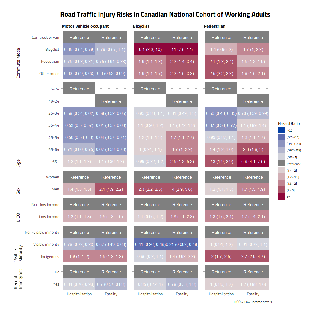
Our analysis used a linked dataset of the long-form census with injury outcome datasets. Data linkage allows us to compare injury incidence between population groups that we otherwise are not able to because injury datasets often only collect information on gender and age.
The economic, built environment, and social conditions of Indigenous people that result from these power structures result in inequities across a multitude of different health outcomes.
In our new paper on comparing traffic injury risks across different population groups in Canada, we found stark inequities, w/ ⬆️risks for low income and indigenous populations for motor vehicle occupant, pedestrian and cyclist injury. Open access⬇️
https://t.co/Ep6A2hxIHh
@walkabilly@SaskatoonCycles @charlieclarkyxe Great article Dan. Targeted interventions aren't the solution, a point you've made quite effectively in the past as well https://t.co/NEfknfEniM
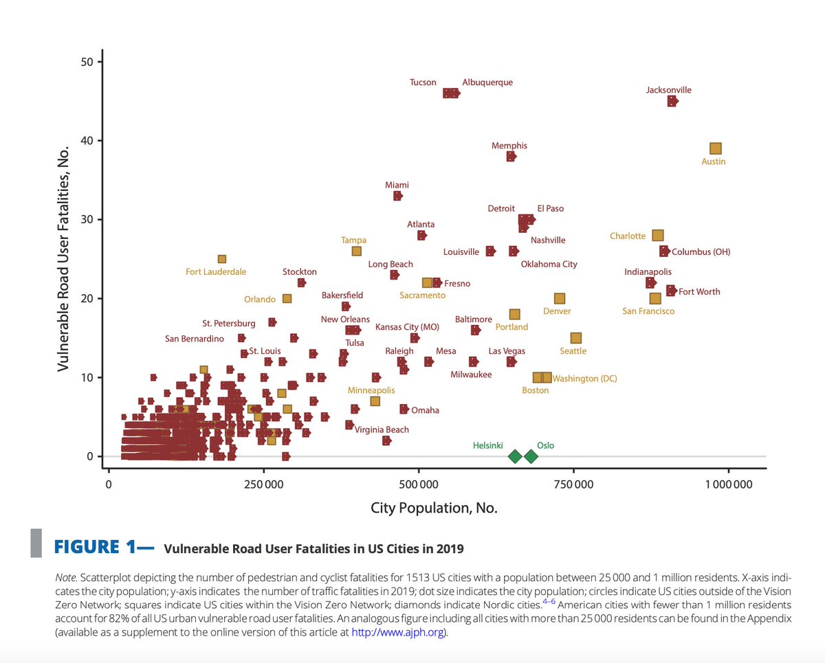
#DYK the cities of Helsinki and Oslo reported zero cyclist and pedestrian deaths in 2019. An @AMJPublicHealth editorial from @johnastaples and our team explore ways that #VisionZero can be applied to American Cities. Read more: https://t.co/RA23z9IM3L @VCHResearch@VisionZeroCA
Our team has been awarded @CIHR_IRSC funding to study inequality in road traffic injury rates of different populations & places in BC! The study uses 2015-2019 BC Gov data to map traffic injury rates in different neighbourhoods. Read more: https://t.co/im48mC6bLR @UBC@ChatrLab