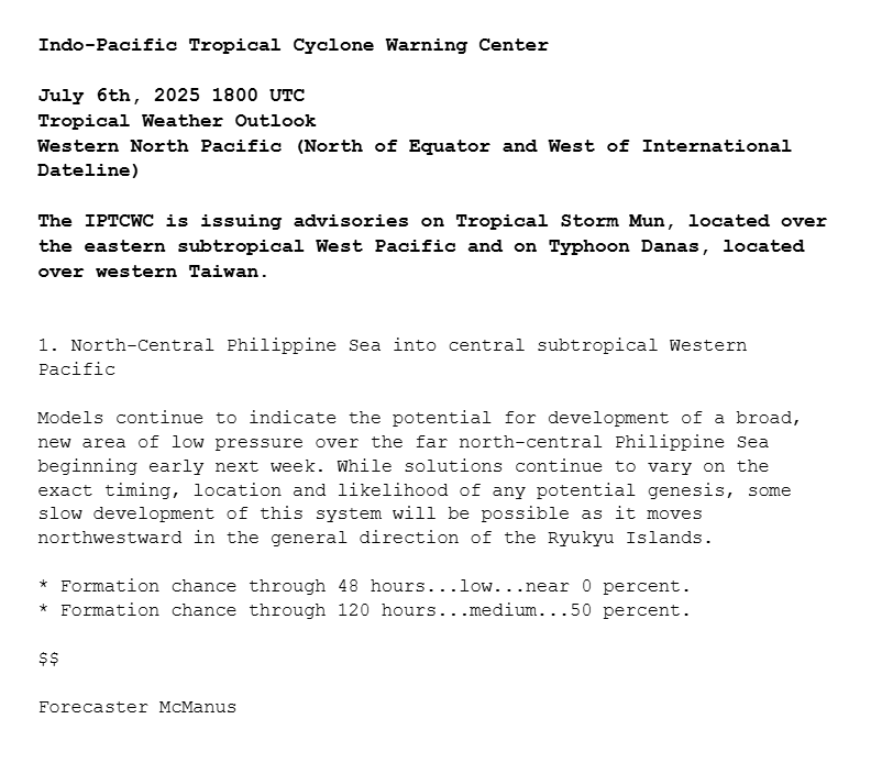
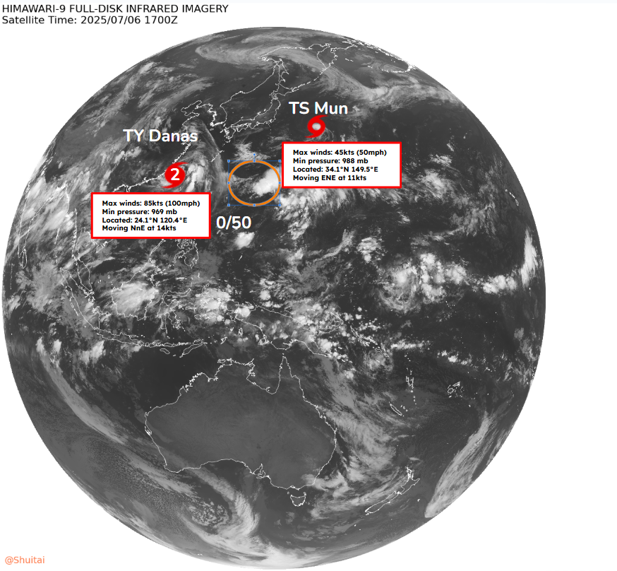
Western North Pacific Tropical Weather Outlook: The IPTCWC is issuing advisories on Tropical Storm #Mun and Typhoon #Danas, the latter of which made landfall in Taiwan as a powerful typhoon today. Elsewhere, another disturbance may develop into a tropical cyclone early next week.
A real life illustration on the power and speed of a Texas Flash Flood . If you don’t understand - this is why people sleeping might have been swept away. This is few hours ago (afternoon of July 5) on the Llano River at the crossing of Ranch Road 3404 at the Kingsland Slab, a popular recreation spot for locals when the river is normal. I’ve crossed the river here and numerous other county roads on the river during bluebonnet season. You can see the rock (granite) structures on the sides of the river - which contributes to the velocity and rapid rise of water. It’s akin to pumping water through a garden hose with the spigot all the way open, and then putting your thumb over the opening.
Stevie Ray Vaughn “Texas Flood”
When you attend church tomorrow - think about our families and remember us in your prayers.
Lake Travis (a flood control reservoir) was 637’ yesterday, it’s already at 653’ today — and there is a few betting pools on where the lake will stop rising in a few days. A full pool is 681’.
The remains of Barry produced 20.33" of rain 4 miles northwest of Streeter TX.
Barry is the 20th tropical cyclone (or remnant) since 1913 to cause 15"+ across Interior Texas. The loop below shows the other 19.
Tropical Cyclone Rainfall Climatology: https://t.co/sZfxYTgme3
Tropical Storm #Andrea has formed east of Bermuda - the first Atlantic named storm of the 2025 Atlantic #hurricane season. On average the first Atlantic named storm forms on 20 June.
Foudre des orages violents à Québec et à Lévis visible... de Trois-Rivières, à plus de 100 km de là!
https://t.co/3AMHGlZYHi
#MeteoQC
(Eh non, les "éclairs de chaleur", ça n'existe pas : c'est parce qu'on voit la foudre d'orages au loin, trop loin pour entendre le tonnerre.)
23 juin 2025, 19 h 58 HAE
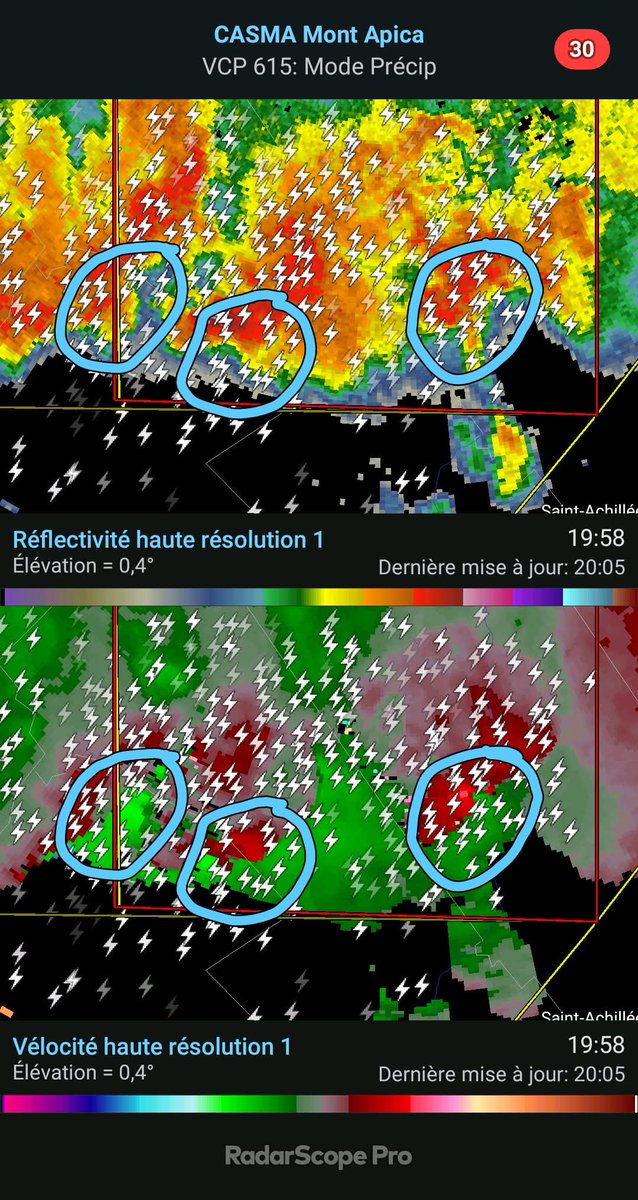
Il y a possiblement 2, voire 3 tornades dans la Réserve faunique des Laurentides, entre L'Étape et le Camp Mercier. TROIS!!! 🌪🌪🌪
#MeteoQC
23 juin 2025, 19 h 48 HAE
Il y a une intense tornade dans la Réserve faunique des Laurentides, entre L'Étape et le Camp Mercier. Très intense. #MeteoQC
What folks beneath the MCV in Eastern North Dakota are currently experiencing is likely equivalent to a Category 1-2 Hurricane.
I don’t think I have ever tracked an MCV this intense. What a complex for the books tonight…
Video shows the rockslide that happened at Bow Glacier Falls in Banff National Park yesterday.
A second person has been confirmed dead, with at least 3 others seriously injured.
I cant remember seeing anything like this.
People say that a lot.
But i genuinely cant remember the last time ive seen this.
The closest thing I can think of that this resembles is a stronger left front quadrant swinging through on the backside for a Hurricane.
#ndwx#mnwx #derecho