A very rare meteotsunami occurred today in Neenah, Wisconsin, after a significant tornado-producing supercell moved through the area. This event may lead to increased algal bloom activity in Lake Winnebago, as Reilly explains in this clip.
📷️ Video Credit: Justin Poublon
A FLASH FLOOD EMERGENCY has been extended for the Pedernales River until 10pm CDT, as life-threatening flooding continues to occur as it crests well above major stage.
If you are in this warning, remain on higher ground! This is an extremely dangerous and life-threatening situation!
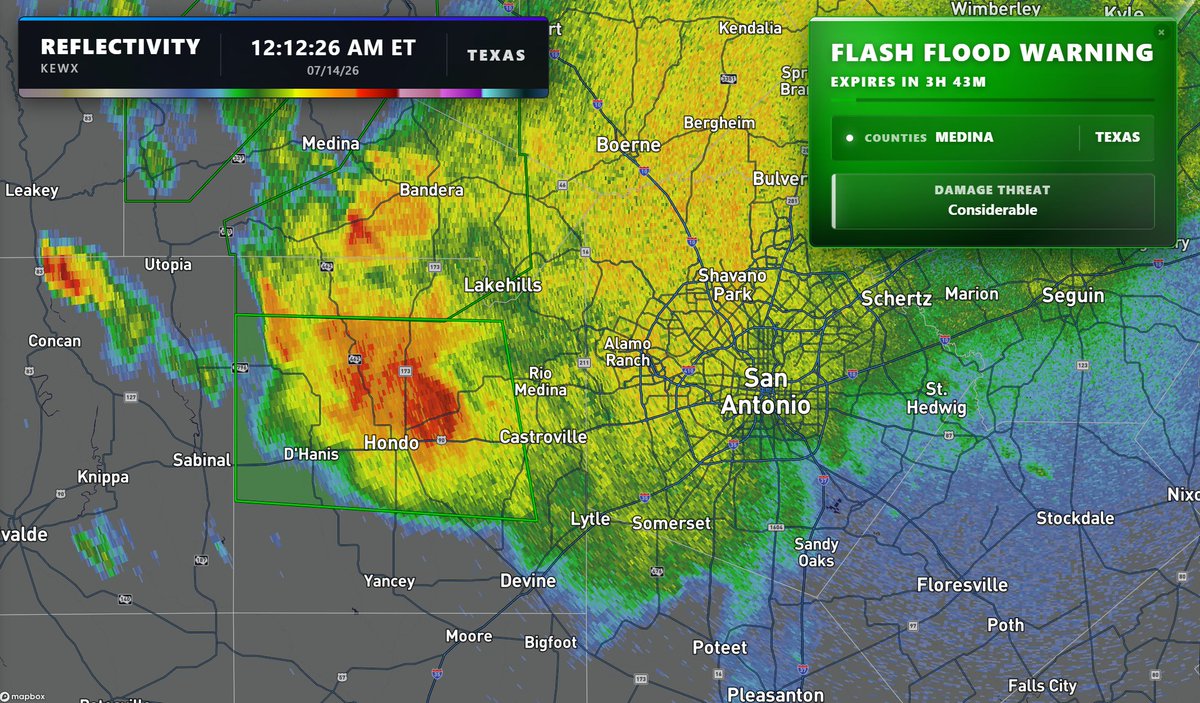
A state of emergency has been declared in Texas, as a multi-day threat of life-threatening flash flooding continues. High precipitable water rates combined with storm motions being very slow will continue through the next several days, keeping round after round of storms moving through, each posing the threat for significant flooding.
Flash flood warnings are already going into effect west of San Antonio, and models have continued to significantly uptrend on the rainfall totals expected by this weekend...
WOW! We have a HUGE severe weather pattern coming over the next two weeks 😬
Multiple chances of severe weather will begin as early as Thursday of this week, with a very favorable pattern set to bring severe storms nearly every day. April is about to wake up!
Today is an INCREDIBLE day for outdoor plans!
Our new outdoor planner has been fully released on our website! This can help plan your upcoming vacations. You can enter your own location or click on the interactive map for more details on any location Check it out at https://t.co/u0eWuuyWBG
The National Weather Service is modernizing operations and moving to the cloud!
This will greatly improve our mission to provide weather, water and climate data, forecasts, warnings, and impact-based decision support services for the protection of life and property and enhancement of the national economy.
Learn more: https://t.co/wrkVOn7j2D
Meteorological winter in Austin will go down as our driest in 12 years. That makes March look so gahtdang beautiful.
Confidence increasing in multiple storm chances beginning WEDNESDAY, perhaps lasting for a week thereafter. Lordy do we need it #atxwxx#txwx
9 PM Update: Widespread freezing rain embedded with sleet has overspread the Hill Country into portions of the I-35 corridor. Another round of freezing rain and sleet is approaching the Rio Grande from Mexico. Icing impacts are escalating. Do not travel unless necessary!
Be cautious of false information and entities impersonating ERCOT during this winter storm. ERCOT does not send text messages to share information on grid conditions. ERCOT communicates grid condition information through our official communication channels, including our website (https://t.co/4lhispuJsn), Texas Advisory and Notification System (TXANS), Emergency Alerts, social media channels, and the ERCOT mobile app.
⚠️As of 6:15 PM Saturday, most elevated roads in Austin are now icing over.
Lots of crashes already due to freezing drizzle, and the heavy stuff is still ahead of us tonight.
DO. NOT. DRIVE. PLEASE.
12:20 PM - THUNDERSLEET can now be checked off of your winter storm bingo card.
Mix of freezing rain & sleet moving through Gillespie county with some lightning strikes. Reminder: "main event" is TONIGHT #atxwx#txwx
12:20 PM - THUNDERSLEET can now be checked off of your winter storm bingo card.
Mix of freezing rain & sleet moving through Gillespie county with some lightning strikes. Reminder: "main event" is TONIGHT #atxwx#txwx