It was an excellent opportunity for me to present my paper in CHNT27.
“Measurment and investigation of surface displacement caused by earthquake using Differential Interferometric Synthetic Aperture Radar on historical monuments area“
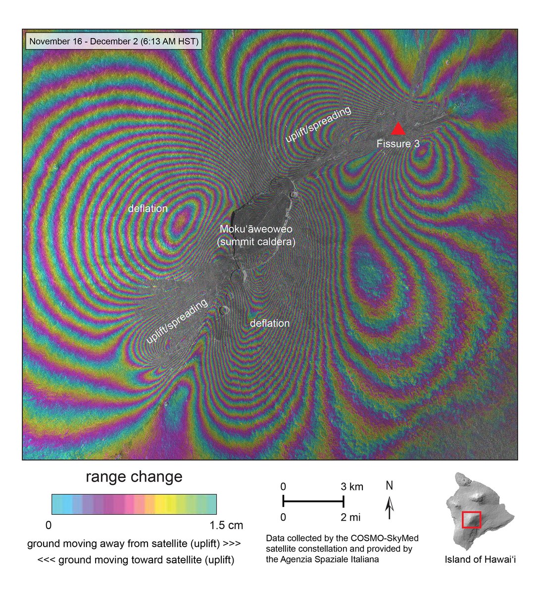
New #radar#interferogram of #MaunaLoa eruption shows deformation thought Dec. 2 at 6:13 AM HST. Deflation of overall volcano by ~50 cm (20 in) with uplift/spreading along summit caldera axis and NE Rift Zone. Thanks to @ASI_spazio for access to COSMO-Skymed data!
Free Python book for Professionals.
This book has more than 200 chapters and it is a great hands-on guide for learning Python.
Download Link: https://t.co/okd0jKCccF
The European Space Agency @esa proudly announces the release of the WorldCover2021 map based on Sentinel-2 & Sentinel-1 constellations with 11 classes, 10m resolution, 77% accuracy independently validated
Visit https://t.co/DMIWNq9Glv @ESA_EO#EuropeanSpaceAgency#WorldCover2021
0.5 m #pleiades satellite image data sample for 18 May 2022, Dubai, UAE from #OneAtlas
I think it will be better in the future.
https://t.co/MIeB9f3rj8
AIRBUS OneAtlas Data
#RemoteSensing
Shocking video of a mountain glacier collapsing in Kyrgyzstan in Central Asia.
Just a week ago Italy saw a deadly glacier collapse killing 11 people.
With a rapidly warming climate expect more sobering scenes like this in the future.
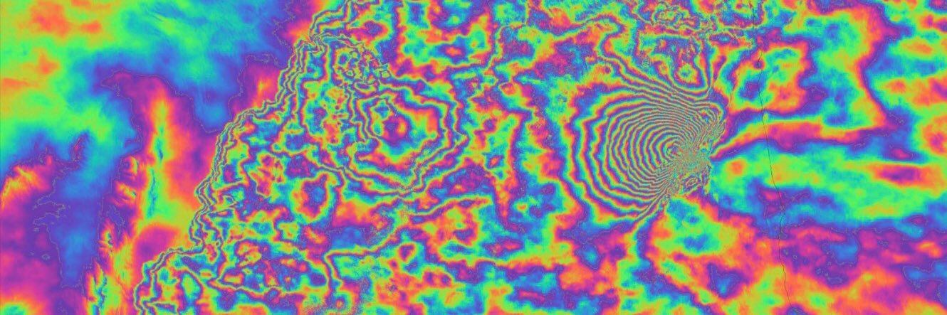
#Iran has experienced many #earthquake s in the last few days. A nice co-seismic Interferogram has been generated for ascending orbit images. (20220622-20220704)
Epicenters by #USGS
Radar images #Sentinel1#DInSAR
#Sentinel1 processing of co-seismic Interferogram for M 5.9 and 4.5 earthquakes #Khost, Afghanistan. 1 fringes = 2.8 cm (LOS). Strong shakes have been detected close to both Epicenters. 2022/06/18 - 2022/06/30
#DInSAR
Remotely sensed studies are an effective tool for #natural_hazards monitoring, especially in the countries at war.
4.3 M #earthquake / 2020-05-18 / #Kabul#Afghanistan two #Sentinel1 ascending images are processed in SNAP software.
#EMSR584#AfghanistanEarthquake 🇦🇫
Our #RapidMappingTeam has delivered its damage Grading Products for the 1⃣3⃣ Areas of Interest over the weekend
➡️A total of 4⃣0⃣2⃣ affected buildings🏚️ were detected in the areas analysed with VHR🛰️ imagery
More at👇
https://t.co/IIr2B4r4Eu
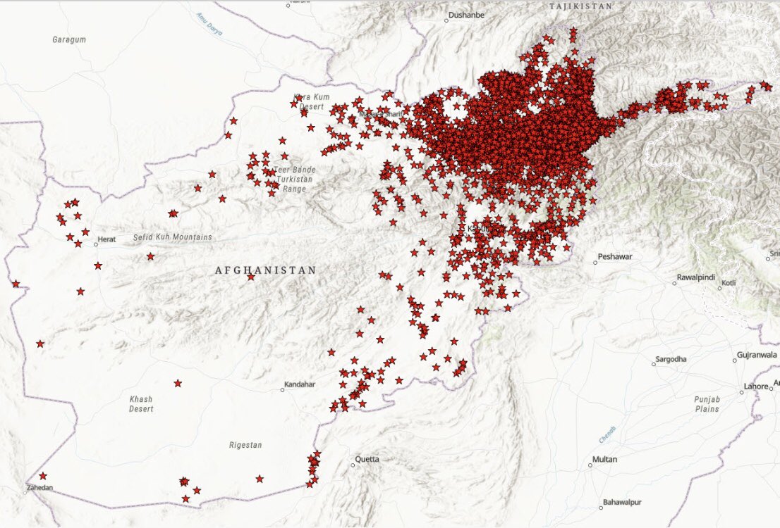
Two #earthquake s, M 5.9 and M 4.5, both in-depth 10 km, shocked #Khost province in #Afghanistan last night. Recent #Sentinel1 A images are available for dates 18 and 19 june 2022. It is needed to wait some days for after-event images. #SAR
I really recommend verified track of #InSAR course: #Hazards on #edXOnline. teaching methods and course materials were very interesting to learn. I have passed this course these days. I think it will help me a lot in the future.