New release of the hereR 📦 on CRAN: In addition to free-text queries, qualified queries are now supported in geocoding.
https://t.co/VNsmZyWEmv
#rstats#rspatial#geocode
Patch release of hereR 📦 v1.0.1 on CRAN:
- Fixes isoline and routing requests for "pedestrian" transport mode🚶♂️
- Improves stability by fine-tuning rate limiting to avoid status 429 (Too Many Requests) ⚙️
Details: https://t.co/VNsmZyWEmv
#rstats#rspatial#routing#datascience
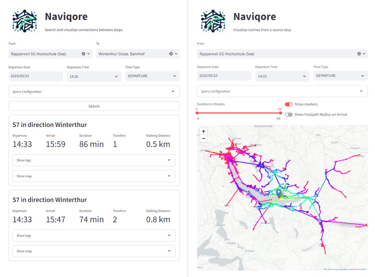
🚇 Proud to announce Naviqore, our new open-source public transit router! 🚀 Built on RAPTOR and GTFS data, it features multi-day routing, customizable queries (e.g., wheelchair accessibility, transport mode, bike accommodation), range queries, and isoline routing. Try it now!
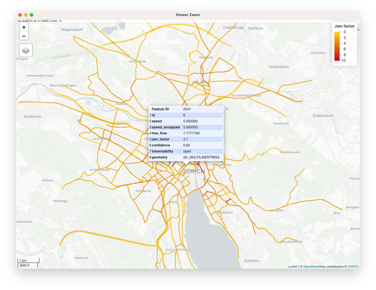
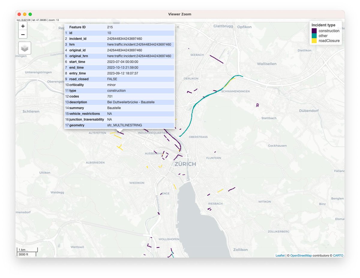
Major release of hereR 📦 v1.0.0 on CRAN:
- Upgraded HERE Traffic API to v7 🚗
- Upgraded HERE Destination Weather API to v3 ☀️
- Support HERE Platform API key 🗝️
Check it out: https://t.co/VNsmZyWEmv
#rstats#rspatial#datascience#traffic#weather
[PAQUETE 📦] - ¿Tenés coordenadas y necesitas direcciones? ¿Al revés? ¿Trabajas con datos de transporte o tráfico? ¡Probá el 📦 {hereR}!
🌐 https://t.co/IhRdQTBmys
✍🏼 @munterfi1#RStats#RStatsES#Rtips#DataScience
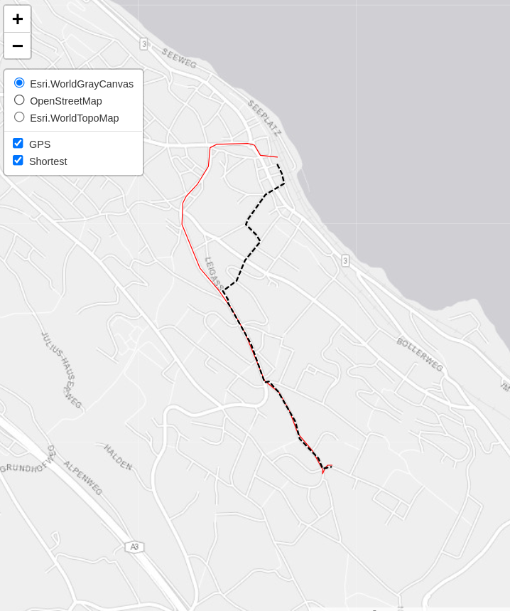
Thank you @munterfi1 for being {hereR} for us 🤪, it's a such a handy package! We're using it to determine road cycling preferences by comparing GPS tracks (red) with the shortest paths from {hereR} (black) #rstats, #gischat
🎉 Release day! 🎉 Shapely 2.0.0 has finally arrived!
Shapely 2.0 is a major release, featuring a large refactor and fast, vectorized (element-wise) array operations. Along with many other new features and improvements!
Full changelog: https://t.co/ap10FghlO2
#rstats admins (and users): If you ever thought
"Why does R package installation differ between macOS vs Linux" (i.e. R system lib vs. user lib)
then it might be a good time now to take part in this r-sig-mac mailing list discussion and share your opinion
👇️
New 📦 on #rstats CRAN by Etienne Grüebler: fca - Perform various floating catchment area (FCA) methods to calculate a spatial accessibility index (SPAI) for demand point data. #rspatial
https://t.co/Sx5FTf5Vc8
Wir suchen per sofort zur Unterstützung des Kantonalen Krisenstabs @Kanton_BL eine/n django Front-/Backend-Entwickler/in mit mehrjähriger Erfahrung in der Entwicklung von Webapplikationen und vertieften Kenntnissen in Javascript.
@djangoproject#covid#baselland#djangodeveloper
It is finally happening! 🙂 We started merging the PyGEOS package into Shapely. I am really excited about Shapely 2.0 that will be the result of this! #python#geospatial
https://t.co/XXfYdPjobz
Veloboom hält an: In der Velosaison 2021 hat die SBB 7% mehr Velotageskarten und 6% mehr Velopässe verkauft. Auf den wichtigsten Linien standen dreimal mehr Veloplätze zur Verfügung. In den kommenden Jahren werden über 400 zusätzliche Plätze geschaffen. https://t.co/ZKRAkAbk19
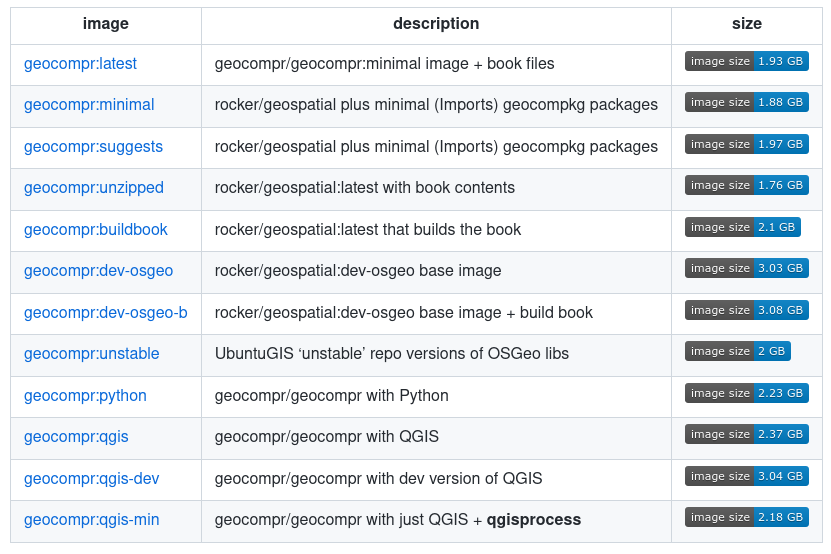
New fleet of Docker containers for reproducible data analysis with #RStats+ (with :python tag) #Python just published! Way faster builds of our #geocompr book in (now <10min on @github actions)🎉 Give them a spin here, feedback v. welcome 🙏 https://t.co/gk6IOsGGjg
@minigamedev@CedScherer Instead of storing package example data as .rda, a safer solution is including the data in the inst folder. Then read the data using the raster package on the current system via 'system.file("your-raster.tif", package = "your-package")'. Example: https://t.co/BcidLJbGZP
Finding POIs along a route - a blogpost describing a #rspatial use case, demonstrating:
- geocoding & routing using @here API 📦 {hereR}
- querying @openstreetmap data 📦 {osmdata}
- general spatial manipulation 📦 {sf}
https://t.co/Jtnuo76vXI