An Extreme Heat Warning is in effect through Friday evening. Afternoon heat indices peak from 105 - 110+ degrees over central Indiana with highs in the 90s. Limit outdoor activities, wear lightweight, loose fit clothing and drink plenty of fluids. #INwx#indy
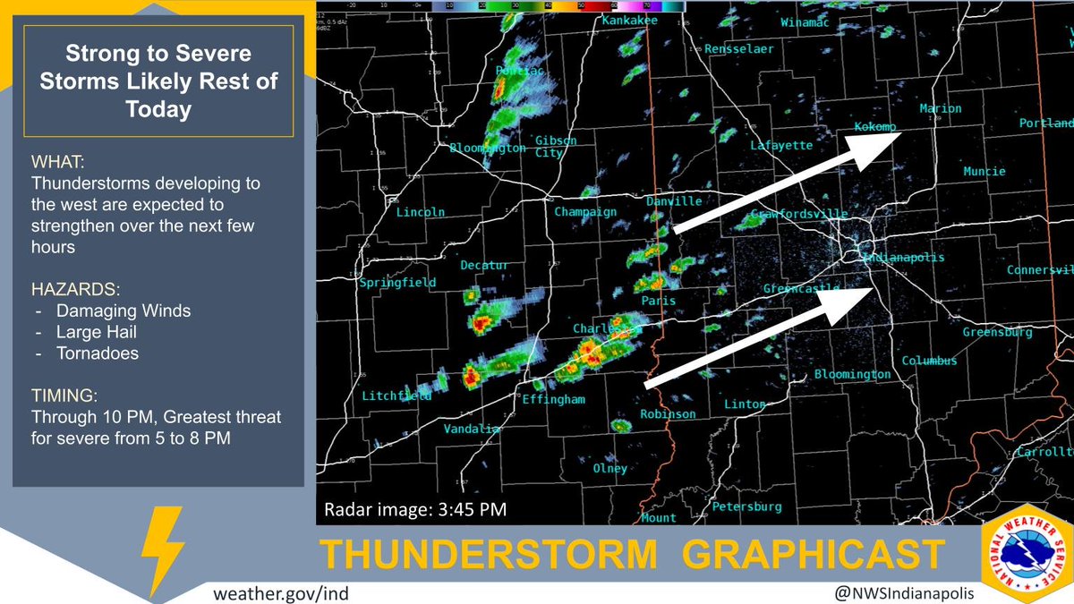
Storms are starting to develop to the west which are expected to strengthen over the next few hours. All hazards will be possible so plan where to take shelter if a warning is issued for your area. #INwx
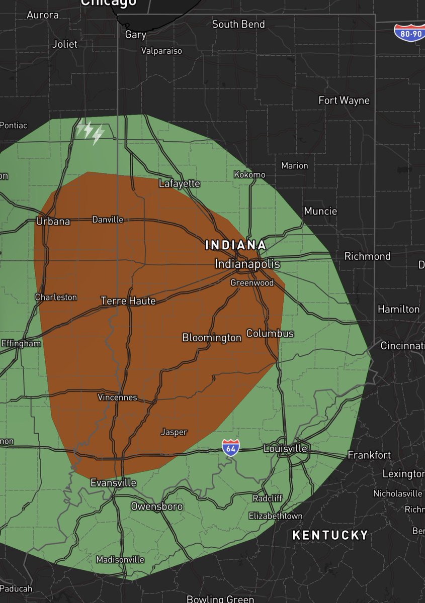
Storms are likely to develop between 3pm to 5pm and will increase in coverage but to only 40% of the area. While there may not be a large amount of thunderstorms roaming, the environment is favorable for some of the early storms to produce tornadoes #INwx
Time to start watching your favorite weather resources for the rest of the afternoon or evening. #Indy under #TornadoWatch until 9pm tonight. Be Weather Aware! #INWX
Need to watch these cells closely.
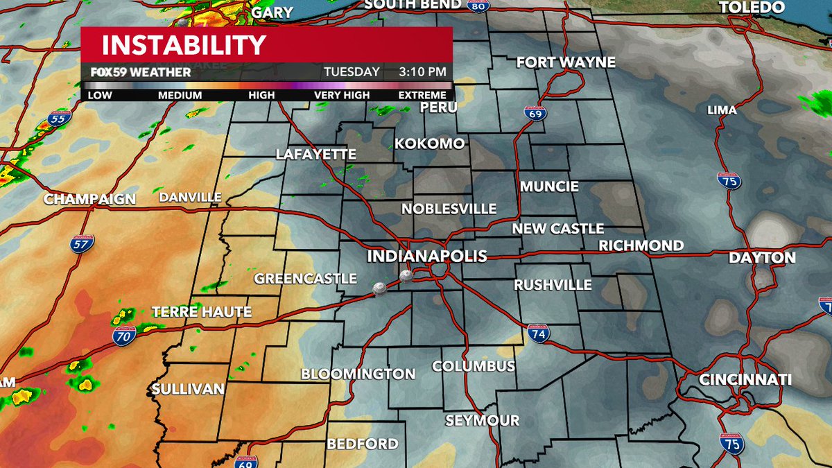
Should intensify in the destabilized warm sector and environment conducive to rotation.
We'll be on @WTHRcom starting at 4 p.m. and follow these storms all evening.
Strong to severe t-storms possible today with a flooding threat. We are closely monitoring for storm initiation in the warm sector over central IL. Should that occur, the best chances for stronger storms in central IN will start around 4 pm and last through the evening. #INwx
Widespread showers and storms are expected later today into this evening. Isolated severe storms will be possible, with localized damaging winds the primary threat, but all hazards possible. Localized flash flooding will be possible as well after recent rains. #INwx
May still have pockets of 55+ mph gusts, but this complex transitioning to more of flood threat now with frequent lightning on front side. Stay Weather Aware