Exciting Hockey news from @tourismpei & the @NHL today! We can’t wait to see the opportunities this partnership will bring to our Island. 🏝️🏒
#PEIProud
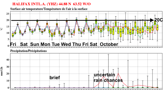
50 model outlook into October: predictions are once again trending toward a mostly fine stretch of autumn weather. The tropical moisture early next week may just clip SW areas briefly.
Crossing my fingers this will work out... we deserve a break!
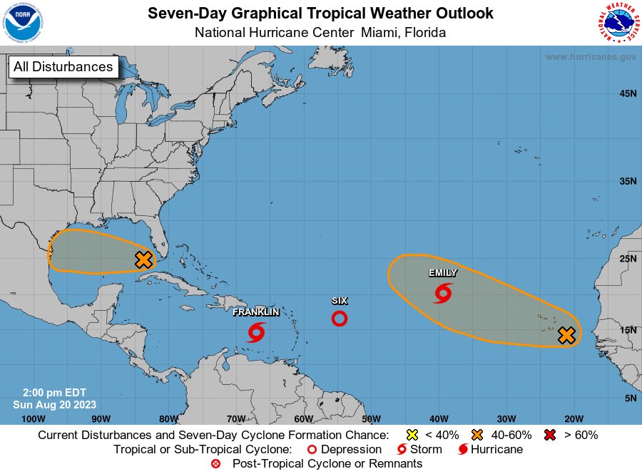
Well there you have it. All of a sudden the Atlantic Basin is very active.
This was well forecast by most guidance as far back as April and here we are.
It’s August 20 - the real hurricane season is here.
North Carolina State University, Jean Ristaino's Lab, identified US 23 late blight strain infecting potato plants in the Alliston area, Ontario.
Spore traps failed to catch spores of P. infestans before the disease developed in fields with Spornados installed nearby.
Give our arena a chance to win $250k and host an NHL® Pre-Season game! Submit your nominations, photos, videos, and more before FEB 19 #KraftHockeyville#NHL#Contest https://t.co/9EzkcYcp03
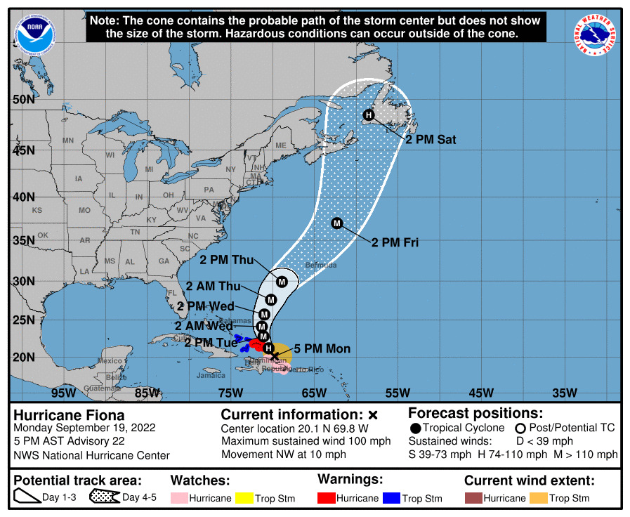
Pretty remarkable to see the filled-in forecast circle representing a fully tropical hurricane all the way up in western Newfoundland.
#Fiona will be undergoing extratropical transition as it impacts Atlantic Canada, but may retain its warm core all the way to #NLwx!
If you live in Atlantic Canada, the trend regarding #FIONA is not your friend.
Here are the GFS ensemble runs from 18Z Sept 15 to 12Z Sept 16.
The ensemble mean (black line) is edging ever closer to Newfoundland.
#NSwx#NLwx#NBwx#PEwx (1/2)
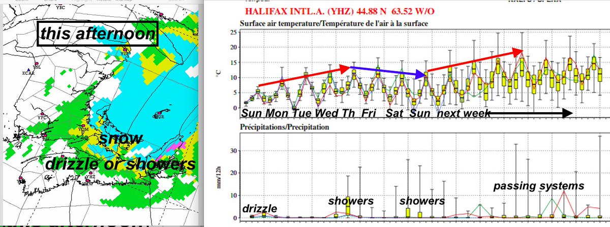
Well, let's put April behind us, eh? Still a cool north flow today with mixed precip developing off Gulf (see pic).
50 model outlook: much warmer this week; showery on Thursday. Even warmer week after!
May's forecast is looking pretty good....