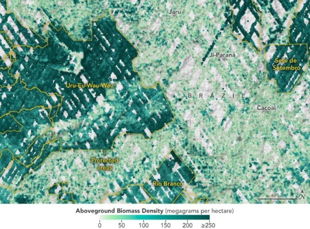
This map shows GEDI biomass density data in Rondônia in western Brazil overlaid with the boundaries (in yellow) of protected areas like the Uru-Eu-Wau-Wau indigenous territory.
Biomass is much denser (dark green) within the protected area. More: https://t.co/cPSoazsl8P
This map shows biomass density This map shows biomass density across GEDI’s observation area.
More dense areas are shown in darker shades of green. GEDI doesn’t collect data north of about 52 degrees latitude.
Sea level rise is a direct consequence of climate change. Currently, sea levels rise more than 0.15 inches (4 mm) per year.
But sea level doesn't rise at the same rate everywhere across the globe, and can be exacerbated by natural ocean fluctuations. https://t.co/pc37LpDuq6
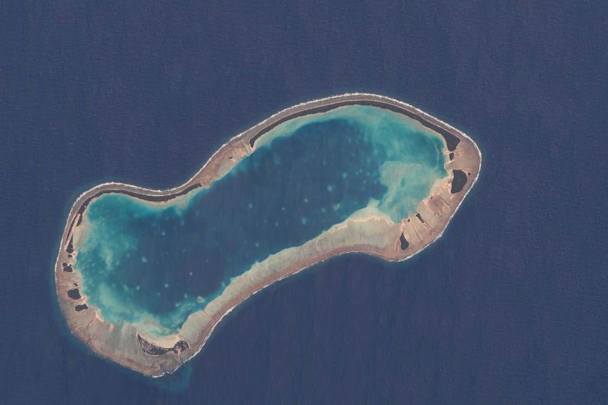
The island nation of Tuvalu, located in the South Pacific Ocean, is threatened with sea level rise.
This graphic shows higher than normal sea level (in red) around two of Tuvalu’s islands from the SWOT satellite on March 21, 2023. 🌊 https://t.co/dgOxXGzsM0
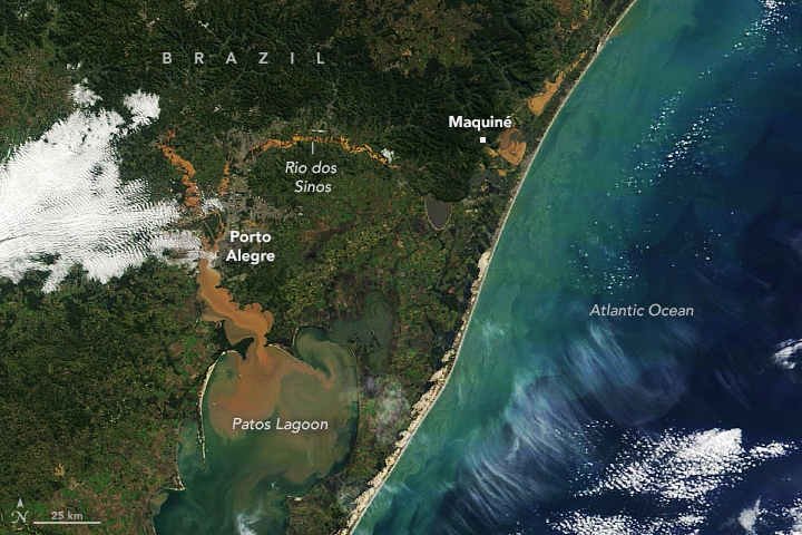
An extratropical cyclone in June 2023 brought torrential rain to southern Brazil, causing deadly flooding.
These @nasa satellite images show the area near the state’s capital, Porto Alegre, before (left) and after (right). https://t.co/emnG0Ebza2
As reported by @CA_DWR, Lake Oroville in California has reached full capacity, thanks to winter storms and snowmelt.
This animation was made with @CopernicusEU#Sentinel2 images and compares the lake's water levels in September 2021 vs June 2023.
📸 https://t.co/Ev4VWZspMd
Wetlands in Spain’s Doñana National Park are drying up due to groundwater demands from agriculture, tourism and drought.
Scientists report that 83% of the wetland’s ponds are flooding less extensively and for less time than would be explained by climate. https://t.co/kzIiuRX5Fs
Home sweet home 🌎 😍
Earth inspires us from every angle. NASA’s missions from ground to space help us discover more about our home planet, how it’s changing, and how we can prepare for the future. https://t.co/GkK7uBEH60
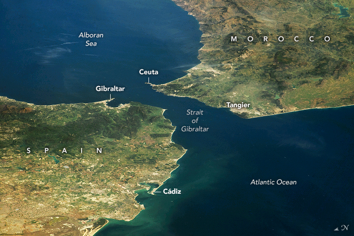
A @Space_Station astronaut took this photo of the Strait of Gibraltar between Spain and Morocco in April 2023. https://t.co/oe2HGBGGoh
The channel connects the Atlantic Ocean and Mediterranean Sea and spans only 13 kilometers (8 miles) at its narrowest point.
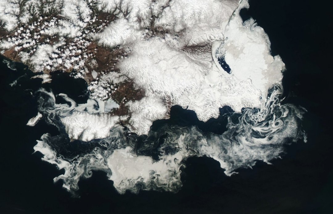
Annual thinning and breaking up of sea ice in the sea of Okhotsk near Russia created beautiful swirls as the ice drifted with the ocean currents and wind.
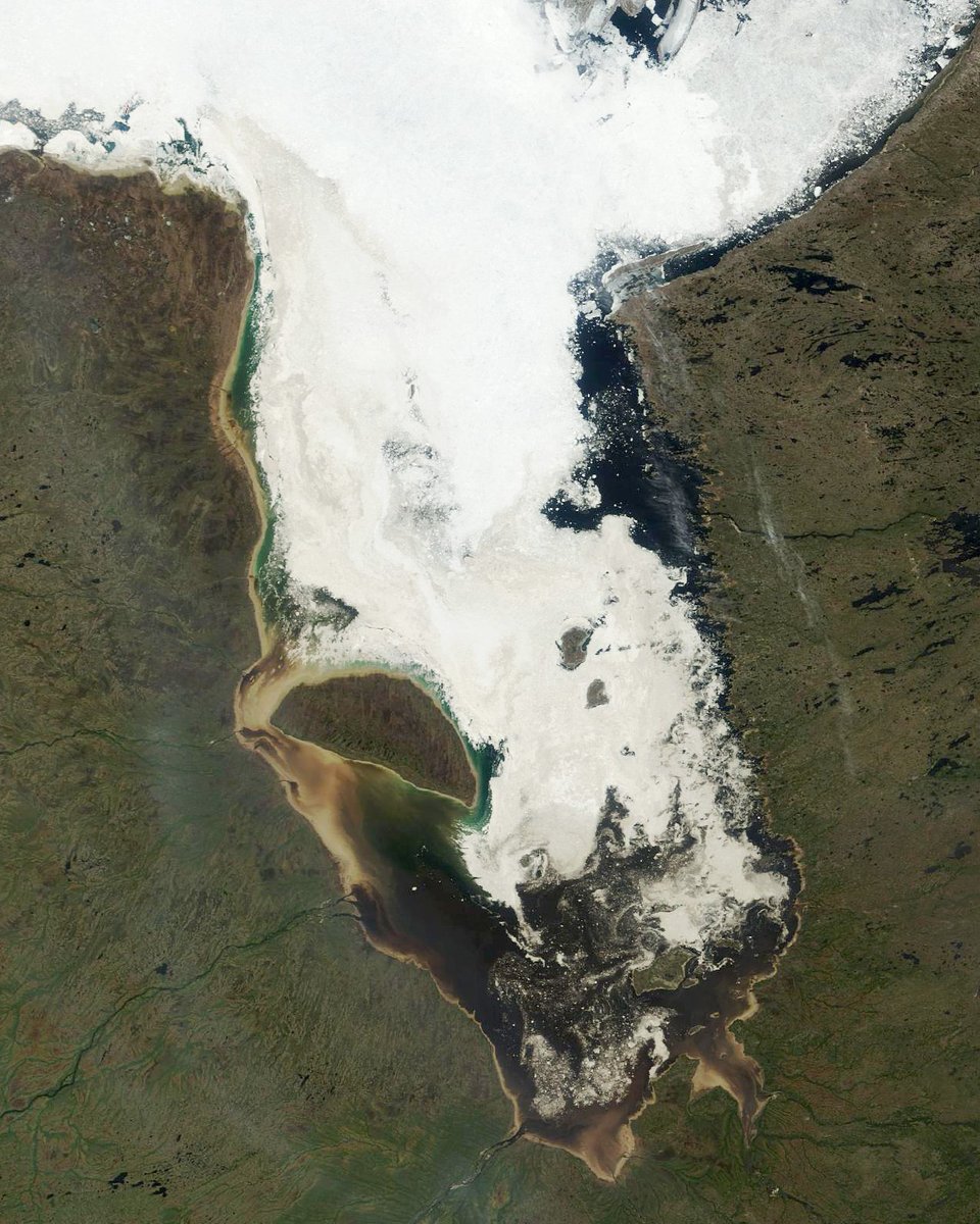
Seasonal sea ice is breaking up in Canada’s James Bay. 🧊
@NASA’s Terra satellite captured this image on June 2, 2023, when little fast ice (ice fastened to the surrounding coastlines) remained. Typically, fast ice grows in December and breaks up in May. https://t.co/OF8GOOWltL
Scanorama is a series of books for kids using movable sliders to transform illustrated creatures into virtual X-ray scans
[read more: https://t.co/9zzD63tu80]