Our X Space is now LIVE! Join us to hear stories from amazing artists behind the artworks at the #CreatingConnections Auction 🚀
https://t.co/FKLX2BMcaX
Urgent Call for Mappers and Validators!
In the aftermath of the earthquake in Morocco’s High Atlas mountains, we need your support to help map the affected area.
You can be a part of this critical mission by joining the project in HOT's Tasking Manager: https://t.co/cfg7yadoVT
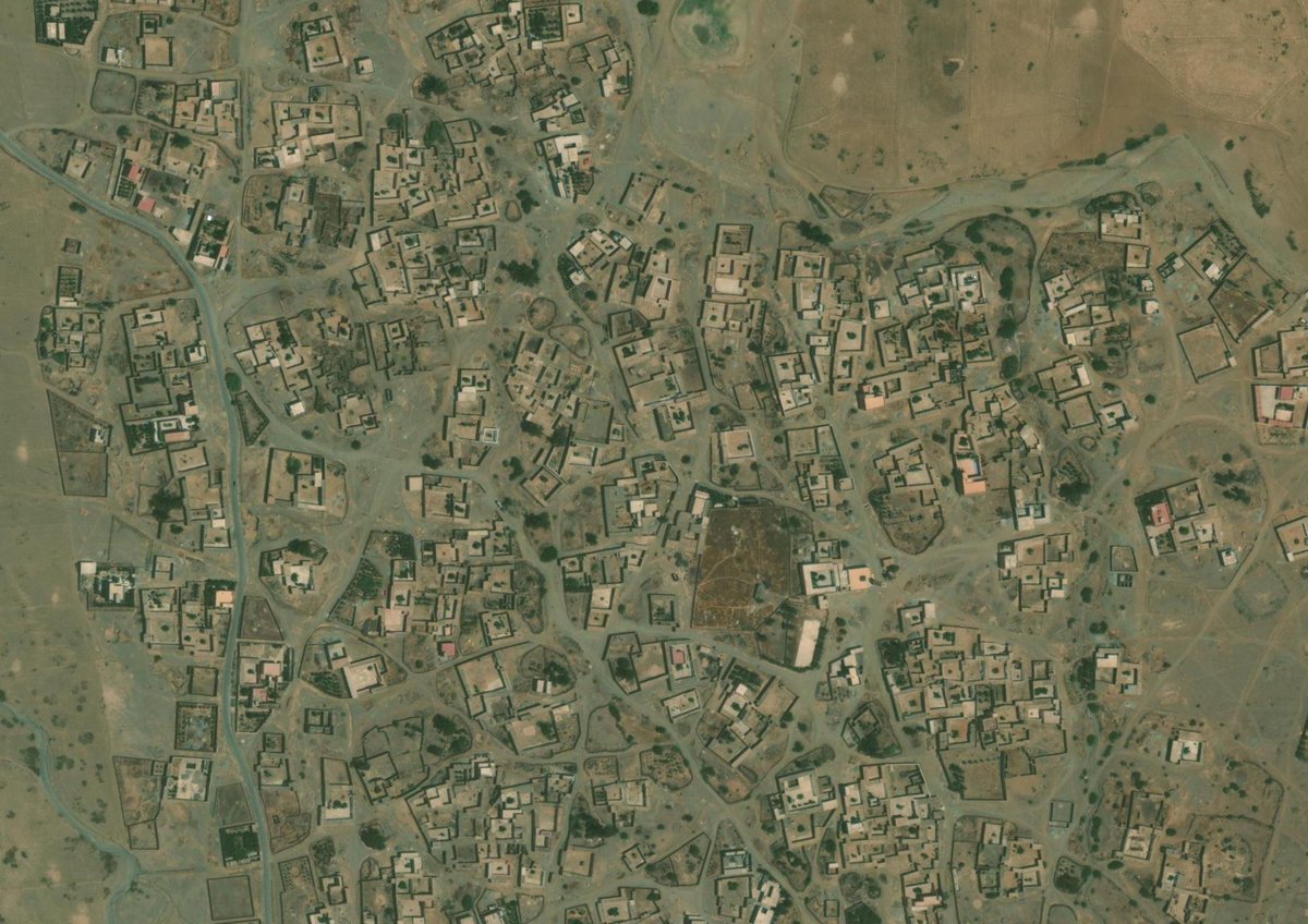
People affected by the Morocco #earthquake are not on the map. See satellite image of epicentre of earthquake, showing homes. The map is blank. Map here: https://t.co/DuDTkKm3PY @hotosm@TheMissingMaps
Hi @mouthofmorrison, we (@hotosm and friends) are trying to update the OpenStreetMap data around Marrakech since the earthquake. Not great access to high-resolution imagery. Not only post-quake; pre-quake is useful to establish baseline for damage assessment. Can you help?
🚀Launching the 5th Cohort of our Mentorship Programme!
Join us as we continue to foster talent and build meaningful relationships across the geospatial sector.
Ready to take your career to new heights? Don't miss out – apply by 8th September at https://t.co/6VJDHMWPDj
The @ITUDevelopment maps offer a key tool for countries to identify #connectivity gaps & explore potential solutions.
From #broadband and infrastructure maps to ICT geospatial catalogue & interactive transmission maps - Discover the ITU-D maps here:
https://t.co/pkFs6Ypc83
Starting on May 14, #Turkey runs a two-round election system amid fears of an internet shutdown in that period.
How likely is an information blackout during Turkey's upcoming elections?
🖊️ @ChiaraCCastro writes for @techradar
https://t.co/aOoGFE0wsI
Take a look at the article about how a local NGO (@YerCizenler) can activate the support of 9000 volunteers for humanitarian response with open geo-data in the Turkey and Syria earthquakes case https://t.co/fcM0vnpv4a @heatherleson@canunen@asturksever
Kahramanmaraş’ın en büyük çadır kenti Kafum’un sorumlu hekimi Dr. Mehmet Faruk Uçum, OpenStreetMap’i sağlık hizmetleri, lojistik, asayiş ve bir çok alanda nasıl kullandıklarını anlatıyor.
Katkıda bulunanlara tekrar teşekkür ederiz. 🙏🏻
@hotosm@TheMissingMaps@openmapping_ap
The World Bank report estimates that 1.25 million people have been left temporarily homeless after Turkey earthquakes. Direct infrastructure damages were estimated to be $34.2 billion.
https://t.co/PlwY5WMeyK
Our mapathon to support the #TurkeySyriaEarthquake is happening now, we are contributing to these two projects #14262 and #14230, join us via the tasking manager https://t.co/D7jSYimPAl
‼🌊TSUNAMI ALERT
Following the #earthquake (#deprem) M6.4 occurred 14 km SW of #Antioch (#Turkey) 20 min ago (local time 20:04:29). Move away from the coast and reach a higher place. Follow national authorities' directives. Updates at the links provided below👇
#EMSR648
We have just published a 🆕 Information Bulletin!
It details #CEMS activities related to the damage assessments performed in the aftermath of the disastrous #earthquake that struck #Türkiye 🇹🇷 on 6 February
5⃣3⃣ maps delivered in ~100h
More👉 https://t.co/hAVwDgCV2G
Mapping Damaged Buildings on OpenStreetMap
Now, we created new MapRoulette tasks to map damaged buildings on @OpenStreetMap. Damaged building data source came from different resources including @CopernicusEMS, manual digitisation by volunteers and field data. #TurkeyEarthquake
Maxar's post-event coverage vs social media reported collapsed building data
- We need further imagery in Hatay, Kahramanmaras, Adiyaman, Malatya, Iskenderun, Elbistan @Maxar
6 Şubat 2023'te gerçekleşen depremler ülkemizde geniş bir bölgeyi etkiledi. Yardım ve müdahale çalışmaları gerçekleştiren kişi ve kurumlara uzaktan destek olmak için eksik harita verilerini tamamlamaya devam ediyoruz.