@jjiglesias@openstreetmap@hotosm Hi Juan. To be honest, I'm not entirely sure what you mean. Do you mean a webpage where you can find any OSM element that has a fixme tag, any OSM node or changeset whose content contains fixme, or something else? You could also open a thread in the OSM community forum ...
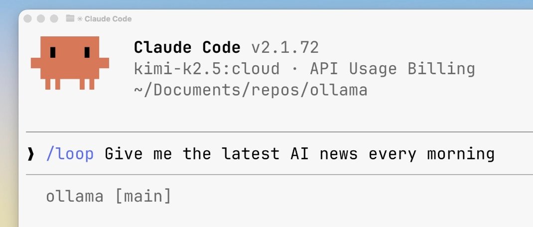
Ollama can now run prompts on a schedule in Claude Code. Stay on top of work by setting automated tasks or reminders.
ollama launch claude
/loop Give me the latest AI news every morning
Examples in thread
Professors are sounding the alarm as students increasingly offload complex cognitive processing to language models.
The Guardian published a piece.
Literature professors are now hiding invisible trap words inside digital assignments just to catch students who blindly feed prompts into.
While science departments welcome these tools, literature teachers realize students are bypassing independent thought entirely.
The widespread adoption of prompt-based text generation in universities is causing a measurable collapse in students' ability to synthesize raw information.
Surveys show 92% of students use generative software for assignments.
---
theguardian .com/technology/ng-interactive/2026/mar/10/ai-impact-professors-students-learning
Ollama can now run subagents in OpenCode
Parallelize tasks which require longer context windows like research, refactoring, and code reviews
ollama launch opencode
Have you been to one of the @PLATIAL_X symposiums and loved it? Do you work with place or platial information and want to connect with a community? Come to the 5th edition of the symposium!
16–18 September, Salzburg, submission of short papers and workshop proposals are welcome
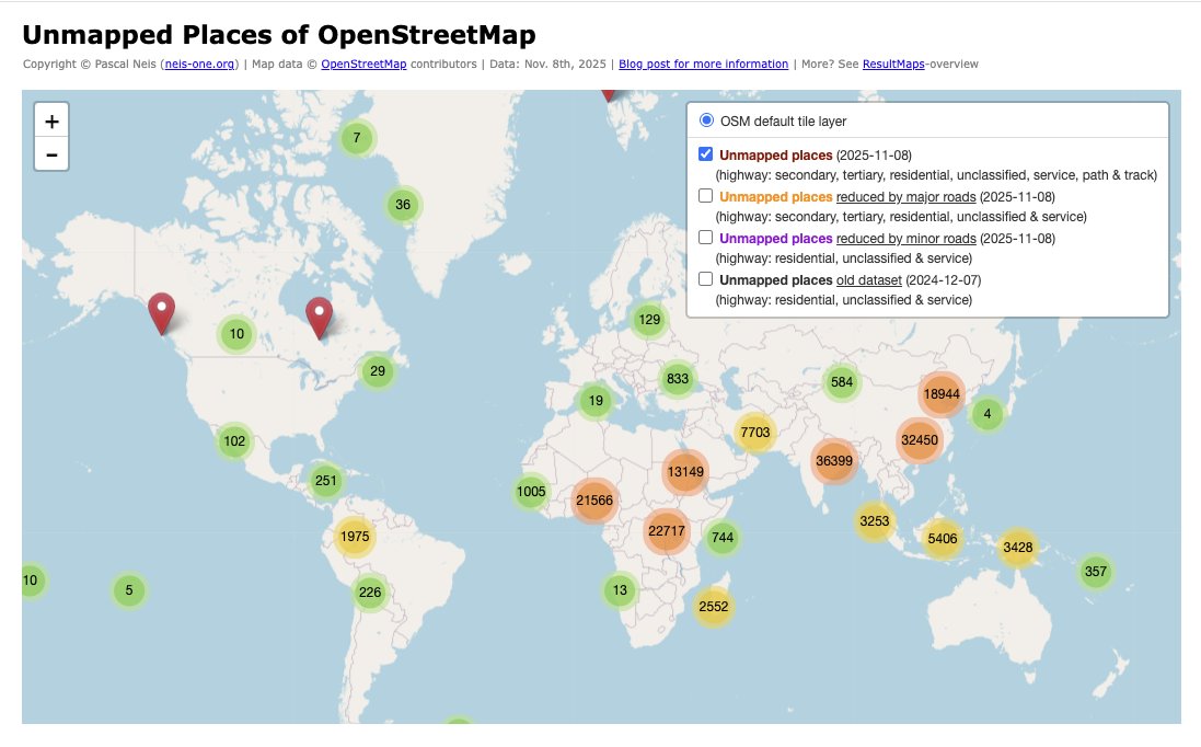
@voyager192866 Yes, I recently switched the list from daily to weekly updates (Saturdays). Had a few issues with the OSMI instance and wanted to keep the load lighter on the free service. Hope that works for you.
🧭 Google is rolling out a new feature for developers using its Gemini AI models—grounding with Google Maps, so apps answer location questions using live Maps data.
Competing platforms like ChatGPT, Claude, or various Chinese open source models probably won’t have this anytime soon.
This update lets developers link Gemini’s reasoning skills with real-time Google Maps data, so apps can respond with accurate, location-based info like business hours, reviews, or what a place feels like.
This ties Gemini’s reasoning to 250M places, routes, hours, ratings, photos, and reviews for location aware responses.
Grounding means the model calls a trusted tool, pulls factual records, and uses those facts while generating the answer.
Developers enable the Google Maps tool in a request and can pass lat_lng to anchor results to a specific spot.
The response can include grounding metadata plus a context token that lets the app render an interactive Maps widget in the app interface.
The widget shows place details like photos, open hours, ratings, and directions so users can quickly verify and act.
Typical asks include full day itineraries with distance and travel time, hyper local picks for housing or retail, and precise place answers.
Combining Maps + Search grounding lets the model use Maps for structured facts and Search for timely schedules or event info, which boosts quality.
The feature is generally available on the latest Gemini models with tool pricing and can be mixed with other tools as needed.
This closes a common gap where language models guessed local facts and now they can base replies on a maintained location database.
@jjiglesias Hola Juan José,
do you know this page?
👉 https://t.co/1xutkYhWrX
It already includes country and other filter functions. For example, here’s the view for Bolivia:
👉 https://t.co/tmV5XMDi4e
#OpenstreetMap#Notes
Github: "AI-Researcher: Autonomous Scientific Innovation"
Helps you propose research ideas and autonomously handles literature review, ideation, algorithm implementation, experimentation and manuscript drafting via containerized multi-agent LLM pipelines.
Benchmarked on 4 domains across 2 task levels: reaches 81 % novelty and 0.92 F1 versus human papers while emitting codebases, GUI and Docker stacks in <3 h per project.
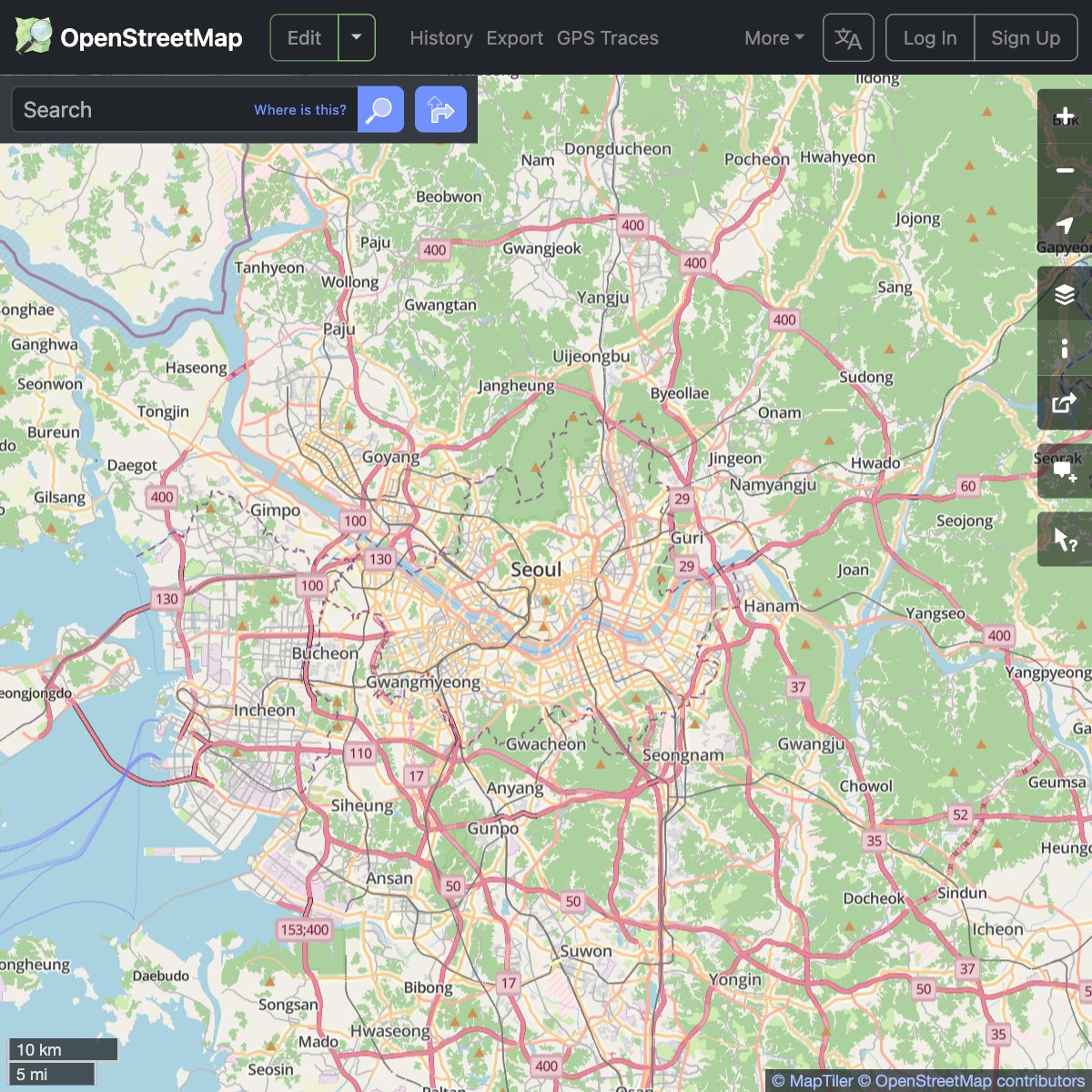
We are happy to announce the deployment of #VectorTiles on OSM Foundation servers & the publication of the layer on the OSM website. We have been working hard to bring you a fresh look to OSM data, paired with exciting technological upgrades.
For details: https://t.co/AFivgqnJTv
We're supporting the @openstreetmap community by providing a new map layer for their website.
Thanks to #VectorTiles technology, you can now read map labels in your own language, no matter what part of the world you are looking at! https://t.co/0d38oKC3Ip
#WebMaps#OpenStreetMap