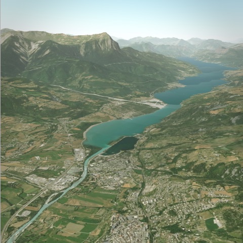
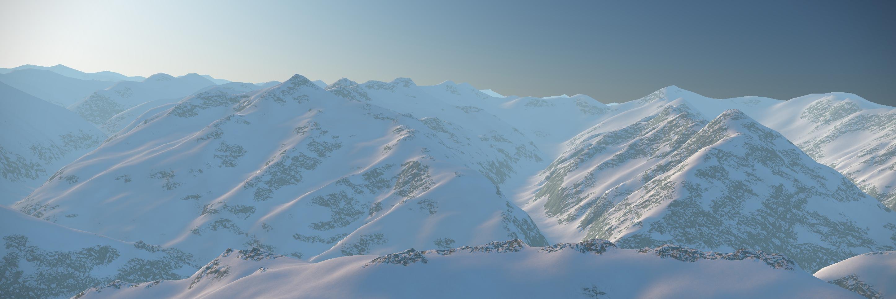
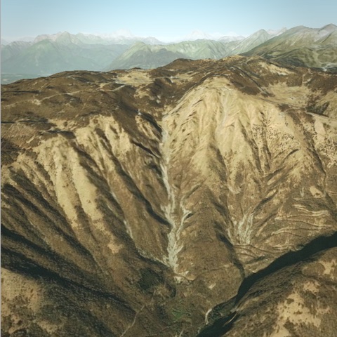
After 7 years of closed-source, I've changed direction and just launched: Procedural GL JS https://t.co/EQcaJ6dMAI, an #opensource#webgl#javascript#threejs#dataviz library, for rendering 3D terrains.
Excited to launch a project we've been working on at @CartoDB for the last few weeks. @GMapsPlatform just announced worldwide 3D tile data and we used it to build an interactive story map using #deckgl#webgl#javascript https://t.co/iTL8X5xbaw
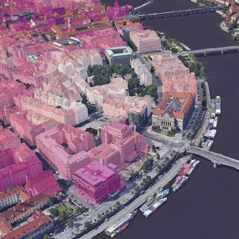
Google Maps has released Photorealistic 3D Tiles. The team of #deckgl, @CARTO, and @GMapsPlatform has worked together to bring compatibility to https://t.co/ANHdmZNrCK
It's possible now to visualize your 2D data on top of the Photorealistic 3D Tiles Geometry.
@RealIvanSanchez@zakjan@bdon @TimSalabim3 @maplibre I do have a depth buffer and support object priority via an accessor: https://t.co/totWmXGA9W
Completely agree it isn't without issues, but that is often the way with realtime solutions :)
@RealIvanSanchez@zakjan@bdon @TimSalabim3 @maplibre At the moment it is in the fragment shader, but coherent lookup across the whole object, so could move to the vertex shader. I have considered an intermediate framebuffer to better support fading. Also, I'm not aiming to implement a full labeling solution.
@RealIvanSanchez@zakjan@bdon @TimSalabim3 @maplibre My approach is indeed doing a point-in-polygon test, which can be used to get good results for regular shapes, but not for arbitrary shapes when pixel-perfect collisions are needed. A curved label can however be approximated by circles: https://t.co/S70Vre6fda
At @CARTO we’re looking for a senior @reactjs dev. I’ve been working here for a little over a year - and I’d like to share a bit on how it’s been. RT appreciated 😊 https://t.co/mbykoAKbBD
This is great time to join us. The product is stable and loved by our customers, but we still have lots of plans for the future and there are many opportunities waiting for you to make your mark.
@tmcw@placemarkio Great news. Get in touch if you want to discuss - I'm also looking at adding labeling now. GeoJsonLayer supports a mode which is zero-copy via a binary format (https://t.co/vQZijkpQPp).
After 16 months of work I'm ready to share https://t.co/8FtBldzYAe, my project to procedurally generate scenic landscapes, packaged as a chill driving game. Built with @threejs to run in your browser - no logins, no installs, just roads...
#threejs#procedural#webgl
After 7 years of closed-source, I've changed direction and just launched: Procedural GL JS https://t.co/EQcaJ6dMAI, an #opensource#webgl#javascript#threejs#dataviz library, for rendering 3D terrains.
Shout out to all #webgl and #javascript#dataviz developers: We are hosting the OpenVisualization Collaborator Summit in Madrid https://t.co/GPsqQEBDFM with the main contributors to the https://t.co/XaMTcZWdg8 library next week.
We are excited to announce that Procedural, the company behind the popular #opensource 3D mapping library, is joining CARTO! Together, we believe we can take the #visualization capabilities of the CARTO platform to the next level. 🚀
https://t.co/AAaoNxJ7HB
The new version of @Mapbox GL JS introduces non-Mercator map projections, reimagined for the interactive maps era in a way you've never seen before. This is a big deal. Thread: