3D observations of the Earth from spaaaaaace? Meet GEDI, a full-waveform Lidar instrument aboard the ISS providing us with 3D observations and precise measurements of forest canopies and surface elevation. Visit NASA's #LPDAAC to learn more: https://t.co/O3WhGxvYJ3 @GEDI_Knights
A year of #GEDI L1-L2 Version 1 #lidar data—covering almost 4,700 orbits is available from NASA’s #LPDAAC! Watch while GEDI L2B elevation fills in over Mount Saint Helens as compared with NASADEM data. Be looking for Version 2 in 2021. https://t.co/o2GFV26FVN @gedi_knights
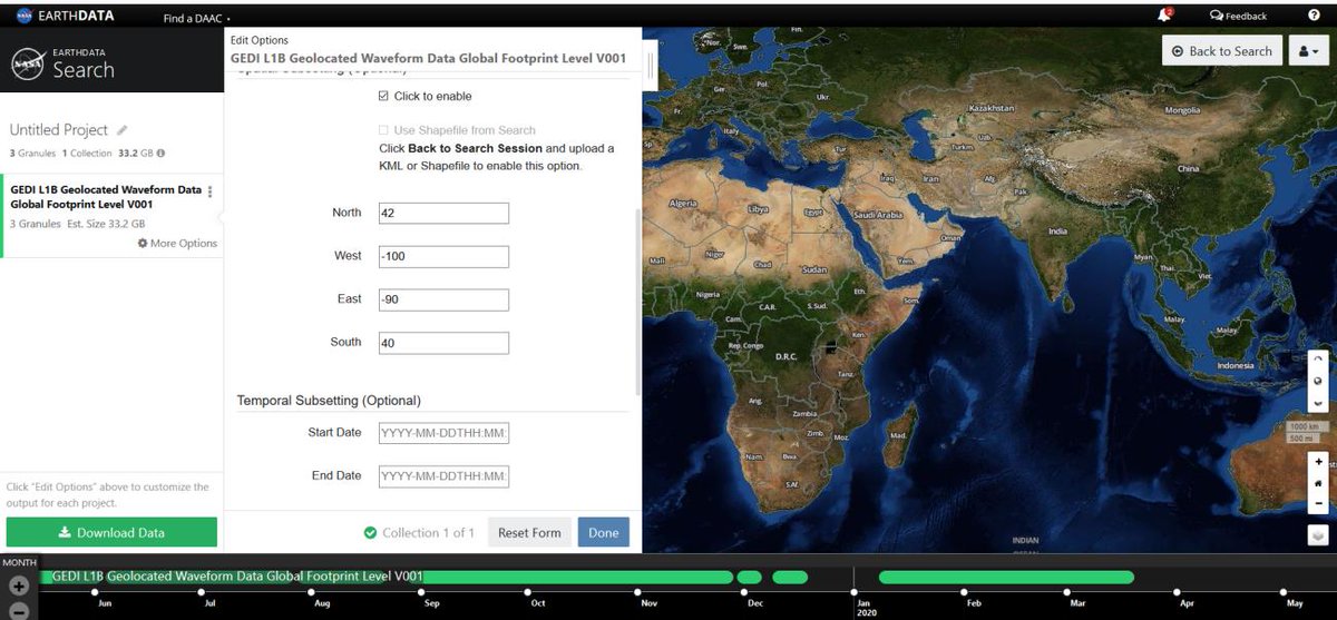
Are you interested in NASA Global Ecosystem Dynamics Investigation (#GEDI) #lidar data? Check out the GEDI Spatial Querying and Subsetting Quick Guide from NASA's Land Processes DAAC: https://t.co/QWH4G5DY1x #OpenScience, @GEDI_Knights
Doing cool research with #GEDI data? Consider sharing it with the community at this year’s @theAGU - online so more accessible than ever! Submit to our GEDI focused session: https://t.co/Bv4W6qVQSS
Why do #GEDI orbits look the way they do? Watch to find out! Learn more about GEDI and the ISS in this #LPDAAC video. Follow @GEDI_Knights for to see more #GEDIVis visualizations and information! https://t.co/gYEIY8B1eg
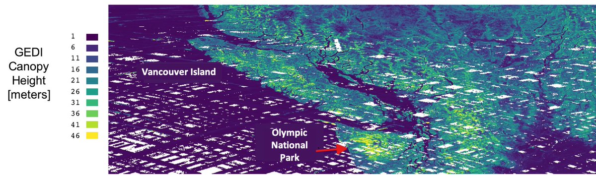
There are now 6 months of #GEDI mission data available from #LPDAAC - data density is highest (almost continuous!) approaching the edges of the ISS orbit ~51.6 degrees latitude, as seen mapping height for Vancouver Island. #OpenData@NASAEarth@NASAGoddard@umdgeography
#EONews Check out @pyGEDI - the newly released python library specifically developed for @GEDI_Knights mission data. This all-in-one library includes functions for extracting, analyzing, processing & visualizing GEDI data. Read more here: https://t.co/PQ8Ue9omQM
@GEDI_Knights@EQMarques But if you follow the link
https://t.co/uyB5gi8EWg
According to "Procedures: Getting Started:" you are actually downloading all of the orbits that pass in your area of interest, isn't it ?
Now we are up to 121 #EarthObservation coding based links, including alot of #Python, videos, code snippets, plenty of projects and some cracking data science links. Check it out and contribute here https://t.co/YDtYmk4msr Awesome-EarthObservation-Code @eoscenefrom
@mosen_tn Currently we don't have tutorial videos, but we have GitHub and Colab notebooks with examples of use of #pyGEDI, you can find them in https://t.co/6slyjdGsWl
#pyGEDI has several functions and is a continuously improved package. If it does not exist in pyGEDI please ask us for a new feature, and depending on the feasibility we will be glad to implement your requested feature.
#GEDI#Python#LiDAR#NASA@GEDI_Knights
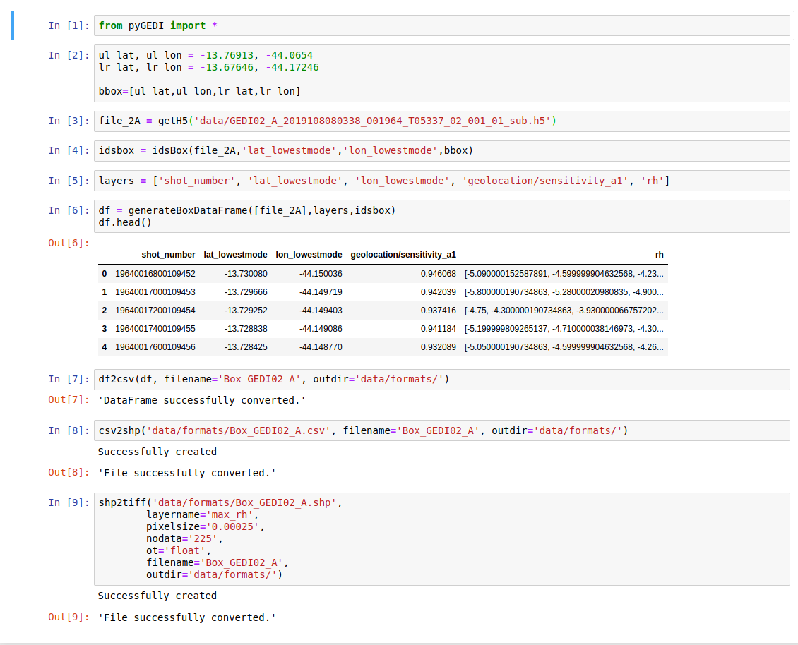
Did you know that with #pyGEDI you can generate .csv .shp .tiff files from your #GEDI@GEDI_Knights@NASAEarthData region of interest:
1. you define your bbox
2. path of the file or files
3. Layers of interest
4. generate DataFrame
5. convert .csv .shp .tiff
6. 😉
Take a look: