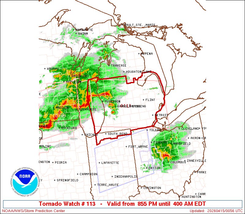
The Union City, MI preliminary EF-3 tornado that occurred on March 6, 2026 is the earliest EF-3+ tornado in the calendar year for Michigan. The previous earliest was an EF-3 that struck north of Ann Arbor, MI on March 15, 2012.
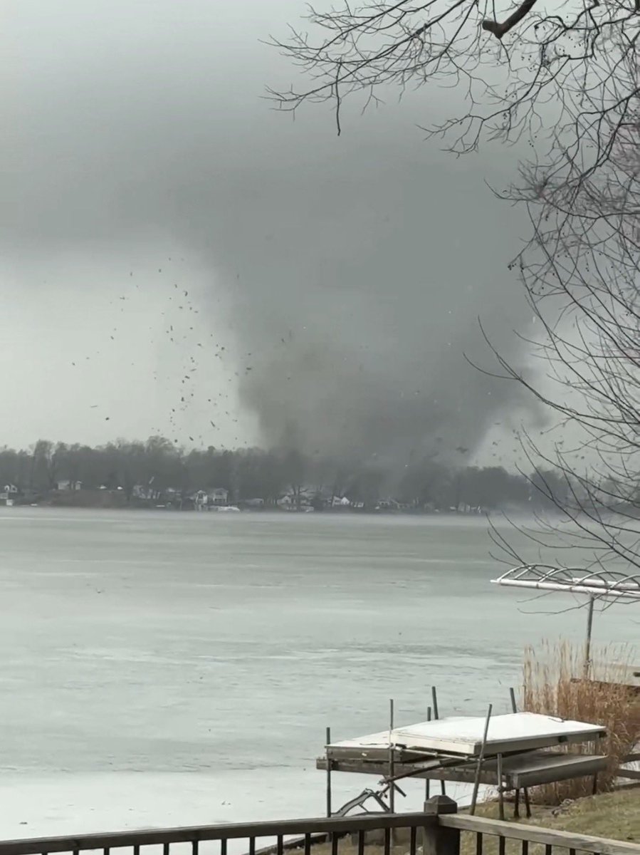
Breaking news: The NWS says their initial findings from tornado damage near Union Lake suggest EF-3 strength with winds of at least 150 mph.
Surveys are ongoing and data is subject to change.
📸 TJ Secord
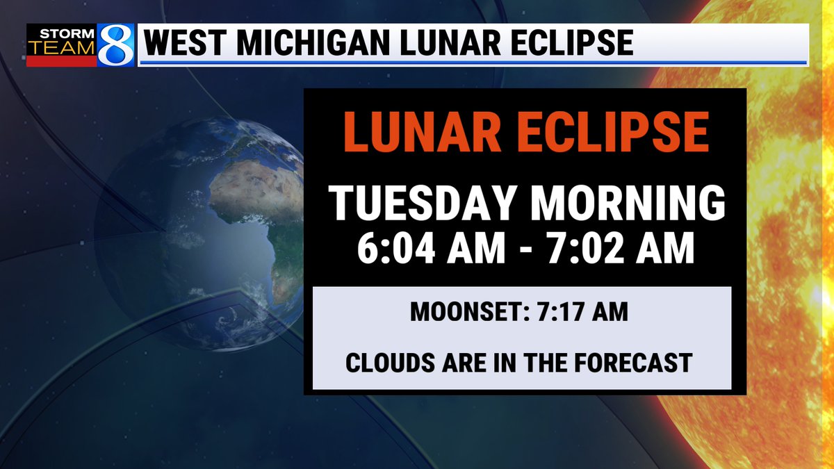
This will be the only full lunar eclipse visible in the MI until June 25-26, 2029. It appears Mother Nature won't be cooperating with abundant cloud cover in the forecast. Maybe we'll get a break in the clouds during that time🙏 #wmiwx#miwx
☀️46% ☀️
Grand Rapids, Michigan experienced their 14th sunniest February on record with 46% possible sunshine being recorded at the @MIKCRC near the @FlyGRFord airport.
We slowly gain another hour and one-half of possible sunshine in March!
#wmiwx#miwx
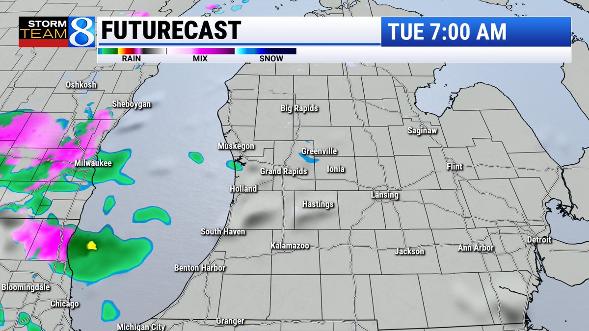
Accumulating snow returns tonight into Monday morning. Most will see an inch or two, but some areas near the lakeshore will see 4-7 inches with isolated higher totals possible. Plan for travel delays, slick roads, and rapidly changing road conditions/visibilities.
The award is given to farms that demonstrate excellence in management, innovation and leadership within Michigan’s dairy industry. https://t.co/Dl53K4IweG
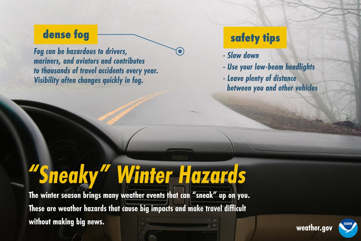
Dense fog is reducing visibilities to a quarter mile or less in areas along and north of M-57 and along and east of US-131. Fog could linger into Thursday morning before clearing. #miwx#wmiwx
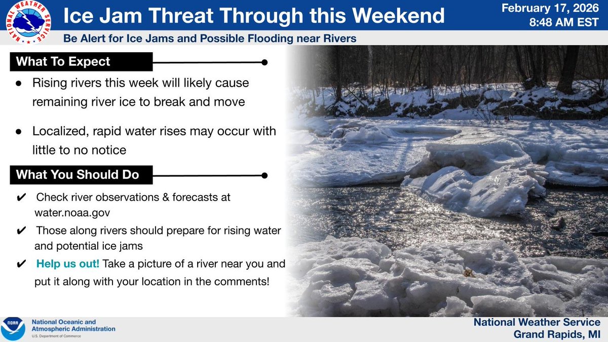
Rising rivers make it likely that remaining ice will break and move. This could cause localized rapid water rises with little to no notice through the weekend. Monitor observations and forecasts and take a photo of a river near you to help us see how much ice is on the rivers.
Mild and dry weather persists into the first part of the week, then unsettled weather arrives Wednesday. For now, snow is most likely in the UP, a mix is favored in central-northern Lower, and rain with some lightning and thunder is probable in southern Michigan.
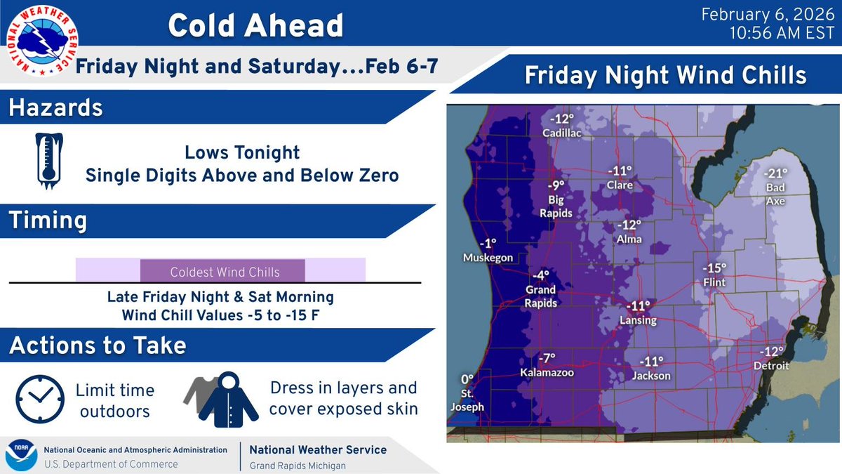
An Arctic cold front will surge through Southwest Lower Michigan this afternoon. Cold air will push south and temperatures will tumble. By midnight temperatures will have dropped into the single digits above zero in many areas. Overnight lows in spots near -10F. #wmiwx
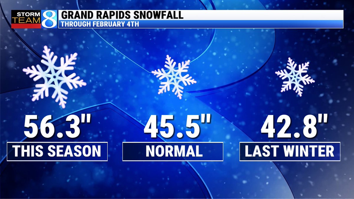
Accounting for snowfall since December 1st, this season is running nearly a foot above normal for Grand Rapids and also well ahead of the same timeframe in 2024-2025.
Our next chance of accumulating snow comes tomorrow & Friday.
https://t.co/R7pSJcyHay
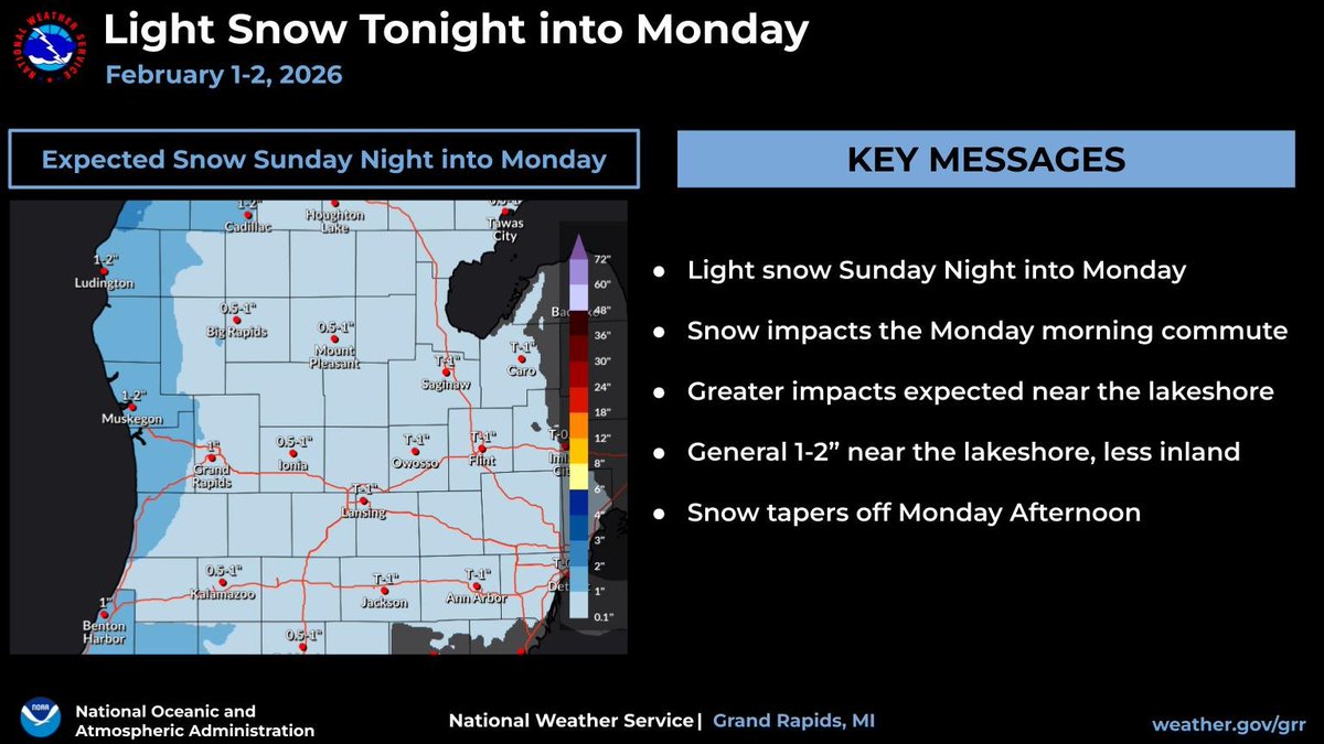
Light snow is expected late tonight into early Monday, impacting the Monday morning commute. An inch or two of snow accumulation is expected near the lakeshore, with an inch or less expected inland. Snow tapers off Monday.
The morning commute is significantly impacted by snow and blowing snow, especially for Kent, Allegan, and Barry counties. Make sure to give yourself extra time to drive to your destination if you have to drive. #wmiwx
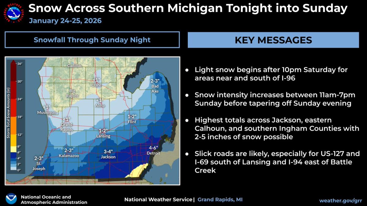
Snow begins late tonight and continues through Sunday evening. The heaviest totals will be across south-central Michigan where 2-5 inches of snow is likely. Prepare for slick roads, especially for US-127 and I-69 south of Lansing and I-94 east of Battle Creek.
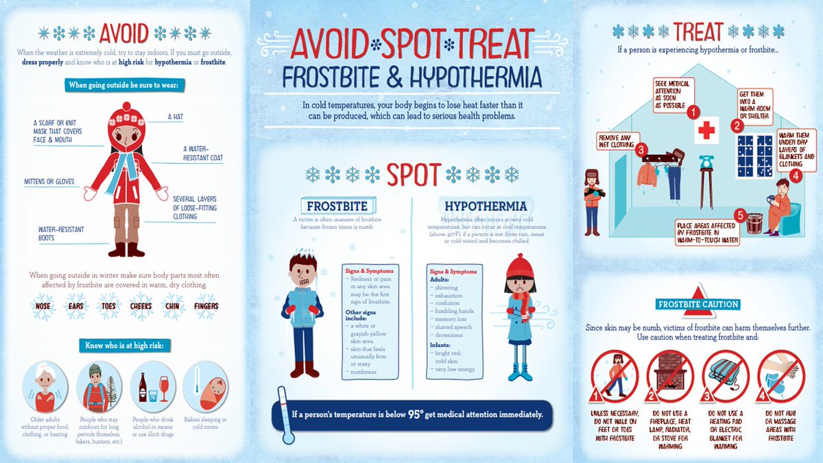
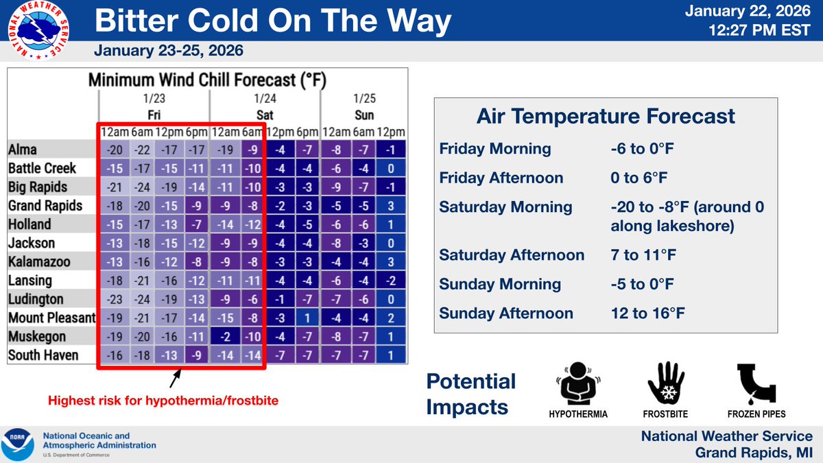
Temperatures fall below zero tonight with wind chills of -15 to -25 (coldest along and north of a Muskegon, to Grand Rapids, to Jackson line). Bitter cold continues through the weekend. Make sure to limit time outdoors and bundle up as hypothermia and frostbite will be possible.
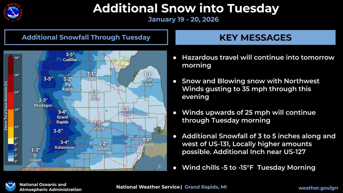
Hazardous travel will continue into Tuesday morning. Snow and Blowing snow with NW winds upwards of 35 mph will continue through this evening. Winds overnight will remain around 25 mph. Wind chills of -5 to -15 are likely Tuesday morning.