South Fork Fire Update - June 12, 2026
The fire has grown to 28,067 acres and is currently 7% contained. Approximately 245 personnel are on site.
Please review the latest closure update of White River Trail from Crawford City Park to Fort Robinson.
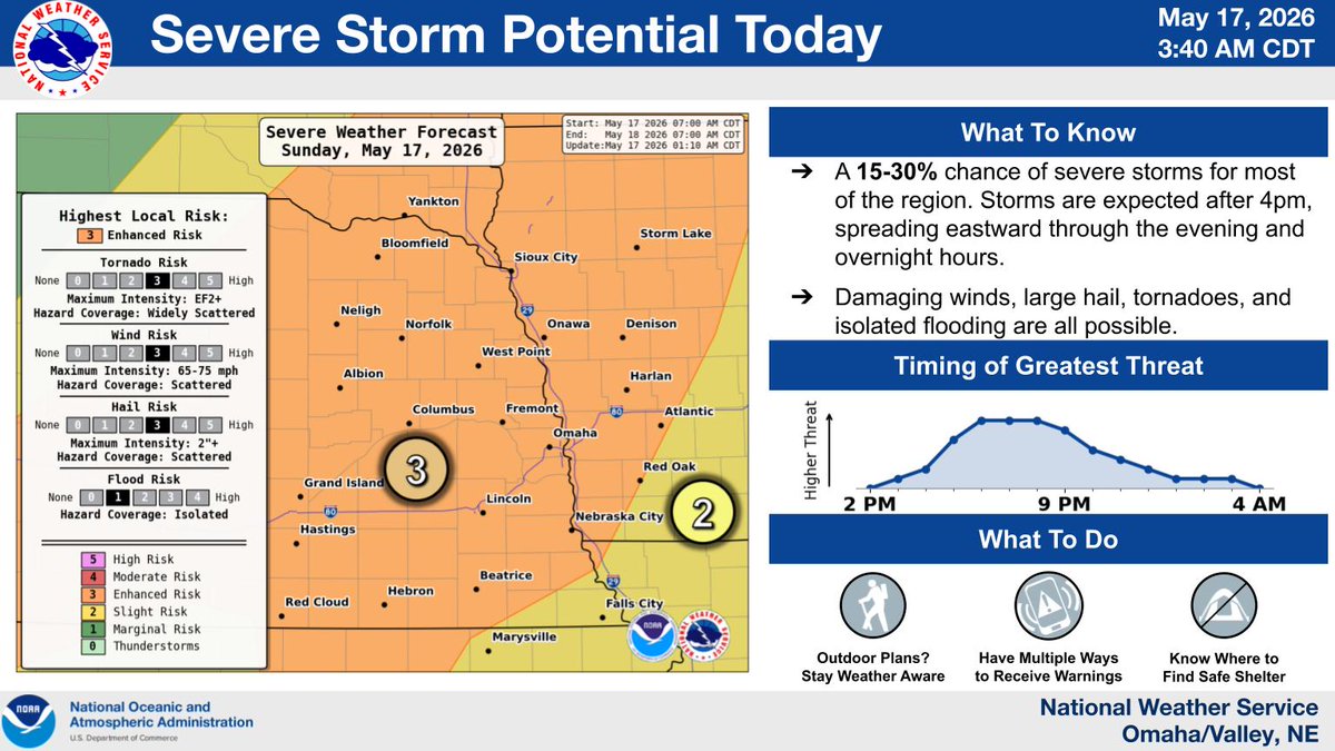
Strong to severe storms remain possible today, with a cluster of storms expected to move in from the west this evening. Damaging winds are the main hazard, including pockets of 75+ mph gusts. Isolated hail and a brief tornado are also possible. #newx#iawx
Strong to severe storms are possible again on Friday. A broken line of storms is likely to develop Friday evening, with the strongest storms capable of very large hail up to 2” or larger, damaging wind gusts, and a tornado or two. #newx#iawx
The entire area is under a TORNADO WATCH this evening. Be careful regardless of where you are. #NEwx#IAwx
The *greatest* threat between now and sunset will be areas northwest of the Omaha/Fremont areas.
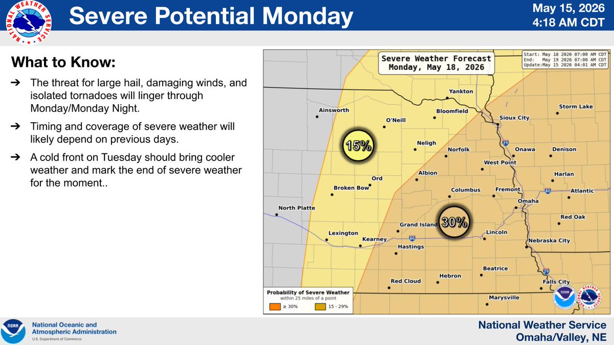
More widespread severe weather is set to develop late this afternoon into the evening hours, bringing an increased threat for hail (2+ inches) and tornadoes. Storms may be stronger Monday.
Have a plan. Check for forecast updates. Have multiple ways to receive warnings!
Significant tornadoes (EF-2+), significant damaging winds (75mph+) and significant hail (2.00"+) expected after 7pm tonight and lasting through the overnight hours and into early Sunday morning across most of eastern NE and western IA, including the Omaha, Council Bluffs and Lincoln metro areas. Please stay weather aware this evening and have multiple ways to receive weather warnings, especially if you are sleeping.
1st graphic: SPC Day 1 Tornado Outlook
2nd graphic: SPC Day 1 Wind Outlook
3rd graphic: SPC Day 1 Hail Outlook
4th graphic: 18z HRRR simulated reflectivity
#newx #iawx #wxtwitter #severe #weather
All modes of severe weather are possible today. See my previous video post for timing.
In SW Nebraska: Baseball size hail, 60-70+ wind gusts, and a couple of tornadoes (EF0-2) possible.
Eastern 11/2 of the state: 1-2" hail, 60+ wind gusts, and a quick spin up tornado possible
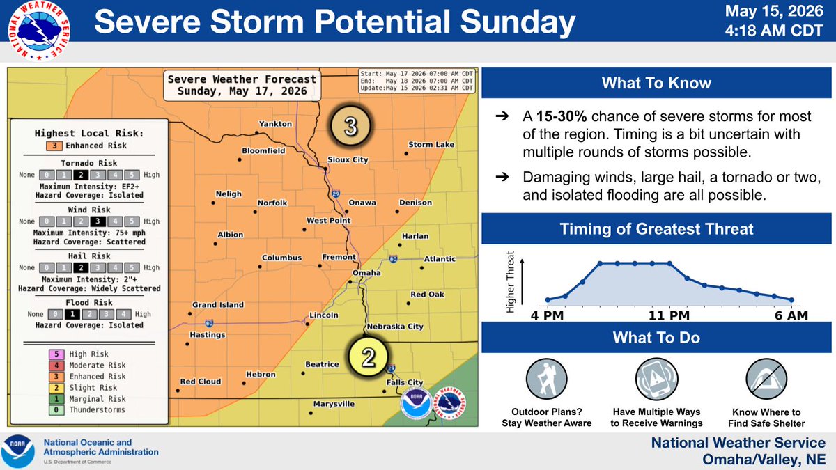
Whether you're celebrating a grad, the end of the school, or arrival of spring, this will be a weekend to pay attention to the forecast.
Multiple rounds of strong to severe storms are on track to affect the area, with each day having new wrinkles that could ruin outdoor plans.