எவன் தன் இறைவன் முன் நிற்பதை அஞ்சி மனதையும் இச்சைகளை விட்டு விலக்கிக் கொண்டானோ,
நிச்சயமாக அவனுக்குச் சுவர்க்கம்தான் தங்குமிடமாகும்.
(அல்குர்ஆன் - 79:40&41)
Use the sunshine for few hours to dry clothes as we will again see rains later today in the evening/night . Once again , North TN remains as a hotspot zone for wide spread rains. Similar to yesterday, some places might record heavy rains. #chennai#chennairains
Slowly, the convergence shifting toward the coast and these storms will be near stationary.Widespread rains with bands developing and flanking inside the core city. KTCC will see more rains in the next 48 hrs. Enjoy the enjoyable rains. #chennai#chennairains
Intermittent spells to continue for #Chennai. Interiors will rock today and heavy to very heavy rains expected over #Kongu belt and part of #Valparai and #Theni too will see heavy rains. Second fortnight of Oct'26 looks very good for NEM. #chennai#chennairains#Nilgiris#CBE
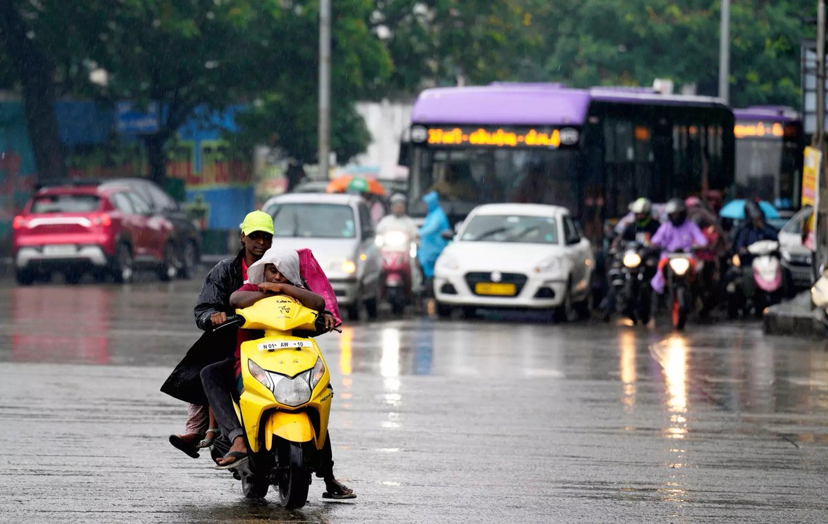
Expect the day to start with the rains tomorrow .These are not gonna be havoc and should be enjoyable one. Do carry umbrellas and raincoats from tomorrow. After a long dry spell, much needed monsoon for us. Red thakkalis are miles away from us finally 🤩🤩#chennai#chennairains
Much-awaited NEM onset announcement likely in the next 48–72 hours! 🌧️ Expect widespread rains across coastal TN from Oct 14, extending to interior regions in the following days. A favourable, high-amplitude MJO could keep the monsoon active. #Chennai#ChennaiRains
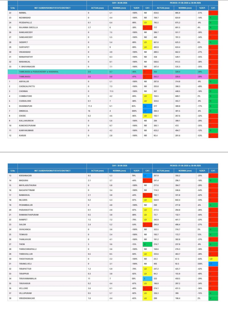
SW Monsoon 2026 comes to an end.
The season’s performance was largely subdued, with many districts fall under deficient rainfall.
Now, all eyes turn for the announcement of NEM and NWP models suggests mostly likely onset in the 3rd week of Oct'26.
#chennai#NEM2026#tamilnadu
Induction of LHB Coaches in Express Trains🚆
Introducing LHB coaches in Train Nos. 22661/22662 Sethu Superfast Express and 20605/20606 Chendur Superfast Express.
The revised composition will take effect from October 2026 on the respective services.
#SouthernRailway#LHB #IndianRailways
Just 2 weeks to go for NEM season! Thunderstorm activity should pick up over #Chennai from tomorrow. An elongated Bay circulation could bring NW winds, favouring low-level convergence over KTCC. Models also indicate a quick SWM withdrawal. Fingers crossed🤞#Chennai#chennairains
Low-level winds appear to be converging around Chennai today, despite the absence of a pronounced sea-breeze push. With supportive mid-level moisture, the environment looks favourable for convection. Very gud chance of evening thunderstorms. 🌦🌂 #Chennai#Chennairains
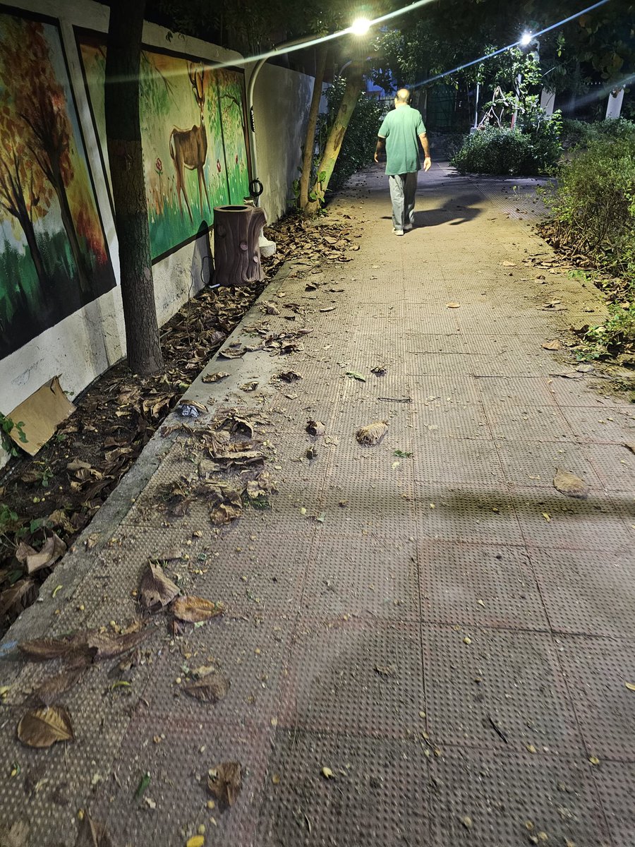
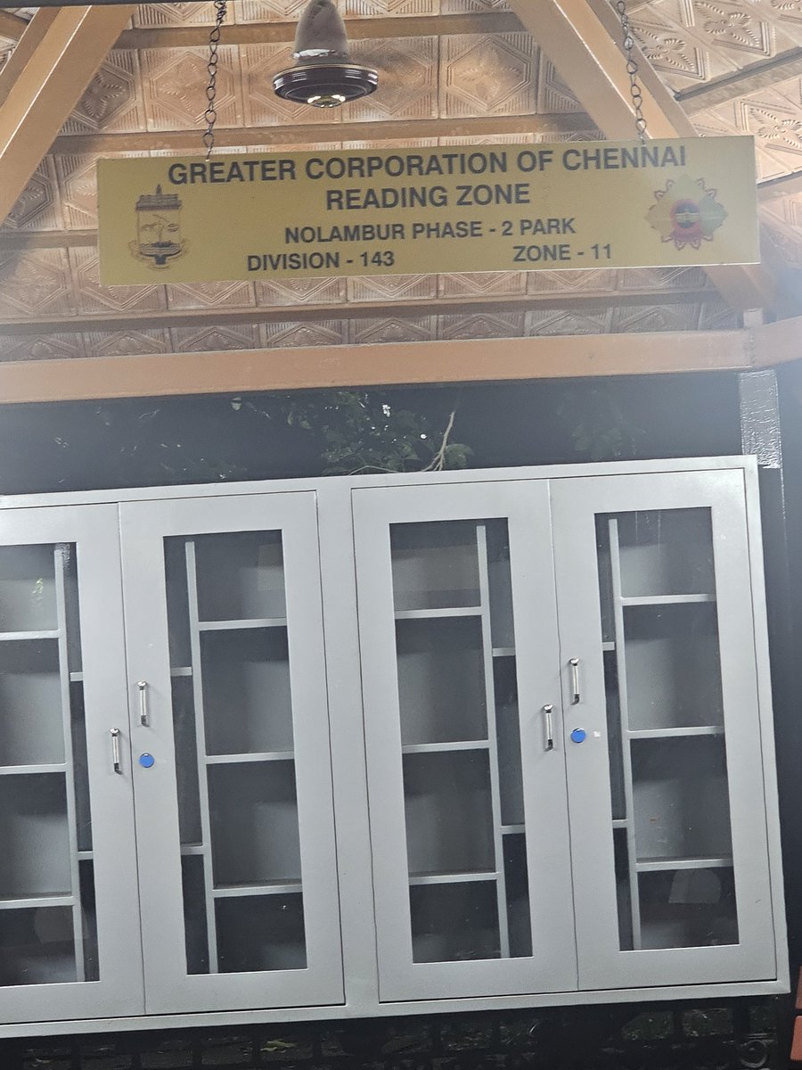
Dear @chennaicorp this park is not being maintained properly. Walkways are filled with dry leaves, litter, and and the toilets are in a very unhygienic condition. Many senior citizens and children use this park daily. Kindly take appropriate action and ensure reg. maintenance.
Once again, North Chennai is getting battered time and again.Looking at the intensity of the bands, conditions are ripe for more cells to push toward the coast.
If any band flanks south or new storms fire up closer to shore, the city will get its share too.
#Chennai #ChennaiRains #Monsoon2025 #CycloneDitwah
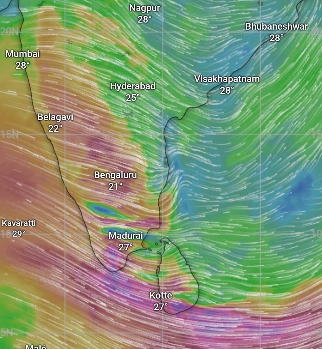
#CycloneDitwah has moved inland, yet convergence and remnant coastal moisture may still bring a few spells of rain over KTCC during the next 24–36 hours. Rains will be mostly moderate, though isolated pockets can see heavier bursts.
As the circulation travels further inland, thunderstorms are likely to develop across interior districts.
The true hero #Ditwah delivered massive rainfall from Sri Lanka to South AP — and more importantly, reminded all of us how complex weather dynamics are, and that there is never a point of “full saturation” in weather. #ChennaiRains
#Chennai #Monsoon2025
Rainfall ending at 08:30 AM today:
1️⃣ Ennore (Chennai – GCC) – 146.1 mm
2️⃣ Wimco Nagar (Chennai – GCC) – 117.6 mm
3️⃣ Thamaraipakkam (Tiruvallur) – 116 mm
4️⃣ Manali New Town (Chennai – GCC) – 113.8 mm
5️⃣ Pallikaranai W190 (Chennai – GCC) – 103.6 mm
6️⃣ Pallikaranai W189 (Chennai – GCC) – 102.2 mm
7️⃣ Redhills (Tiruvallur) – 96 mm
8️⃣ Ponneri (Tiruvallur) – 94 mm
9️⃣ Okkiyam Thoraipakkam (Chennai – GCC) – 93.8 mm
🔟 Kathivakkam (Chennai – GCC) – 92.4 mm
#Chennai #ChennaiRains #CycloneDitwah
Very heavy to extreme rains have battered Chennai, and more heavy-very heavy spells are expected today. With the depression stalling, the circulation keeps regenerating convection fueling this relentless rainfall. A poor November has now been compensated with a massive start to December and NEM quota. #CycloneDitwah has exceeds the expectations — and the show isn’t over yet. Commuters, please plan your day accordingly and avail WFH if you have an option to do so. #Chennai #ChennaiRains #CycloneDitwah
நன்மையும் தீமையும் சமமாகிவிடாது. (ஆதலால், நபியே! தீமையை) நீர் மிக அழகியதைக் கொண்டு தடுத்துக் கொள்வீராக. அவ்வாறாயின், உமது கொடிய எதிரியை அதே சமயத்தில் உமது உண்மையான, மிக்க நெருங்கிய நண்பனைப் போல் காண்பீர். @shafeeqkwt@srinileaks
(அல்குர்ஆன் : 41:34)
மற்ற பெண்களைப் பற்றி தவறாகப் பேசுவதற்கு இஸ்லாமில் எந்த அனுமதியும் இல்லை.அப்படியிருக்க, ‘வேறு மதப் பெண்கள்’ என்று தனியாகப் பிரித்து பேச வேண்டிய அவசியமே இல்லை. @srinileaks@shafeeqkwt
25-30mm rains in average for #Chennai while all other regions recieved the expected spell of rains from #CycloneDitwa
Heavy - Very heavy rains have not materialized so far but there is still hope of rains from this system as this is not expected to move beyond #Chennai making a loop and pushed down as said in the earlier post. Even Mahabalipuram recieved 70mm yesterday but we haven't received the share.
Low level vortex is still evident and this should pull eq. westerlies which will continue to build the convection and this is where we are holding our rain chance.Let's wait how well things goes in the next 24 hrs.
Also, please note that very heavy rainfall alert is withdrawn.
#Chennai #ChennaiRains