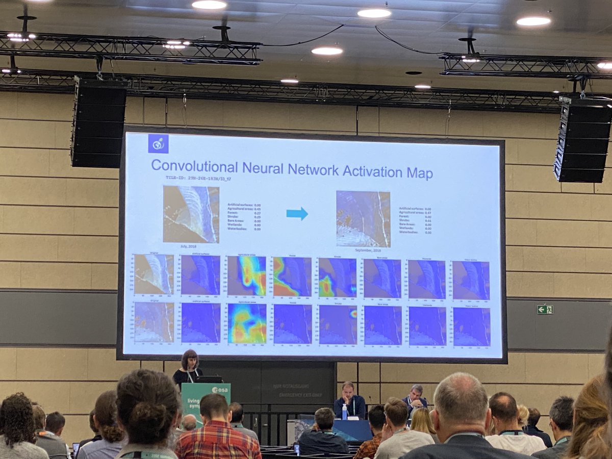
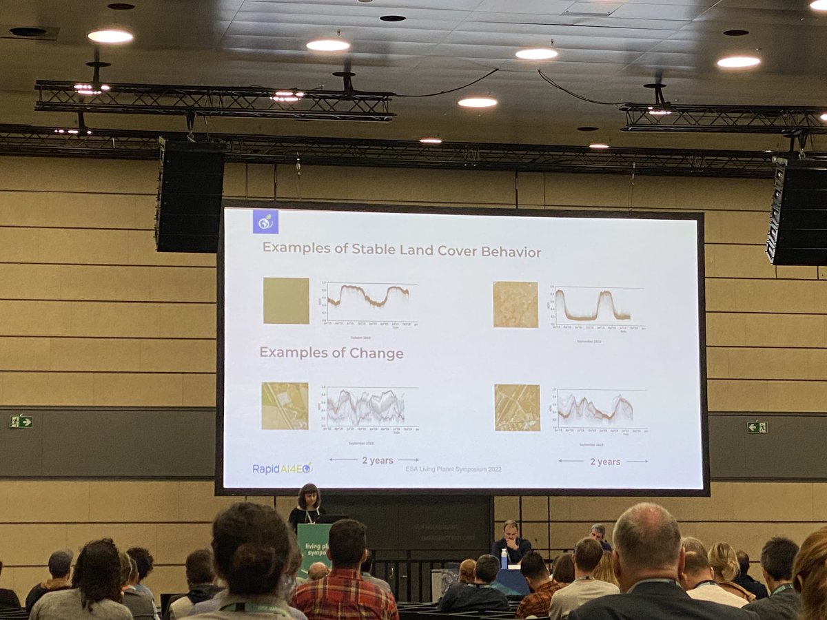
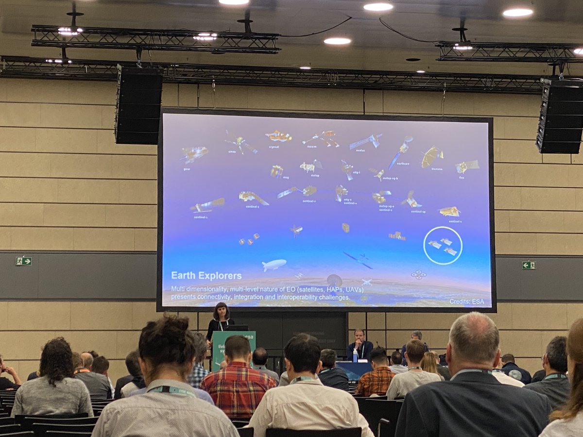
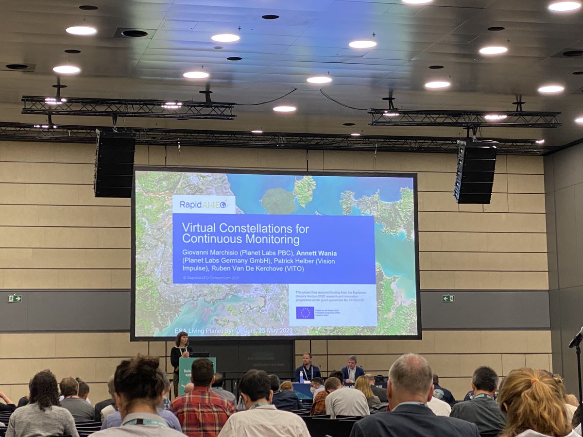
Exciting to see our #H2020#RAPIDAI4EO project at @esa's Living Planet Symposium #LPS22 in #Bonn🤩 Many thanks to Annett Wania from @planet and @RubenVDKerchove from @VITO_RS_ for the great talk and session🙌 If you attend #LPS22 and want to chat, please feel free to reach out.
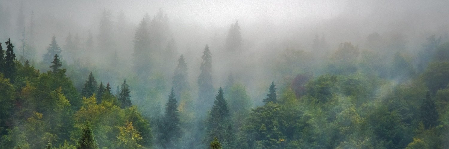
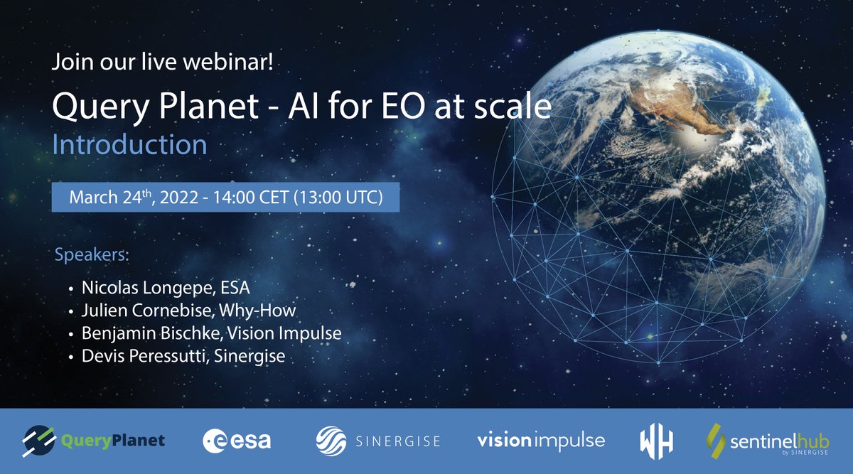
Are you interested in how we've built a solution for large-scale forest monitoring using Sentinel-2 imagery and machine learning? Join the webinar to see @benjaminbischke introducing our pan-European forest type mapping, developed within #QueryPlanet, an ESA-funded project.
🔵 Our next #webinar will introduce #QueryPlanet, @ESA-funded project that facilitates the use of AI algorithms to build large-scale EO apps. The use-cases tackle EO challenges, building on #SentinelHub and #eolearn.
🗓️ March 24 ⏲️ 14:00 CET
🎯 Register ➡️ https://t.co/zJmGrdXCx4
Excited!🛰️😊 Today, @planet and @VisionImpulse will share first insights into the work of the RapidAI4EO consortium advancing rapid and continuous land monitoring with Machine Learning models. Join our #IGARSS presentation TH1.O-9.3! RapidAI4EO is funded under the H2020 program.
Exciting times 🛰️😊. We are looking for motivated and proactive researchers, machine learning engineers, software engineers, and frontend developers to extend our team. We offer full-time, part-time, and internship positions.
Check out our website: https://t.co/sF3SDQxQVJ
We are proud to be part of the RapidAI4EO consortium. Together with our partners (Planet, VITO, IIASA and ONDA DIAS/Serco), Vision Impulse leverages innovative machine learning models to bring land monitoring to the next stage. RapidAI4EO received funding under the H2020 program.
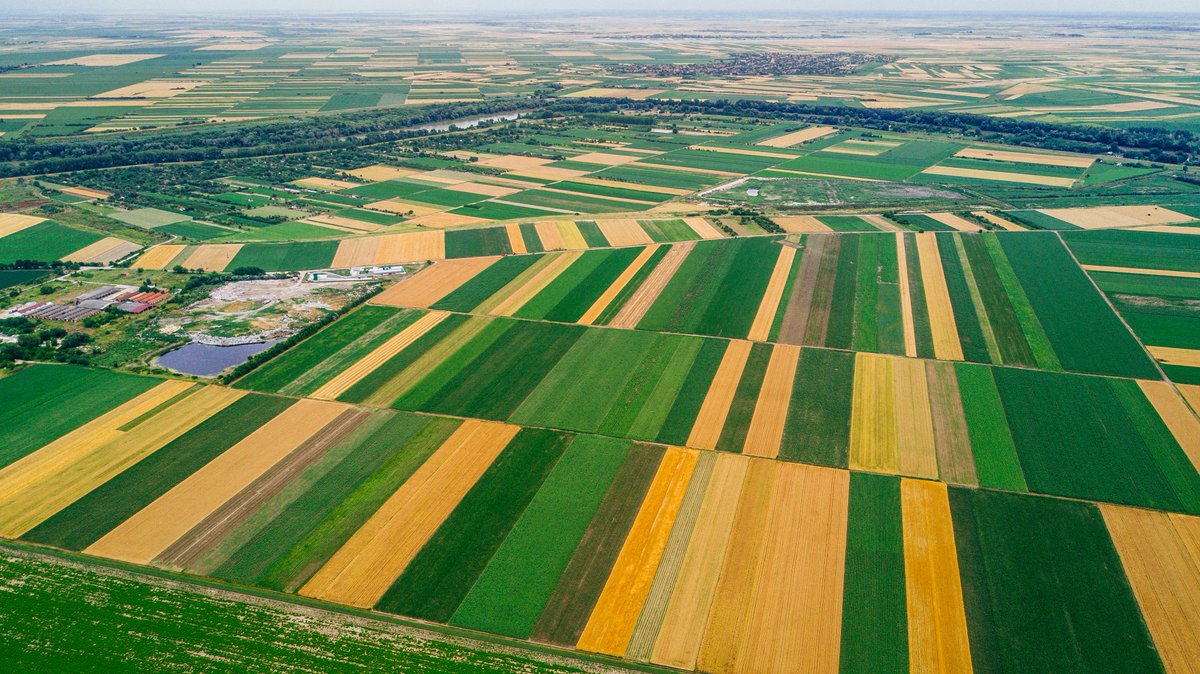
A Planet-led consortium has been awarded a grant under the Horizon 2020 program to advance continuous land monitoring applications using Copernicus satellite data and Planet's Fusion Monitoring products. Read on for details on this important work: https://t.co/he4TQLq4b7
Ready for #H2020#RAPIDAI4EO to establish state of the art #AI for #EO!🤩
🆙Let's leverage the spatiotemporal dimension at scale & realize rapid, continuous land monitoring for #sustainable development.🛰️💚🌍
➡️https://t.co/d8wzXO4tXR
Die @faznet über Erdbeobachtung, Künstliche Intelligenz und Startups wie unser Spin-Off @VisionImpulse: "Aus der Luft gegriffen" https://t.co/ywReke8f7C
Our partners in TreeSatAI are: Geoinformation in Environmental Planning Group of TU Berlin, @LiveEO_space, LUP (Luftbild Umwelt Planung), DFKI and @VisionImpulse.
@VisionImpulse haben ein Neuronales Netzwerk geschaffen, mit dem trockene Bäume identifiziert werden können. So sollen langfristig Wälder besser geschützt werden. via @tagesschau
https://t.co/d8S2yt4ezH
See on @tagesschau how Machine Learning & Earth Observation technologies from our spinoff @VisionImpulse support adaptation to climate change through sustainable forest management. Read about analysis of forest areas with drone and satellite imagery here: https://t.co/t7MIibul54
Proud to be nominated for an AI junior award by @informatikradar and @BMBF_Bund based on our analysis of the Sentinel satellite images @ESA_EO@Sentinel_Hub. I would be happy if you have the chance to support our research with your vote: https://t.co/bK9lx8p8Cz #AI4EO#KI50@DFKI