I built an AI marketing agent to run my $100K media company.
After 4 months of prompting, tooling, and integrations, I built this agent that effectively replaced my content team.
Here’s how it works under the hood:
→ Scrapes Reddit, Hacker News, X, and Google News
→ Publishes a Morning Brew–style daily AI newsletter (10k daily readers)
→ Repurposes that content into:
• viral Twitter threads (like this one)
• short-form videos for TikTok & Instagram
• Reddit posts
• high-engagement LinkedIn updates
→ Produces content that’s driven millions of impressions
→ Generates custom, brand-aligned images for every unique asset
All automated.
The entire system runs through Jarvis-like voice commands, powered by ElevenLabs + n8n (see video below, I literally trained it on Jarvis from Iron Man).
No manual content creation.
No team to manage.
Runs while I sleep.
I'm no longer focusing on this business, so I'm giving all this away for free. If you want the complete system, prompting, n8n templates, & setup walkthrough:
Comment “AGENT”
Like & Retweet
Follow me (so I can DM you)
I’ll send everything over.
Episode 15 is live!
Automate your geospatial feature engineering with Python — scale smarter, not harder. 🚀🌍
#GeoML#Python#GIS#ML
https://t.co/W2xRt7rjkZ
🚀 More features ≠ Better models! ⚡
Choose the right geospatial features with:
✅ Correlation filters
✅ RFE & feature importance
✅ LASSO regression
Smarter features = Faster & more accurate models! 🔥
#GIS#MachineLearning#GeospatialAI#DataScience
https://t.co/ZMA31ICxO5
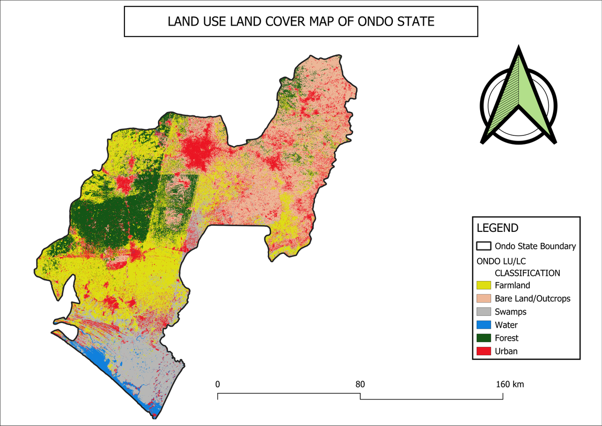
🚀 Geospatial Insights: LULC Classification of Ondo State! 🌍
Our analysis reveals land use patterns:
🌲 Forest: 2,088.43 km²
🌾 Farmlands: 4,196.43 km²
📊 This data is crucial for agriculture, conservation, and sustainable planning.
🔍 #GIS#RemoteSensing#OndoState#Anadata
🚀 Struggling with imbalanced geospatial data? If your ML model favors urban areas over forests & wetlands, it's time to fix the class imbalance!
https://t.co/jM3q8e2iEM
#GIS#MachineLearning#GeospatialAI#DataScience
I'm adding more peaks (with name and elevation attributes) to the Natural Earth map dataset. The trick is deciding which ones to include—there's 1,000,000+ to choose from.
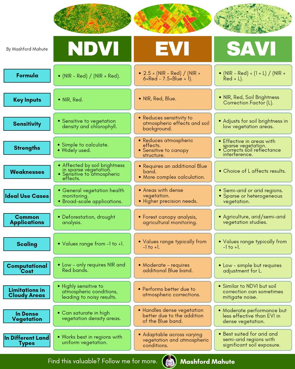
Vegetation indices are powerful tools in remote sensing, offering insights into vegetation health, density, and distribution.
Here's an infographic comparing the main indices — NDVI, EVI and the SAVI.
#GIS#RemoteSensing#Geospatial#QGIS#ArcGIS#DataViz
🚀 AI + Geospatial = Smarter Cities! 🏙🌍
We used the Segment Anything Geospatial model to extract building footprints from satellite imagery! 🛰
💡 Why it matters:
✅ Urban planning 📍
✅ Disaster response 🚑
✅ Sustainable land use 🌱
#AI#RemoteSensing#Anadata#GIS
The first Geographic Information System (GIS) was developed in the 1960s by Dr. Roger Tomlinson, a Canadian geographer known as the "Father of GIS." He created the Canada Geographic Information System (CGIS) while working for the Canadian government.