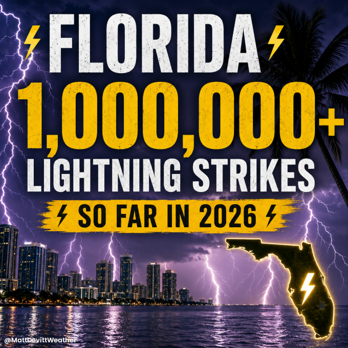
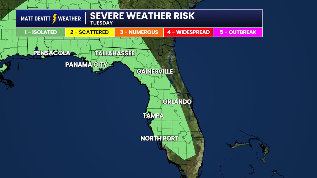
1 MILLION LIGHTNING STRIKES! ⚡️
That's how many Florida has seen so far in 2026 according to new data. In fact, we've had over 200,000 just in the past week with many more strikes ahead.
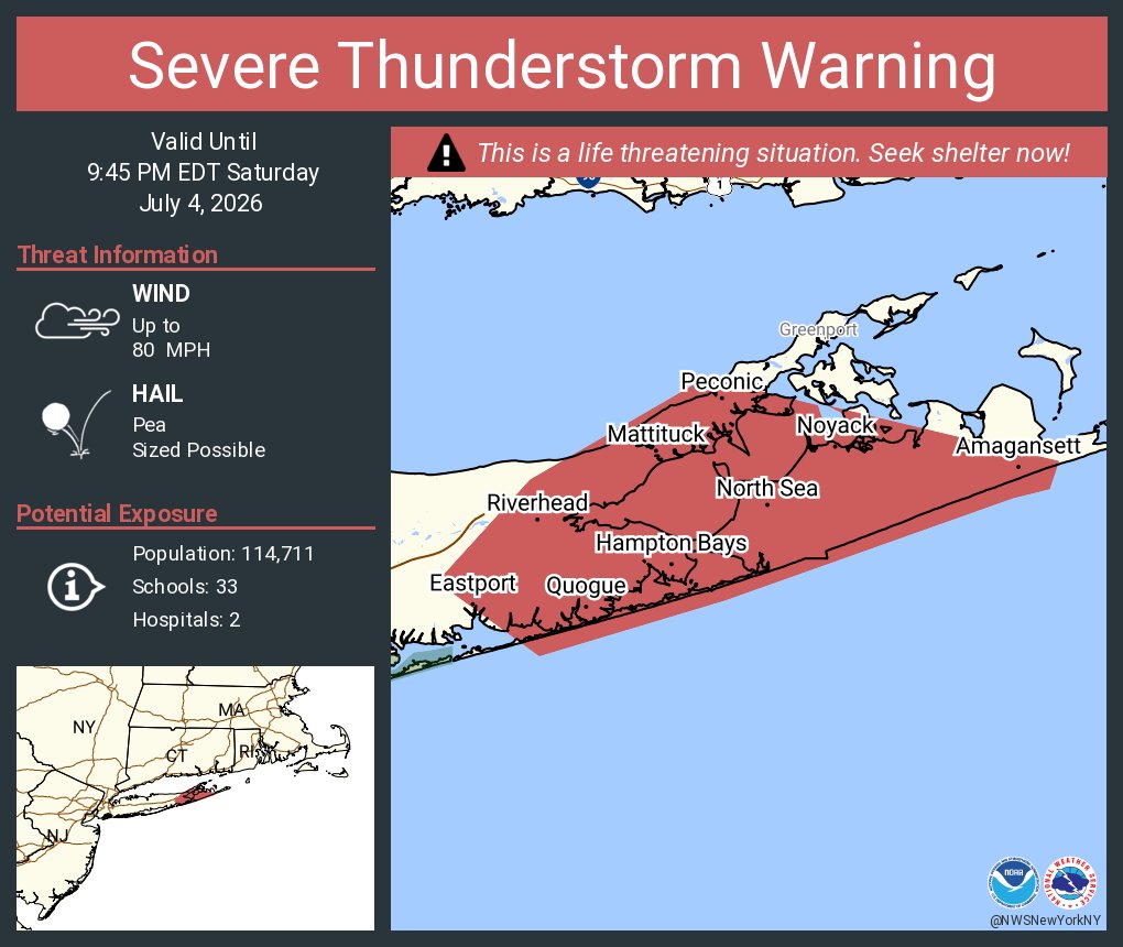
Severe Thunderstorm Warning continues for Hampton Bays NY, Riverhead NY and East Quogue NY until 9:45 PM EDT. This destructive storm will contain wind gusts to 80 MPH!
At 16-under, 18-and 36-hole leader/co-leader Lucas Glover and Lee Hodges share the 54-hole lead at the John Deere Classic.
It marks the fifth 54-hole lead/co-lead of Glover's career on TOUR (2-for-4 in converting to victory) and the third for Hodges (1-for-2 in converting to victory).
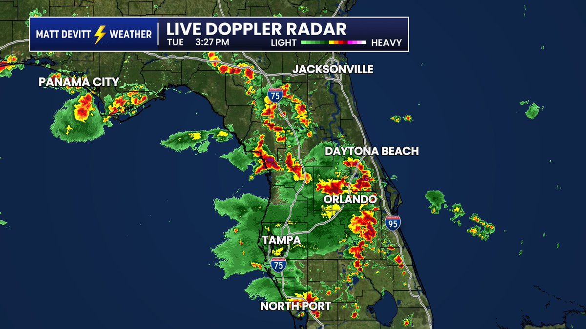
LIVE RADAR: Lightin' up across Florida as of 3:30 PM with thousands of lightning strikes and strong scattered storms. Even a few storms could go severe (typical rainy season severe). Watch for gusty wind, some hail, and a brief spin-up.
Breaking: LeBron James will continue his NBA career for the 2026-27 season and has informed the Lakers that the franchise can move on without him because he will play elsewhere, his agent told @ShamsCharania.
Very eerie message transmitted over the emergency alert system in Colorado as wildfires threaten Buelah.
Pueblo County has established an evacuation center at 1650 Cooper Place.
If you have large animals, bring them to the Colorado State Fairgrounds. (Enter at Gate 6 & 7.)
BREAKING: It appears we have the SECOND HIGHEST thunderstorm wind gust ever directly recorded in the United States.
Winds to 131 mph – equivalent to an EF2 tornado – were measured around 6:15 a.m. in central South Dakota.
There were multiple corroborating measurements AND several additional gusts over 110 mph nearby.
Based on everything we can find, these are the strongest straight-line thunderstorm gusts to be directly-measured since August 1, 1983, when a microburst hit Andrews Air Force Base in Maryland. Just seven minutes earlier, Air Force One had landed with Ronald Reagan. A gust to 149.5 mph was clocked.
A derecho, or violent straight-line wind storm, did impact the Cedar Rapids, Iowa area with 140 mph winds on August 10, 2020; several transmission towers were felled and up to 8,000 buildings damaged or destroyed. But the strongest directly-measured gust was 126 mph in Atkins, Iowa.
"You are in a life-threatening situation," warned the Weather Service in Aberdeen on Monday morning. "Flying debris may be deadly to those caught without shelter. Mobile homes will be destroyed. Expect considerable damage to homes and businesses. Expect extensive tree damage and power outages."
Much of the impact-based verbiage was borrowed from the Weather Service's template for tornado warnings. Only on rare occasions is that phrasing used in severe thunderstorm warnings. That said, the impacts were similar.
"This is an EXTREMELY DANGEROUS SITUATION with tornado-like wind speeds expected," wrote the Weather Service.
The storms accompanied a warm front lifting through the region. Despite the early time of day, there were between 5,000 and 6,000 units of thunderstorm fuel; 1,000-2,000 is enough to fuel severe thunderstorms.
The storms were effectively able to grow tall and tap into jet stream energy, mixing momentum to the surface.
It is unclear if Monday's storm will be classified as a derecho. While the winds were surely sufficient, a derecho must produce a damage path about 250 miles long. Moreover, historical definitions required a wind swath 60 miles wide. This bow echo may have been slightly too narrow. The Storm Prediction Center will have the final say.
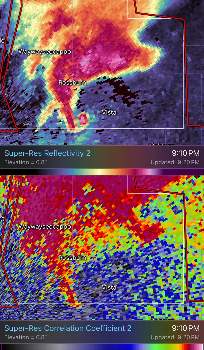
That is radar data to remember up near Rossburn in Canada. Those radars are lower res, but clearly it doesn’t take much with intense tornadoes like this…
At 20-under, Collin Morikawa is the leader in the clubhouse at the Travelers Championship following a 61, equaling his career-low round from the 2023 TOUR Championship (R1).
The National Weather Service webpage is currently experiencing an outage. As of now, there is no timeline on when it will be restored. We apologize for the inconvenience.