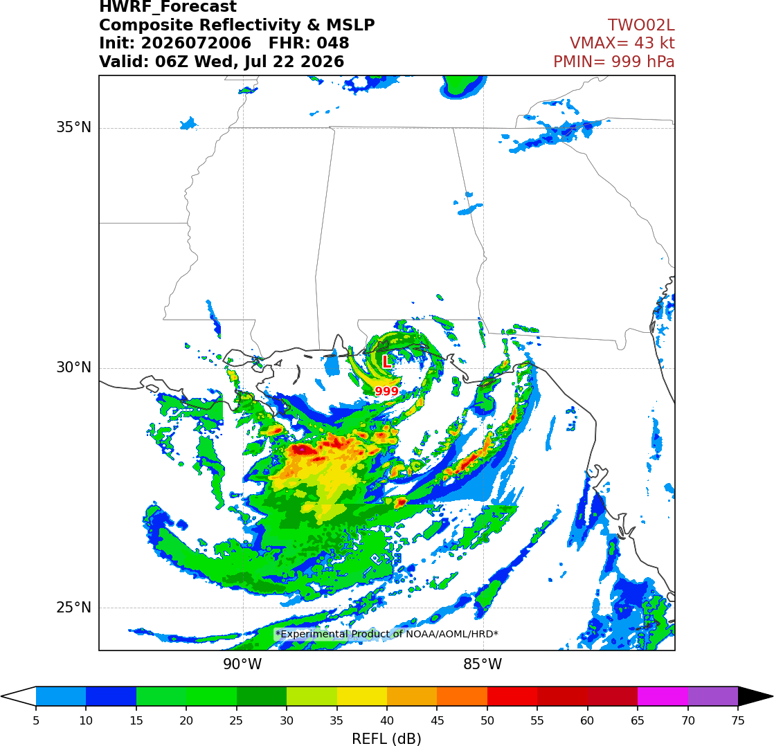
Typically for Gulf storms, the shear is out of the west or southwest, such that regions "downshear" (mostly east of the center) get heavy rain and sometimes tornados with landfalling storms. This is sometimes called the "dirty side" of the storm.
For #TD2, because of the more unusual shear from the NE, the "dirty side" will actually be to the south of the low-level center, likely mostly out over the Gulf. This will hopefully limit impacts from the storm, though of course don't let your guard down til the threat is over.
Most 0z Models overnight don’t have a TD2 becoming more than a moderate TS due to close proximity to the coast. Lots of the models dissipate it after passing and interacting with Louisiana.
FORT MYERS BEACH, Fla. (WINK)—The National Weather Service issued a high-risk rip tide statement for some Southwest Florida beaches as a tropical depression creates choppy waves in the Gulf. https://t.co/L41vcvL22l
Tropical Depression #Two Advisory 4 (4 AM CDT, Mon Jul 20): Depression Expected to Become a Tropical Storm Later Today. Tropical Storm Watch Extended to Mississippi/Alabama Border. https://t.co/tW4KeGdBFb
my thoughts... this area "close up and personal" everyone should be watching this is a storm in the process of forming... while it's "stationary" nothing is static so stay tuned... https://t.co/XLVVLmtkcS updated info in blog TD2 Spins.... owns the Eastern Gulf!
#TD2 remains broad and weak for now, with dry air entrainment evident west of the circulation, clearly limiting the intensity and coverage of deep thunderstorms.
Gradual pressure falls are being observed at Buoy 42036 at about 28.5N, 84.5W, indicating that slow organization likely continues.
Things to watch for tonight/tomorrow: evidence of a step change in convective activity as dry air mixes out and a contracting of the max wind ring in future aircraft reconnaissance missions.
Given that stiff vertical shear awaits TD2 near the central Gulf Coast, it could simply dissipate if it remains weak by then. Significant intensification prior to that point would increase the risk of TD2 surviving as a substantial storm and affecting areas like western #Louisiana and southeast #Texas later.
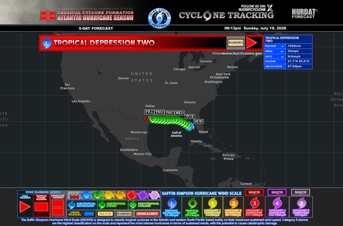
8 pm #TD2 update:
🔴Located: lat 27.7 N, long 85.0 W. It's nearly stationary
🔴A very slow NNW track is forecast, then due west. It'll move near the Gulf coast states during the next several days.
🔴Top winds: near 30 mph w higher gusts.
🔴It could become #Bertha by Monday.
First recon mission into TD #02L reveals an elongated circulation and a disorganized wind field, which makes sense given the poor convective organization.
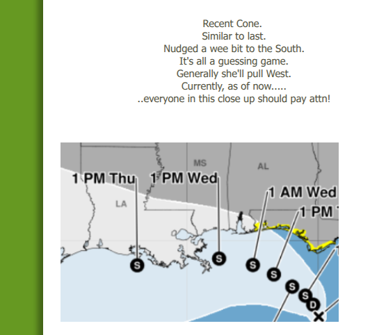
Notably, the aircraft has assessed the center slightly further south than initially anticipated, which could have some implications on an already uncertain track forecast.
MID-MORNING UPDATE: Invest 91L is in the Gulf, and has an 80 percent chance of becoming a tropical depression or tropical storm.
The general motion will be to the northwest; the center is expected to remain south of the Alabama/Northwest Florida Gulf Coast.
91L could become Tropical Storm Bertha, but it is not expected to grow into a strong tropical storm or hurricane. The main impact will periods of rain, heavy at times, along the Gulf Coast for the next few days.
Key messages for the Central Gulf Coast (Gulf Shores to Panama City Beach):
*This feature will bring elevated coverage of showers and storms over the next few days, but no day will be a wash-out. There will be good periods of sun. Just expect occasional tropical showers.
*A few waterspouts or brief tornadoes will be possible near the coast tomorrow through Wednesday.
*There will be a high danger of rip currents tomorrow through Wednesday.
*Showers thin out along the coast late in the week as the tropical low moves west away from the region.
Should you cancel your beach trip? I can't answer that since different people go to the beach for different reasons. The information posted here will help you make the decision.
Invest 91L in the northern Gulf is well situated to slowly take advantage of very warm ocean temperatures, and intensify into a tropical storm.
Uncertainty about structure & potential ... but outside chance at a stronger Tropical Storm Bertha e.g. pressure < 1000 mb
#91L looks quite sloppy this morning, looks to be dealing w/ some dry air. Still broad & lacking centralized convection. Stronger ensemble/model scenarios have it steadily organizing today. Some of these get pretty interesting, but none of that matters if it can’t get its act together & start to work on its lower levels.
This is a high ceiling/low floor system, all depends on how quickly it can get an established LLC & take advantage of Gulf conditions. Needs more convection to begin that process. (TCG) Looks to be firing some now, we’ll see if this is the beginning of further organization.
#tropics #wx
A potential limiting factor with regards to intensification of #91L will be the introduction of increasing northerly shear in a day or two. Notice how the GRAF model depicts a sheared system near the mouth of the MS River early Wednesday, with most convection south of the center.
GFS-based SHIPS guidance also shows a significant increase in shear in the days ahead.
Gonna be honest: this Gulf swirl is getting interestin'. It's not what I'd call gorgeous workmanship, but 1) cloud pattern shows definite arcing, 2) low center is turning W (meaning more time over Gulf), & 3) computer models have gotten more aggressive. Folks in FL, AL, MS, & LA need to watch this—& some models suggest TX threat down the road. Me: heading back to the Bay Sunday.
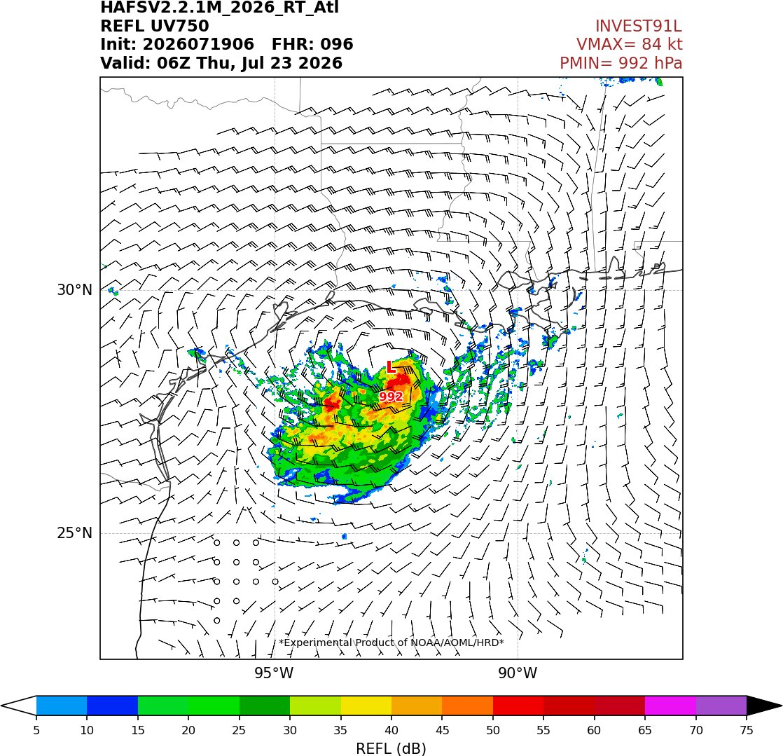
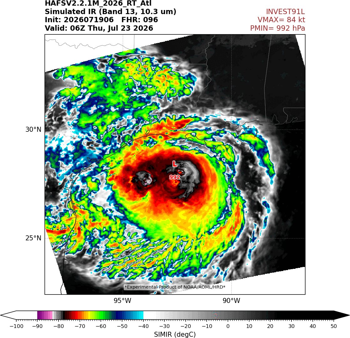
FWIW, our experimental basin-scale/multistorm version of HAFS-B, which is now running experimentally, has #91L further south and west than the operational HAFS and shows a possible hurricane threat to the Texas coast (though the system is still battling some shear).
Use this with caution since it's not an operational model, and of course always refer to NHC for official forecasts.
We'll hopefully have graphics for this version on our website very shortly.