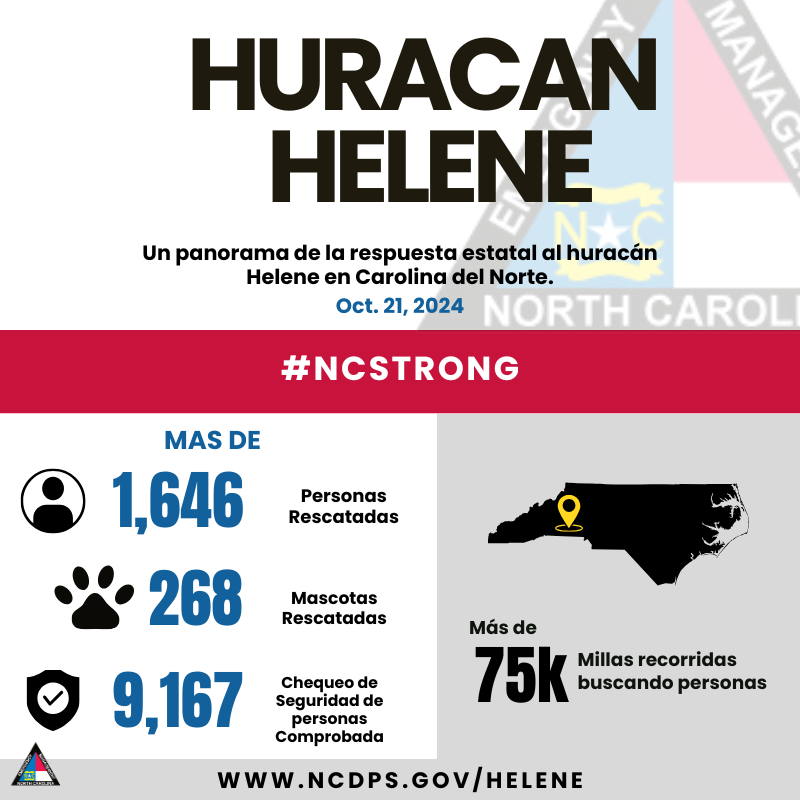
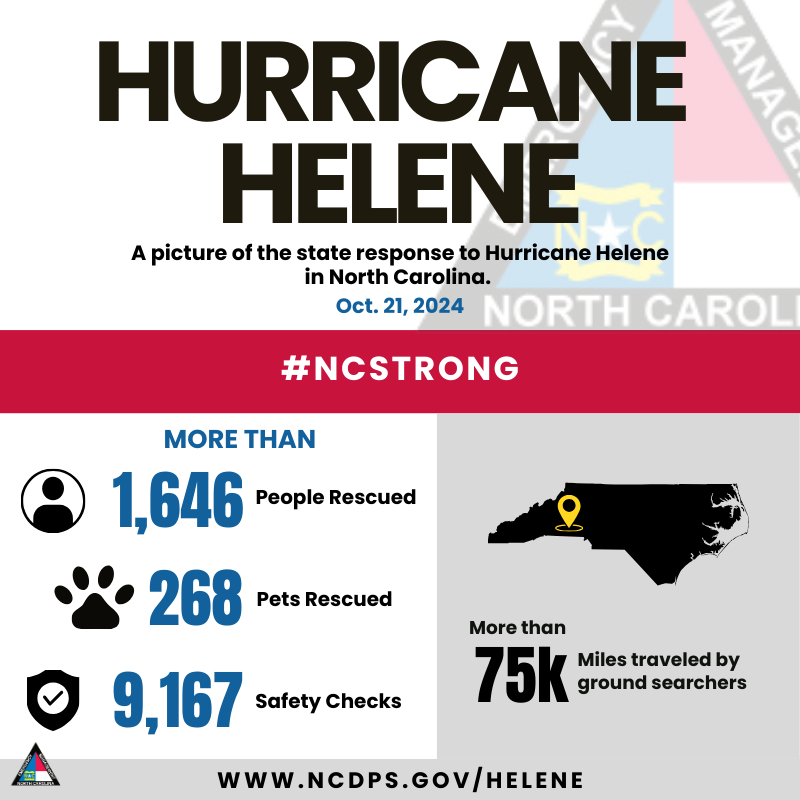
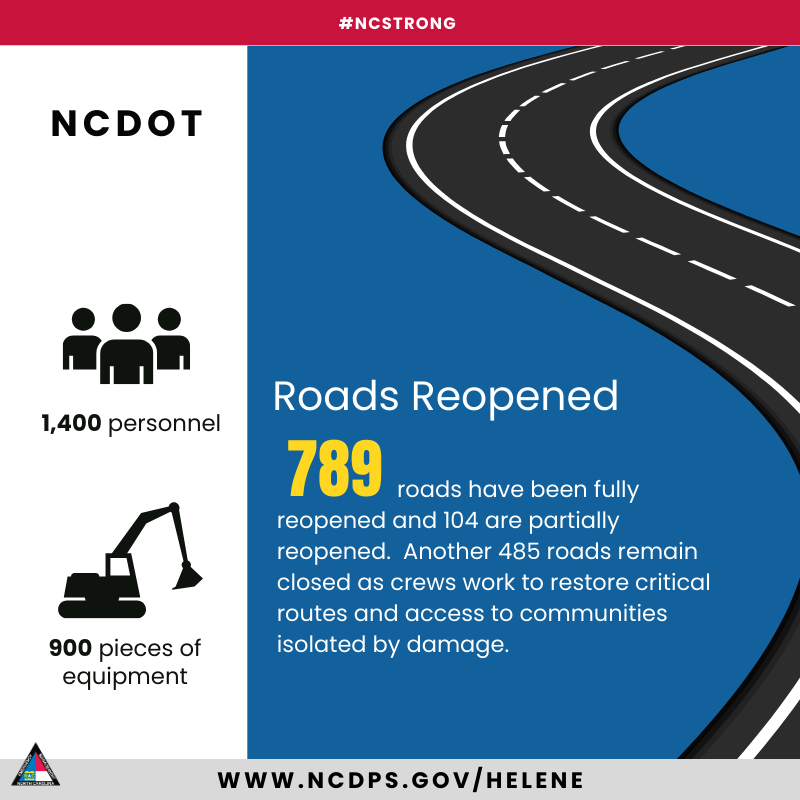
Desde que el huracán Helene azotó el oeste de Carolina del Norte hace más de tres semanas, hemos visto una gran cantidad de apoyo y asistencia de todo el país. A continuación, se muestra un vistazo a lo que hemos podido lograr trabajando juntos.
Since Hurricane Helene hit Western NC more than three wks ago, we’ve seen an outpouring of support and assistance from across the nation. Here’s a glimpse at what we’ve been able to accomplish when we work together. #NCStrong#HeleneNC
Need assistance? ➡️https://t.co/Lc5FCqSZTc
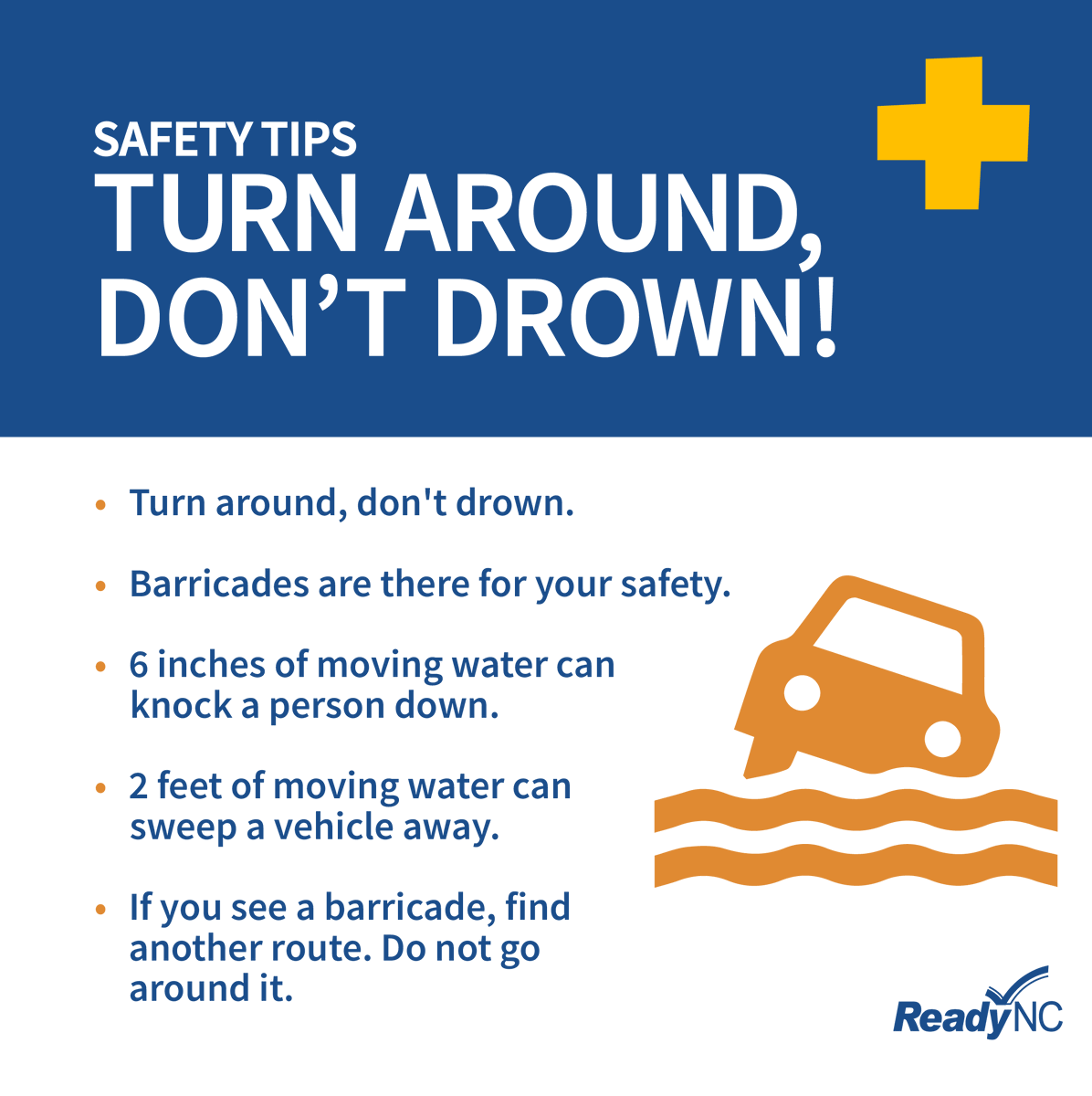
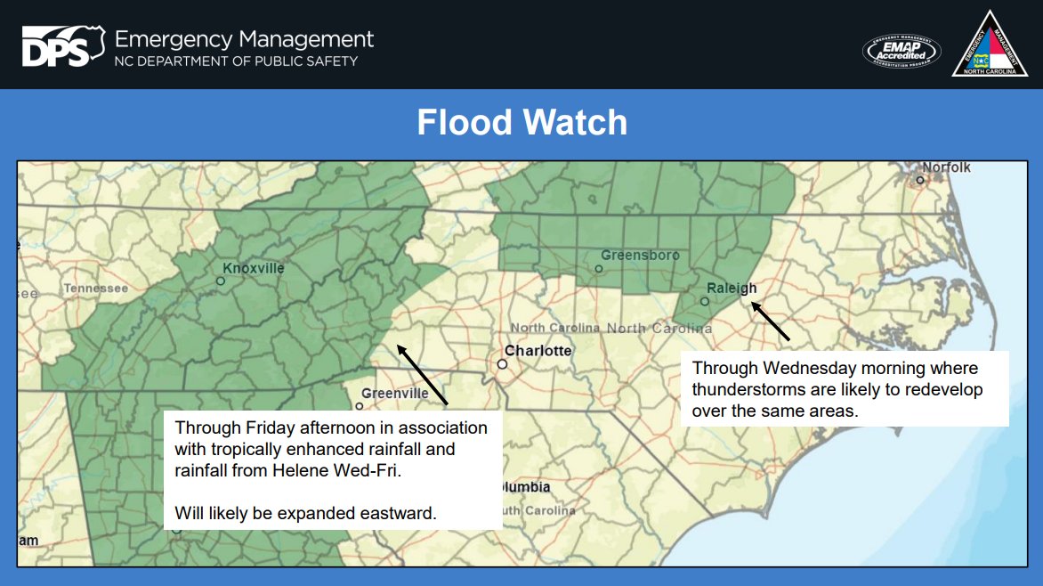
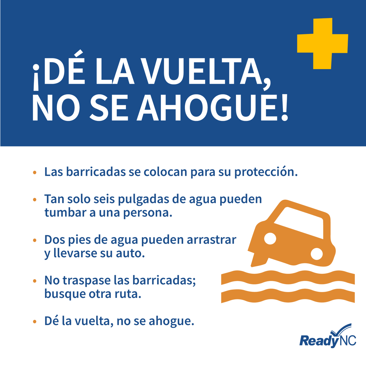
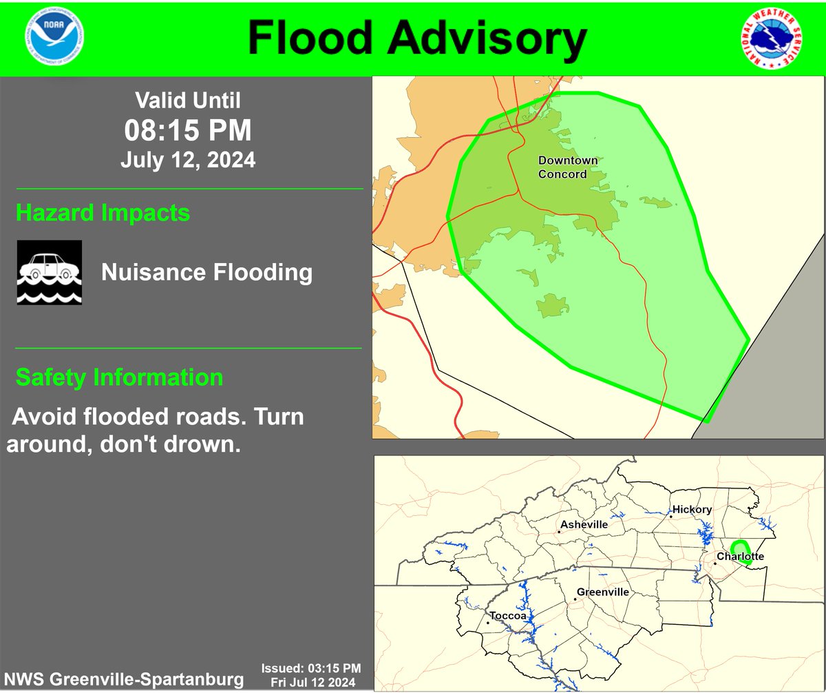
With heavy rains come flooded roads. Remember, don’t drive through flooded areas. Turn around, don’t drown!
-------
Con las fuertes lluvias vienen las carreteras inundadas. Recuerda, no conduzcas por zonas inundadas, date la vuelta, ¡no te ahogues!
Prepare now for #Helene! Be ready for more flooding! Do NOT try to walk or drive through flooded areas. Visit https://t.co/kChSPTKPhQ for details on what to do before, during, and after the storm.
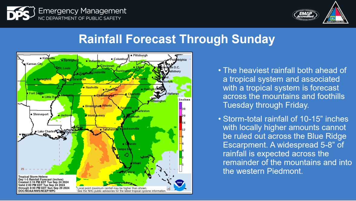
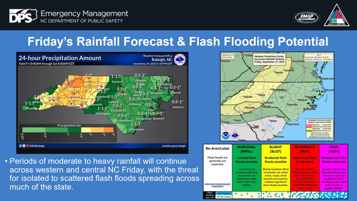
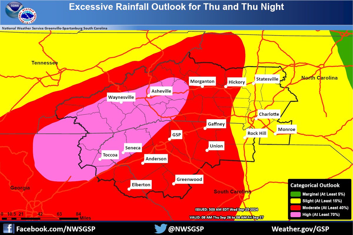
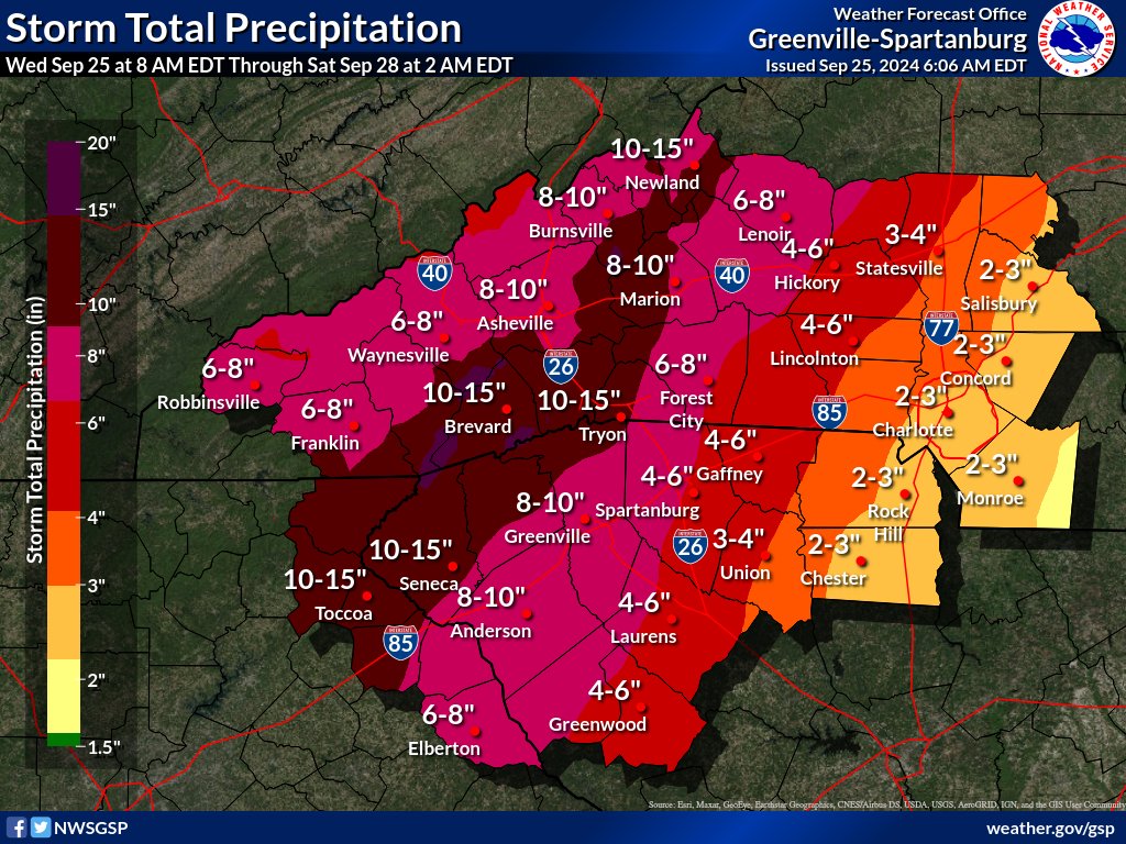
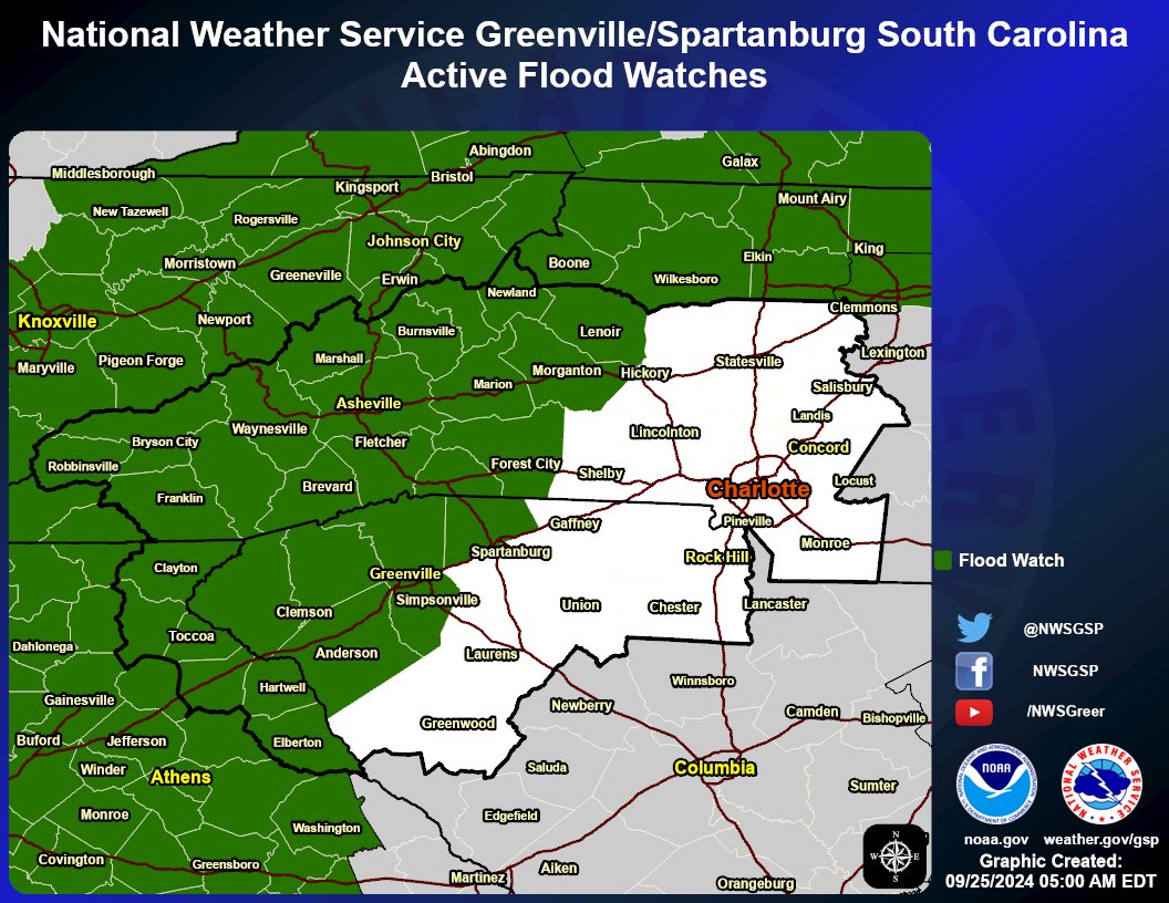
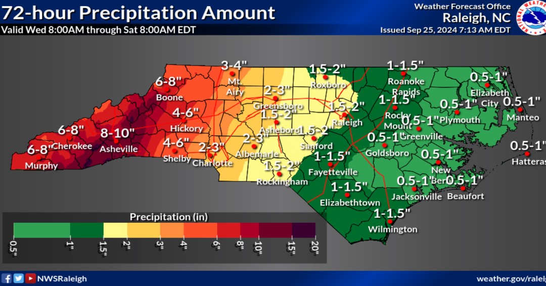
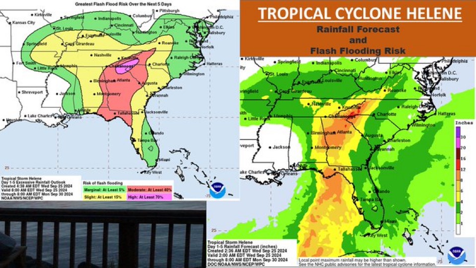
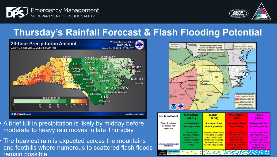
There have been a few changes in the expected impacts to NC from Helene since this morning. Rainfall totals have increased across much of western NC and portions of central NC, leading to an increased concern for widespread flooding.
#ReadyNC
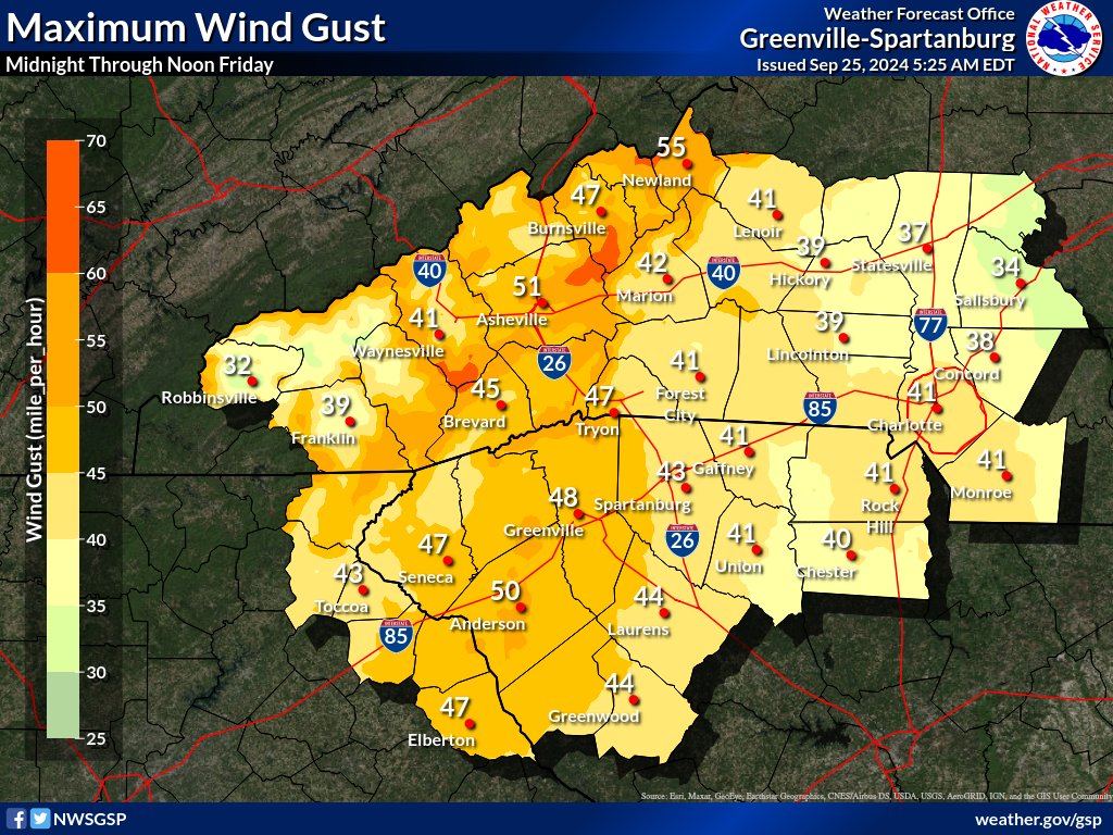
Helene will bring significant impacts to our area: widespread heavy rain develops later today and continues through Friday morning. Severe flash flooding (mainly across our western areas) and strong winds leading to power outages could develop Thu night. #gawx#ncwx#scwx
Let's get ahead of the forecast with some reminders that should still be fresh in your mind.
⚠️ DON'T drive thru standing water or around barricades
⚠️ SLOW DOWN
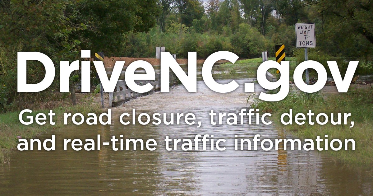
⚠️ Check https://t.co/AGDVnBcrXk for road conditions
⚠️ Share this with a friend
#ncwx
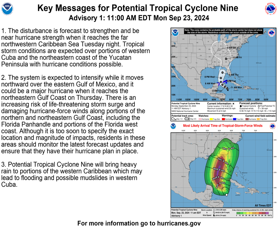
NHC has begun advisories for Potential Tropical Cyclone 9! The cone of uncertainty may take the cyclone near our forecast area circa Friday, but possible impacts are very uncertain this far out. Stay tuned for updates! #ncwx#scwx#gawx
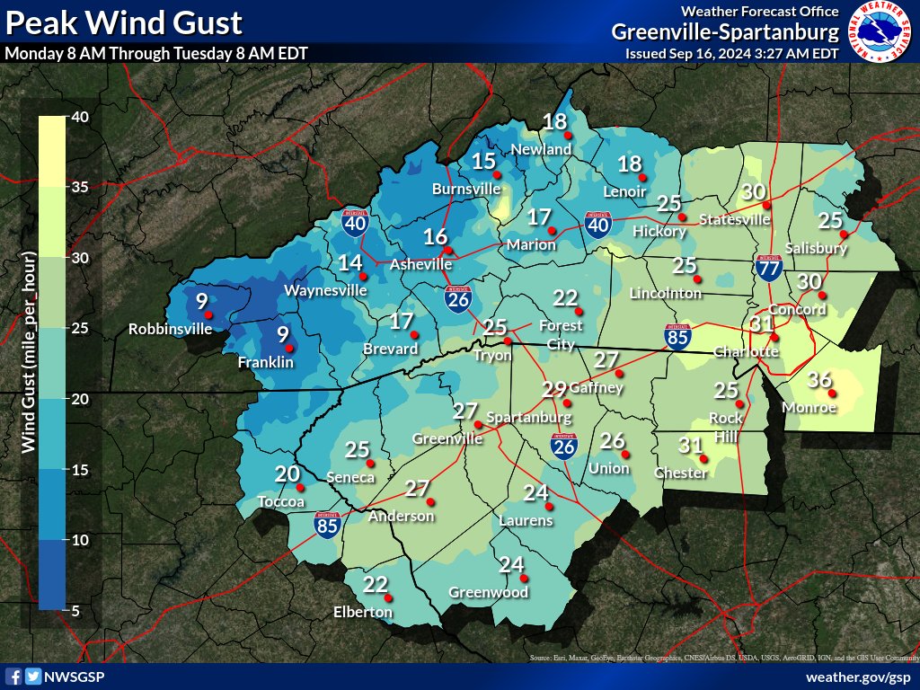
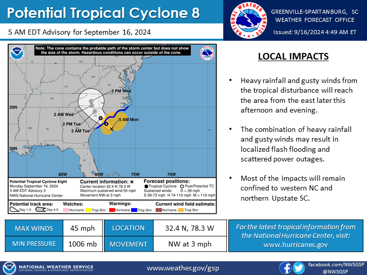
Potential Tropical Cyclone 8 is expected to make landfall along the SC coast this afternoon/evening, then move inland across the Carolinas tonight through Tuesday. Heavy rainfall and gusty winds are expected starting this afternoon through Tuesday morning. #scwx#ncwx#gawx
Flooding can be an emotionally and financially devastating event. Just one inch of water can cause $25,000 in damage to your home. #PrepareNow#Floodsmart#ReadyNC
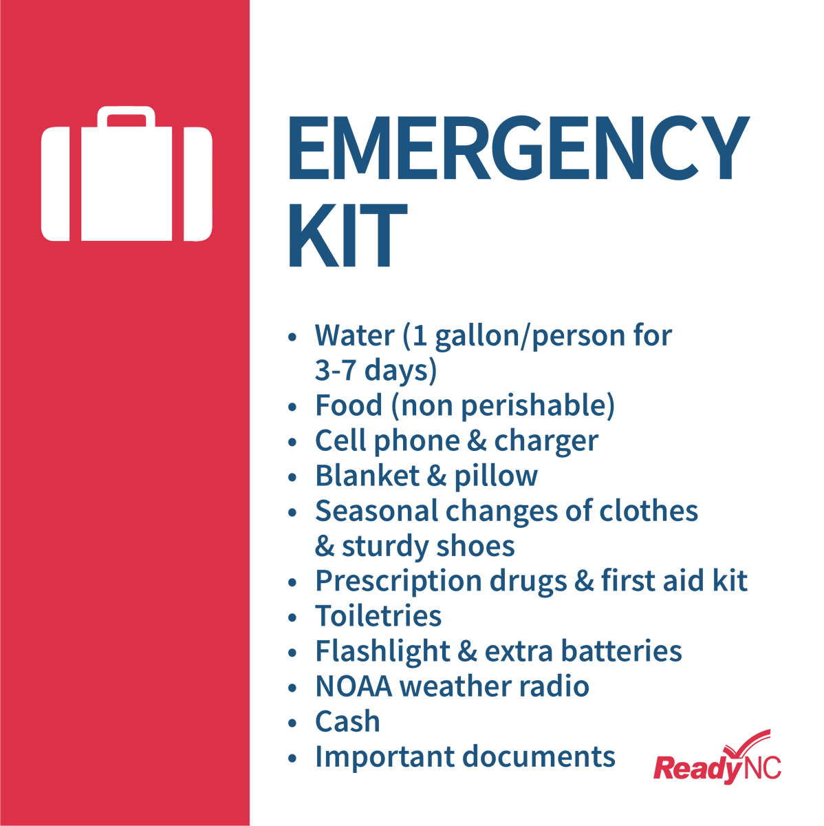
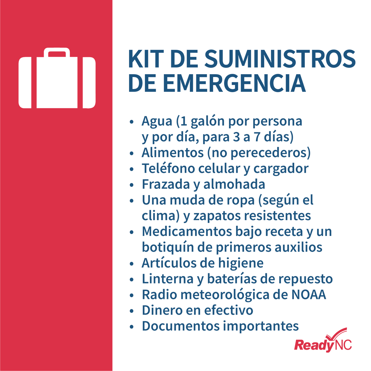
Be prepared for a power outage by having enough food, water, & meds to last for at least 72 hours: https://t.co/Sw2PN41B9S. #PrepareNow
__
Prepárese para un corte de energía teniendo suficientes alimentos, agua y medicamentos que duren al menos 72 horas: https://t.co/Sw2PN41B9S.
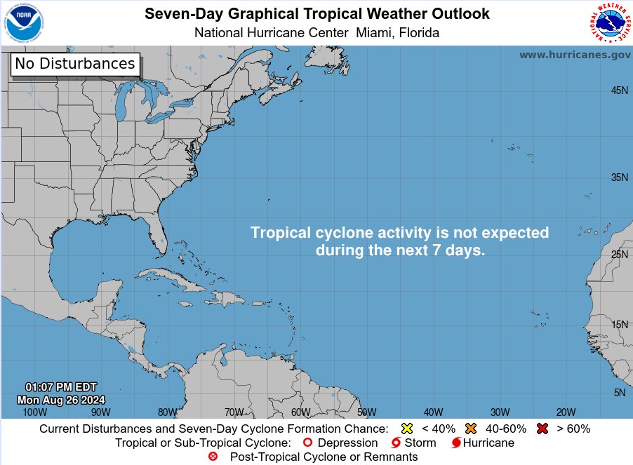
Shhhh.... don't want to wake the Atlantic up from it's nap! The best way to enjoy the break is by making sure you are ready for Sept-Oct. Did you know- 78% of tropical storms, 87% of Cat 1-2 hurricanes, and 96% of Cat 3-5 major hurricanes form from mid-Aug to mid-Oct?
#ReadyNC
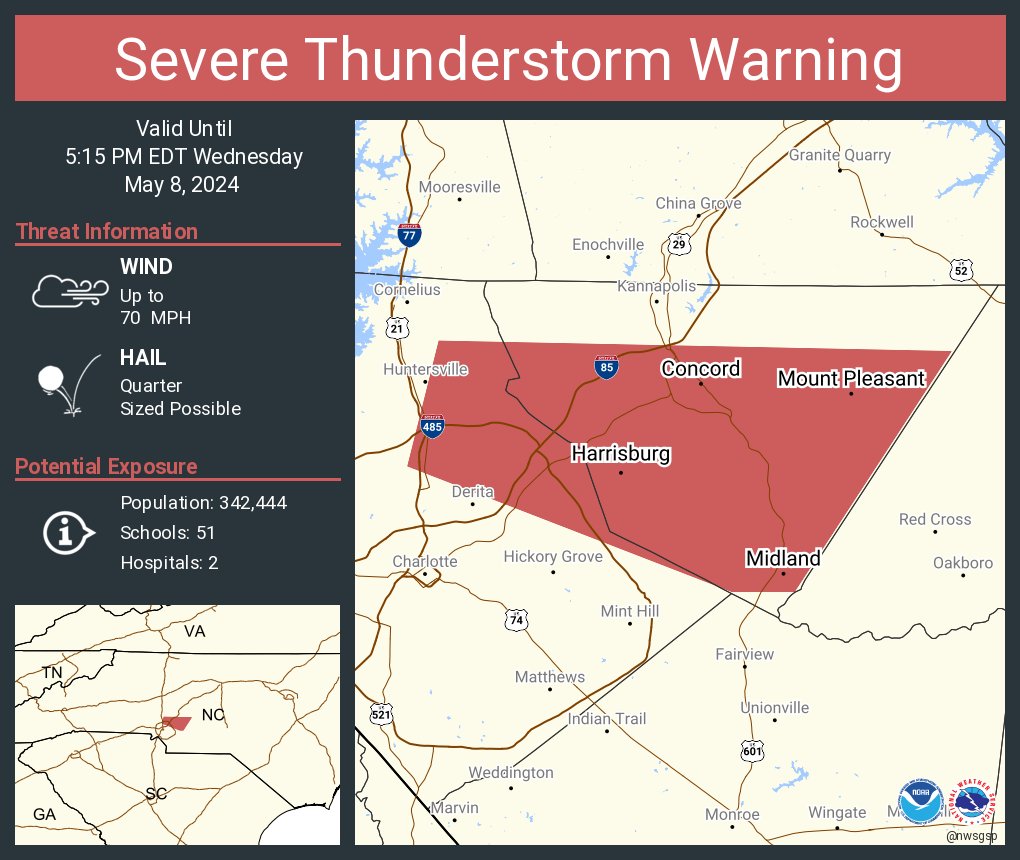
Severe Thunderstorm Warning continues for Charlotte NC, Gastonia NC and Charlotte/Douglas Airport NC until 4:45 PM EDT. This storm will contain wind gusts to 70 MPH!