A super cool phenomenon is happening today, as a strong cold front dives into the Gulf! Called Tehuano Winds - wind is funneled through the Isthmus of Tehuantepec mountain gap in S Mexico - becoming a wind firehose into the Pacific, with gusts 💨 reaching near hurricane force. These winds bring rough seas, upwell nutrients, and sometimes, when they happen early enough in autumn, can help spawn the spin needed to aid hurricane formation. Science!!
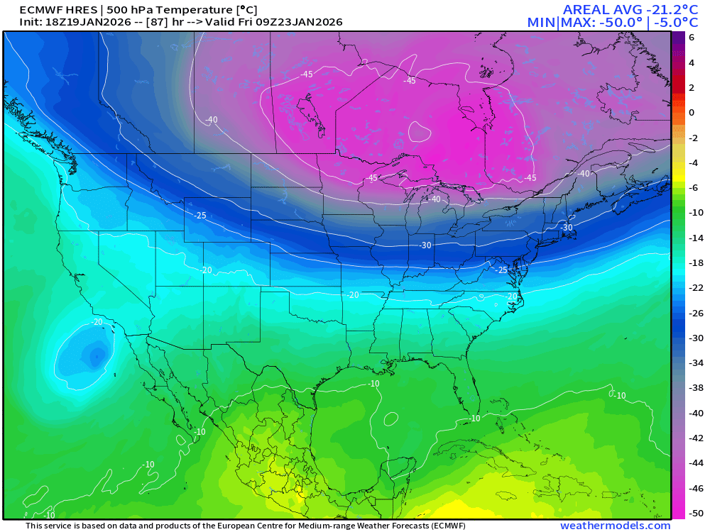
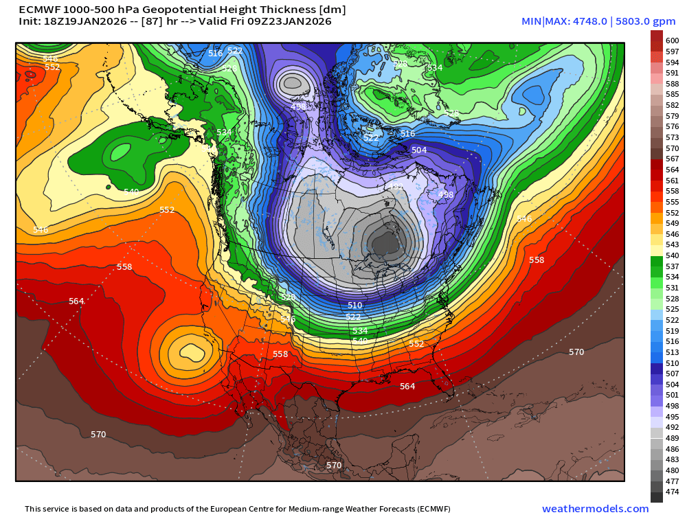
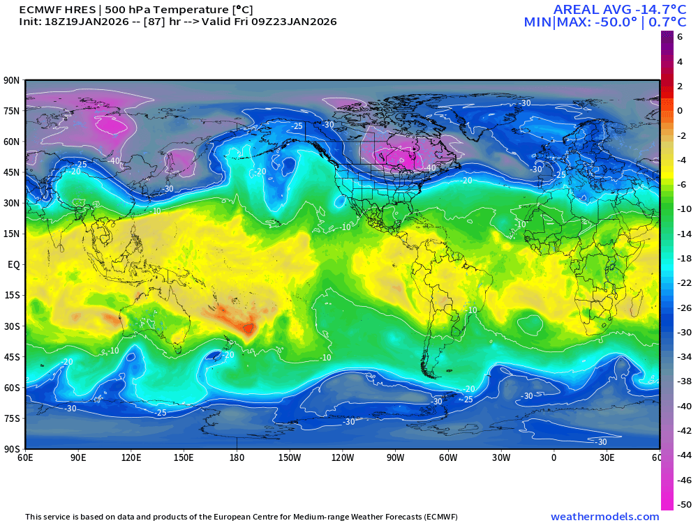
Friday: Coldest airmass on Earth will be centered over Ontario with mid-level temperatures of -50°C rarely observed except with most extreme Siberian cold.
And we'll be given (almost) the "whole load" Polar Vortex -- until it comes back for Round 2 in another week.
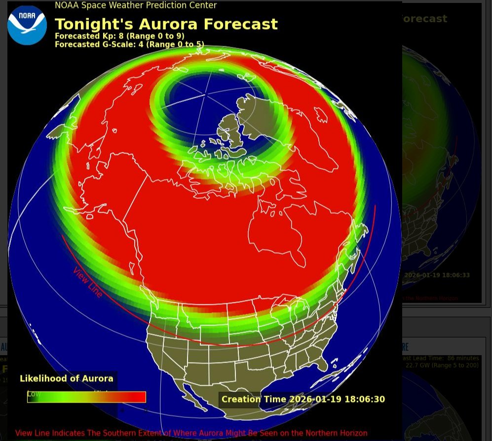
Heads up photographers and aurora fans. We could see the northern lights tonight. G4 Watch in effect for tonight due to anticipated CME ( coronal mass ejection ) arrival at Earth. For many areas the sky will be clear. #wawx
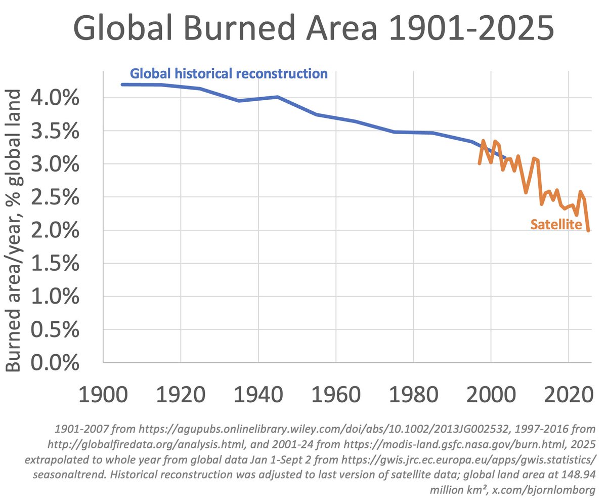
The world is burning less, not more
Contrary to standard climate narrative
Satellite data shows that burn has declined this century
2025 is on track for lowest burn in 21st century
And historical reconstruction shows that burned area has likely declined since 1900
https://t.co/wDu9oa90Q5
https://t.co/sbVr6xtrSI
https://t.co/iDqlYckvRT
Powerful early September "polar vortex" blast of "cool air" out of the Arctic will crash into the Lower 48.
Much below normal temperatures
Thank goodness we're not in December ... would be well below 0°F
Go back to the beginning of this Thread from July 2022 to see the original of the "Green New Scam" as President Trump calls it ... framed as reducing inflation.
Washington Post and other media outlets cheered on the passage of the Inflation Reduction Act all based upon sketchy math from an outfit that stood to collect billions in government grants.
And, plenty of inflation.
Tropical wave is entangled with monsoon trough / ITCZ but that's a good place for development in next few days (50%)
Next tropical storm name is Gabrielle and models point to becoming a hurricane over central Atlantic w/most likely path to north away from the mainland U.S.
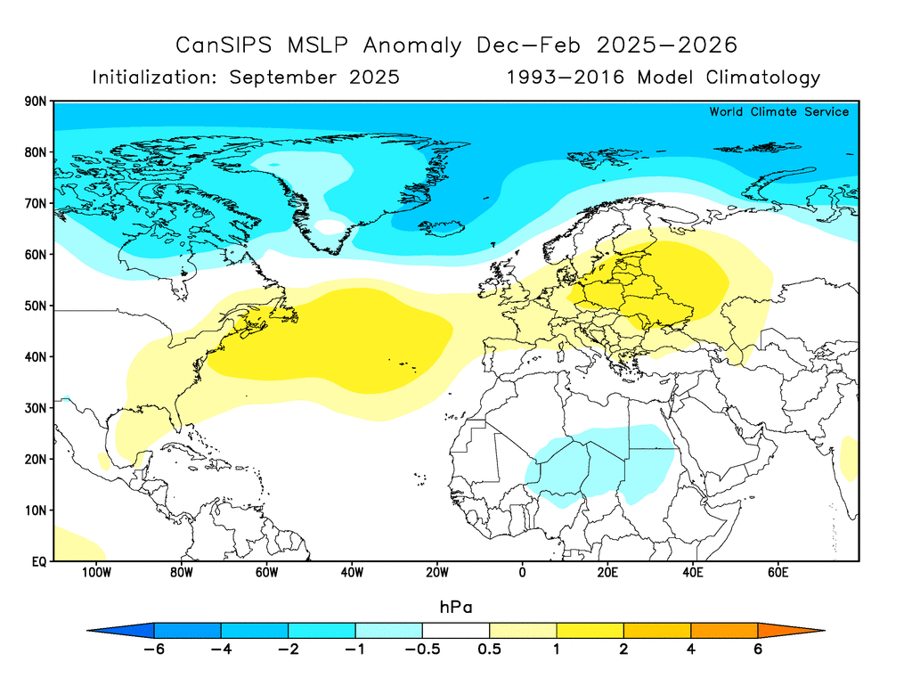
The September CanSIPS update is available, showing a fairly robust +NAO pattern for winter.
The change (to a more positive NAO) from last month's forecast is substantial for Jan-Feb, as we might expect with a stronger La Niña signal emerging recently.
🥶 Another Arctic Blast!
It’s incredible...we’re looking at another shot at record cold later this week. Highs may struggle to get out of the 60s by Friday.
This air is coming from northern Russia in the Arctic Circle
#mowx#kswx#kcwx
Over 10,000 lightning strikes in the state just today & thunderstorms are still going up north! Unfortunately, some of the strikes have started new wildfires following the hot weekend w/dry fuels. #CAwx#weather
It’s quiet - now - as we head into peak season, but that may change soon. The Atlantic has been under large scale sinking, crushing tropical development. But rising air from the Pacific is rounding the bend, and heading into the Atlantic in the coming weeks. That will cause favorable conditions for hurricanes to develop especially by mid September, but there’s a wave moving off Africa right now with a good chance of development later this week/weekend. The hope is that strong cold fronts in the US will block these Atlantic storms from reaching the US. Stay tuned. (Hurricane pictured is merely an illustration, not a real storm)
#fyp # hurricane
@Glen_Evans_01@ClintonDesveaux Using ice breakers to escort ships out of and into, Churchill, through Hudson Bay, across the Hudson Strait & into the Atlantic Ocean during the winter,is reckless,and irresponsible and will put peoples lives at risk.The financial cost to pull that off will not be worth the risk.