European Institute for Advanced Earth Studies
A non-profit R&D NGO focusing on:
- Geophysics
- Solar Physics
- Oceanography
- Simulations
- Geo/Archeology
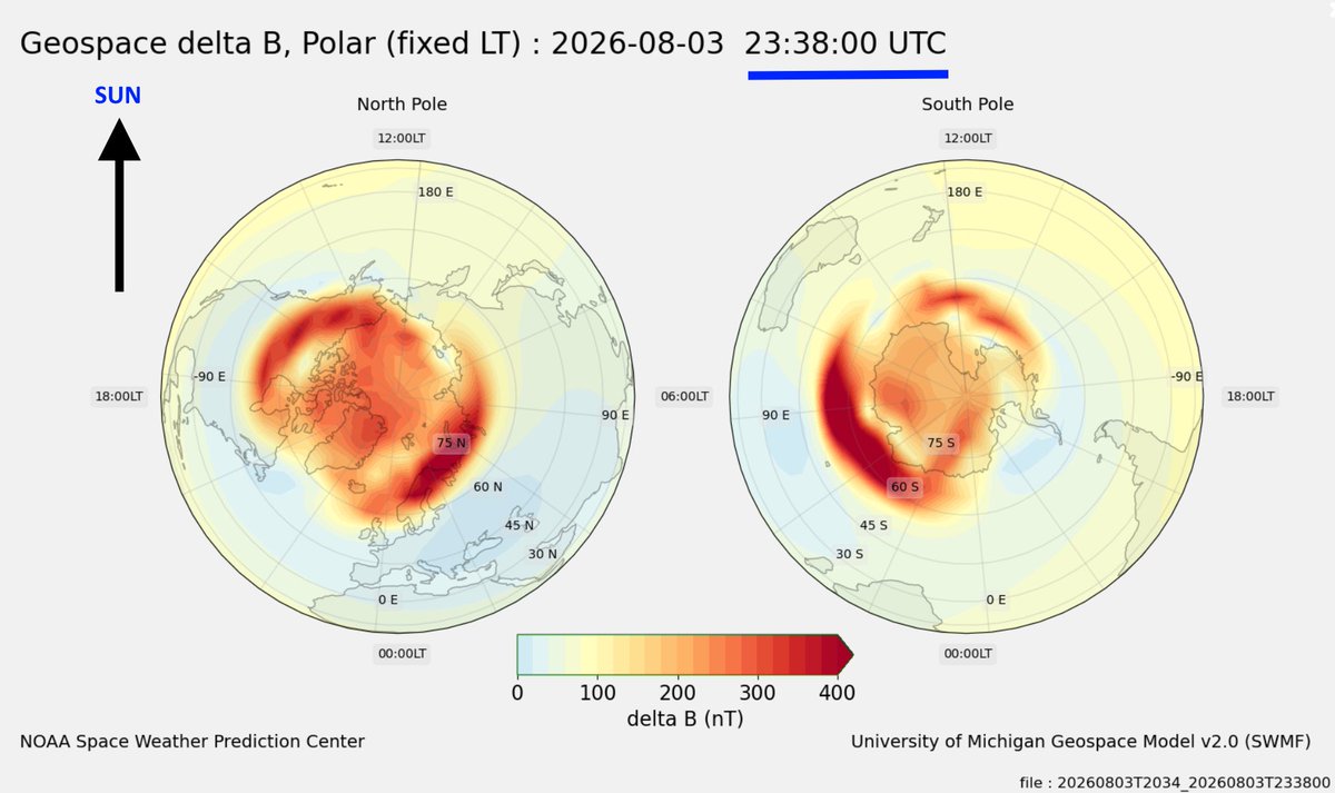
@WillsmitBill It's actually part of video clip (form the link) showing how the magnetic field on the ground changes in a ~24 hr period. We selected the images over the poles as they are most interesting, because they are the regions first influenced by the solar wind and incoming CME's.
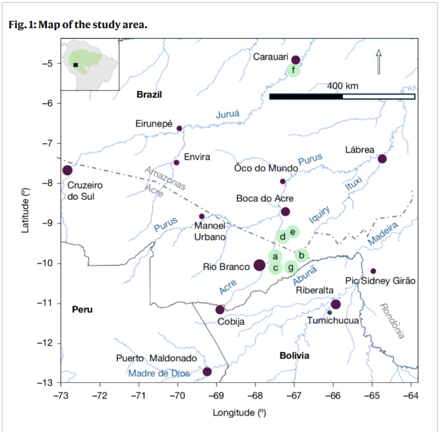
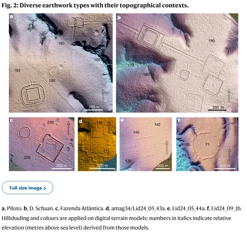
I was honoured to work with Martti Pärssinen, Alceu Ranzi and Fabio de Novaes to feature their spectacular LIDAR discoveries in the Amazon in Season 2 of my controversial Netflix docuseries Ancient Apocalypse (released October 2024). I have remained in close and friendly contact with the team and their ongoing work ever since and congratulate them on their newly published open-access paper in Nature which is linked at the end of the report in Science Alert below:
https://t.co/twQGqzcUoV
LiDAR has discovered over 20,000 hidden structures below the Amazon foliage.
- The pre-colonian population in that region is now estimated ~10 Million. While many of the geo-glyphs is estimated to have been created ~ 600 BC.
History changes every day.
- Make it a good one!
Lovely to see one of our collaborating scientists taking proactive E&M Earth modelling to the next level.
If you can't find a suitable open source E&M Solver solution, make you own!
Let us know how we can help!
I couldn’t find a validated electromagnetic forward solver I had access to, so I’m building my own.
I’ll start with a simple 1D model of Earth. It’ll calculate how changing magnetic fields create electrical currents in the ocean, crust, and mantle, and where that energy turns into heat.
Later, I’ll expand the model into 3D and test where the effects become geographically concentrated. I also want to add a separate module for the magnetic signals created by ocean tides and circulation.
*How deep does geomagnetic storm energy reach?
*Where is the most heating produced?
*Once the energy becomes heat, where does it go, and how long does it stay there?
*Are electromagnetic anomalies caused by Earth structure?
*Can ocean tides and circulation be observed magnetically?
I’m building a tool that will be able to answer many questions.
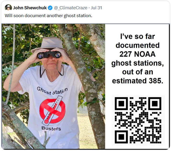
This lonely warrior is single-handedly disproving one of the most influential weather monitoring organizations on the planet, #NOAA.
Using weather station data that is 100% made up!
Legend 👊
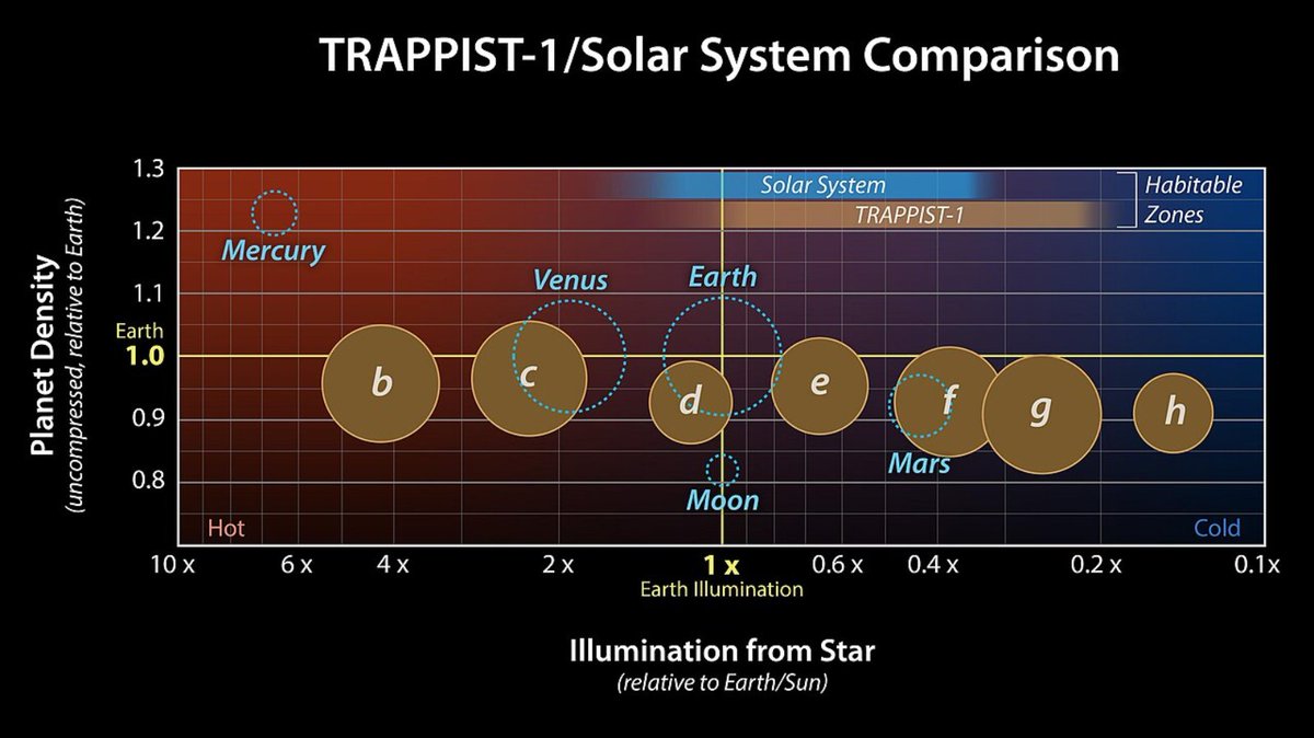
Indeed. This is exactly why we are interested in this planetary system.
It can reveal a lot of new insight of Earth, and no scientist need to be scared of making unpopular predictions.
Q: What is TRAPPIST-1?
A: It's a small red dwarf star (M8) about 40.6 LY from Earth in the direction of Aquarius, orbited by seven Earth-sized rocky planets.
Q: Why is this interesting?
A: Very similar to our own solar system.
https://t.co/n9EfC09b0x
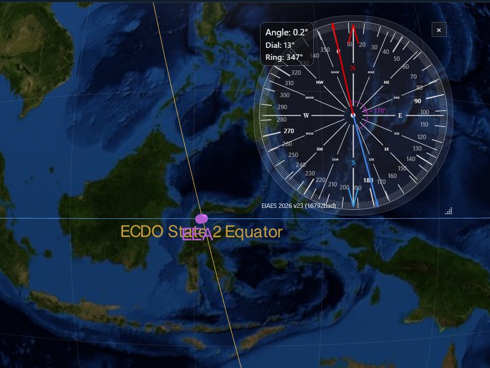
Don't lose your bearings! 🧭
Use our transparent compass app, to make angular measurements directly on your screen.
✅adjustable compass rose
✅adjustable bearings dial
✅adjustable transparency
✅cw/ccw bearings toggle
✅2 custom bearings with angular separation
[win-x64]
2023-10-16
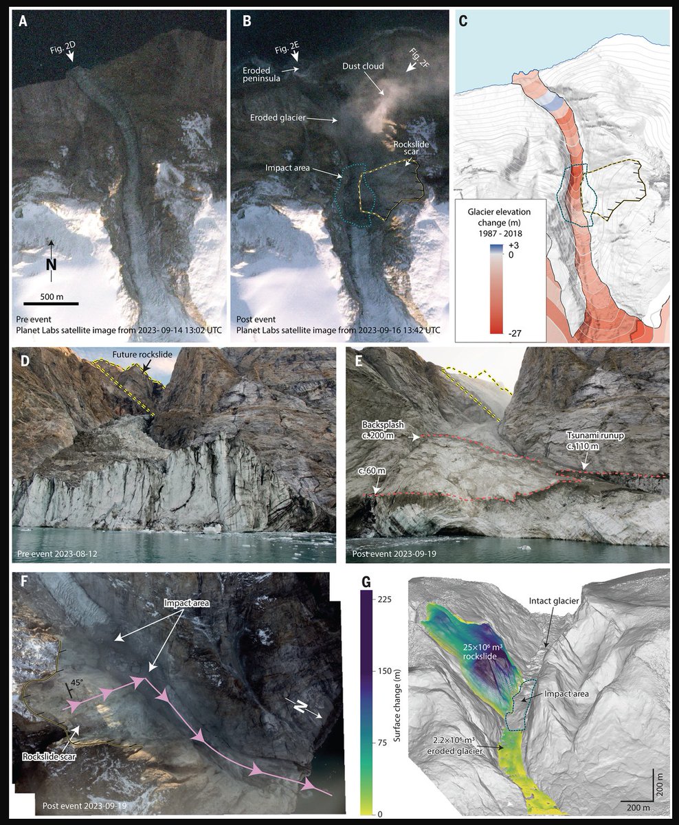
A large rockslide entered a Greenland fjord, creating a 200 m high tsunami. The tsunami evolved into an 7 m high, oscillating seiche with a period of ~90 seconds. This was seismically detected around the globe for 9 days.
https://t.co/YcQfZ5Z91k
@nobulart [Craton]
Is the oldest part of continents, large and tectonically stable block of crust that has remained relatively undeformed for billions of years.
Consist of a thick crust (often 50+ km) overlying a cold, buoyant lithospheric mantle root that can extend 200–300 km deep.







![EIAES0's tweet photo. Don't lose your bearings! 🧭
Use our transparent compass app, to make angular measurements directly on your screen.
✅adjustable compass rose
✅adjustable bearings dial
✅adjustable transparency
✅cw/ccw bearings toggle
✅2 custom bearings with angular separation
[win-x64] https://t.co/2ZEMkYHD3K](https://pbs.twimg.com/media/HOnCcqBWwAAPxP2.jpg)