A Twitter bot that automatically retweets everything about #EarthEngine, #GoogleEarthEngine. Account managed by @giswqs. Not affiliated with Earth Engine team
The ongoing Iceland eruption from Space 🛰🌋
The #GoogleEarthEngine app shows how can we use SWIR to see the lava flow path and help with decision making.
📍 Reykjavik, Iceland
🛰 Sentinel 2
🔗https://t.co/VYAq8ocDfS
➡ Code available on my #GitHub: https://t.co/bjU00vbUgb
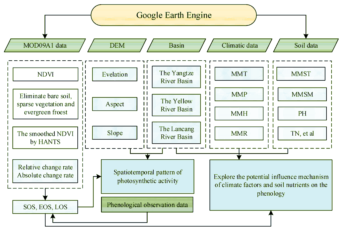
📢Dynamics and drivers of #vegetationphenology in Three-River Headwaters region based on the #GoogleEarthEngine by Jiyan Wang, Huaizhang Sun
and Junnan Xiong, et al.
👉 Read the full article: https://t.co/eGHTxMiEX1
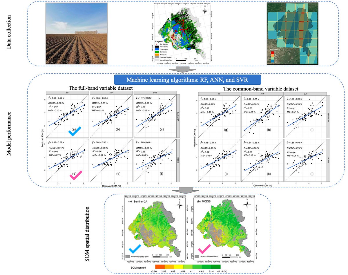
📢Mapping Regional #SoilOrganicMatter Based on Sentinel-2A and #MODIS Imagery Using #MachineLearning Algorithms and #GoogleEarthEngine by Meiwei Zhang, Meinan Zhang, Haoxuan Yang, et al.
👉 Read the full article: https://t.co/C2HJccThjD
📢Dynamics and drivers of #vegetationphenology in Three-River Headwaters region based on the #GoogleEarthEngine by Jiyan Wang, Huaizhang Sun
and Junnan Xiong, et al.
👉 Read the full article: https://t.co/eGHTxMiEX1
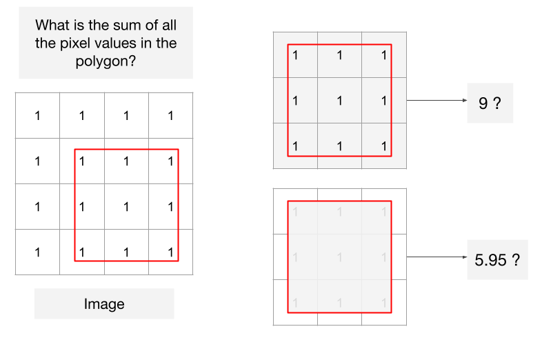
#GEE#LevelUp Tip: Do you know that #EarthEngine has 2 different modes for computing image statistics? 'weighted' mode uses proportional values from partial pixels, and unweighted mode considers the full pixel value. https://t.co/pb571dqGjj
GOOGLE EARTH FIND🌎🛸
Explain this away for me, go ahead I'll wait.
More Antartica. Middle of nowhere, manufactured disk or entrance cover?
Look on google earth.
LAT: 66°16'24.27"S
LONG: 100°59'10.68"E
#ufotwitter#antarctica#spaceship#ufo#mystery#googleearthengine
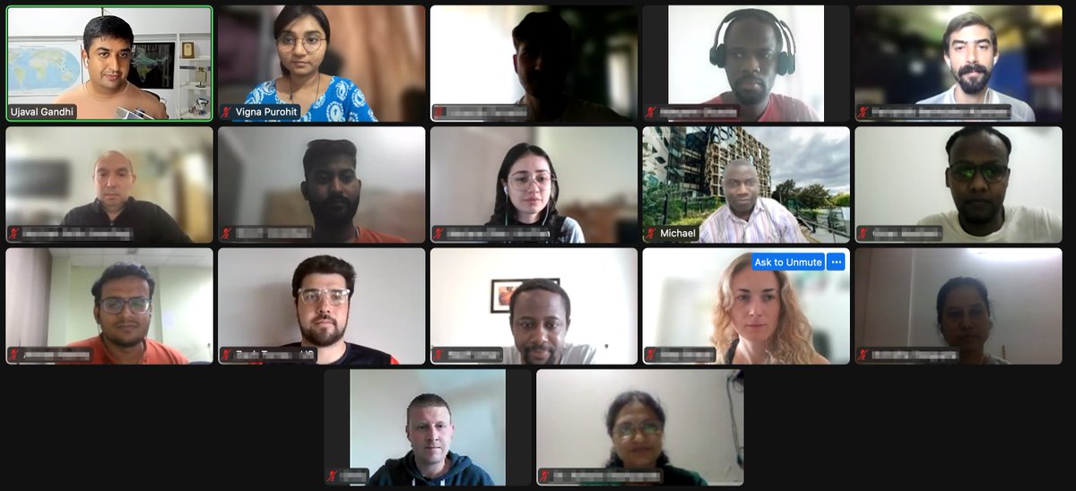
Finished the first cohort of the new Google #EarthEngine course "Creating Publication Quality Charts with GEE" with a very special group of Spatial Thoughts alumni. Great feedback on the content and structure. Get on the waitlist for our next cohort https://t.co/FitM5WoMTz
Finished the first cohort of the new Google #EarthEngine course "Creating Publication Quality Charts with GEE" with a very special group of Spatial Thoughts alumni. Great feedback on the content and structure. Get on the waitlist for our next cohort https://t.co/FitM5WoMTz
Tropospheric vertical column of #Nitrogendioxide 🛰️observed in Europe over the last 5 years, generated via the powerful open platform #EarthEngine. Fruitful collaboration between the two giants, @googleearth and @CopernicusEU, advancing #openscience & global🌍connectivity.
Measuring salinity with satellite imagery 🛰
Check the result using #GoogleEarthEngine (#Javascript) to measure #salinity in the #mangrove.
🛰 #Sentinel2
📍 Vitória, Espírito Santo, #Brazil 🇧🇷
🔗https://t.co/ZjESLWUYWp
➡ Code available on my GitHub: https://t.co/s9aUFomWPn