Another massive rain dump in a forest/low pop area with few rain gauges in westernmost South Carolina... Flood Warnings in effect, spotter reported >8 inches of rain overnight. Radar estimates wide area of 4-5" #scwx
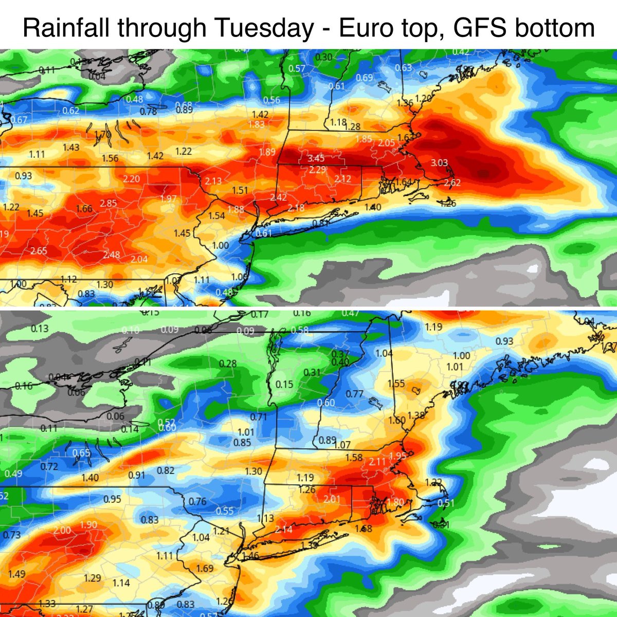
Modeling has trended quite wet. Rainfall through Tuesday shown. Low pressure may form along the stalled front enhancing the rainfall. Labor Day not looking great. Doesn’t rain all the time but it looks fairly wet.
🍔🌭 If you're planning a #cookout this weekend, today is looking to be the day for it!
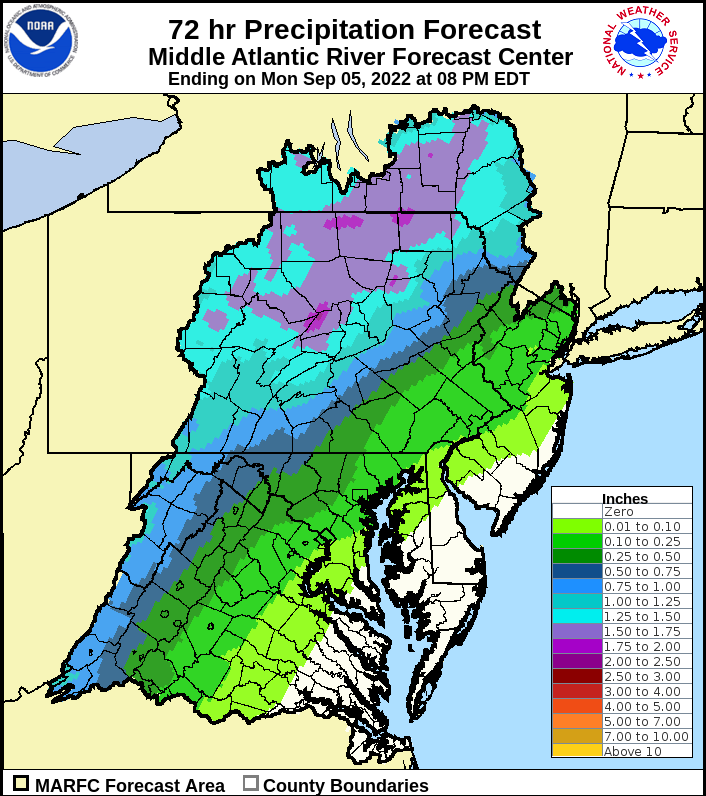
🌧 Soggy conditions move into the Mid-Atlantic for tomorrow and #LaborDay.
🌊 Minor to moderate rises on the #rivers are anticipated for early week, but no flooding is expected at this time.
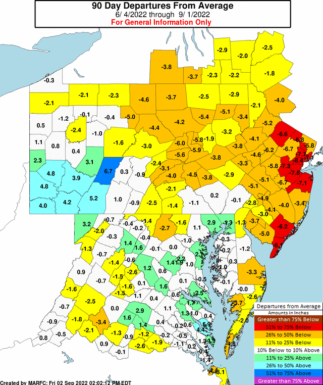
Over the past 90 days some areas have a rainfall deficit of 2 to 8 inches of rain. We are expecting some #rain on Sun and Mon as shown in the 3 day rainfall forecast. Additional rain is expected on Tue and into Wed next week.
Saturday’s Weather Rating: 8/10
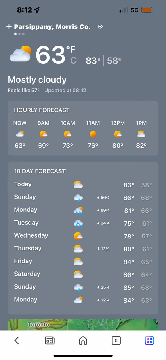
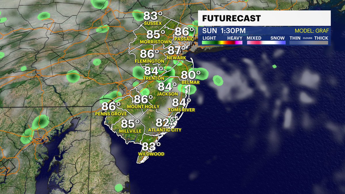
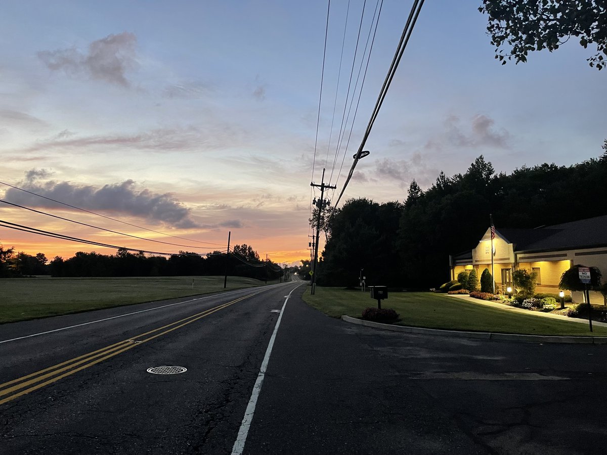
Partly cloudy skies, highs in the lower 80’s and a nice breeze! An onshore flow will allow dew points to creep up a bit today, and an increase in cloud cover is possible later. But you know what, the vibes are still pretty dang good!!
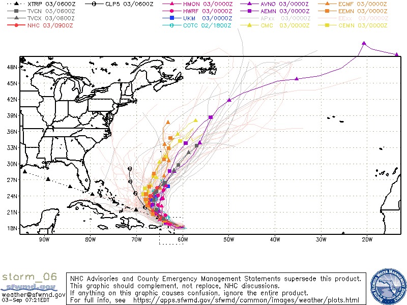
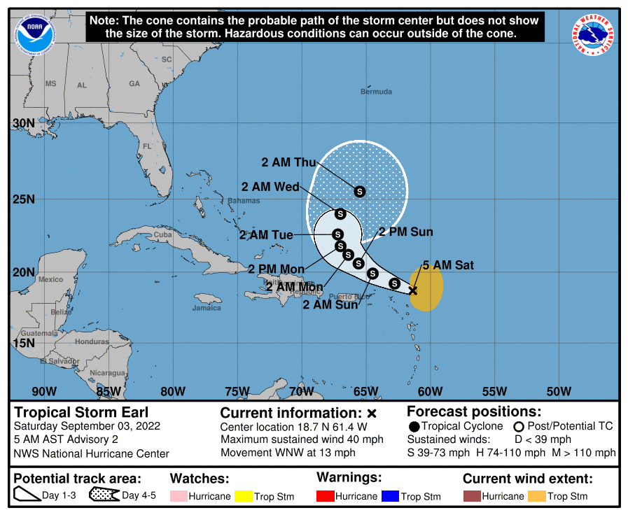
Saturday morning spaghetti models on Tropical Storm. Majority showing that recurve coming. Some EURO ensembles keeping it west some (pink lines). Close enough for Bermuda to be watching for sure. https://t.co/Hk3pbO7x8H #weather#tropical#storm#hurricaneseason
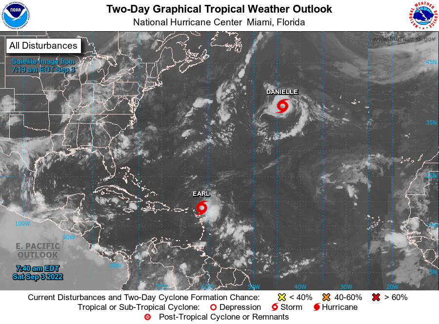
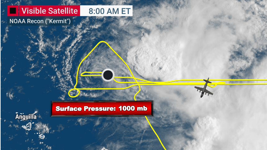
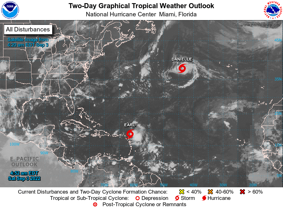
Two Tropical Storms, #Danielle and #Earl, are churning in the Atlantic this morning (9/3). Neither system poses much of a threat to the mainland. However, Earl could bring heavy rain and rapid river rises to the Leeward and Virgin Islands, and Puerto Rico as it passes nearby.
Good morning Earl. Latest NHC track update. High confidence on that curve. EURO ensembles still being sneaky. Storm is close enough to the northern Lesser Antilles and VI they are feeling. https://t.co/Hk3pbO7x8H