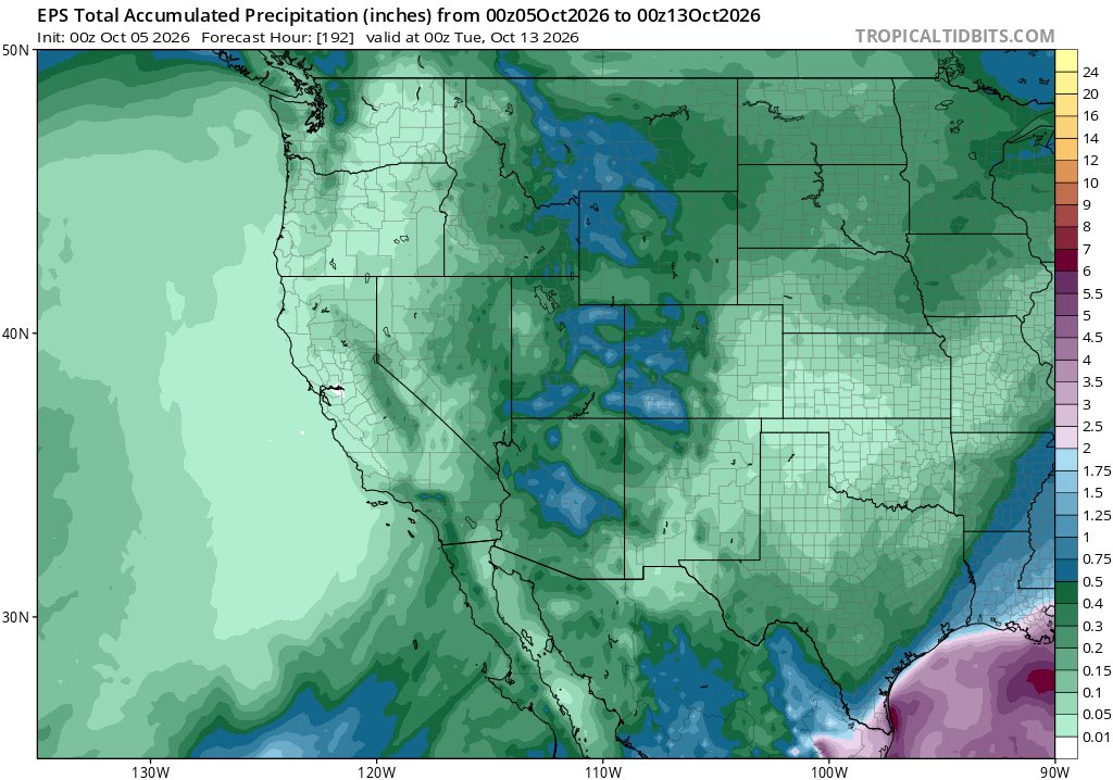
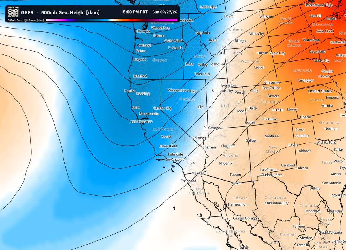
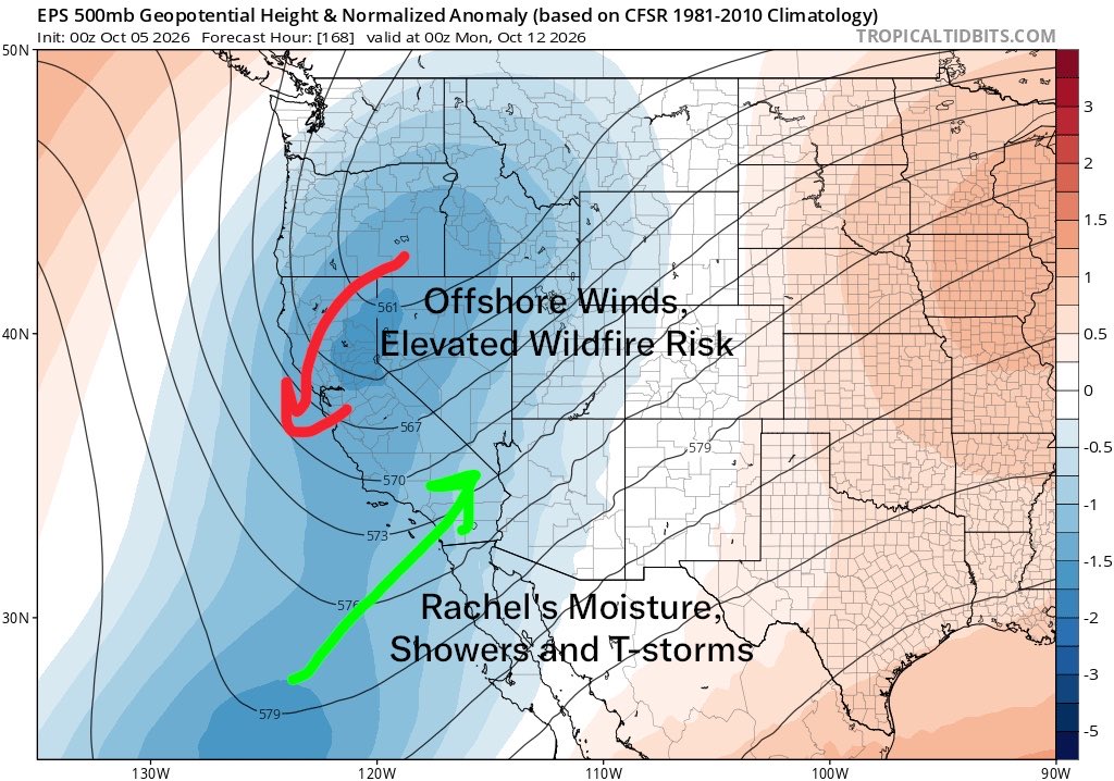
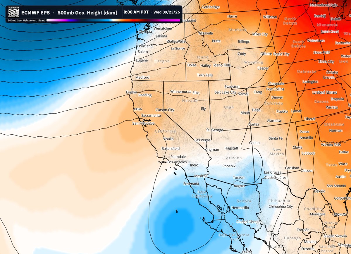
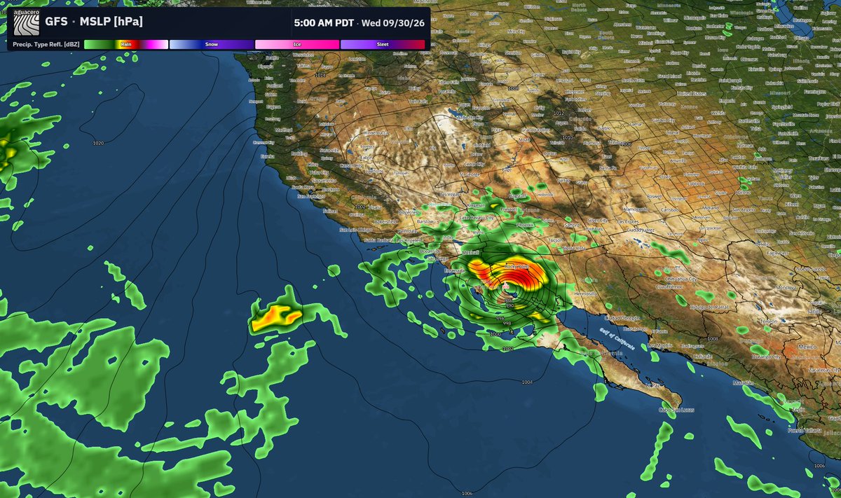
It’s looking more likely that a trough will develop over the Pacific Northwest and head southward around Sunday-Monday. Some moisture will be drawn into the Southwestern U.S. from tropical storm Rachel, increasing the chance of some showers and thunderstorms.
Essentially all locations in the west will see a significant cooldown, even CA which is dealing with an unusually late-season heatwave. In fact, temperatures may fall below average next week in much of the west.
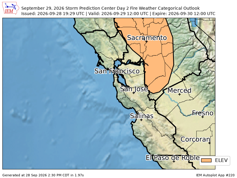
For NorCal and the Northwest, this doesn’t look like a good set-up for rainfall. In fact, given the low pressure area will center itself inland, this may lead to a dry offshore wind event, which is not ideal at all in a fire-weather perspective.
Antecedent conditions in NorCal are very dry right now. They’ve seen very little rain since May (which isn’t unusual). However, I’m a bit concerned that this anomalous heatwave is drying out brush, increasing their flammability. An offshore wind event would increase the odds of fire starts, but also increase the chance that wildfires will rapidly spread from northeast to southwest if they start. Given we’re a week out from this event, it’s unclear how strong offshore winds will be. It’s also not guaranteed a fire will start even if offshore winds are strong.
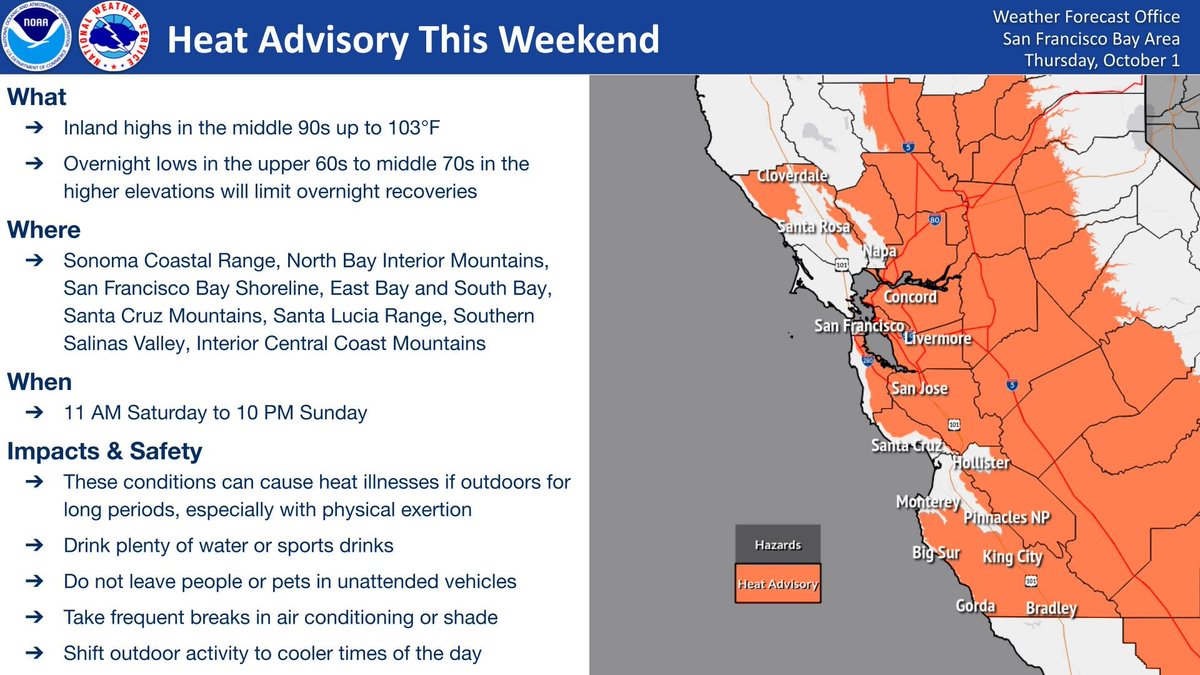
⚠️Heat Advisory Saturday and Sunday for the inland Bay Area and Central Coast due to highs in the mid 90s to near 103. Risk of heat-related illnesses exists for anyone without adequate cooling or hydration. Stay hydrated and never leave anyone in unattended vehicles! #CAwx
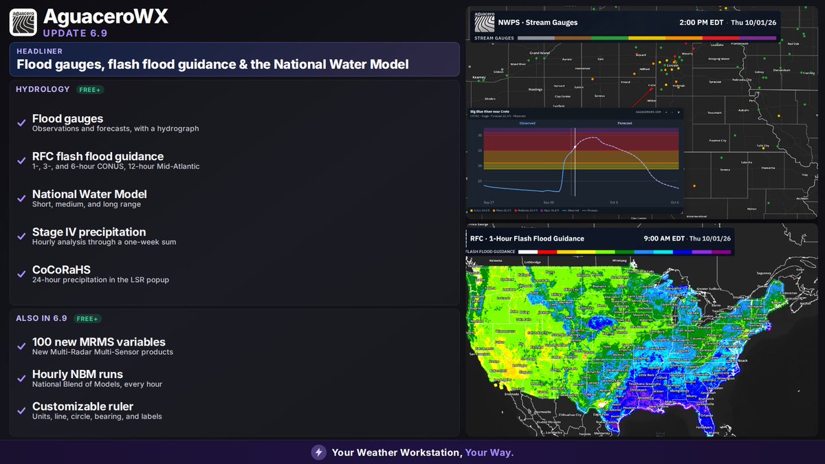
🚨Aguacero 6.9 is live!
🌊Flood gauges with observations and forecasts
⚠️RFC flash flood guidance
National Water Model: short, medium, and long range
Stage IV precipitation
CoCoRaHS Observations
100 new MRMS variables
Hourly NBM runs
ALL FOR FREE! https://t.co/E4FpZiioN1
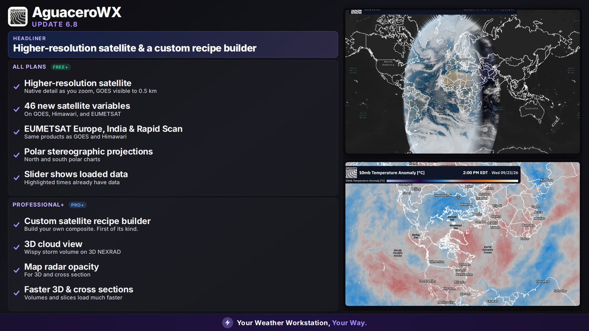
🚨Aguacero 6.8 is live.
🛰️ Full resolution satellite (even full disk)
- 46 new satellite variables
🗺️EUMETSAT
🧑🍳 A first of its kind revolutionary custom satellite recipe builder
⛈️3D NEXRAD Cloud
🥶 North/South Polar Stereographic Projections
https://t.co/tmGzmDs1vP
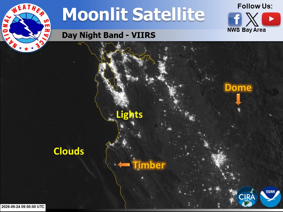
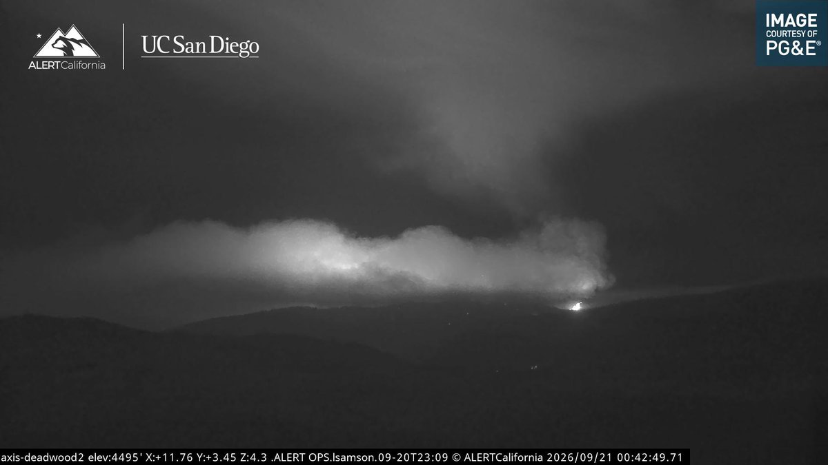
Hello Night 🦉 - Tonight's nearly full Harvest Moon is lighting up our satellite! 🌕 You can see offshore clouds, city lights, plus the recent flare-up at the Timber Fire & the ongoing Dome Fire. #CAwx
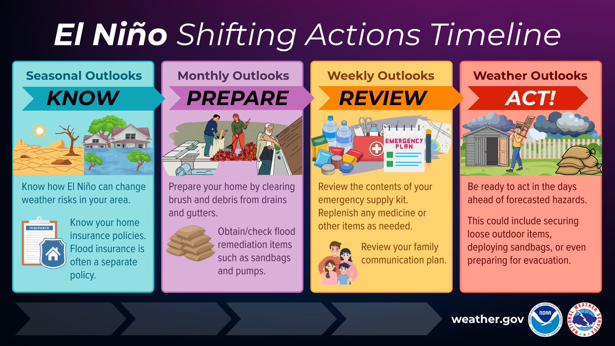
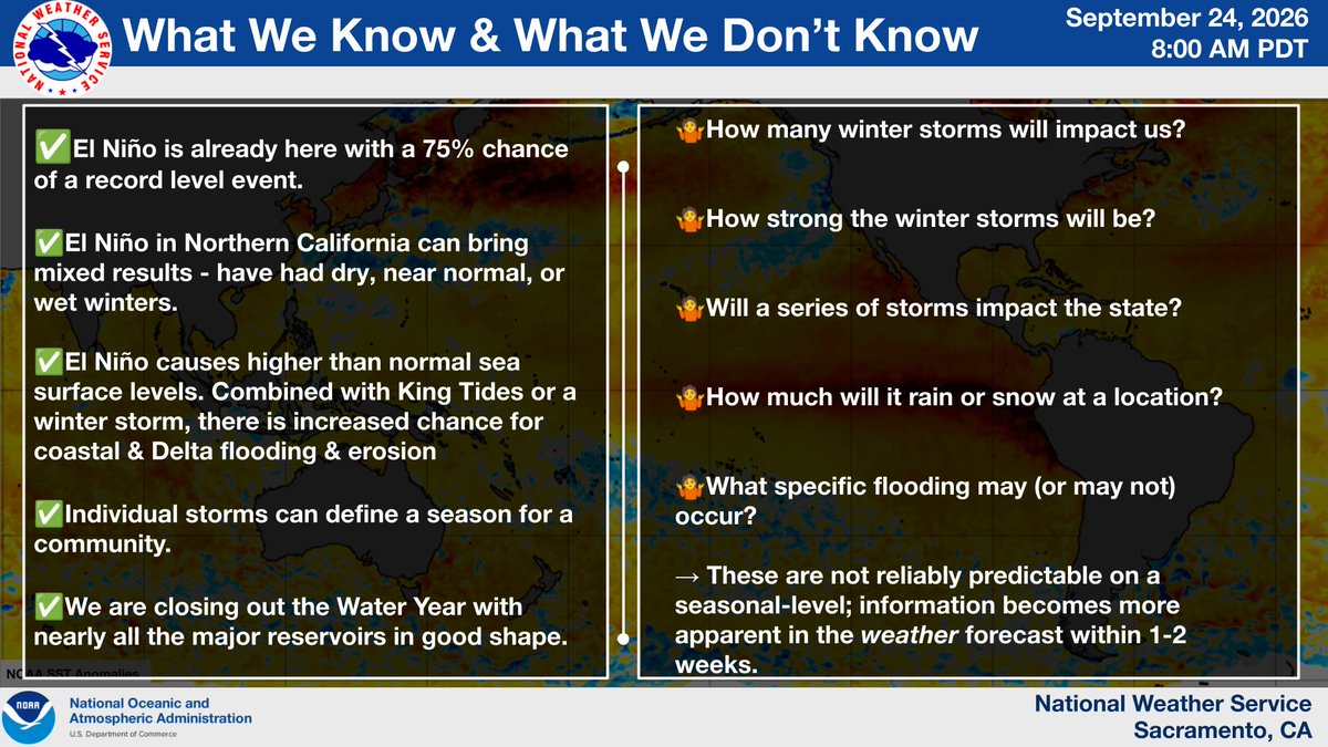
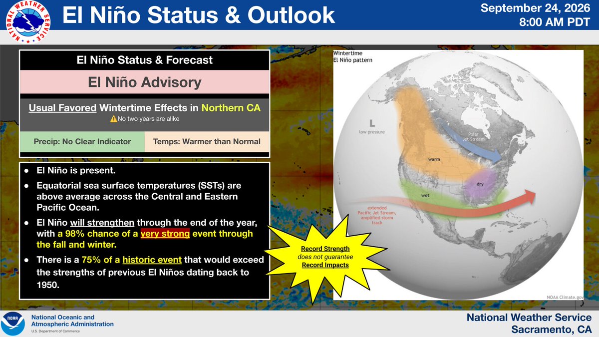
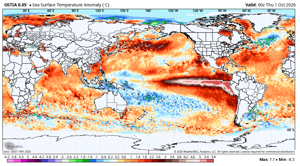
El Niño is here!
No, it isn't a storm. No, it isn't an AR (or series of ARs).
#ElNino is a natural phenomenon measured by the warmer-than-normal sea-surface temperatures in the equatorial Pacific. These warm waters can (& do) influence weather patterns, including here in CA.
It looks like the models has me a little too excited! Ens and global models both show continuing persistence in high pressure overspreading the region keeping any tropical activity clear of Southern California, and leaving most of the wet wintery weather farther north in the PNW. But we could see the emergence of large low pressure systems draping down across California over the coming weeks into october.
Looks like the California Fall/Winter rainy season is upon us coming late September. The most recent GFS Sept, 20th 12z, 18z, and 00z Sept 21st runs all hold firm on potential tropical activity along the Cal/Mex border that could bring widespread weather to most of south, central, and northern California. Winds, rain, and thunderstorms could all be possible. I'll update with new runs as they come and see IF this trend continues.
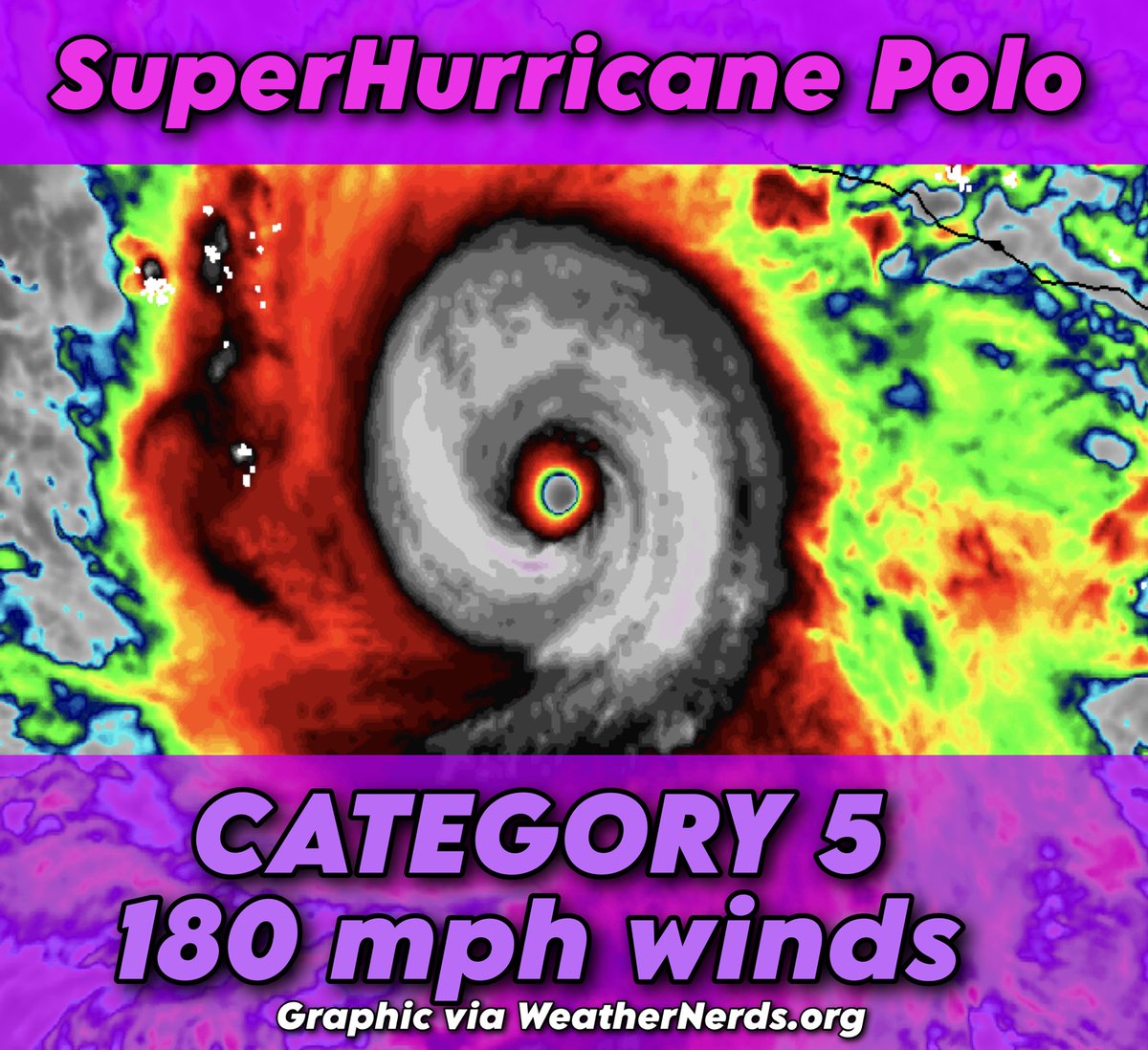
SuperHurricane Polo, an extreme Category 5 hurricane, is now the second most-intense eastern Pacific hurricane on record!
The storm likely contains maximum eyewall sustained winds of 170 to 180 mph, with gusts exceeding 200 mph.
The system strengthened from a 50 mph tropical storm to a 160 mph hurricane in 24 hours, marking the second fastest intensification on record in the eastern Pacific – behind only Patricia in 2015.
Polo's rate of strengthening was more than THREE TIMES what is necessary to qualify as "rapid intensification".
SYNOPSIS: Hurricane Polo is a powerhouse and is continuing to strengthen. Its eye is surrounded in lightning, known as an EEL (enveloped eyewall lightning) signature. That indicates continued strengthening is likely.
It's located over water temperatures between 86 and 88 degrees. Those 86+ degree waters extend to 190 feet below the sea surface, meaning that it can't churn up cooler waters. No matter how much it slows and stirs up the seas, it won't be able to upwell anything to slow it down.
Meanwhile, it's located in an oasis of calm winds aloft, meaning there are no harsh winds to disrupt it or knock it off kilter. AND there are broad clockwise winds aloft, helping fan "exhaust" air away from the system. The more efficient the outflow, or exhaust, the more heat and moisture that can enter the storm from below, supporting continued strengthening.
DISCUSSION: Polo's air pressure is now BELOW 890 MILLIBARS! That's virtually unheard of!
At flight level, the eye is about 29 degrees warmer than the surrounding atmosphere. Tropical cyclones are "warm core" systems. That heating from the oceans below causes warm air to rise, lifting air away from the surface and leaving a "void", or deficit, of air.
It has lifted 565.3 BILLION pounds of air, or about HALF A TRILLION POUNDS! That's the equivalent to 47 Great Pyramids of Giza!
That "missing" air creates a vacuum of sorts. That's why hurricanes have powerful inward suction, resulting in extreme winds.
When we talk about air pressure, we're talking about how much air there is! In this case, 12.2% of the air is missing from the middle! That's incredible!
PATH: Polo will stall through early Wednesday, then drift northwestward, parallel to the west coast of Mexico. That should keep it offshore for the time being.
Uncertainty increases by Friday, at which point competing influences complicate Polo's forecast. It could be tugged west by Odalys, another tropical system with which Polo will interact. That "Fujiwhara effect" could help Polo to be pulled westward.
Alternatively, an approaching upper-air disturbance could tug Polo east, increasing the risk to the Baja Peninsula. In that scenario, Polo's moisture may impact the Desert Southwest in about 7 days' time.
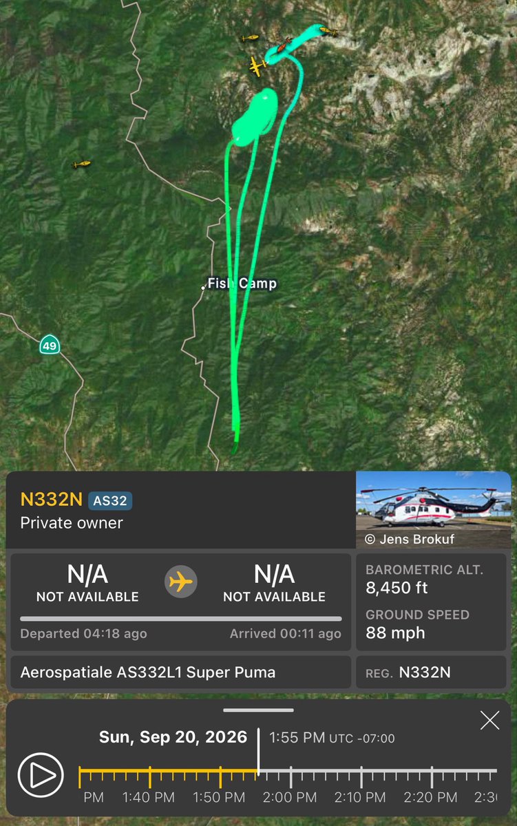
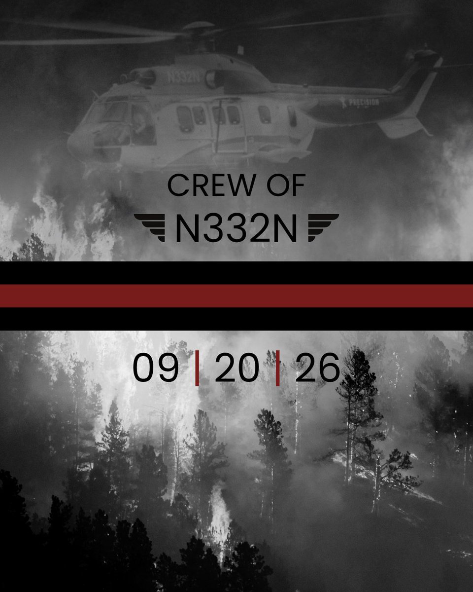
Yesterday, the wildland fire community lost two of its own.
A helicopter crashed while supporting the Dome Fire in Yosemite National Park, taking the lives of two pilots. One has been identified as Greg King, a longtime wildland fire aviator who supported firefighters across the country, including many years flying fires in Alaska. The identity of the second pilot has not yet been released.
It has been a difficult season for the wildland fire community, with too many lives lost. Every day, we carry their service and sacrifice with us and work to honor those we’ve lost, this season and in seasons past.
Our thoughts and prayers are with their families, friends, the Precision team, and everyone mourning this loss.
Rest easy.
#aerialfirefighting #wildfire
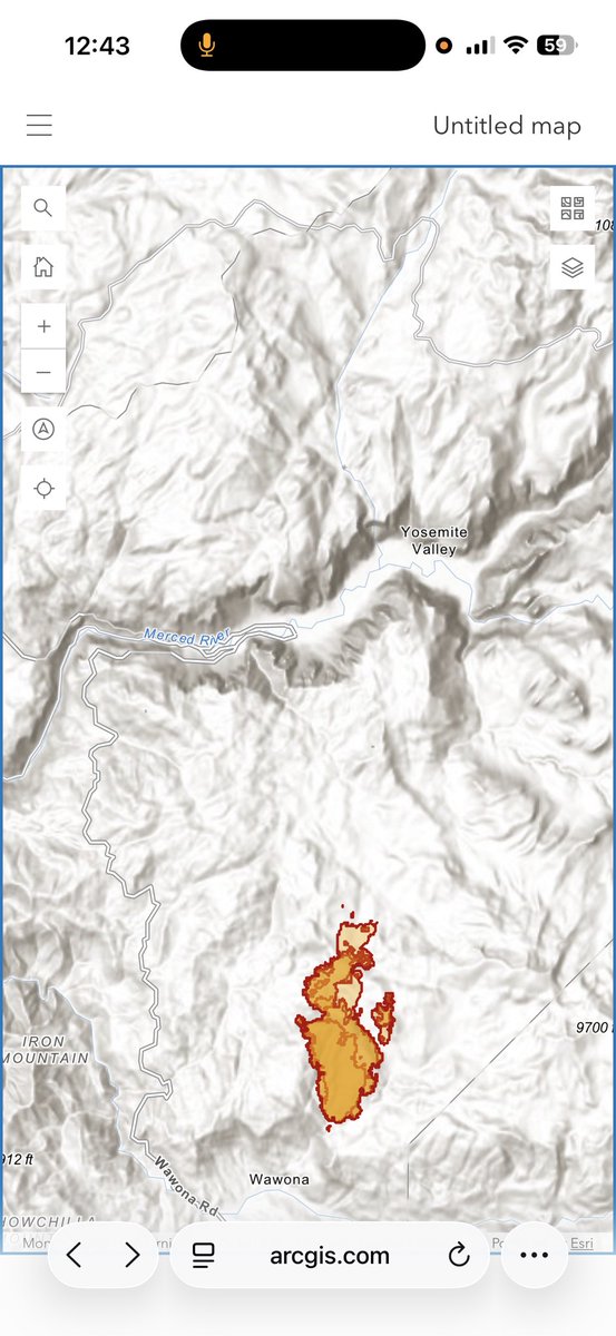
An Intel Flight earlier mapped the #DomeFire at 3,042 acres at 1:50 PM, currently 15% Contained, Yosemite National Park.
With other sad news from someone on Instagram there was Type 1 Super Puma Helicopter Crashed on the Dome Fire in the Afternoon and both pilots sadly lost their lives, Reg (N332N), and this is one of the helicopters who arrived on the Fire on day one.
Looks like the California Fall/Winter rainy season is upon us coming late September. The most recent GFS Sept, 20th 12z, 18z, and 00z Sept 21st runs all hold firm on potential tropical activity along the Cal/Mex border that could bring widespread weather to most of south, central, and northern California. Winds, rain, and thunderstorms could all be possible. I'll update with new runs as they come and see IF this trend continues.
Sep 20: TD 17-E has formed in the eastern Pacific off Mexico. It is forecast to reach hurricane strength by Mon night, creating very dangerous marine conditions in the major shipping lane off SW Mexico and Baja California into next week. See more at https://t.co/Wk7xxBl094
Time-lapse of the start and growth of the #FloristonFire north of Lake Tahoe in Nevada County. Look to @CALFIRENEU for incident updates and see conditions live from multiple ALERTCalifornia cameras at: https://t.co/EyWrtGnkpU
New Start, California: The Floriston Fire is moving at an extreme rate of spread, with spot fires already reported 1 mile out. The fire is burning in Nevada county, California, and westbound I-80 has been closed.
A very large order has gone in for Tankers, helicopters, crews, engines, and dozers. Full response underway. Winds are in the teens, with an RH in the low 20s. This thing is moving.